
 On the way home from our mountain trip in West Jefferson we decided to take advantage of the close proximity to Mount Jefferson and pay a visit. Mount Jefferson State Natural Area is located just east of US 221 at 1481 Mt Jefferson State Park Rd in West Jefferson (elevation 3000ft). It lies along the drainage divide between the north and south forks of the New River, which influenced the size and shape of the mountain. Mount Jefferson and its nearby peaks are remnants of a once lofty, mountainous region but weathering and erosion over millions of years wore away the softer, less resistant rocks. The more resistant rocks, amphibolite and metagraywacke of Mount Jefferson, were slower to erode. The mountain received its name in 1952 in honor of Thomas Jefferson and his father, Peter, who owned land in the area and surveyed the nearby North Carolina-Virginia border in 1749. In 1956 the mountain became an official state park.
The main access road up the mountain is easy to navigate and offers two beautiful overlooks. The small parking lot at the top of the mountain provides quick, easy access to the mountain’s trails, large pavilion, and picnic tables.
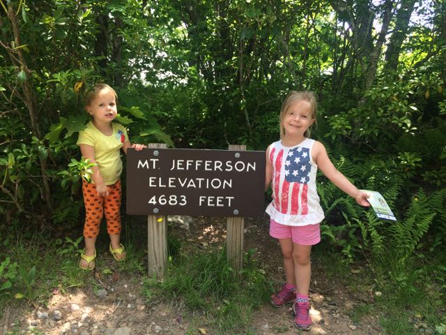
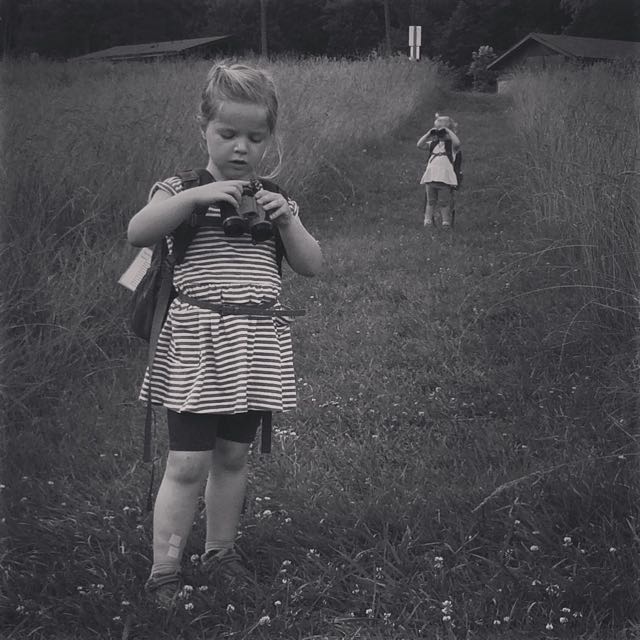
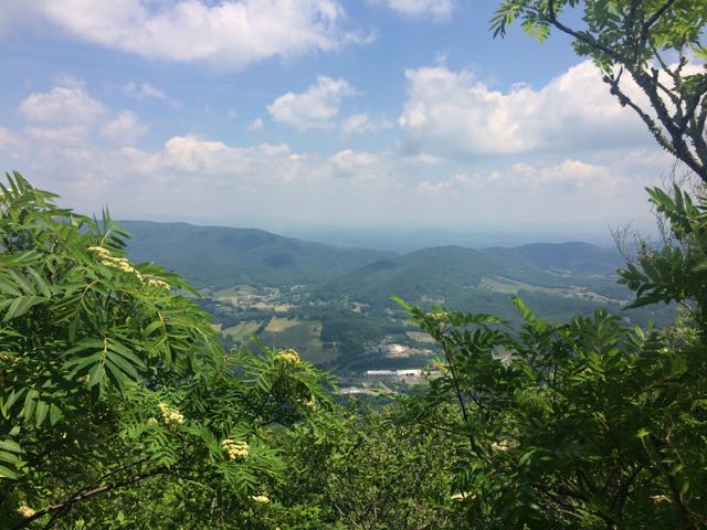 We walked through the picnic area and followed the short Summit Trail (0.3 miles) up the mountain. Although the website lists this trail as strenuous, we felt it was more on the moderate side. Due to our haste planning half of us wore flip flops, but could easily walk the gravel trail. The gravel path is wide and shady giving a cool mountain feel to the hike. Along the way we saw butterflies, rhododendrons, mountain laurel and red-starred flowers; though stop by the park office for official plant and animal checklists. We visited the bathrooms along the way, which were super convenient and an easy walk from the main path. We passed access to the Kids TRACK trail, which is part of the longer Rhododendron Trail (1.1 miles). Near the top we turned left to the Mount Jefferson summit, which has an elevation of 4683 feet. I climbed out a little further to catch the beautiful views of the Blue Ridge Mountains.
Even though this is a smaller state park in size, it offers 5 moderate to strenuous hikes that are great for quick hikes with beginners or young families. It would also be a great spot for a quick picnic if you’re out and about in West Jefferson or on the way home like we were.
Additional Resources:
- Mount Jefferson map
- Mount Jefferson main website
Thumbs up: quick, easy access to hiking trails from the parking lot, easier hikes for beginners and families, beautiful views of mountains from Mt Jefferson summit, picnic spots are plentiful
Thumbs down: nothing to report


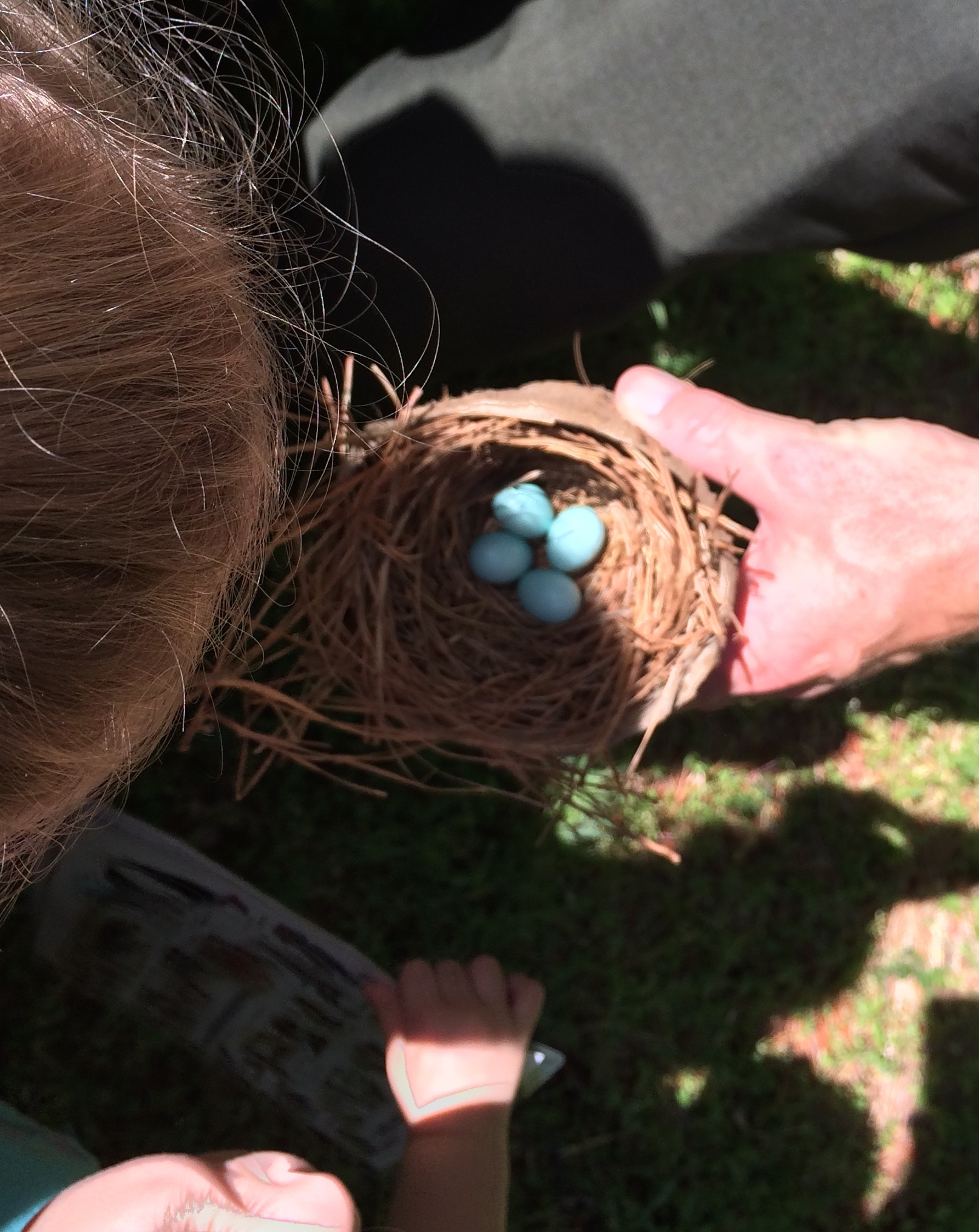
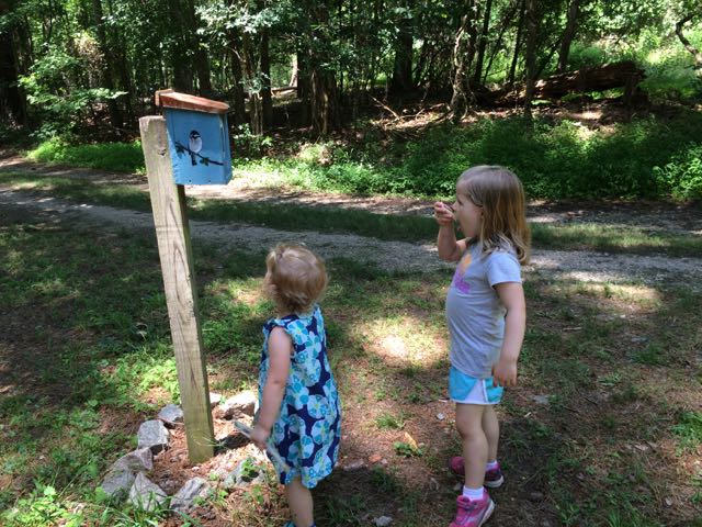 Once the girls finished in the natural play area, we walked across the parking lot and open field area to the bird and butterfly garden. The butterfly garden has a short trail surrounded by natural butterfly habitats of lilac, Queen Anne’s Lace, daylilies, eastern blue star and more. The butterfly garden leads into the shaded bird garden that features a mulched trail with several feeders, bird houses, and informational guides. We heard and saw a lot of birds flying in and around the gardens, but my bird identification skills are pretty pathetic – maybe some adult birding classes are in my future!


 On a cloudy summer day we headed to Annie Louise Wilkerson Nature Preserve Park to explore the nature playground and do some light hiking. It’d been awhile since we’d
 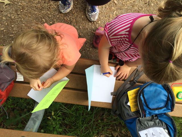 After our short hike we walked through Dr. Wilkerson’s former home, which has been renovated into an Education Center for the purpose of being a nature park research center. The front room is a mini museum of Dr. Wilkerson, highlighting her career and time she spent on the farm. We didn’t visit the other parts of the center, but the


 On day 2 of our
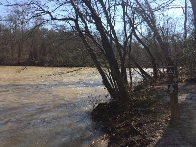
  This trail is about 1.3 miles in total length and is marked as being moderate. The only moderate part of the hike was heading up the bluffs on the way back. The parts along the river were flat and quiet, the only sounds coming from the river and wee ones. In the future when the kids are much bigger I’d love to explore this area further by canoe and camping!


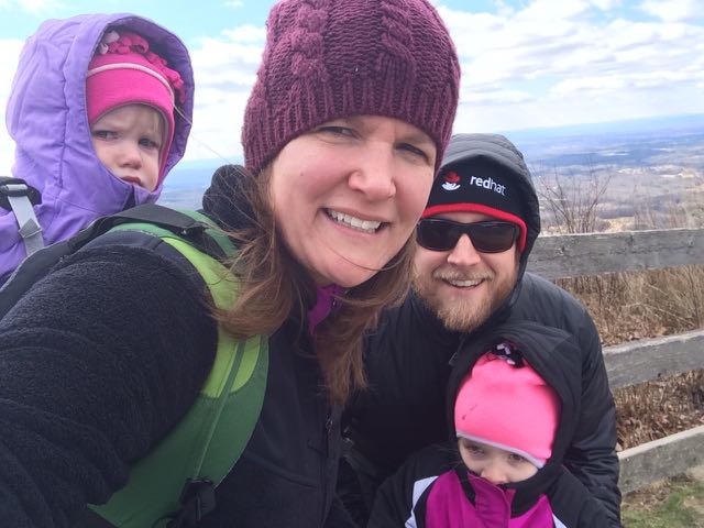 Two months ago our family headed west to Dobson, NC to visit old neighbors and friends whose son was having a first birthday. Wanting to extend the trip so we could explore more of the Yadkin Valley area, we made it a three-day trip so we could visit Pilot Mountain State Park, the nearby towns, and vineyards. Having passed Pilot Mountain dozens of times via US-52 on our way to Blacksburg, VA we had always wanted to explore this area.
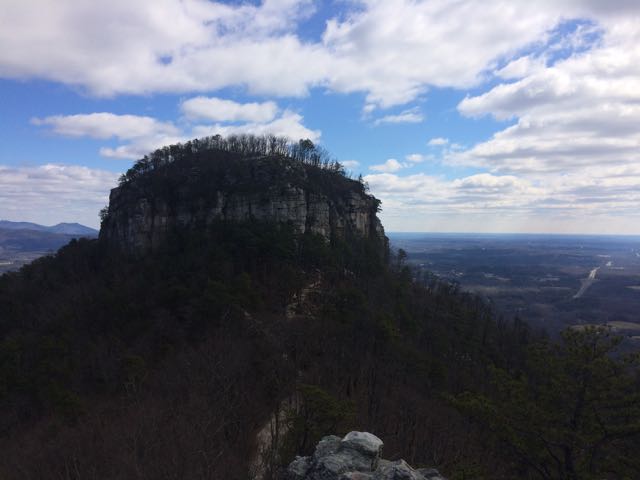 After a restful sleep on Thursday night we got up early and headed for Pilot Mountain State Park. We made a beginner’s mistake by going to the Bean Shoals Access of Pilot Mountain and after a 20 minute detour we found the main entrance to the park (
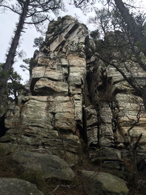 Jomeokee Trail is a short 0.8 mile looped hike around the base of big pinnacle sitting at 2400 ft elevation. To the Saura Indians, the earliest known inhabitants of the area, the mountain was known as Jomeokee, the “Great Guide” or “Pilot.” We headed around the trail counterclockwise, climbing up and down rock steps. There was little up and down terrain on the trail, but the cliff views were impressive to say the least. The trail can get rather narrow and offers some really up close views of the 200 ft Big Pinnacle. After making it about halfway around the base, our crew decided to call it a success and head back, given the cliff views were getting a little too hairy and too close for comfort (there are no railings).


 After exploring the northernmost section of
 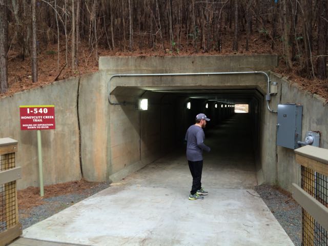 After running along the walkways we crossed under the I-540 pedestrian tunnel near the 2.75 mile marker. I was pretty out of breath pushing the double stroller up the small hills we’d run so far, but I was definitely not prepared for the long, steep hills on the other side of the pedestrian tunnel. Holy hills, Batman! Thankfully, Honeycutt Park (our destination) was only 1/2 mile away.


 We took advantage of the gorgeous weather over Christmas break and spent a lot of time exploring new places outside. The day after Christmas we drove north to Falls Lake for a 2.5 mile morning hike. If you haven’t checked out the
  We hiked Day-Hike D that starts near


 When the weather hovered in the high-70s on Christmas Eve, my family headed to a newly opened section of greenway for some exercise before filling up on holiday libations and rich foods. East Fork Mine Creek is a 2.5 mile north-south paved trail that runs along Mine Creek near Lynn Rd to the north side of Strickland Rd. We drove to one of the entrances of the trail near the intersection of
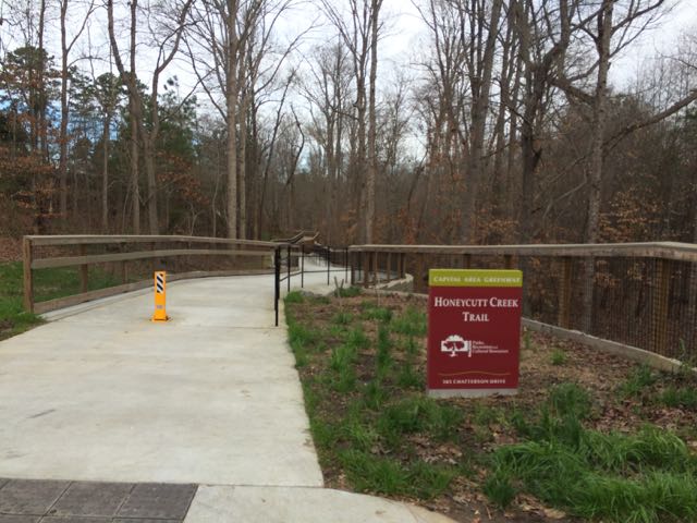
 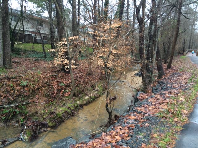 We continued north on the trail until we came to Old Deer Trail, a neighborhood street in the Summerfield subdivision. We crossed over Old Deer Trail and followed the Capital Area Greenway signs as we winded our way through this cute, low-traffic neighborhood. We passed a few other bikers and walkers along the way before coming to Strickland Rd. We crossed Running Cedar Trail, heading east on Strickland Rd where we also passed West Millbrook Middle School and mile marker 2.5, the end of East Fork Mine Creek Rd. At this point of the trail there is a well marked pedestrian crossing area designated for crossing over busy Strickland Rd. My aunt and I opted to head back to the car while the rest of the group crossed Strickland Rd to extend their run on the connecting Honeycutt Creek Trail (more on this hilly trail in a future post).


 Back in November we took advantage of my aunt visiting and went on a greenway biking day date! We biked along Crabtree Creek Trail from milepost 0 to 4.75, completing the final segment of this greenway that we had left to explore. We parked at Anderson Point Park and biked past the traffic circle near the park’s main entrance to the Crabtree Creek Trail greenway entrance and headed west (note: there are also signs for Neuse River Trail).
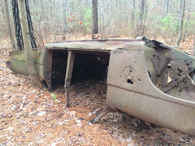
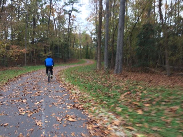 We biked until about mile marker 4.75 where we turned around at an abandoned commercial building with a gantry crane to ensure we returned to the park before sunset (note: just past this spot is


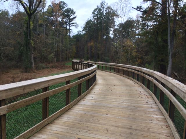
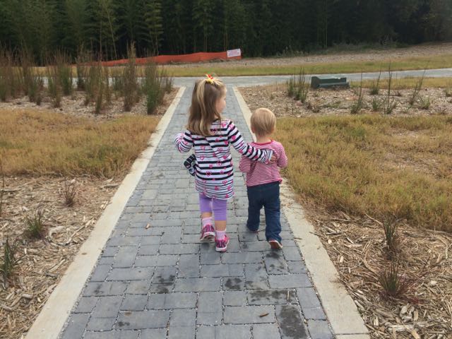 One Sunday morning at the end of October I took the girls to the newly opened Horseshoe Farm Nature Preserve. The park is located at
 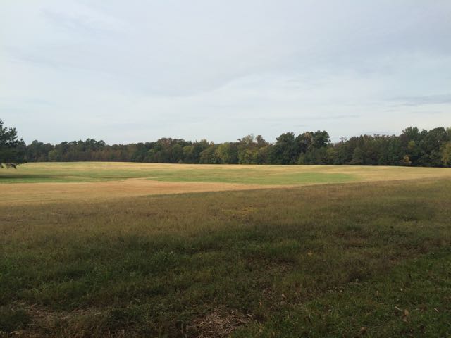 After parking in the main parking lot, we headed toward the large pavilion and then to the large open space to run and kick the ball around. Down from the large pavilion is an old red farm house and white picket fence leading to a rustic barn, all perfect for an outdoor photo op (which we witnessed while there). In looking at future phases, the farm house looks to be used for the education/art center.
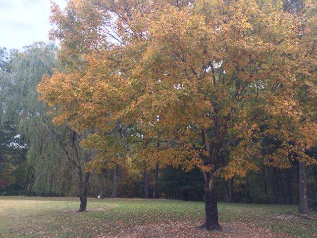 After our walk we rested under the pavilion with snacks and water and then used the compost restroom facilities before heading home. I look forward to coming back to this park over the years to see new developments and to hopefully better time the changing of the colors of the leaves. Check out their list of


