I love North Carolina’s weather. The distinct seasons provide a general schedule I can count on each year. Each season lasts long enough that I don’t tire before the next season begins. Then, sometime in early March the weather consistently warms up, the daffodils start to bloom, and the sun stretches beyond 6:00pm. That’s my signal to put away the snow gear, bust out the springtime table runner, finish birthday planning for my oldest, and welcome spring time.
The other weekend we took advantage of the gorgeous spring weather and headed to Durant Nature Preserve for a hike. We’ve visited Durant Nature Preserve several times over the years (see previous blog posts) but it had been awhile since our last trip. For this visit, we brought fishing nets, our collapsible bucket, and rain boots to play in the streams. Despite predictable resistance to hiking, the girls ended up having the best time!
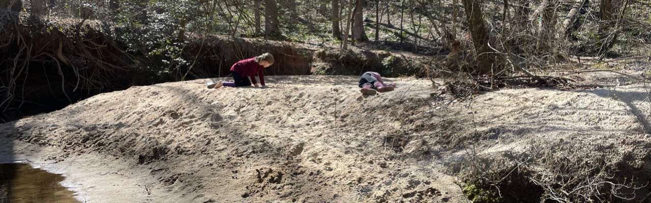
Border Trail
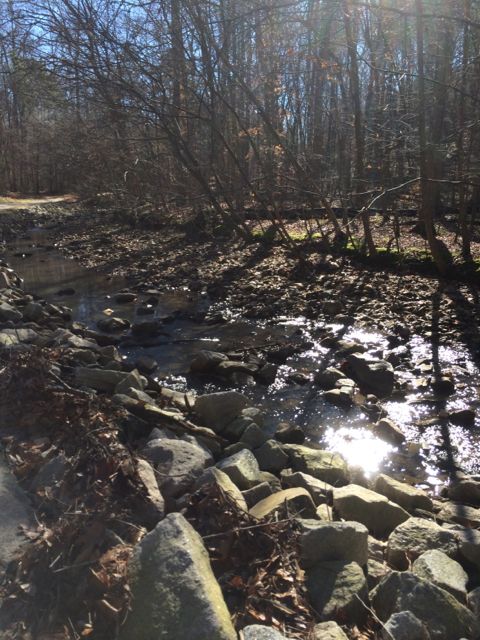
We parked at the north entrance and set off on the White House Rd Trail (see park map). Despite grumpy moods (including a short sit-in) and warning signs about muddy trail conditions we pushed on. From the White House Rd Trail we veered right onto the Border Trail, which circumnavigates the park. The Border Trail leads downhill to the creek, where at the bottom you turn left to stay on the trail. The creek sits between the wooded Border Trail on the park’s side and the paved Simms Branch Trail on the far side. Simms Branch Trail connects to Abbotts Creek greenway trail which connects to Raleigh’s longest greenway trail, the Neuse River Trail. Despite being close to a residential neighborhood the trail feels miles away. We only heard the crunching of our boots on the leaves and the trickle of the water.
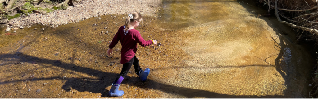
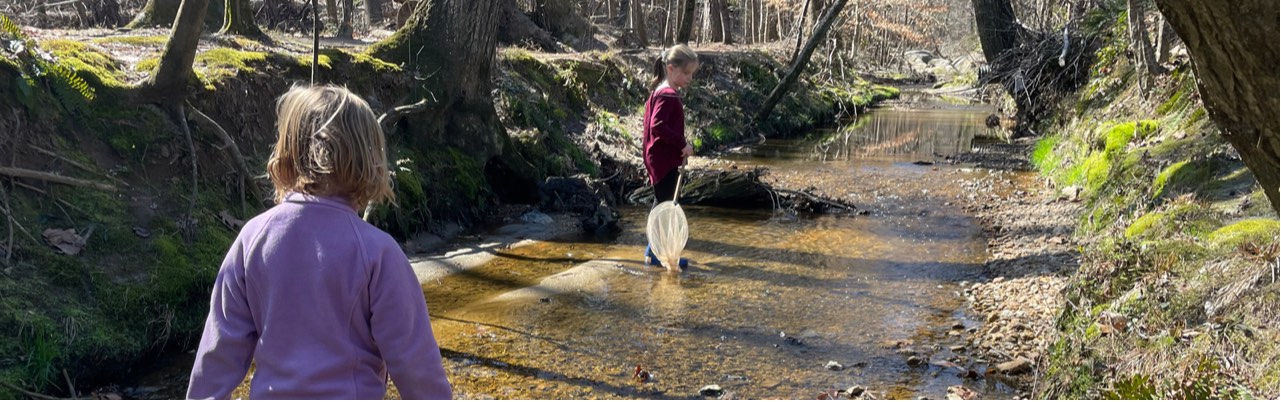
Family hiking success (for us) increases if water is involved. As soon as my kids feasted their eyes (and boots) on the creek, their hiking attitudes instantly transformed! Despite being a sunny day the water was super cold. Since the Border Trail parallels the creek, they flipped between walking on the unpaved trail and the creek. They’d scamper down the creek bank, walk through the water or hop across rocks, and then pull themselves back up the creek bank if the water level threatened to flood their boots. This type of hiking continued until we reached Whale Rocks.
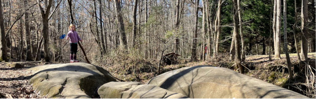
Whale Rocks is a stop along the Border Trail that boasts large rock formations as big as, well, whales. My kids loved jumping from whale rock to whale rock and timing themselves to see how long it took to climb from the creek bed to the rocks and back.
After hiking with the whales we continued on the Border Trail bouncing between walking in the creek and walking on the trail. This trail is mostly flat and features many hardwood trees and rock outcrops. We found dry creek beds and natural sand pits along the way that made for fun imaginary fossil dig play. They also enjoyed climbing across several of the trees that laid across the creek.
When we hiked about halfway around the Border Trail we turned left to follow Order of the Arrow Trail to the lake. Order of the Arrow Trail is a wide, flat trail surrounded by many pine trees. At the fork in the trail we turned left to stay on the trail and continue towards the lake. When the trail intersected with White House Rd, we turned right onto White House Rd. Then we turned left on Lakeside Trail, following the north side of the lake. The map posted along the trails was a helpful guide.
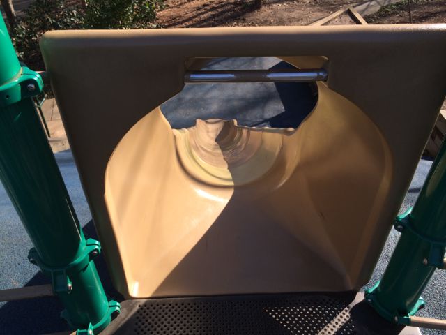
The north side of Lakeside Trail parallels the edge of the lake providing gorgeous views. The girls enjoyed walking along the shore line to spot turtles, lizards, and minnows. We also saw and heard several red-tailed hawks. We walked past campsites, benches, the closed boat house, and the fishing docks before ending at the playground.
Secret Creek Trail
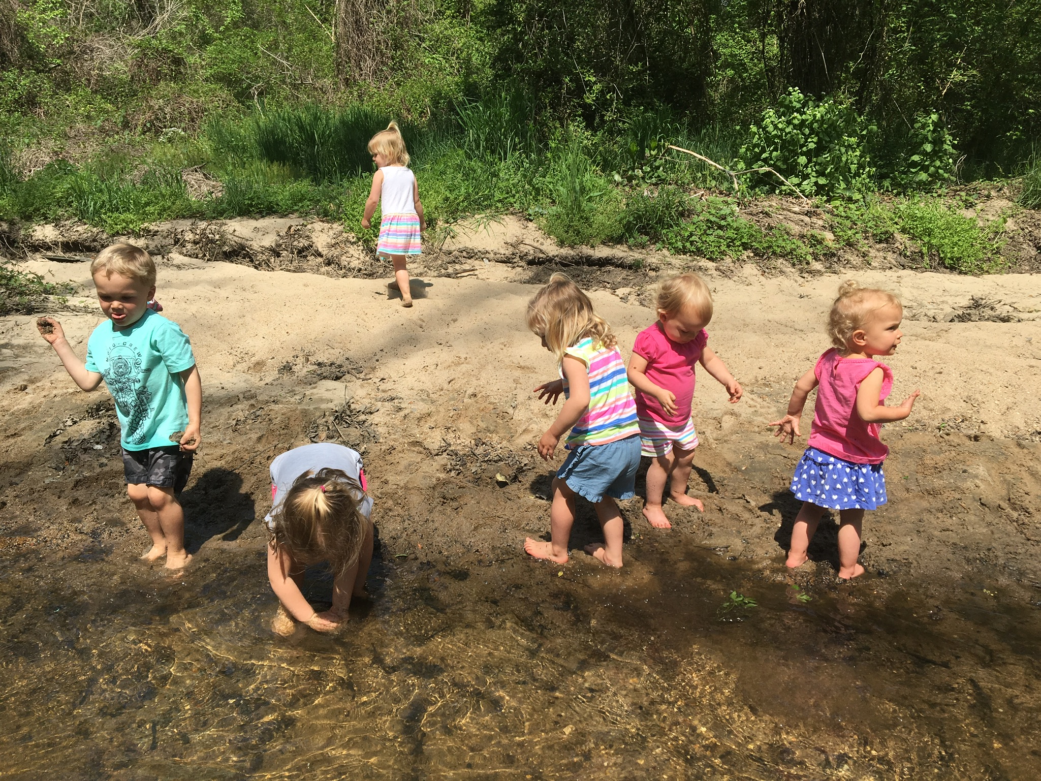
After playing on the playground we followed the Secret Creek Trail, which begins across from the playground. We originally discovered this trail about 3 years ago when my now 4th grader attended a field trip at Durant Nature Preserve. To this day, it was one of her most memorable fields trips. She caught (and released) tadpoles and dragonfly nymphs, and had an awesome time exploring the Secret Creek Trail with classmates.
Secret Creek Trail is an easy trail with a few small hills along the 1/2 mile hike. The trail parallels a section of the creek that has gentle banks and small waterfalls throughout. In past visits we’ve seen a family of deer behind the park office and huge turtles resting in the creek under the large trees. Again, we flip flopped between walking on the trail and walking in the water. The trail’s canopy provides a lot of coverage, making it a cooler walk during warm weather. We also discovered some large sandy spots great for picnics, digging, and relaxing. Secret Creek Trail finishes at Camp Durant Rd, so you have to walk up the hill along the road to return to the main parking lot.
After we finished our hike, we headed to Char Grill for some much needed lunch! As we ate we recounted how fun the hike was and how we can’t wait to explore it again during the warmer weather months!
Thumbs up: improved trail markings and maps, rocking climbing at Whale Rocks, easy access for exploring the creek
Thumbs down: nothing to report


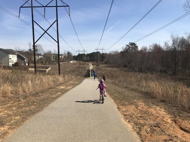 Looking for a fun family bike ride over the holiday weekend? Discover the
 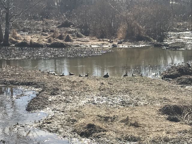 We maneuvered through the neighborhood sidewalks and carefully crossed Hodge Rd to continue on Mingo Creek Trail. Shortly after, we biked along the half-mile causeway, which was sandwiched between marshy areas and residential homes. We stopped on the causeway to watch the turtle and duck families sunning in the water. A great heron (or egret) also caught our eye.


 In January we headed with friends to Umstead Park to explore the super kid-friendly Oak Rock Trail, which is only 1/2 mile long. This is a great hike for young families or large groups with young kids. The trail has easy access to clean restrooms and picnic tables, and shallow stream access for water fun in the warmer months. It’s also part of the


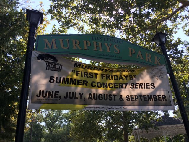 And so begins my multi-part series on public parks we explored in Northern Ca. At the end of the summer we took the girls on a huge adventure to visit my aunt and uncle in Northern California. It’s unfortunate we waited so many years before visiting them – we made amazing memories this trip and I’m so glad we shared it with our kids.
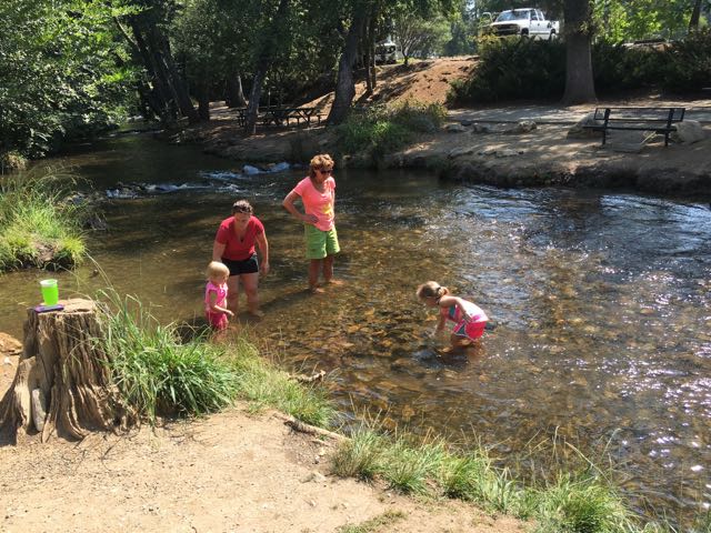
 After exploring the park we visited retails shops in downtown Murphys and ate a yummy lunch at


 When the weather hovered in the high-70s on Christmas Eve, my family headed to a newly opened section of greenway for some exercise before filling up on holiday libations and rich foods. East Fork Mine Creek is a 2.5 mile north-south paved trail that runs along Mine Creek near Lynn Rd to the north side of Strickland Rd. We drove to one of the entrances of the trail near the intersection of
 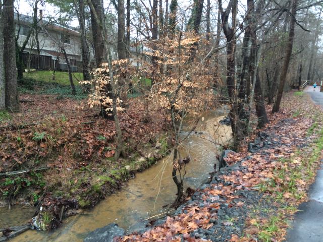 We continued north on the trail until we came to Old Deer Trail, a neighborhood street in the Summerfield subdivision. We crossed over Old Deer Trail and followed the Capital Area Greenway signs as we winded our way through this cute, low-traffic neighborhood. We passed a few other bikers and walkers along the way before coming to Strickland Rd. We crossed Running Cedar Trail, heading east on Strickland Rd where we also passed West Millbrook Middle School and mile marker 2.5, the end of East Fork Mine Creek Rd. At this point of the trail there is a well marked pedestrian crossing area designated for crossing over busy Strickland Rd. My aunt and I opted to head back to the car while the rest of the group crossed Strickland Rd to extend their run on the connecting Honeycutt Creek Trail (more on this hilly trail in a future post).


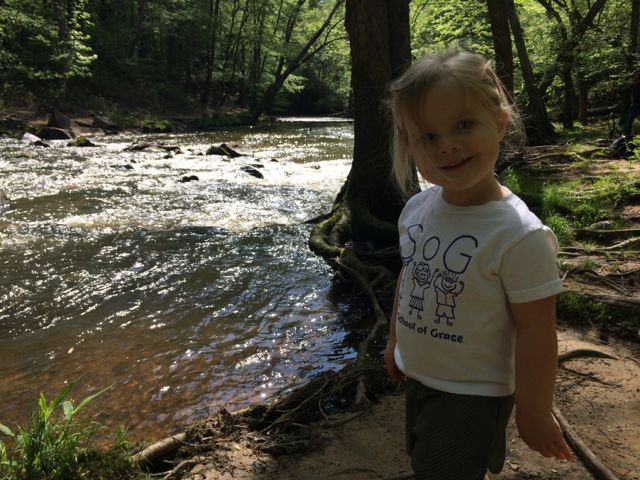
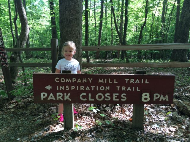 So, for our hike we headed out to the
 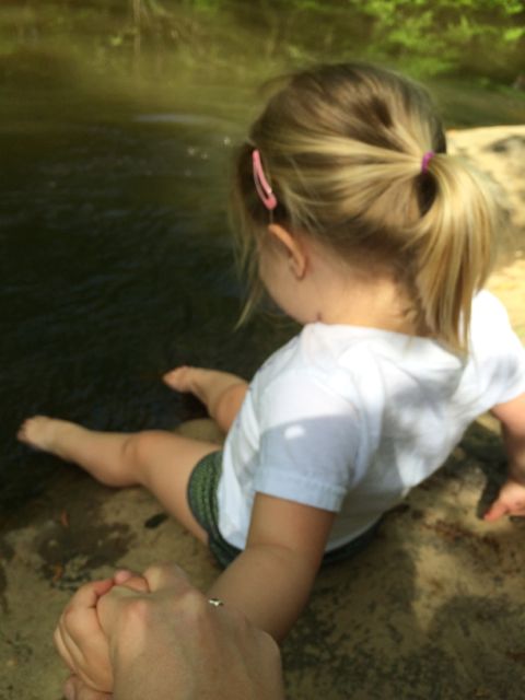 So we set off and hiked for a mile until we came to the creek. Before heading across the bridge we walked down some steep rocks and had a snack along the creek’s edge near the remnants of the old mill wall. According to an information board near the parking lot, Company Mill was built in 1810 by Anderson Page and was used for grinding wheat and corn. It was also a popular spot to have fish fries, weddings, and social gatherings before being washed away by a flood in the 1930s. There are several flat spots below the old wall and near the water that are great for stopping. A friendly photographer took our picture for us and then warned us of some water snakes he saw (luckily we didn’t see any). After our snack we headed across the bridge and turned right to join the few crowds on the large rocks near the opposite side of the creek bank. Ashley loved scooting down to the water and got tickled when I told her she could take her shoes and socks off and soak her piggies in the water. This child was in heaven! And, after a short while later we hiked the one mile route back to our car. She was pretty exhausted for the last half of the hike home, but stayed in good spirits and finished on her own…I was so proud of her!


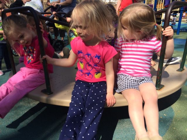
 MacDonald Woods Park has playground areas for the 2-5 and 5-12 age groups with two swings for both groups. The 5-12 age playground is rather large with several ladders and slides, monkey bars, and climbing wall with rope. The loop-shaped ladder was by far a challenging favorite for this duo. The younger playground is very small with only 2 slides, steps and a platform ladder. There are a few bouncy rides and a small low-to-the-ground structure for early walkers. A small elevated sandbox is located between the two playground areas. But, by far, the best feature of this park is the merry-go-round. Yes, that’s right…they have a merry-go-round! Go Cary! Of all the parks we’ve been to this was a first so you can imagine the confusion when the girls first saw it. Having never been on a merry-go-round they watched several groups of people get on and off before getting on with a group of toddler girls. These sweet maniacs quickly caught on as to why you hold on to the bars but also moved into more challenging feats such as dangling their feet over the edge. That proved to be rather anxiety-ridden for us but they had fun and no one went flying off the thing, so it was a success!


 This past winter has been one of the longest I’ve seen since moving to Raleigh over 11 years ago so when the temps hovered above 45 degrees in January we headed to North Cary Park with a friend and her girls for a short run and playground time. North Cary Park is located at 1100 Norwell Blvd in Cary off of Cary Pkwy. It’s a very large park situated along the northern end of