The Best Spots for Camping, Eating, Drinking & Hiking in Elkin, NC

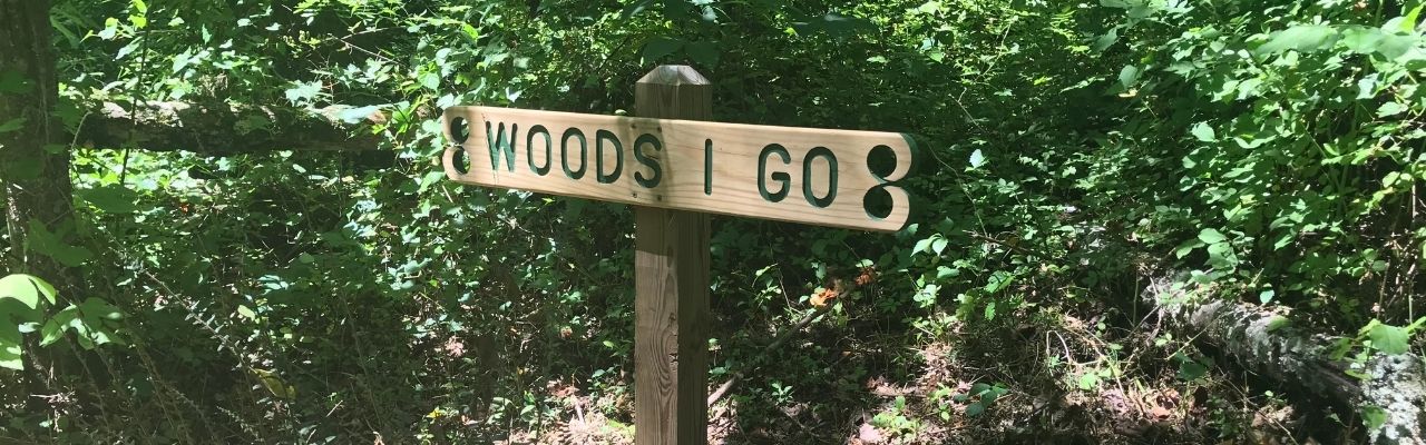
“Into the woods I go to lose my mind and find my soul.”

John Muir

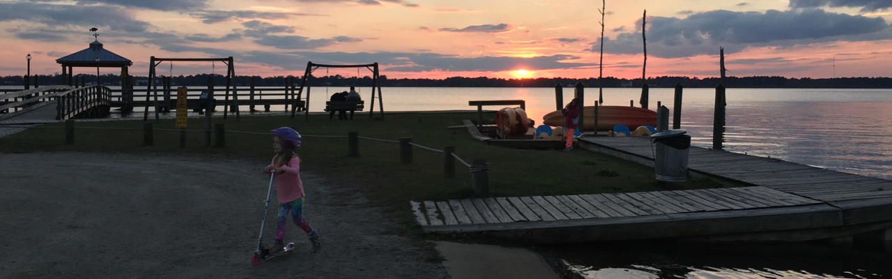
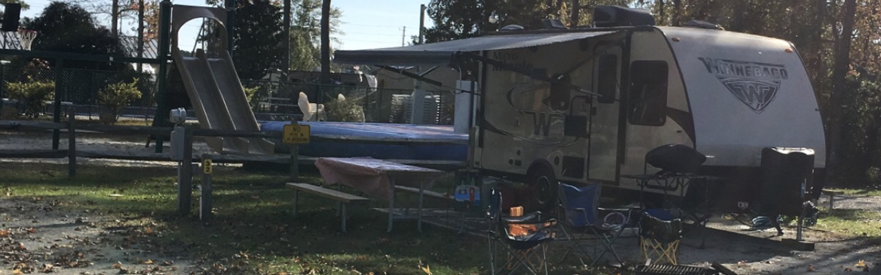
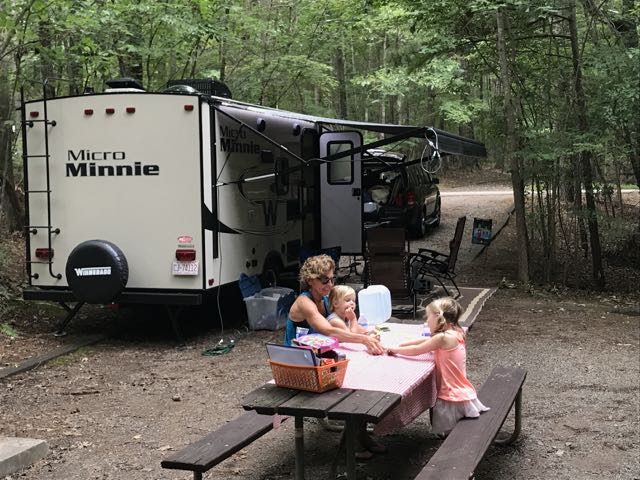
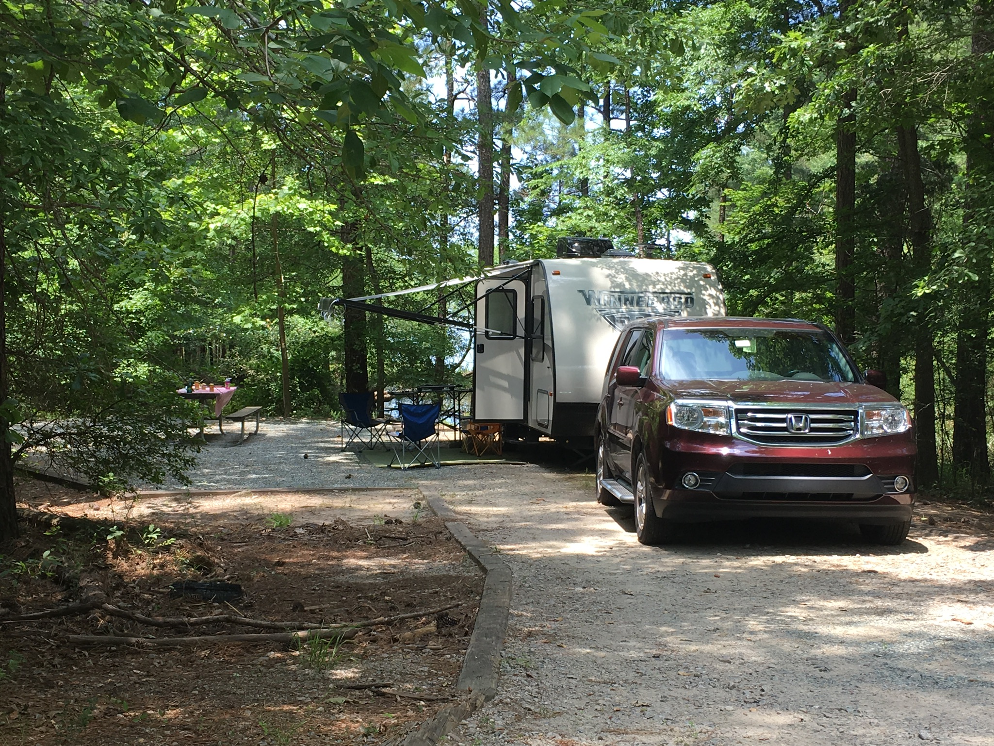
A quiet and peaceful escape. It looks different to everyone. For myself, I love being outside exploring a path, whether it’s covered in water, leaves, rock, or sand. In 2019 we purchased a few acres of land with a small creek in the Elkin, NC area. Like the first settlers to the region, we were attracted to the area because of its great wilderness and close proximity to water. Probably less like the first settlers to the region, we fell in love with their mix of restaurants and watering holes. So, over the past two years we’ve spent a lot of time exploring the woods, rivers, and towns in the NC foothills. We settle the Winnie in during warm weather months to make weekend visits comfortable. One day we hope to build a small cabin on it, but for now we’re enjoying it as we camp for short getaways.

History

The earliest known visitors came to this region about 10,000 years ago attracted by the convergence of the Big Elkin Creek and Yadkin River. The Sioux Indians settled along the Yadkin River around 500 BC, and the first Europeans settled in the mid-1700s1. The region also owes a lot to the Gwyn and Chatham families who settled and started successful manufacturing businesses.

Richard Gwyn settled in the area and began a cotton mill, the Elkin Manufacturing Company, along the Big Elkin Creek in the mid-1850s. After serving in the Civil War, Thomas Chatham and his brother-in-law, Thomas Lenoir Gwyn, started woolen mill Chatham Manufacturing, most notable for making woolen blankets2. Years later the mill moved closer to the new railroad system, which also happened to be adjacent to the Yadkin River. After the large flood of 1916, Chatham rebuilt its mill in Elkin on higher ground.

Chatham Manufacturing survived the Great Depression and expanded into complimentary industries as the country’s needs changed throughout the World Wars. The business was a huge economic part of the town, employing over 3,500 people at its peak in the 1970s. A Danish company outbid a stockholder group in the late 1980s for ownership of Chatham Manufacturing, which led to its eventual demise. Sadly, the new company then became wrapped up in financial scandal and piece by piece they divided up and sold off Chatham Manufacturing3.

After researching the history of the area, I’m more intrigued than ever to walk the streets of Downtown Elkin more closely and hunt down old blankets from my childhood to see if they don the Chatham name. I feel like we’ve only scratched the surface of the Elkin area and I can’t wait to dig deeper!

Camping in Elkin

Sandy Creek Family Campground

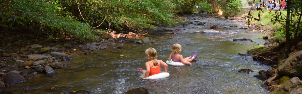
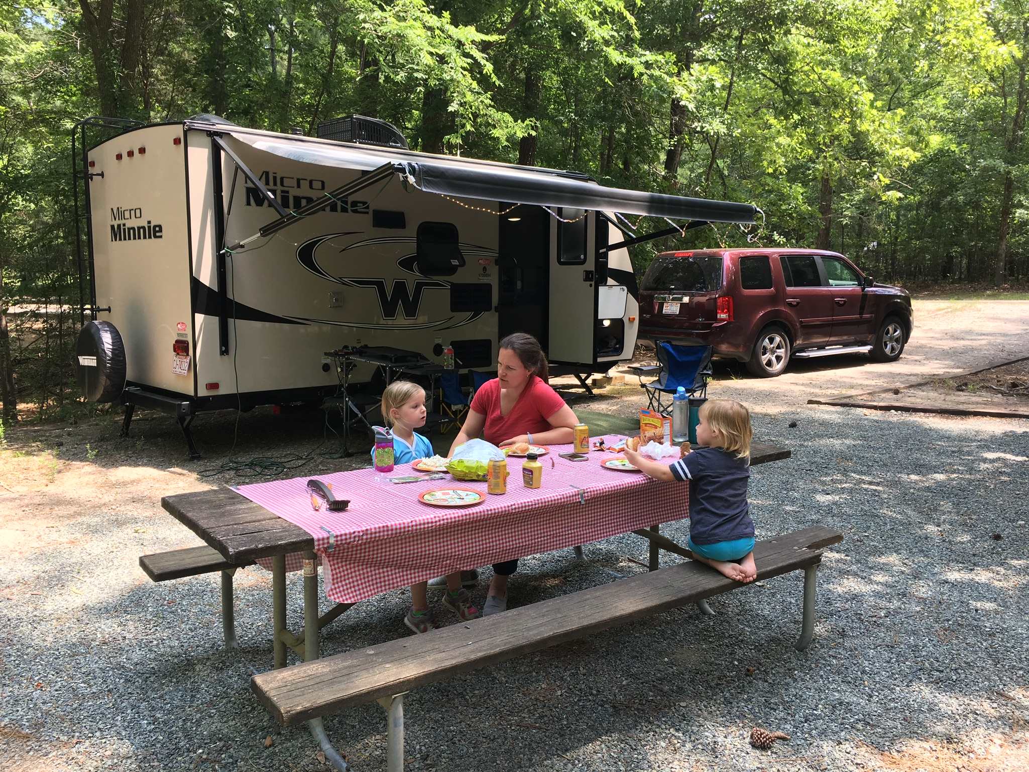
Our favorite campground spot in the area is Sandy Creek Family Campground in Traphill. A friendly, local guy named Barry owns the campground, which used to be part of a dairy farm for his cheese making. The land sits along the banks of Big Sandy Creek, which typically boasts kid-friendly wading and tubing spots. The campground is also within walking distance to the southern edge of Stone Mountain State Park, where you can connect to the bridle trails and be at the Lower Falls in a few miles.

Sandy Creek Family Campground has electric and water hook-ups and a dump station along the road. The sites are all very flat, with lots of tent camping options near the creek. Barry works hard to greet each guest, keep the bath house clean and maintain the open field area with fun recreational toys. We’ve stayed here in spring, summer and late fall and my kids always have fun splashing in the water, playing in the sand and making friends with other visitors.

Stone Mountain State Park

Two years ago we camped with two additional families at the group tent site at Stone Mountain State Park. There are four group sites which feature a clean, convenient bath house and easy Upper Trailhead parking lot access. Stone Mountain State Park provides group, backpack camping, RV and tent spots. Each group site holds up to 25 people and comes with a concrete pad, fire ring, water access and table. The families had plenty of space to spread out their tents and the kids had plenty of room to run wild. Though, I plan to upgrade our backpacking tent to a larger size before trying to cram all four of us into one tent next time!

Additional Spots

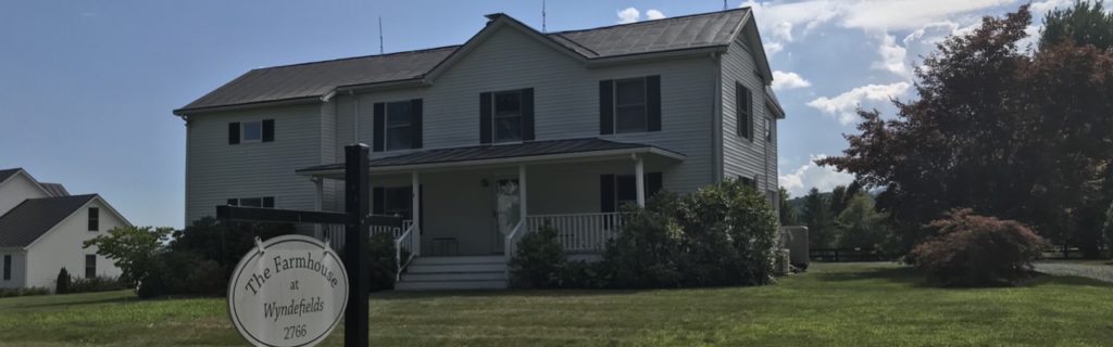
When we’re not camping or glamping in this area, we highly recommend the Fairfield Inn or the Ridenour Ranch. The Fairfield Inn is a very clean hotel with a swimming pool, great breakfast buffet and close proximity to 77. We stayed at the hotel one fall season and they blew us away with their Halloween decorations.

Ridenour Ranch is a unique place to stay if you’re looking for that country feel. The rental house sits on a working alpaca farm. The owners renovated an old two-bedroom cabin and live in another house on the farm. We stayed here one summer for a few nights and thoroughly enjoyed the peacefulness of the house and visiting with all the animals.

Riverwalk RV Park is a new campground that opened earlier last summer in the Yadkin Valley area. We haven’t stayed there before, but judging their Instagram photos it looks like campers have a great time and the owners take great pride in maintaining it. Byrds Branch Campground is another camping option in Elkin adjacent to the Mountains to Sea Trail that connects to Carter Falls and Grassy Creek Vineyard.

Grassy Creek Vineyard is home to the Klondike Cabins. Klondike Cabins features unique rental cabins that have been preserved on the former Klondike Farm property. Full of rich local history dating back to the 1920s, I can’t wait to stay here during a visit to the area.

Food & Drink

Food

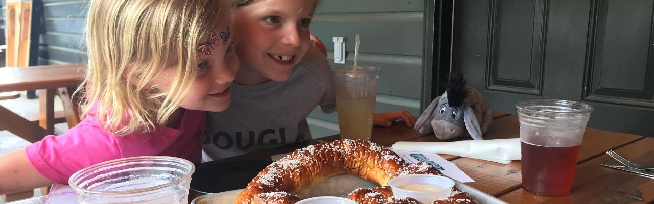
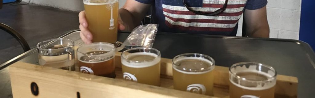
Since spending so much time in the Elkin area, we’ve gotten to know several local spots for eating and drinking. Skull Camp Brewing features the tenderest brisket and hugest homemade pretzels. They also have a great selection of craft beers – the Tr’ale B’red (Red Ale), Basin Creek Blonde, and Elkin IPA are some of my faves. Skull Camp has a huge facility with lots of outdoor patio area making it very kid-friendly and easy to socially distance.

We also recently dined at Angry Troll Brewing in downtown Elkin for the first time. We were really impressed with their wood fired pizzas, crispy chicken wings and selection of craft beers. Down the block from Angry Troll Brewing is Southern on Main restaurant. Southern on Main features a modern take on comfort food. We devoured their crispy brussels sprouts and fried green BLT. Their prices are very reasonable and their wine menu highlights several Yadkin Valley wineries.

If you’re looking for a more country setting, you can’t beat the fried chicken, potato wedges and slushies at Foothills Grocery & Deli in Thurmond. It’s a one-stop shop for gas, food and friendly service!

What is a trip to the mountains without a stop for ice cream! Creamy Dayz is located in a renovated gas station on Bridge St, not far from Downtown Elkin. Their ice cream is very tasty and they’re always experimenting with new flavors. We recently tried the cookie monster flavor, but haven’t yet tried unicorn poop! They’ve also updated their menu to include new offerings, including a donut ice cream sandwich!

Wines

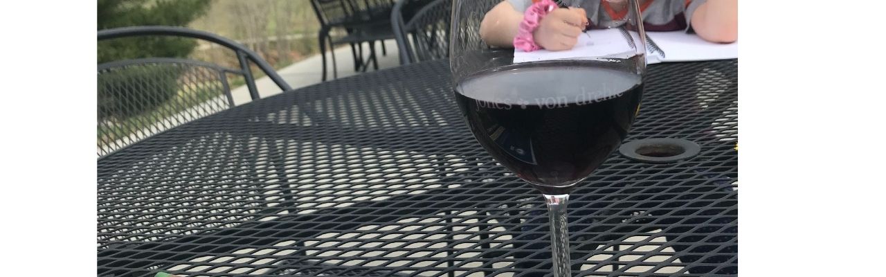
Situated in the foothills of the mountains, Elkin is also a hot spot for wine country. Located down the street from our camp spot is the striking Jones Von Drehle Winery. They are a family-owned vineyard and winery featuring delicious dry wines near the Blue Ridge Mountains. Over the summers I frequently ran over to grab a few bottles of their scrumptious rose. In the colder months, I’ve enjoyed pairing their cab sauv with a steak. Visitors can grab bottles to go or stay to enjoy a glass or tasting on their outdoor patio while overlooking the breathtaking vineyard. I recently joined their wine club and took home a delicious assortment of bottles.

Another great spot we’ve visited through recommendations of Raleigh friends is Elkin Creek Vineyard. Elkin Creek Vineyard is also located in a picturesque area with beautiful spots along the creek for an outdoor picnic. We visited Elkin Creek Vineyard pre-Covid so their full dining menu was available. Based on their website they’re still offering their famous pre-order wood-fired pizzas on Sunday. As always, you’ll want to call ahead early in the week to reserve your dough (no joke).

During Covid we had the fortunate chance to get away for the night (sans children) in Thurmond. We enjoyed our first trip to Grassy Creek Vineyard & Winery, complete with a wine flight and cozy conversation. The owners happily shared the history of their winery as we narrowed down which wines to try! The winery sits on beautiful farm land with outdoor seating, indoor seating, a hiking trailhead, and the Klondike cabin rentals.

Though only Bill has visited, he was a big fan of McRitchie Winery & Ciderworks. The folks were super friendly and the ciders were delicious. He’s more an IPA or cabernet sauvignon guy, but he also really enjoyed their cider.

We recently learned about the Elkin Vine Line, which offers transportation to five different groupings of wineries. You reserve a date/time/line, catch the bus in downtown Elkin and hop between the different wineries. Each bus line serves four wineries so it’s a fun and safe way to visit the vineyards.

Hiking in Elkin

Stone Mountain Hiking

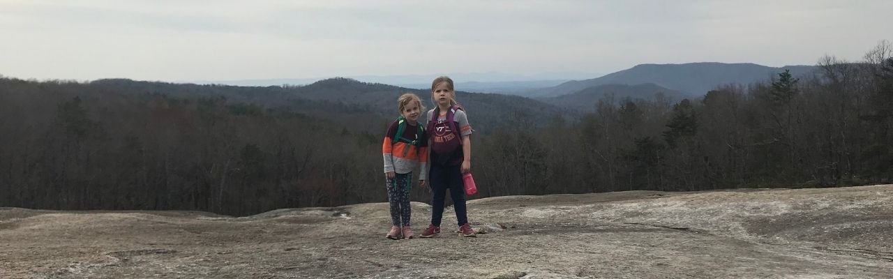
When I first hiked Stone Mountain, I felt as if I were an astronaut who landed on the moon. Stone Mountain features massive granite domes with craters large enough for your family to camp in. From the upper trailhead parking lot we hiked the Stone Mountain Loop Trail (summit side) to the summit (elevation 2,305 ft) and back. It starts off rocky and flat, and then becomes wooded and steep with several switchbacks. Along the way we crossed over the large domes of Stone Mountain’s face. We gingerly walked down the face a few yards to sit among the craters and gawk at the forests below, feeling like Armstrong, Aldrin and Collins. The entire loop trail is about 4.5 miles. If you only hike from the upper trailhead parking lot to the summit and back it’s about 2 miles. The views from the summit and along the way are gorgeous!

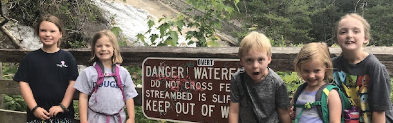
During our group camping visit to Stone Mountain we hiked to the Lower Falls from the upper trailhead parking lot. It was a hot summer day, so everyone loved playing in the Stone Mountain Falls. We came prepared with towels, bathing suits and water shoes. After playing in the water, some of the group hiked down to the Lower Falls which was about one mile away.

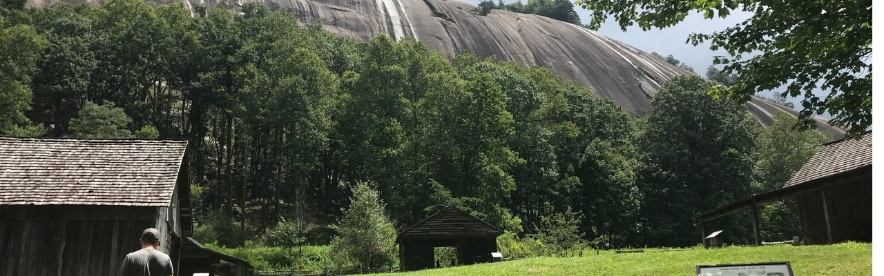
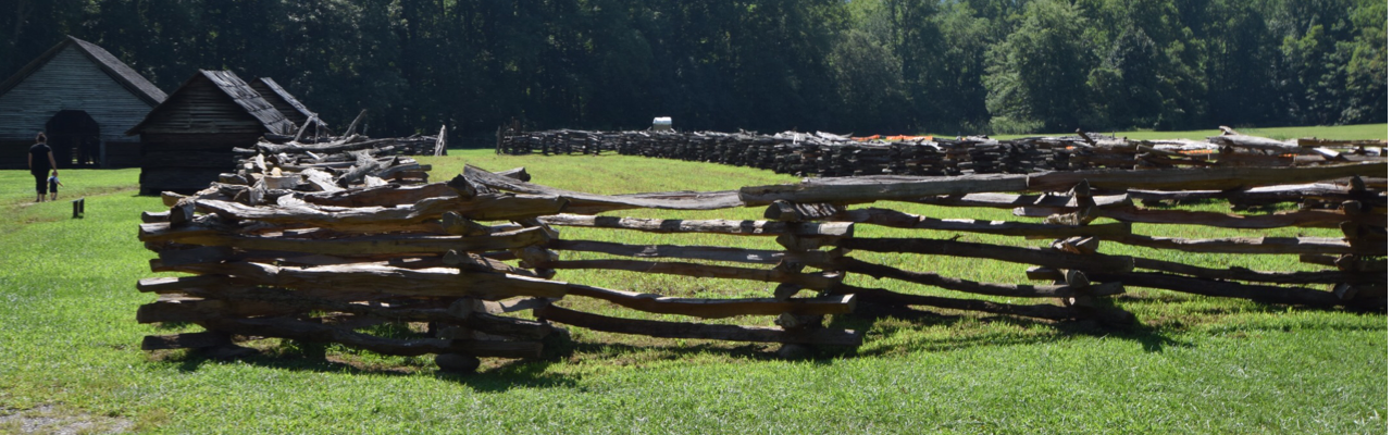
During a different summer visit to Stone Mountain we parked at the lower trailhead parking lot and hiked to the Hutchinson Homestead area. Hutchinson Homestead is a historic homestead from the mid-19th century that was recently restored. The farm features old buildings to learn what life was like during that time. The homestead sits below the huge granite outcrops, giving guests that jaw-dropping feeling from a different perspective.

Hiking at Grassy Creek Vineyard & Winery

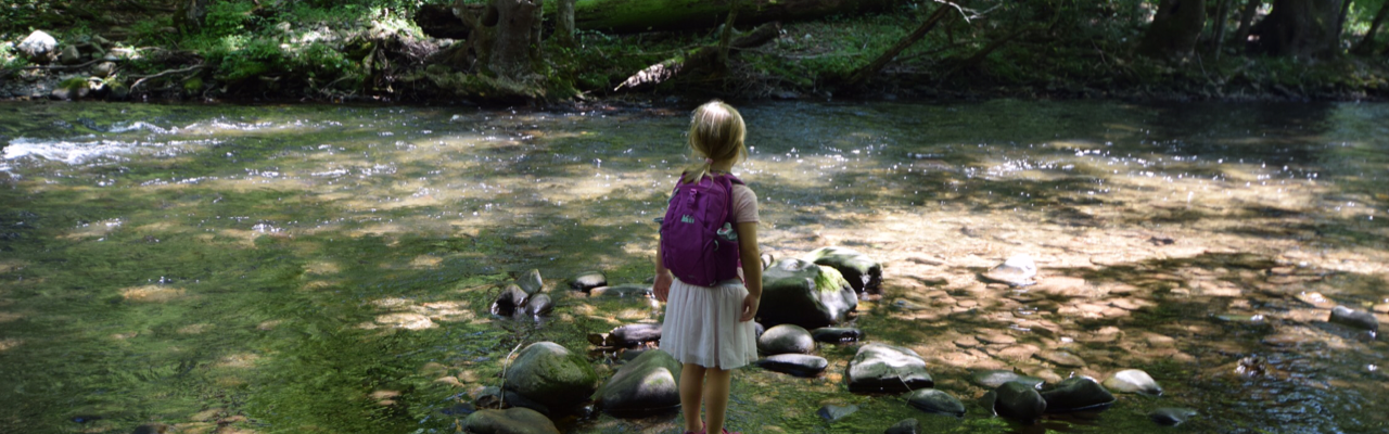
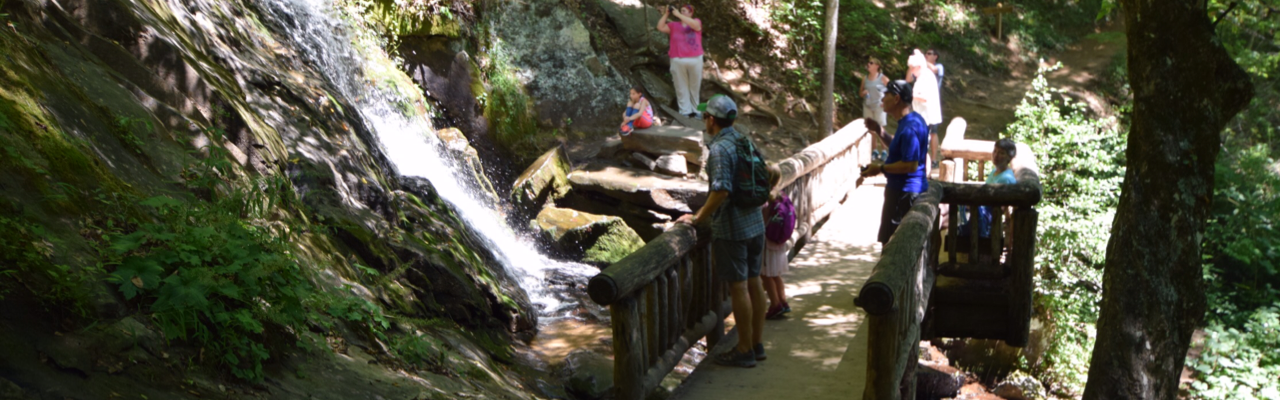
Last year during one of our many trips to the area we hiked from Grassy Creek Vineyard & Winery to Carter Falls. The trailhead is located adjacent to the vineyard parking lot and is about a total 5 mile out and back hike. After about 1/2 mile, the Grassy Creek Trail connects with the Mountains to Sea Trail segment 6. We headed westbound on the trail where we crossed a few bridges, hiked through pine forests, walked along old country roads and farms, and hiked by Byrd’s Campground.

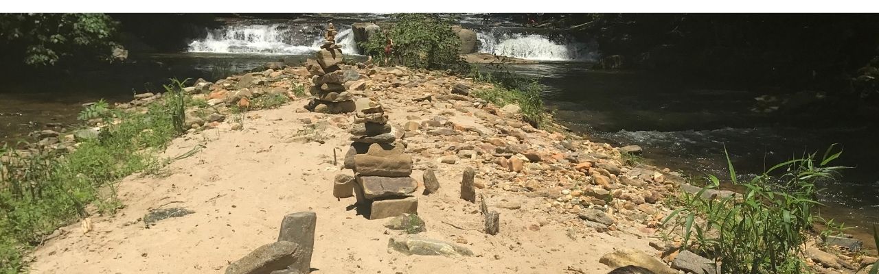
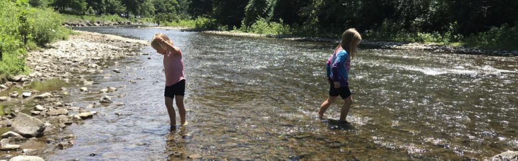
After hiking past Byrd’s Campground (feel free to stop by the camp store for ice cream) we crossed over Pheasant Ridge Rd. Then we hiked along the Powerhouse Trail which winds downward through the woods to a beautiful section of Big Elkin Creek. We played in the water, took in the waterfalls sights, and the girls played on the rocky/sandy island for almost an hour. We brought water shoes to change into from hiking shoes, which helped cross onto the island. Previous hikers built small cairns, man-made rock formations, on the small island.
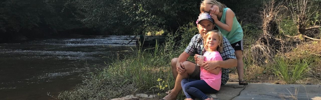
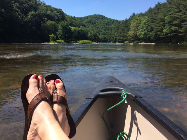
The Rivers

As noted earlier, the nearby rivers are a huge attraction for visitors. East Prong Roaring River is known for its trout fishing. Big Elkin Creek and the Yadkin River converge near downtown Elkin, providing great recreational sources today. The New River snakes way north of Elkin, also offering fun adventure options.

We haven’t done much exploring on the rivers yet, except for tubing down the New River. We rented tubes at the New River Campground in Independence, Va. They drove us up to the takeout spot and we spent about an hour floating. Summer thunderstorms popped up while we floated causing some scary moments. However, we stayed the course and limited our stops so we could float as quickly as possible. My husband and kids have returned for Y-Guides trips and each had awesome, thunderstorm-free trips!

Years ago we hiked Ivy Bluff Trail along the eastern section of the Yadkin River at Pilot Mountain State Park. This summer we hope to bring our paddleboard and kayak to the Yadkin River for some local paddle trips. The Elkin Valley Trail Association is a great resource for finding a network of connected hiking, biking and paddle trails in the area.

Celebrations

Fourth of July

If you’re looking for down-home family fun the Fourth of July celebration at Mountain Park is amazing. When we visited during 2019 they blew us away with their fireworks display. Other fun annual festivals include:

Additional Resources

Thumbs up:

  • variety of recreational activities, small town feel, network of connected trails/wineries, breathtaking views at Stone Mountain State Park, great restaurants

Thumbs down:

  • construction on I-77

Citations

  1. History of Elkin, North Carolina“, Town of Elkin North Carolina, http://www.elkinnc.org/residents/living_in_elkin/history.php.
  2. Elkin: A Town Woven Together by Chatham“, Explore Elkin, https://youtu.be/fbFv25L8LFI.
  3. “Chatham Manufacturing Was Engine That Drove Town of Elkin for over a Century“, Wilkes Journal-Patriot, 28 July 2017, www.journalpatriot.com/news/chatham-manufacturing-was-engine-that-drove-town-of-elkin-for-over-a-century/article_fe7518ce-73d9-11e7-8418-33de212843ab.html.

Waynesboro, Va

I carry my childhood close to my heart. I didn’t really realize what effect it had on me until later in life, when I started having kids and after my mom’s passing. Several times I find myself wondering what I was like at ages that correspond to my kids’ ages. I love re-visiting special places from when I was young so I can pass those fun memories onto my kids and, also, selfishly so I can feel the spirit of my childhood.

As I’ve written about in the past, my mom was big on taking us to local parks and libraries. My dad, who worked all day at IBM, always spent late evenings and long Saturdays with us on the soccer field or in the backyard. My parents were also really big on introducing us to different experiences, mostly outdoorsy ones like skiing, water sports, and animal husbandry (turkeys, ducks, dogs… you name it and we had it). Though my aunt lived 90 minutes away in Charlottesville, she also played a big part in my childhood. My parents often met her halfway at a car dealership on Route 29 and she’d whisk us away for some type of crazy adventure that usually involved hiking, camping and swimming!

My aunt’s old farmhouse

One of the favorite places my aunt used to take us was to Mint Springs Valley Park in Crozet, Va. So, when we planned out our 2018 summer trips (not a typo, that’s how far behind in writing I am), I suggested camping in Central Virginia so I could get back to Mint Springs.

Mint Springs Valley Park

Mint Springs Valley Park is nestled in the mountains of Albemarle County sitting at 1,000ft in elevation. As soon as we drove up, the tree-lined entrance took me back to being 10 years old again. The park seemed just as I remembered, though so much time had passed. We drove past the stocked fishing pond and to the main parking lot outside the swimming lake.

The swimming lake sits between the mountains and features a large sandy beach with designated swimming area. It’s a great place to bring noodles, floats and small inner tubes. The swimming area has at least two lifeguards on duty – one on the sandy beach and one on the wooden dock. The wooden dock sits about 25 yards from shore, and makes for a great spot to sun and jump into the deep water. As a tribute to my childhood, I swam the 25 yards to the dock and sat with my feet dangling over the water and waving to my family back on shore. I thought about old trips with my aunt and siblings where we jumped over and over from the dock into the colder, deeper water. And then, without hesitation, I plunged into the water and swam back to shore.

After swimming and picnicking on shore, we drove to the fishing pond, where we tried to catch some fish. Without any live bait we didn’t have much luck fishing. But, we did enjoy the peacefulness of the pond, casting from the dock, and using our nets to catch and release minnows.

Camping

We stayed for three nights over Fourth of July weekend at North 340 Campground. Overall, it’s a great campground with all the amenities – swimming pool, full hook-ups, camp store, and playground. The campground even hosted a Patsy Cline tribute singer one night, who was really fabulous! The girls loved biking around the campground and per usual, met friends to swing with at the playground and shared sparklers with neighbors. However, we felt the campsites were very closely packed next to each other. We could definitely hear the comings and goings of our neighbors who had a large group of people and dogs.

Exploring Waynesboro

When we weren’t swimming at the campground or at Mint Springs we explored all over the Waynesboro area. From caves to breweries, farms, and downtown parks, we did it all!

Grand Caverns

The morning after exploring Mint Springs, we headed to Grand Caverns in Grottoes, Va to explore the caves. Bernard Weyer (not the landowner) discovered the caves in 1804 when he was looking for his lost raccoon trap. Grand Caverns opened in 1806 to the public, and has hosted many tourists since then, including several Confederate and Union soldiers during the Civil War. Grand Caverns is an enormous space with many rooms to explore. Rivers once flowed through the rooms, and the cave is mostly formed into the hill so there’s not much cave space underground.

Grand Caverns conducts walking group tours that last about an hour. Our tour guide was super knowledgeable about the caverns and kept our group moving. He told us interesting facts about special events and church services held inside the caves in the 1800s, and pointed out unique stalagmites that seemed to take the shape of old presidential faces. Despite the lengthy tour, there was so much to admire that it held our kids’ attention.

After finishing the tour we enjoyed a picnic lunch at the large covered pavilion. The park also features hiking trails, fitness trail, swimming pool, playground and mini-golf. After lunch, we headed out to the Blue Ridge Parkway for a quick hike before storms came through.

The Slacks Overlook

Despite the name of this stop on the Blue Ridge Parkway, the Slacks Overlook (near milepost 20) does not have an overlook. We hoped to find the nearby White Rock Falls so we headed off on an unmarked trail behind the picnic tables hoping it was the White Rock Falls trail. The pull-off area did not have a map and our cell reception was not working, but we pushed on.

After hiking awhile we found a sign showing we were on the Slacks Trail. At the directional sign we continued towards the White Rock Gap Trail. After hiking a bit longer we never found the falls. We noticed stormy weather coming and with little things of interest on the hike, we decided to turn around. The girls also became super frustrated on this hike, which started the idea of bravery stones. They found stones on our hike to hold that helped them refocus and get back to the car with less crying. Since this hike, we’ve found many bravery stones on future trails.

Though our hike was a bust, we made it back to the car right before the heavens opened up on us. After further research I found a similar website highlighting more information about how to find the White Rock Falls waterfall. And, I feel better knowing he, too, had difficulty finding the falls at first.

Breweries

During our trip we explored Basic City Beer Co and Stable Craft Brewing. Even though both places are breweries, that’s where the similarities stop. Basic City Beer Co is located near the intersection of 340/250 at 1010 E. Main St in a renovated warehouse in the older downtown part of the city. The brewery’s name is a tribute to the history of the Waynesboro area, and features a cool steel structure outside. Basic City Beer Co is the first brewery I’ve been to that features an area in the back for food trucks to pull-up to and operate a mini storefront, complete with a counter – genius!! We enjoyed delicious food, played kid-friendly games, sampled beers, and can’t wait to return some day!

We visited Stable Craft Brewing after our big hike fail from above. Stable Craft Brewing is located in the western part of the city among the beautiful rolling countryside. We first visited this brewery in 2015 when it hadn’t quite opened yet, and was the setting for a friend’s wedding. I remember falling in love with this space then, and couldn’t believe the beauty of it the second time around.

Stable Craft Brewing is a working horse farm, special events venue, restaurant, and brewery all wrapped into one. We enjoyed some yummy dinner and beers inside, and then took the liberty to explore the farm before having a final beer overlooking the countryside. The girls loved climbing the spiral staircase out front to look over the barn, seeing inside the horse stalls, and waving to the horses from afar. If you are craving country hills and yummy beers, this is the place. Dare I say it rivals Rising Silo Brewery in Blacksburg??

Ridgeview Park

On a different day we explored Ridgeview Park located adjacent to the South River at 700 S. Magnolia Ave. With its huge open space, rolling hills, established trees and easy river access we all immediately fell in love with this park! Situated on 85 acres along the South River, this park also features a large outdoor swimming pool, ball fields, amphitheater, Serenity Garden, shelters, tennis courts, and soccer fields.

The girls played on the playground for awhile and then cooled off in the river. The South River is very shallow for a good stretch, making it pretty kid-friendly. We walked up and down the banks of the river and even rented kayaks from the nearby swimming pool for some extra activity. This park also features a pedestrian bridge that connects to a large neighborhood on the other side. Bill and I seriously checked Zillow for surrounding houses for sale – the proximity to the park and river would be amazing for any family!

Dining Out

We made most of our food at the campground, but did make it out for food a few times. After our big hike we made our way to Kline’s Dairy Bar for delicious ice cream. They’ve been around for 75 years, so it felt great to support such a historic spot.

For lunch one day we enjoyed coffees and light food at Farmhaus Coffee Co at 908 W. Main St. The weather was perfect for sitting outside on the patio, though they also have beautiful sitting areas inside, too. I loved the farmhouse decor, bookcases of books everywhere, and oh yeah – the food and coffee were delicious too!

Waynesboro, you exceeded all our expectations! We packed in so many adventures, but with the rural settings our trip still felt very peaceful and relaxing. We can’t wait to come back one day!

Thumbs up: Ridgeview Park, South River kayaking and access, breweries, peaceful rural settings, campground amenities, proximity to dining/hiking/adventure

Thumbs down: squished feeling at North 340 Campground, hiking trail signage at Slacks Overlook

New Bern, NC


If you’re looking to get out of Raleigh for the weekend, but don’t want to drive to the beach or mountains, head to the river instead! Last fall we took a quick weekend Winnie trip to New Bern, NC. We camped, hiked, explored museums and historical homes and walked around downtown. And, we took our time leaving on Sunday because it’s such an easy drive home!

Camping in New Bern

New Bern is located along the Neuse River about 2 hours east of Raleigh. The Neuse River near New Bern is much wider than near Raleigh and eventually dumps into the Pamlico Sound. We stayed at a fantastic KOA campground on a campsite adjacent to the playground. Though it was a super cold weekend with lows in the lower 40s, the Winnie’s heating system kept up and we slept very comfortably. 

This was our first KOA camping experience and it was crawling with kids and activities. The campground features a big pirate ship playground, miniature golf, a huge jumping pillow, a catch and release pond, and breathtaking waterfront views of the Neuse River. Both evenings we followed the short path to the waterfront and sat on the swings to catch views of the sunsets.

The campground is less than 10 minutes from downtown New Bern so it was super convenient for the price. Other than RV rental sites, they also offer rental cabins and tent sites, which all looked very nice. When we come back to New Bern, we’ll definitely stay at this KOA campground again.

Exploring Downtown New Bern

The first night we headed into downtown New Bern for dinner and to explore the shops during the Art Walk. We enjoyed a delicious seafood dinner of steamed crab legs, oysters, and clams and the girls tried their first alligator bites at MJs Raw Bar & Grille. Then, we walked through some of the nearby shops, which all seemed to be super dog friendly.

As we walked around we noticed the frequency of large life-size fiberglass bears everywhere. The girls loved taking pictures with them, and after a quick Google search we learned the founder of New Bern named the city after his native city of Berne, Switzerland. Bern means “bear” so the bear symbol is shown on the city flag and local artists painted the fiberglass bears in honor of the city’s 300th anniversary in 2010. 

Downtown New Bern is surrounded by the Trent River to the south and the Neuse River to the east. Though we didn’t make it down to the waterfront, we drove by a large waterfront park and several waterfront restaurants that looked fun for a future trip. 

Hiking in Croatan National Forest

The next morning we headed out to Croatan National Forest for a quick hike along the river. We drove about 20 minutes south of New Bern along US-70 to the Flanners Beach/Neuse River Recreation Area located at the end of Flanners Beach Rd. This area features picnic areas, restrooms, ample parking, hiking, biking, and a nearby campground. The campground has about 40 wooded sites (some with electric hook-ups) that accommodate RVs and tents.

The trailhead for Flanners Beach/Neuse River Loop Trail begins near the campground area. The path starts out paved and then transitioned to unpaved dirt and gravel after we hiked further into the forest. Ash and Claire weren’t in a prime hiking mood, so we quickly made a scavenger hunt game with scrap paper in Ash’s hiking backpack. Searching for natural items of different colors definitely cheered them up! 

This 2-mile loop trail features dense hardwoods, pines and ferns. The girls enjoyed picking up downed pieces of pine limbs and using them as sweepers to clear the pathways. The trail signage wasn’t very helpful, but having GPS on our phones helped us stay on the right loop. At one point we crossed a narrow wooden boardwalk over a marshy area before coming to beautiful views of the Neuse River. At the end we arrived back at the open recreation area and walked down the steps to explore the river’s shoreline. Being a cold morning, there weren’t many people out hiking and we had the beach to ourselves. The views from the shoreline were amazing; it’d be fun to explore this beach during the summer months.

Exploring Tryon Palace

Later in the afternoon we headed back to downtown New Bern to explore Tryon Palace. Tryon Palace is a Georgian-style mansion built between 1767 and 1770. It served as the first capitol building of North Carolina and home to Royal Governor Tryon and his family. Tryon moved to New York a year later and a new Royal Governor moved in until the start of the Revolutionary War. Patriots made the palace their capitol and the General Assembly met there to draft North Carolina as a new state. Subsequent NC governors used the palace and even George Washington visited the palace in 1791.

After Raleigh became the capitol in 1794, the palace served as a boarding house, school and for other purposes. A fire broke out in 1798 causing major devastation to the main house. The house stood in disrepair until local residents started a movement in the 1930s to raise money and awareness about potential renovation. In 1959, the palace opened to the public.

We attended a guided tour of the main house, which are held hourly on a first-come, first-serve basis. A lot of the furnishings in the palace are English. The guided tour lasts about 45 minutes and the tour guides wear period dress. After the main house tour, we walked through the kitchen and stables, which showed cooking and stable demonstrations, respectively. Finally, we walked through the English-style gardens behind the main house. The guided tour was the perfect amount of time for our kids (ages 4 and 6 at the time). They really enjoyed seeing the cooking demonstrations and playing old-time games on the front lawn.

After Tryon Palace, we headed over to the Pepsi Family Center to virtually travel back in time to 1835. We learned about New Bern’s history through hands-on activities with sailing a ship, making foods, and sewing a quilt. The girls chose interesting patterns for their quilt squares and the computer “sewed” them together. Their favorite activity involved playing unique roles on the ship to help guide it to its destination. 

Overall, we had such a fun weekend exploring New Bern, but I know we’ve just broken the ice with what the area has to offer. I was impressed with how family-friendly the historical places were and look forward to future excursions at New Bern. Next time, I’d love to explore the waterfront area and generally spend time on the water.

Additional Info:

Thumbs up: unique history center, beautiful river views, great campground amenities and convenience to New Bern, hands-on activities at history center, bustling downtown New Bern, variety of family-friendly places/activities

Thumbs down: poor signage on the hike

Great Smoky Mountains, NC

Like so many people at the end of last summer, we too, jumped on the total eclipse bandwagon and drove out to a remote part of NC to watch the phenomenon. It was a lot of firsts for our family – tailgating for science, visiting the Great Smoky Mountains, and exploring parts of NC west of Asheville. I’m not usually a follow-the-crowd type of gal, but my science lovin’ family wanted to be a part of it, so I was game too! 

Timberlake Campground

We wanted to stay within an easy drive to Andrews, NC (total eclipse central) and be close to the Smoky Mountains for hiking and exploring. So, we booked three nights at Timberlake Campground in Whittier, NC about 3 months ahead of time.  Timberlake Campground is located at 3270 Conleys Creek Rd between Sylva and Bryson City. A sweet couple owns and lives on the campground property, which features 50 sites. We stayed in one of the water/electric sites across from the playground on the stream side. The site was perfect for us – lots of shade and next to a creek where the girls “tubed up” and down for hours! With my birthday being so close to our trip, I brought my new birthday ENO hammock, which was ah-mazing! We felt comfortable letting the girls ride their bikes up and around the loop near our campsite.

When the campground owners aren’t in the camp store they rely on the honest system for people to pay. They even gave us a tour of their farm and let us collect their blue chicken eggs. Bill enjoyed taking the girls fishing in the pond

Oconaluftee Museum

The first day we drove into Great Smoky National Park and visited the super popular Oconaluftee Visitor Center and Museum. The museum is located at the southern end of the Blue Ridge Parkway just past Cherokee, NC at 1194 Newfound Gap Rd.

The Smoky Mountains get its name from the smoke-like mist coming off the mountains. The water vapor from the conifers mixes with the trees’ natural terpenes to give off the mist. It’s a beautiful site to see, especially early in the morning. We explored the indoor exhibits, which give some history and information about the history and early living conditions in the Smoky Mountains. Then, we spent most of our time exploring the outdoor exhibits. The outdoor exhibits give a glimpse into life on a mountain farm in the 19th century. They feature an old log cabin, spring house, barns, apple house and smoke house. The girls enjoyed walking through the different houses and pondering life before there was live streaming TV, air conditioning, and electricity.

We also walked through the short walking trails down to the river, where we saw people fishing and tubing. The gentle river banks and shallow water allowed the girls to easily wade in and cool off. 

Juney Whank Falls

After leaving Oconaluftee Museum we headed south towards Bryson City to catch some waterfalls in a different section of the Smoky Mountains. As we drove to the park near Deep Creek we passed several tube rental companies. When we arrived at the park we were amazed to learn this park is a tubing mecca for the whole family! Deep Creek feeds from the Tuckasegee River, which runs through Bryson City. Had we realized the tubing option we would’ve planned better with bathing suits and towels. Though the park doesn’t offer tube rentals, there are plenty of places like Deep Creek Tube Center & Campground that rents tubes for $6/day and features camping and other outdoor activities.

Trying to divert our kids’ attention (and ours) away from tubing and back to hiking was no easy feat! But, we promised them a future trip, which we can’t wait to plan! The trailhead for Juney Whank Falls is located towards the back of the park. The trail was a short loop less than a mile long. When we arrived at the falls we were a little disappointed we couldn’t get into the water. We walked over a small footbridge to reach over and touch the falls as they cascaded down. The trail was a bit busy especially near the falls, so we quickly continued on the loop. We hiked the rest of the trail fairly easily except for the downhill ditch-like spot that we tip-toed over.

After the hike we longingly watched the tubers on repeat: float down the creek and walk back. Then, we drove back through Bryson City and stopped at Nantahala Brewery for some much deserved beers. As Bill ordered our beers, I took the girls to the nearby ice cream shop for their dessert. In all my time in NC, I’ve only ever heard Bryson City referred to as the place to go around Christmastime. Though it’d be cool to come back for the train ride, I’m dying to come back and take my kids tubing in summer!

Andrews, NC Total Solar Eclipse

The next day being the big total eclipse day, we awoke early and headed west on 74 through the Nantahala National Forest for Andrews, NC. The drive along 74 was beautiful – the road parallels the Nantahala River and is busting to the seams with outdoor adventure. We passed several ziplining/ropes courses, kayakers, white water rafters, paddleboarders and more. Again, I made a mental note of a family adventure place!

After driving about 1.5 hours we arrived mid-morning in Andrews, NC. For a very small town, this place was bustling on such a big day. We parked in a large farm field designated for the Total Eclipse Festival. Though the total eclipse wasn’t happening for several more hours, we lucked out with one of the last parking spots. Several folks set up their telescopes in the field in preparation – it was like tailgating with science nerds! 

Then we walked to downtown Andrews to explore the pop-up art, food and live music. The girls made some cute candles and snacked on huge italian ices, while Bill and I enjoyed local BBQ. Around 1pm we grabbed some local beers and headed to the big open “eclipse watching” field. We set up our chairs and blankets while the girls ran around with several kids.

Around 1:00pm, the partial eclipse slowly began where we could see small chunks of the sun being eclipsed by the moon. Several people set up cameras with tripods and telescopes in the open field and hopped between taking shelter in the shade and grabbing a quick shot in the sky. Thanks to Bill we came prepared with a special solar filter for my camera. The girls loved wearing their special eclipse glasses and seeing the progression of the sun’s eclipse.

Around 2:30pm when the sun was just a small sliver, everyone descended into the middle of the field. The temperature dropped rapidly and the sky darkened. Suddenly all you could see was the sun’s corona creeping from behind the moon. It was quite a site to see, and it lasted more than 2 minutes! Then, just like that, everything went back to normal and the sun got bigger and bigger. We didn’t stick around to watch the sun’s complete return to normal so we could beat the traffic out of Andrews.

Watching the total solar eclipse was a really cool thing that I hope our kids remember. Planning the trip around the event motivated us to explore the very western parts of NC, for which I’m so thankful. I can’t wait to return to the Great Smoky Mountains and the Nantahala River for fun family outdoor water adventures!

Thumbs up: outdoor recreation activities, friendly campground owners, watching a total solar eclipse, 

Thumbs down: busy and poor signage at Juney Whank Falls, lack of sufficient parking at Oconaluftee Museum

Juney Whank Falls


Oconaluftee Museum


Timberlake Campground


Total Solar Eclipse in Andrews, NC

Falls Lake: Rolling View Campground

Throughout my early childhood, my family spent several summers renting a weekly beach house in Cape Hatteras. We always went in mid-September because the pricing was just right for a large house that could fit grandparents, aunts, uncles and my family of five. Once we got busy with after school sports in middle school, our family stopped making the annual trip. So, when our family decided to head back to Cape Hatteras last summer after a 25-year hiatus, only a mandatory evacuation could stop us – and it did!

Hatteras Evacuation

Due to an unfortunate accident on Bonner Bridge, Dare County prompted a mandatory evacuation of Cape Hatteras island two days before our vacation was set to start. With family coming from CA, TN, and VA, my sister acted fast and found us an amazing last-minute house in Emerald Isle, starting a day later.

With the extra day’s wait and our kitchen in full demolition mode, we did what any sane family would do. We loaded up the Winnie for a nearby overnight trip to Falls Lake Rolling View Campground.

IMG_9853Falls Lake Rolling View Campground

Falls Lake Rolling View Campground is located at 4201 Baptist Rd, just north of 98/west of 50. Since my aunt arrived from CA the day before, she also ventured with us, excited to be the first overnight guest. We rented a back-up spot in Loop A, close to the bathrooms. Falls Lake does not have sewer hook-ups (as is the case of most state parks) so we used the surprisingly comfortable restrooms/showers. Overall, our shady camping spot was perfect for a late July Saturday.

Being only about 30 minutes from the house we arrived mid-morning to a quiet campground and swimming area. We enjoyed cooling off in the roped-off swimming area with the $5 tubes we purchased earlier in the season. Between splashing and exploring the nearby playground, the girls also played in the sandy beach. Overnight guests have access to the beach area with their rental fees. You can also just pay a “per car” fee to use the beach daily.

IMG_9858
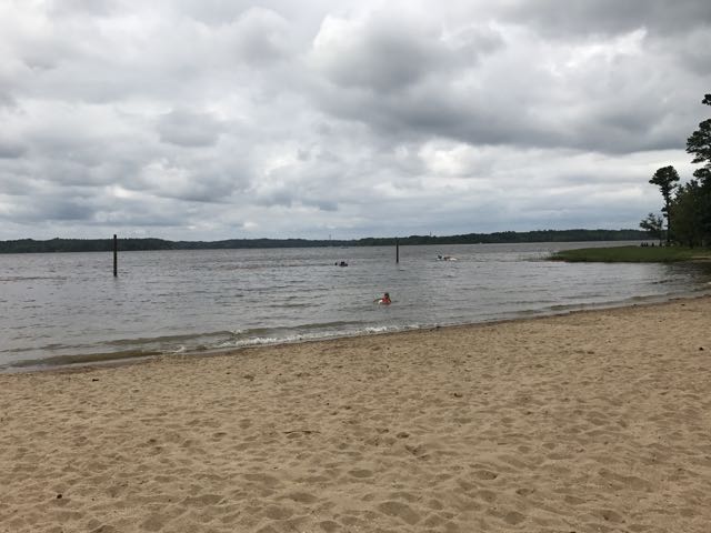
After a few hours at the beach, we headed back to the campsite for quick showers at the bath house. Then, we hiked a short trail through Loop B to access another playground. The girls spent at least an hour swinging on the tire swing – a big novelty to them. 

After the playground we explored the marina near the park entrance. The marina features boat launch facilities, a convenience store, snack bar, and water recreation rentals (kayaks and paddleboards). Then, we cooked hotdogs and sausages on the campfire and made mac n cheese on the stove. Though it sprinkled a bit, we quickly roasted some s’mores and had a nature scavenger hunt.

Early the next morning, we cooked a modest breakfast before packing up the trailer. We stopped at the dump house on the way out of the park, which was relatively quick and convenient. Then, thirty minutes later we arrived back at home with plenty of time to re-pack the car for Emerald Isle. Having Falls Lake within thirty minutes makes for fun family outings of all types – day, overnight, or multi-days!

Additional Resources

Thumbs up: peaceful campsite, fun beach area, clean bath house, playgrounds with tire swings, water recreation rentals at the marina, ease and convenience of renting, close proximity for last-minute trips

Thumbs down: nothing to report

Tom’s Creek Falls & Roaring Fork Falls

“The mountains are calling and I must go.” – John Muir

Roaring Fork FallsFor our next Winnie adventure we headed to the beautiful Blue Ridge Mountains near Marion, NC. We stayed at the Mountain Stream RV Resort off Hwy 80 at 6954 Buck Creek Rd. After making a wrong turn down a one-lane gravel road (Little Buck Creek Rd) we drove a white-knuckling 3 miles to the road’s end. This was not how I expected our first big Winnie adventure to begin. After several deep breaths, I jumped out of the car to instruct Bill on turning around. Easy Peasy!

Nothing will test your marriage’s communication skills like trying to make a 3-point turn with a 20-foot trailer. Cue the Austin Power’s 3-point turn parking scene! Luckily, our family has previous experience driving down harrowing gravel roads (see my Yosemite post), so we tried to remain calm and go back on course!

Mountain Stream RV Resort

DSC_0071
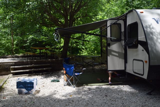
The Mountain Stream RV Resort was the perfect spot for camping. They have 40 camp sites situated around a loop gravel road with a grassy median. A cool, clear mountain stream runs behind more than half of the campsites. We stayed in one of their prime spots near the back of the campsite with easy kid-friendly access to the stream. We loved splashing in the water, walking upstream, and sitting at the campsite listening to the babbling stream.

Despite some big thunderstorms that came through during the weekend, we really enjoyed our time in the Winnie. The girls made friends with the neighbors, rode bikes around the gravel loop, and played in the stream. During the daytime downpours, the girls also had downtime playing cards and watching movies. We tried to go fishing, but big floods from past years pretty much wiped out the fish habitats.

We grilled yummy steak tips, broccoli, and potato wedges one night and chicken quesadillas the other night in honor of Bill’s birthday weekend. For Father’s Day breakfast, I made homemade biscuits with my new pie irons. Though they didn’t rise completely, they still tasted delicious smothered with steak, eggs and cheese. The girls gobbled down the Bisquick Shake ‘N Pour pancakes. When we weren’t eating, sleeping or playing at the campsite, we were hiking.

Tom’s Creek Falls

DSC_0115
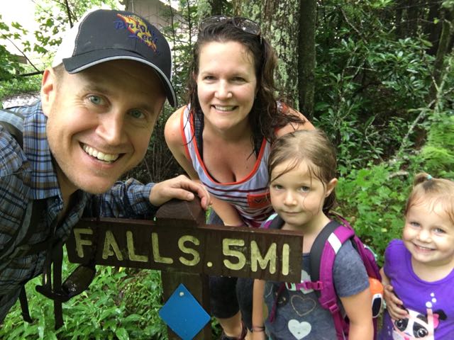
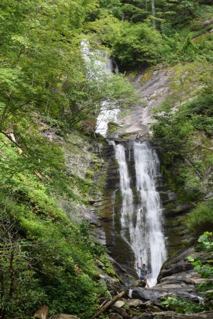
We spent all day Saturday hiking waterfalls in the Pisgah National Forest and exploring interesting places off the Blue Ridge Parkway. First, we explored the Tom’s Creek Falls, located about 20 minutes northeast of our campsite. Tom’s Creek Falls trailhead is about 1.3 miles from the intersection of US-221 and Huskins Branch Rd. This trail is about 1-mile roundtrip hike with wide gravel paths, lush green forest, and spots along the way for splashing in the creek. It’s an easy, shaded hike with gentle switchbacks towards the top. It even has benches near a clearing to rest. Along the way we spotted a lot of mica (from old mining days), ferns, and mountain laurel.

We climbed to the overlook area and then followed a narrow path to the right to access the water. Wanting to get a closer look at the falls, both girls scurried up the rocks (with our help) to the bottom of the falls, reaching an elevation of approximately 1800 ft. The water flows at three different levels before dumping into Tom’s Creek. We loved splashing in the water and being so close to the falls. 

Roaring Fork Falls

07402233-DCCE-443C-B72F-47997007596E
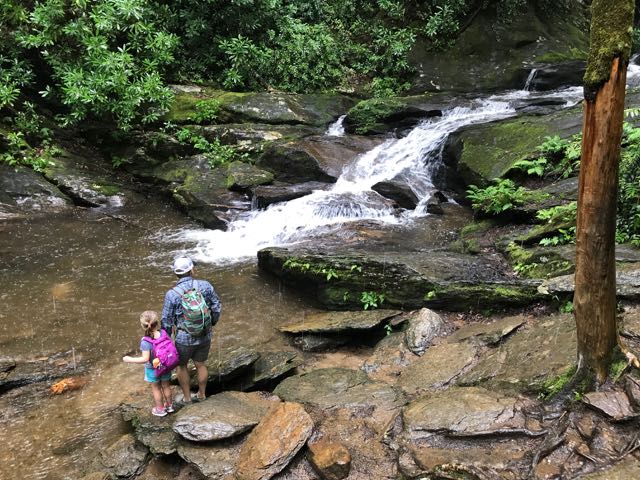
After leaving Tom’s Creek Falls, we drove about 45 minutes northwest to the Roaring Fork Falls trailhead. Roaring Fork Falls trailhead is located near the intersection of S Toe River Rd and State Hwy 80. Follow the signs for about 1/2 mile until the road dead ends into a small parking lot.

Roaring Fork Falls is a 1.5 mile out and back trail, despite the “Falls .5 miles” sign near the parking lot. With the forecast calling for heavy rains, we booked it up this trail. The trail begins on an old logging road in a heavily wooded forest. The trail is slightly uphill and mostly shaded with pockets of sunlight throughout. After crossing a small wooden bridge, we climbed over roots and small stones to reach the falls. The falls cascaded down several levels creating the large roaring effect.

Ashley and Bill climbed down to the bottom of the falls while Claire and I waited on the trail. The heavy rain caused the rocks to become very slick, so we stayed safe on the trail. After a quick dip in the water, they carefully climbed back to the trail and we all rushed to the car. The rain started pouring heavier on our hike back to the car, but carrying Claire on my shoulders kept my back dry! 

The girls changed into dry clothes at the car and we enjoyed a much-deserved picnic lunch. After lunch, we hopped onto the Blue Ridge Parkway and visited the NC Minerals Museum (MP 331) and Linville Caverns. After driving at least 100 miles around mountains all day, we returned to our campsite hungry for food and thankful for nature. Watching, touching and listening to the waterfalls made us appreciate the mountains even more.

Hike Info

Thumbs up: little traffic along hikes, beautiful views, exciting waterfalls, easy family hikes, comfortable campsites

Thumbs down: no cell phone reception (although I’d put this in the thumbs up column)

Jordan Lake State Recreation Area: Poplar Point Campground

For our maiden voyage in the Winnie, we headed to Jordan Lake State Recreation Area for a quick 24-hr overnight trip. We wanted to get a small sample of camping while staying close to home. Jordan Lake State Recreation Area is located about 30 minutes west of Raleigh off US-64. Whether you’re going for a short trip or several days, Jordan Lake has lots of outdoor experiences and recreational activities to offer.

Camping

A few weeks before our trip we reserved a campsite online with electric and water hook-ups at Poplar Point Campground. The entrance for Poplar Point Campground is located at 558 Beaver Creek Rd in Apex. Jordan Lake State Recreation Area is enormous with over 1,000 RV and tent campsites scattered over five different areas. We chose Poplar Point Campground because it has many waterfront campsites available with water and electric hook-ups and a recreation beach at Loop E. We reserved spot 58 at Loop H, which is a back-in spot, like most at the park. The NC State Park registration system is very useful. You can search by amenities, whether you need a pull-through spot, and length of site. Similar to hotel room booking systems, it also shows multiple pictures of each campsite.

We arrived early on a Saturday morning and checked-in at the Poplar Point front gate. The ranger confirmed that we could switch our spot for the more popular first-come, first-serve spots at Loop E if we wanted. Loop E features a beach area, playground and more waterfront sites. But, after driving by our site at Loop H, we decided to stick with our original plan. We were anxious to set-up the Winnie and explore the campground. 

IMG_2418
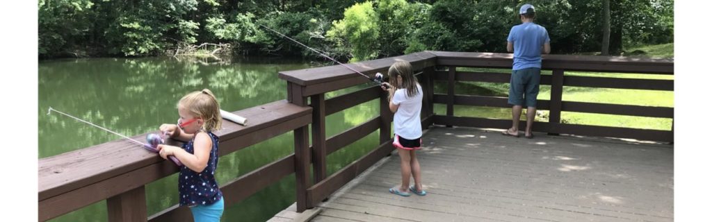
Our partially shaded campsite featured a flat gravel pad, picnic table and grill. There’s a short walk to the water, which we were hoping to use for fishing access, but unfortunately there was more poison ivy than we wanted to dodge. We found another access to the water, but the low-lying trees made casting difficult for the girls. Surprisingly, we didn’t have any neighbors during our entire stay. Though the girls were sad because they couldn’t play with new friends, it also meant they could run around like maniacs without worrying about traffic.

We spent about 45 minutes setting up camp by rolling out the rug, organizing the outdoor food station, hooking up the water and electric, and making sure the party lights hung perfectly. This park (and most state parks) features a dump station near the entrance, which we used on the way out to empty our gray and black tanks. For lunch, we quickly cooked hot dogs and grilled deli sandwiches on the griddle before heading to the beach. 

Recreation Area

4
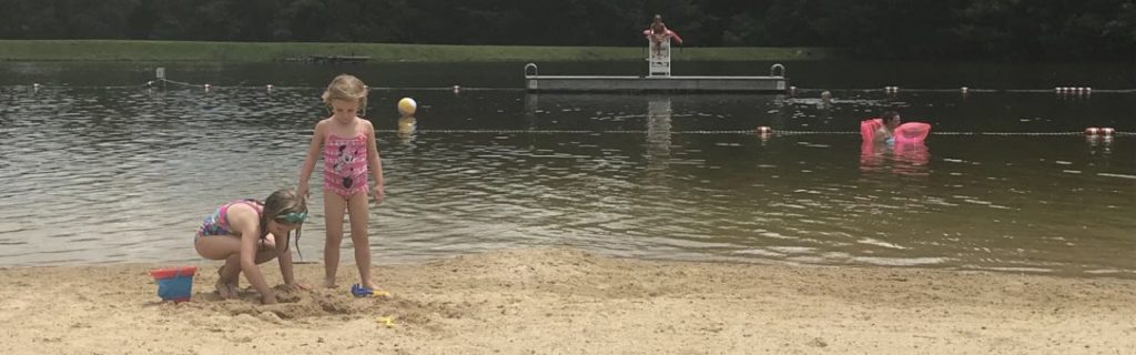
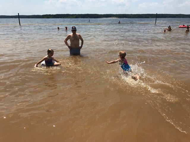
After lunch we headed to the recreation area to cool off in the beach. The recreation area at Loop E features a large sandy shoreline with designated swimming area. The water was refreshing and the boats racing by made fun waves for the girls. The girls loved catching the waves with their inner tubes and building sand castles on the shore. They enjoyed racing into the water and diving into the calm water. Even though the water was a little murky, they didn’t seem to mind.

The recreation area has a narrow forested area near the parking lot with picnic tables and benches. We spotted several fishermen fishing further down the shoreline. We also saw a pontoon boat selling shave ice and snacks on the shoreline. Even though we just missed the shave ice, we watched the boat motor to the recreation area on the opposite side of the lake.

Unfortunately we left several of our beach essentials (beach chairs, umbrellas, sand toys) at home, placing greater attention on our camping items. We bought inner tubes at the convenience store off US-64, which proved crucial beach toys. Despite not having all our regular beach things, we spent over two hours at the lake beach having a fabulous time.

Dinner Camping

IMG_2425
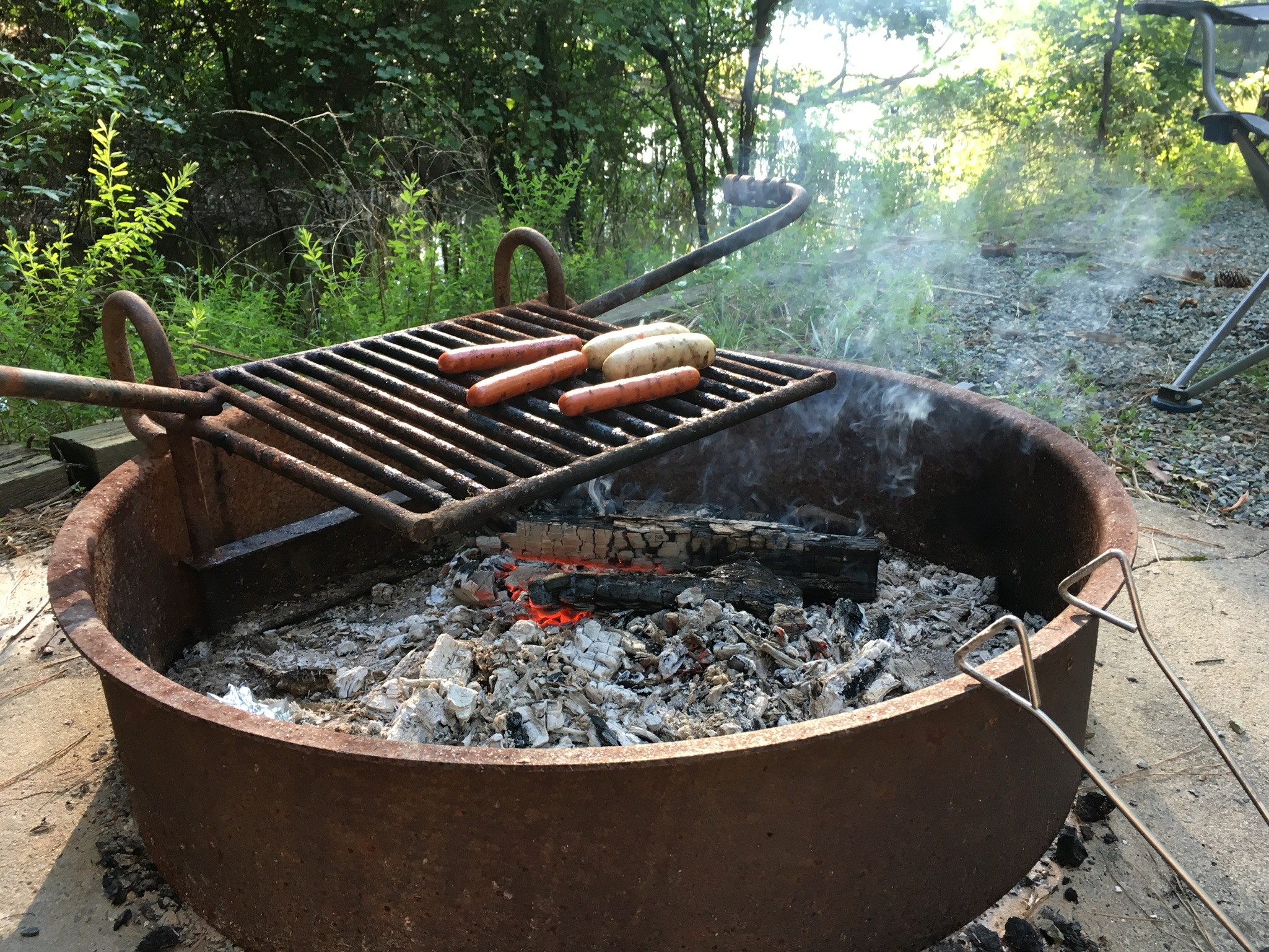
After playing at the beach we headed back to our campsite for showers and dinner prep. The girls helped shuck corn for grilling on the fire pit while I made mac n cheese on the trailer range. We grilled chicken sausages, corn on the cob, hot dogs and cinnamon sugar filled apples for dessert. 

After cleaning up dinner we settled in for puzzles and Uno. I also taught the girls how to play the card game, War, which immediately became their favorite game! Once the sun went down, we chased fireflies around the loop and used our campfire to make s’mores. Then, we read a bit of Wind in the Willows around the campfire before tucking the girls into their bunks.  

Though it took the girls a little longer to fall asleep, they slept soundly until morning. Bill and I enjoyed some music around the campfire while listening to insects chirp near the water. Overall, our first overnight trailer trip was a big success! Camping in the trailer was an exciting, but relaxing experience while Jordan Lake offered lots of fun at a quick drive away. 

Thumbs up: campsite space, large beach recreation area, affordable family camping, 

Thumbs down: poison ivy down to the water near campground

Raven Rock Loop Trail at Raven Rock State Park

Raven Rock Loop TrailIn mid-January we headed to Raven Rock State Park for a morning hike and picnic. Raven Rock State Park is located about an hour south of Raleigh along the Cape Fear River in Harnett County. The underlying rocks in the area formed nearly 400 million years ago through heat and pressure. High winds and rushing water gradually shaped the huge crystalline rock where ravens perched. River captains relied on the outcrops until hurricanes permanently damaged the locks and dams in 1859. Railroad transportation soon replaced river travel, and the state established the park in 1969. The old Northington lock and dam are visible from the park.

We parked in the southern section of the park near the Visitor Center at 3009 Raven Rock Rd in Lillington. Newly built in 2010, the Visitor Center is a great first stop before heading to the trails. Inside the center we explored the exhibits with the topography map, animal scat samples, and history of the the dams. The ranger was friendly and helpful when guiding us to the trailhead. After making a last-minute stop in the clean restrooms, we walked along the left side of the road to access the Raven Rock Loop Trail.

The Raven Rock Loop Trail is about 2.6 total miles. We walked clockwise around the loop, so the beginning of the trail was wide and gently sloped. The back half of the trail was slightly steeper, making the girls push harder at the end of our trip. About a mile into the hike, we arrived at the overlook above the Cape Fear River. The overlook provides beautiful views of the river and surrounding forests.

DSC_0086
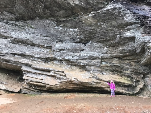
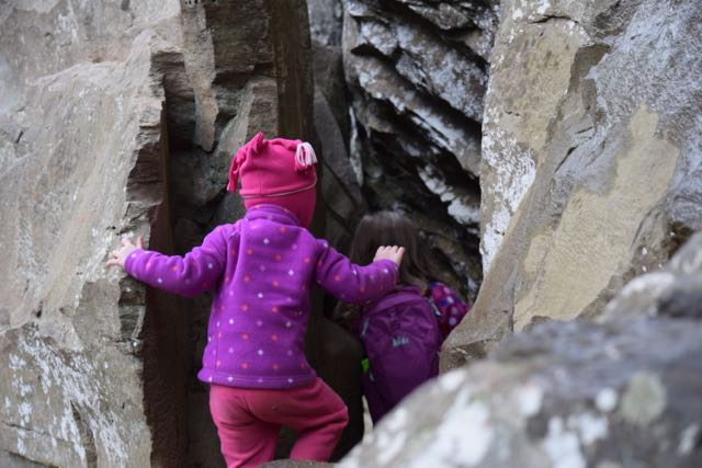
Then, we walked a little further until we arrived at the steep zig-zag stairs leading to the Raven Rock outcrop. We carefully walked down the windy stairs, stepping to the side to allow others to pass us. At the bottom we reached flatter ground with easy access to the river and the enormous Raven Rock outcrops. The girls loved climbing around the huge rocks and over the tree with the tangled web of tree roots. Portions of the rocks were large enough to crawl under and around, making for fun hiding spots. We also enjoyed listening to the trickling springs dripping from the moss-covered rocks overhead. 

DSC_0096
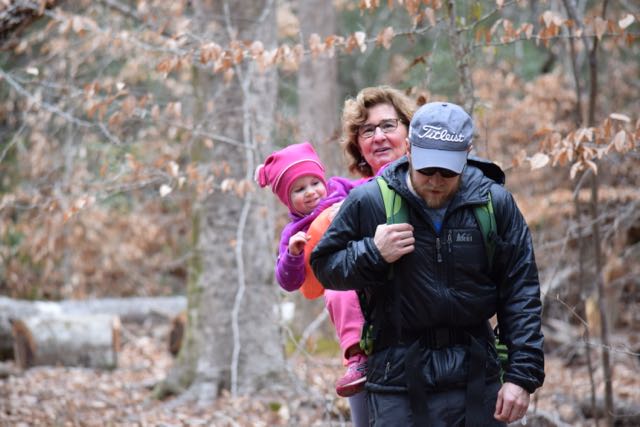
After climbing around the main Raven Rock attraction, we ascended up the windy stairs and finished the steeper part of the loop trail. We crossed the stream a few times and enjoyed looking for wild animals through the bare forests. Lastly, when we returned to the trailhead we passed picnic tables, a large pavilion and the entrance for the American Beech Trail featuring the Kids in Parks Track Trail. Though we didn’t have time to hike it, this easy 0.5 mile hike features fun adventures such as Nature Hide ‘n Seek to excite kids about hiking. We also passed signs with information about the canoe-in camping.

Though hiking can be tricky with small kids, the more you hike together the less whiny easier and more fun it can be. For hikes longer than 1 mile, we still bring our hiking backpack for our 3 1/2 year old. We always pack lots of snacks and/or picnic lunch and started letting the girls use our older cameras to capture sights along the way. The girls started melting down towards the end of this trail because we unknowingly saved the steeper portion for the end. Next time, we’ll hike this loop trail in reverse order and visit in warmer months to take advantage of playing in the streams!

Thumbs up: friendly park staff, informative visitor center, steady foot traffic along trail, beautiful views over river, interesting rock outcrops

Thumbs down: nothing to report

Yosemite in a Day with Young Kids

Yosemite with young kids
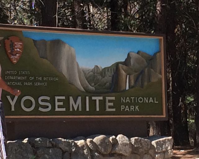
Who’s up for a last minute visit to Yosemite with young kids during the super busy summer months? We are! Capitalizing on our successful Norther Ca trip, we rolled the dice on our final full day and drove our family two hours west to explore Yosemite for the day. With plans to rendezvous at my uncle’s rural 1910s family cabin situated on original Yosemite roads, we left early in the morning with a full tank of gas, fully charged iPads, open minds, and lots of food.

Yosemite National Park spans nearly 1200 sq miles in Eastern Ca, making it about the size of the state of Rhode Island. It reaches across the Sierra Nevada mountain range and is mostly known for its mammoth granite cliffs, waterfalls, giant sequoias, and diverse plants and animals. The geology of Yosemite National Park is a result of a combination of volcanic activity, uplift, erosion, exfoliation (responsible for the dome-shaped granite areas), and glaciation that happened over 25 million years ago. Starting in the 1850s, explorers, artists, and writers advocated for preserving Yosemite Valley and slowly expanded the protected area to include nearby forests and mountains. Yosemite switched from a state park to a National Park shortly after the National Park Service was started in 1916. We visited 100 years later!

Getting There

IMG_6941
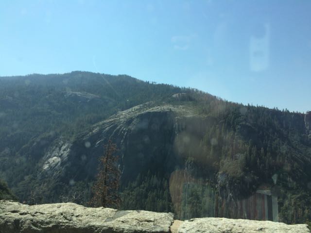
Since the Yosemite trip was last minute,  intermittent cell service limited my mobile-friendly research as we drove through harrowing switchbacks and rural towns.  Following my aunt and uncle’s advice, we headed to the popular Valley area of Yosemite in hopes that we could catch glances of El Capitan, Half Dome and some of the waterfalls. Driving from Sonora, Ca we drove along 120 East through Groveland and the Big Oak Flat Entrance.  The drive through Yosemite starts out hilly with dense conifers and then becomes hillier with sparse shrubs, dead underbrush, sand, rocks and old dying pine trees. Then, suddenly before crossing into the big tunnel, the massive granite rocks explode before your eyes. You catch really quick (yet far away) views of El Capitan and Half Dome before going through the tunnel. After the tunnel you wind through switchbacks catching different views of the granite formations. Yosemite is enormous – it takes at least 40 minutes to drive from the main entrance to the bottom of the park.

Bridalveil Fall Trail

IMG_6947Knowing the park would be busy, we aimed for short hikes easy in difficulty and with easy access. Using the simple Yosemite Valley day hike chart, we hiked the 0.5 mile (round trip) Bridalveil Fall Trail on our way into the park. We parked at the trailhead and follow the paved path to the 620 ft waterfalls. Since we visited in late summer, the waterfalls trickled, but I imagine in spring time after snow melts the falls are quite a spray. Other visitors climbed along the large boulders to the bottom of the light waterfall. Even though the waterfall spray was barely visible, it was amazing to look up at the massiveness of the rocks and feel so tiny.

After Bridalveil Fall Trail, we parked in the main parking areas near the Visitor Center/Museum so we could scope out the center and easily hop on the free shuttle buses. In my little research, I learned the shuttle buses were key to getting around busy Yosemite Valley. The trailheads and points of interest are spread out so we either walked along the wide bicycle paths or rode the bus. Wishing for more time in the museum and to see the short Spirit of Yosemite film, we pushed on and walked about a half mile along the bicycle path to access the Lower Yosemite Falls Trail.

Lower Yosemite Falls Trail

IMG_7088Lower Yosemite Falls Trail is a one mile paved trail with little elevation change making it an easy walk for everyone. The path is mostly shaded with giant sequoias and huge slabs of granite rock making for nice photo backdrops. About half mile into our walk we arrived at the observation bridge of the falls.  Lower Yosemite is the bottom waterfall section of the three-part Yosemite Falls. Unfortunately, with it being late summer the waterfall sprayed a mere trickle, but we tried to imagine the command it carries in spring after the snow melts. Before leaving the falls we admired, in jaw-dropping fashion, as pea-sized rock climbers scaled the mountain.


Views of Half Dome

IMG_7016
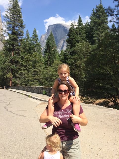
Wanting to get closer to Half Dome I quickly researched places within the valley to catch a glimpse. I learned the meadows behind the Majestic Yosemite Hotel (formerly known as the Ahwahnee Hotel) provide good views of the massive mountains, so we rode the shuttle bus to stop #3 outside the hotel. The hotel was built nearly a century ago with the design influences of Art Deco, Native American, Middle Eastern, and Arts & Crafts Movement. We walked to the back of the hotel, through a small path and turned left on the pedestrian path. Before crossing over the pedestrian bridge we arrived at the best spot we could find with a good glimpse of Half Dome (elevation 8800ft) in the background. Even from so far away it’s amazing to imagine people (including my crazy aunt) hike the 16-mile round trip.
After capturing a few pictures with Half Dome in the background, the girls and I splashed around in the crisp, cool Merced River that flows behind the hotel.  We were hot and tired from the long day and we felt refreshed after a quick dip.

Driving out of Yosemite Valley, we followed my aunt’s handwritten directions for meeting them at my uncle’s rural cabin. After a harrowing 7 mile drive up original access roads into Yosemite, we arrived at the cabin. I immediately relaxed after enjoying a beer on the hammock and we took in the beautiful sites of the meadow from the back deck. My aunt and uncle planned a delicious steak dinner with all the trimmings – it made for a very memorable early birthday celebration! After a restful night’s sleep, we left for San Francisco the next morning feeling very accomplished as a young family of four and thankful to experience Yosemite! We can’t wait to return to Yosemite and spend an entire week camping and exploring the different trails – maybe one day we’ll even hike to the summit of Half Dome!

Looking Ahead & Tips For Young Families

Having spent only about 5-6 hours in Yosemite, we definitely maximized our visit with seeing a few waterfalls and catching a glimpse of Half Dome and El Capitan (on the way out). The girls pushed through the early afternoon hour when they’re usually quietly relaxing, but felt refreshed with our backpack snacks and a quick ice cream treat. 

  • Plan ahead and stay for a few days – camping spots in the park fill up months in advance, so plan your trip early or stay outside the park
  • Less is more – bring a small backpack to carry around the park with essentials and snacks; visit the convenience stores and restaurants to refill with snacks and treats
  • Bring a good camera – I’m kicking myself for not having my big camera with me
  • Park & ride – park your car in one of the main lots and ride the bus as much as you can
  • Do some swimming – there’s lots of options for cooling off in the creeks and Merced River
  • Visit in late spring when the waterfalls are at full peak
  • Wear your patience pants – if visiting in summer be aware of the large crowds and take breaks accordingly

Additional Resources:

Thumbs up: breathtaking views, massive rock formations, free shuttle bus rides, bike/pedestrian path connecting many points of interest, paved trails provide accommodations for everyone

Thumbs down: little time for planning on my part, drier waterfalls in summer mean less dramatic views, busy summer crowds

Canoeing the New River in NC

New RiverLast month good friends invited our family to their mountain cabin along the South Fork of the New River near West Jefferson, NC.  Though this was my first time on this river in NC, being back on the New River reminded me of past trips whitewater rafting through West Virginia or lazily tubing the New River Junction near Blacksburg, VA.  We made those trips before we had kids so it was fun to share this trip with our kids and new friends we’ve met since having kids.

The New River is unique in that it flows south to north and is believed to be one of the oldest rivers in North America, and maybe the world.  This ancient river begins in the mountains near the TN-NC border, flows north through NC, VA and WV where it joins with the Gauley River (I’ve always wanted to raft during the fall release dates) to become the Kanawha River and eventually flows to the Gulf of Mexico via the Ohio & Mississippi Rivers. Portions of the New River in NC flow through different access points to the New River State Park where you can camp, hike, canoe, kayak, fish, or any combination of those.  While we spent a lot of our weekend exploring the private area around the cabin, wading in the family-friendly river, or teaching the kids to kayak, my friend Annie and I got out for a few hours on Saturday afternoon for a relaxing canoe trip.

IMG_5566
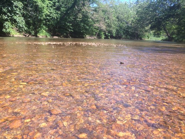
After an exhilarating drive down one-lane gravel roads in an old Chevy truck with a canoe in tow we arrived at a small put-in near the intersection of Dog Creek Rd and Joe Little Rd.  The bank is steep and the pathway to the water is narrow and overgrown on the sides, but it made for a quick water entrance.  Joe Little Rd is a narrow one-wayish road, so use caution when driving.  It was a beautiful day to be on the river so we passed quite a few tubers, kayakers, and fishermen.  The water was pretty brisk, so it felt good to be dry in the canoe.  Along our way we passed Wootens Mill on Dog Creek Rd, which is no longer in service but dates back to the 1770s.  We also passed the Wagoner Access portion of the New River State Park on the south side of the river.  We saw lots of tents set up for weekend camping and canoe put-in areas.

We made a quick pit stop back at the house to refill our cooler before heading further upstream (remember, the river flows south to north).  We made our way over a few mini rapids and shortly passed the River Bend campsite area of the New River State Park that features primitive canoe-in only camping.  With the exception of the flowing water and birds (and our girl talk), the river is void of any other sounds as it snakes through the Blue Ridge Mountains.  After awhile we pulled the canoe out near a shallow rocky area to take a break.  The river rocks feature those smooth, round shapes so we easily laid down in the water to chill.  After a few more minutes of deciding we needed to start a yoga retreat on the river we paddled some more to a popular swimming hole.  We pulled the canoe out near a small island and swam to the large rock to jump into the deep water below.  It was heavenly!

After paddling a bit more we called our ride home as we reached the take-out spot near Absher Rd/Gentry Rd Bridge.  It was late afternoon when we got out, so we had to wait a few minutes before we could pull out the canoe.  With stops, it took us about 3 hours to go about 6 miles on the river. With its gentle, shallow waters and tranquil rapids the South Fork of the New River offers so many family-friendly or beginner adventures.  The river’s beauty is something to experience first-hand and I can’t wait to get back here again!

Additional Resources:

  • New River State Park map – includes paddling times/distances from different access spots
  • New River State Park

Thumbs up: lots of shallow wading spots for little ones, camping/canoe options at New River State Park, beautiful scenery along river, river’s beauty and tranquility, gentle and mild rapids are great for families and beginners

Thumbs down: nothing to report