
 Believe it or not, Nags Head has hills and I’m not talking about the sand dunes near the beach or at Jockey’s Ridge State Park. During our annual end-of-summer Nags Head beach trip we decided to break up our beach days with a hike in the Nags Head Woods Preserve. We also make an annual trip to the Nags Head Woods Preserve every May for the Yuengling 5k race, but we’ve never had time to explore the woods other than the gravel race trail we run. I should’ve remembered how hilly that race can be and then better prepared myself (and family), but what fun would planning be?!
Nags Head Woods Preserve is located at 701 West Ocean Acres Dr on the sound side of US-158. We like to use the local dive bar, Mama Kwans, as a reference point for where to turn from the main road when heading to the woods area. And, turning by Mama Kwans makes us reflect on crazy silly late-night bar stories that involve Bill ordering a bottle of Veuve Clicquot because, “I’m getting a raise next week!” But, I digress!
Follow West Ocean Acres Dr through a small residential area until you arrive on a gravel path, which you’ll continue on for 1/4 mile. You’ll then see a sign for the Nature Conservancy and a small parking lot for the woods. The Nature Conservancy owns and operates the Nags Head Woods Preserve, which is over 1100 acres of wetlands, dunes, ponds and marshes. According to their website, “Working with the towns and other partners, The Nature Conservancy has succeeded in protecting this fragile ecosystem, overseeing both terrestrial and marine research and monitoring programs and providing trails for visitors to enjoy.”
After unloading in the parking lot, we walked up the boardwalk and the little ones scoped out the murky ponds while we decided on a trail to hike. Being overly optimistic we decided on Trail #2 – the 2.25 mile Sweetgum Swamp Trail; with three little people (and only one carrier) and five big people we figured we could handle the trail.
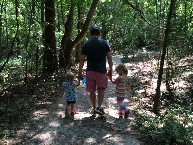
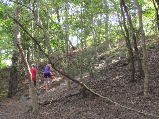 So, we set off on the trail and before you knew it we were in a dense forest just minutes from the beach. The unpaved trail is covered in pine needles, but well marked; Ashley was even able to follow the trail markings to stay on the path. After heading straight for awhile, we climbed steps up a steep hill to what felt like the ridge of a mountain – the trees were shorter and all of a sudden we were walking down a sandy hill. I quickly learned that kids love sand unless they have to hike through it. After several moments of juggling kids on shoulders and in carriers and distractions of the colorful flowers, berries, and butterflies, the sandy trail base was replaced with the preferred compact pine needle trail. We took a right to stay onto the looped portion of the trail. Along the way we passed by several swamps (complete with croaking frogs), more steep hills with steps, spooky Charleston-like trees, and several different plant communities. Halfway around the trail loop is access to Trail #3 (Blueberry Ridge), but we decided to save that trail for another time.
The second half of our hike consisted of more kid juggling on shoulders and in the carrier just so we could make it back to the parking lot in one piece. There was a lot of kiddo melting down, but in their defense it was a hot morning and we had walked almost 2 miles by this point. When we got back to the sandy portion of the trail (that was downhill on the way in), all I could do was laugh because I knew the kiddo melting down was headed to a new level as they had to climb the steep sandy hill.
But, we all survived and cheered enthusiastically when we saw the Visitor Center signs. It really only took us about 1 1/4 hrs to complete this hike. After getting very hot and sweaty from our hike we rushed over to the Bonzer Shack for a hearty lunch and much-deserved beers and milks! Despite this hike being too strenuous for our girls, I look forward to coming back to explore other trails in the future – bring on the beach hikes!
Additional Resources:
- Nags Head Woods Preserve Map
- Nature Conservancy
- Nags Head Woods 5k Run
- Plan, Book & Go to Nags Head with All The Rooms travel
Thumbs up: adventurous hike with lots of plant and pond life to see, contrasting landscape at beach, signage, well-maintained trail
Thumbs down: better suited for older children, hilly hike for toddlers


 Before summer came to an end we headed back up to VA for a final party at my mom’s house before turning it over to new owners. To counteract the bushel of crabs (and beers) we were going to eat that weekend, we headed into downtown Fredericksburg on Saturday morning for a run and some playground time.
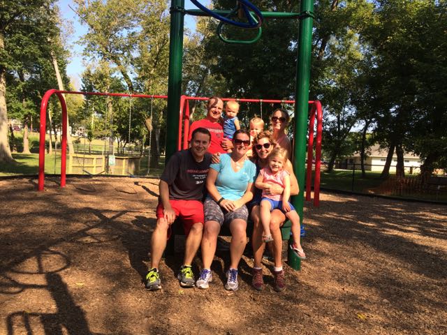 The Canal Path is a paved 1.8 mile trail that parallels the canal until Princess Anne St where it then connects back with the Heritage Trail making a loop through downtown. The Canal Path is mostly shaded, making it a great way to escape the summer heat. We passed behind Mary Washington Hospital, ran under Route 1 again, ran by the Wetlands at Gayles Pond, and passed the


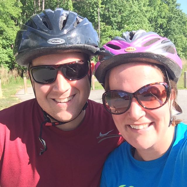
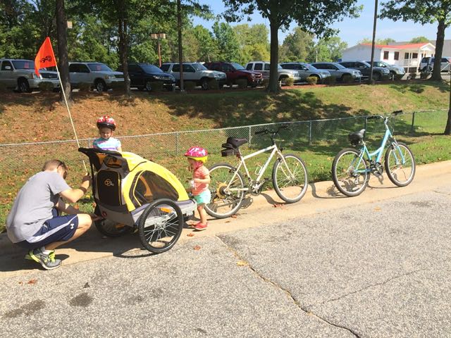 Before summer ended, we explored a new section of Crabtree Creek Trail via bike. With the hot and humid weather, we knew pushing a double stroller would be tough, so why not pull the girls by a bike trailer?! The girls were super excited about the prospect of riding in a bike trailer and despite having to cut our trip short because of a busted bike chain we had a great morning ride and even stumbled upon a new park.
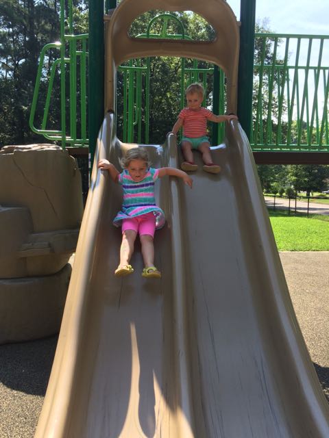 Lockwood Park is small fenced-in park designed mostly for ages 5-12. It has a large climbing rock boulder, sand box with diggers, swings, and large playground with slides and various climbing structures. The playground has a rubberized surface with a picnic table and benches and a nearby open grassy field. The girls loved climbing on the boulders the best, but were also excited to get back into the bike trailer to continue on our ride.


 As of this past Monday, Raleigh had 12 days of consecutive rain, tying a


 Blue Jay Point County Park is an outdoor mecca for people of all ages! We visited Blue Jay Point County Park about a month ago after hearing so much great news about the new
 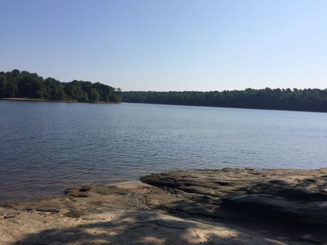 After some playground time, we headed towards the covered pavilion where the Laurel Loop nature trail begins. This was such an ideal walk for young kids – it is a well maintained unpaved trail with lots of shade, has several benches and picnic tables throughout, is only 0.2 miles, allows for a short walk by adjacent Falls Lake, and loops you back to the playground area. All of the girls from ages 18 months to 4 years old loved exploring this trail, especially finding the dozens of caterpillars along the trail.
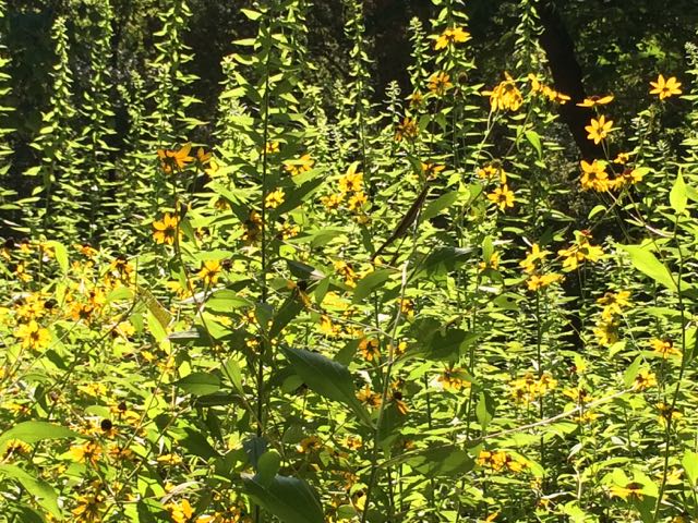 We then headed outside to the nearby fenced-in garden area for a much deserved picnic lunch. After our lunch we walked all throughout the gardens learning about the different herbs, flowers and vegetables they’ve planted. The biggest highlight for me was the “pizza garden” where they planted lots of basil and tomatoes. The biggest highlight for the girls was spotting butterflies and checking out the resident turtles and water snake in the small pond area.


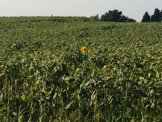 Near the end of July we ventured to the southern section of the Neuse River Trail in hopes of finding the beautiful field of sunflowers that were in bloom (from a hot tip by
  We continued south along the greenway and caught a closer glimpse of a few sunflowers still in bloom. We turned around when we reached mile post 23.75 near the
 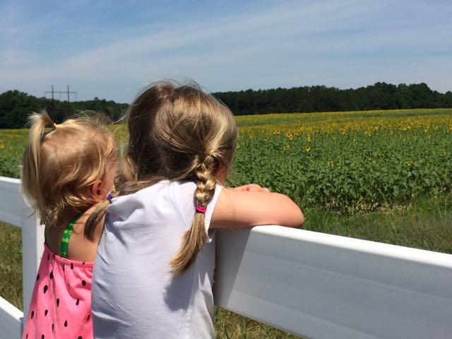 2016 Update:


 Sunday mornings in Raleigh with little ones require creativity! The few indoor play places that are open are usually crowded so that’s when we escape to the outdoors. One summer Sunday morning we decided to re-visit Historic Oak View Park in search of their vegetable garden and newer nature walking trails.
 We headed down the main trail path, which has a small gravel base, making it doable with a Bob stroller. After a short 100yd walk we came to the small pond, amphitheater, and gazebo. After playing in the gazebo we walked around the Hunnicut Trail, which is a 0.4 mile loop through the woods. It was a nicely shaded and flat gravel path making it an easy walk for little ones. The forest was alive with noises from hundreds of insects and birds. We passed an old vehicle gate, presumably evidence of the old working farm’s


 On the heels of family visiting at the end of May, my aunt offered to watch the girls while Bill and I headed out for a date night. Instead of gorging ourselves at a new restaurant, we decided to dust off our bikes and chomp away at another segment of the Neuse River Trail between the Bedford neighborhood and US-401 (followed by beers at a new brewery,
 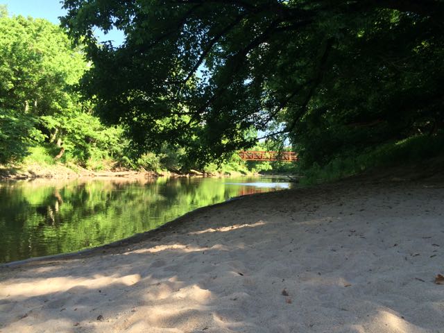 milepost 3.5 – look over the river to spot old gas or electricity lines running across an old steel bridge


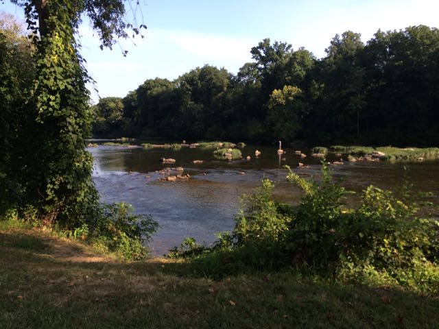
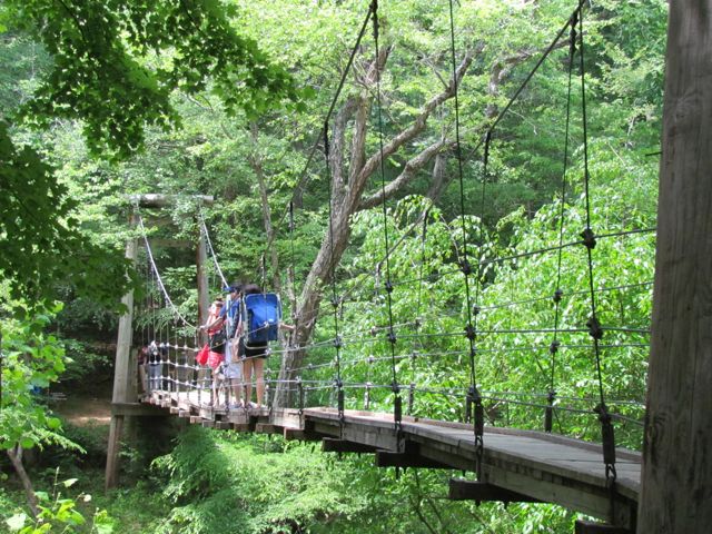 This summer we explored Eno River State Park in Durham over Memorial Day weekend. Despite a 40 minute drive and a lot of preschooler crying when we first arrived because there was no playground in sight, we enjoyed the short hike across the swaying footbridge and to the river.
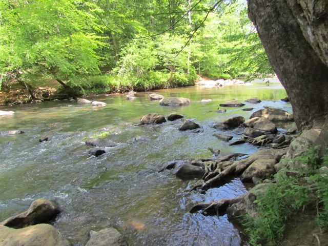 After we reached the bank of the river, we followed the trail over a narrow suspension footbridge that seemed like a much, much less dramatic version of the foot bridge Indiana Jones crossed in Indiana Jones and the Temple of Doom. It’s less than a 15ft drop to the river, but with large openings in the sides of the bridge I walked Ashley slowly across the bridge, trying to reiterate the importance of no jumping on the bridge.
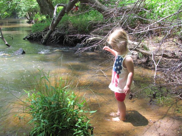 On our hike back we stopped in one of the several swimming holes to splash around a bit, promising to bring the girls back again soon with bathing suits in tow. Other than over 25 miles of hiking, Eno River State Park offers fishing, camping, canoeing, educational programs, the annual


 Towards the end of March we headed out to Neuse River Trail to explore the area surrounding Horseshoe Farm Nature Preserve, in anticipation of the
 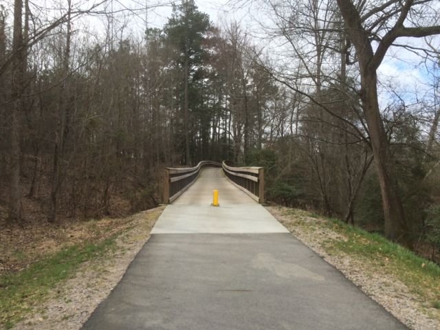 This portion of the greenway continues to be relatively flat and shady. The areas surrounding the greenway are mostly dense forest to one side with the river to the other. We saw quite a few fisherman on both banks of the river with most of them concentrated in spots near US-401. Our run back to the car was much faster than the run out so we took advantage of happy little faces and retrieved a balance bike, scooter and helmets from the car and let the girls ride on the greenway. It wasn’t a busy morning on the trail, so the girls had a carefree time riding. Ashley biked south on the greenway all the way to milepost 9 where we crossed over a small bridge with a shallow creek below, perfect for spotting turtles. Claire enjoyed her first scooter ride where we pushed her from behind as she cruised along. They were troopers for such a long morning run of about 4 miles and then some bike time.


