
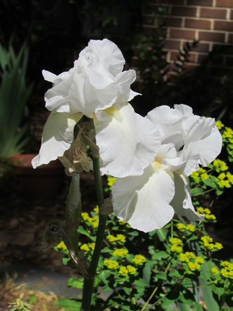
 It’s week three of an NC cold wave and I’m longing for our hot summer hike in Kilmarnock, Va. When traveling last summer we started looking for hiking suggestions with the All Trails app. Its helpful app lets you filter and search by distance, rating, suitability for kids, difficulty and more. With it being a hot July day and having small children we needed a shortish hike with easy water access. After a quick search we found Hughlett Point Natural Area Preserve, which had a 2 mile trail and access to the Chesapeake Bay.
Location
The Hughlett Point Natural Area Preserve is 200 acres of undeveloped land located on a peninsula on the Chesapeake Bay, about 15 minutes northeast of Kilmarnock off Route 605. It has a large sandy shoreline, marshy wetlands, forested areas, and is home to the federally threatened northeastern beach tiger beetle. Though we didn’t see any tiger beetles, we saw several shore birds, crabs, and bugs on our hike.
The Hike
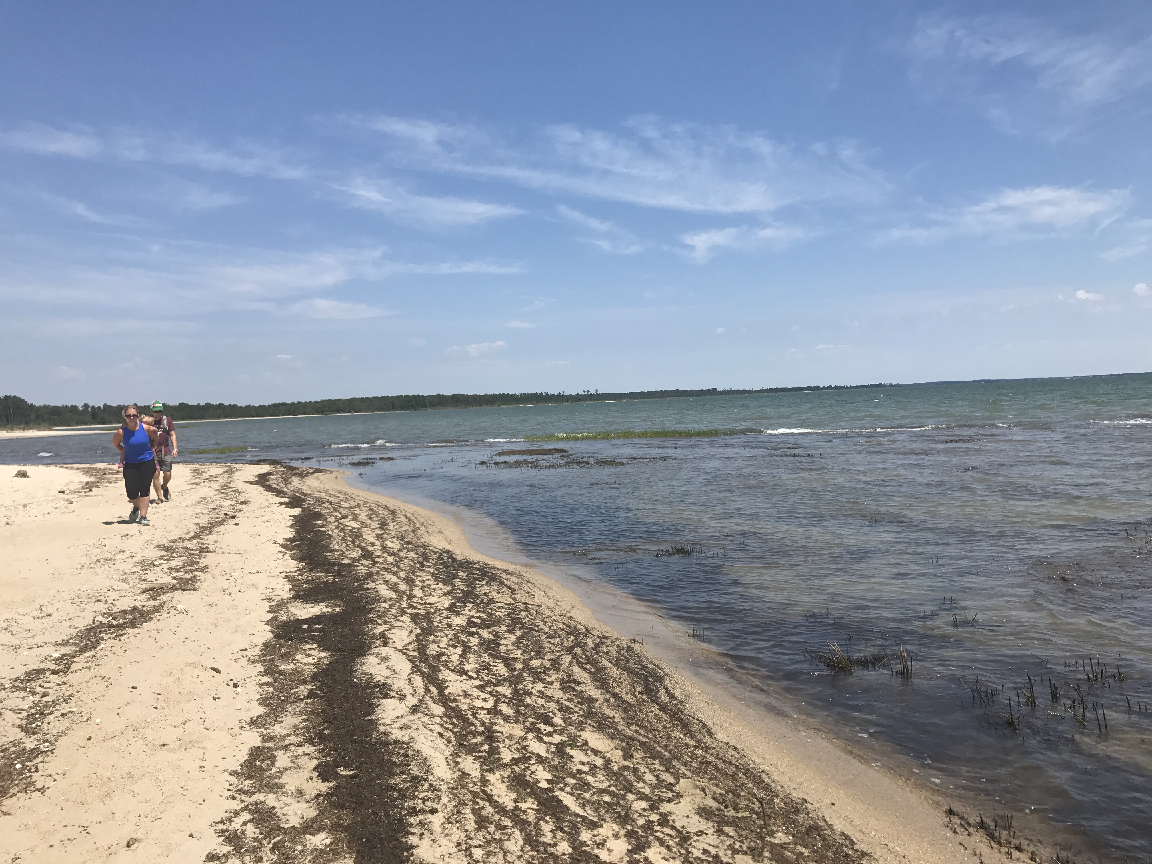
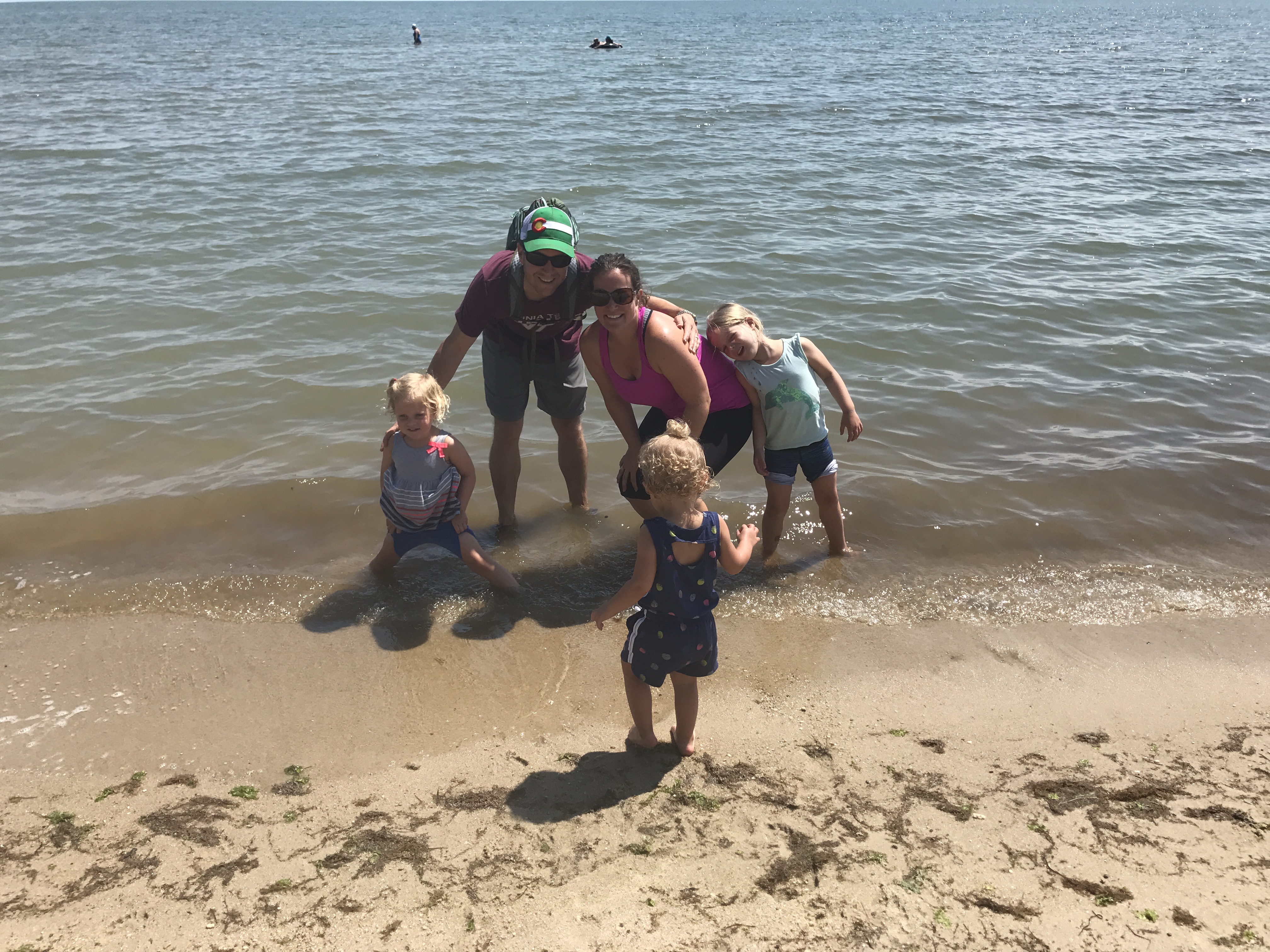 After parking at the trailhead we walked along the wooden walkway through the forest. We soon saw a sign post, and turned left to follow the North Loop. Shortly after starting along the North Loop we arrived on the Chesapeake Bay’s beautiful sandy shoreline. The sudden change from forest to deserted beach was breathtaking. The girls immediately waded into the water, while the adults took in the beautiful views. Being a flat undeveloped area, every direction we looked gave different views of a sandy shoreline, endless bay water, or grassy wetlands. It almost felt like we were on a deserted island.
Despite the lack of signage, we headed south hoping the shoreline kept us on the right path. Because we hiked next to the water, the full sun beat down on us, making the little ones quickly tire. My sister and I, each, soon started carrying a little one on our backs. After walking about a half mile in the sand, we cheered as the trail met back up with the mainland.
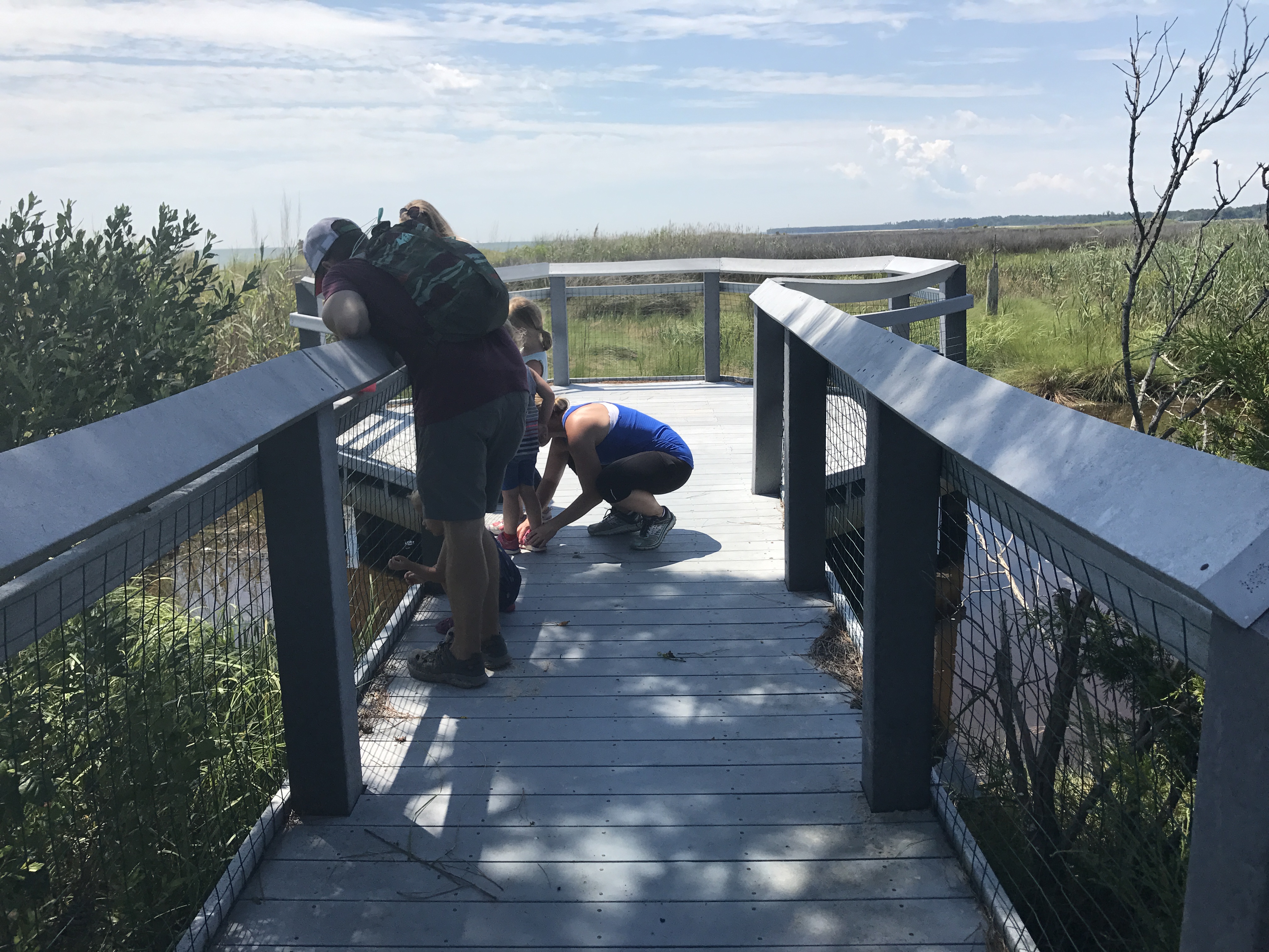 We caught our breath at an observation deck where the swimming crabs distracted the little’s tears. This trail features a few observation decks that overlook the flat and vast wetland areas. After watching the crabs swim through the water we continued walking on the dirt trail back to the parking lot. Unfortunately, we ran into some dense bug families through the forested walk back. Since the girls regained their breath while watching the crabs, they miraculously sprinted through the dense bug fog, and made it back to the car in record time.
For this hike, I felt we arrived pretty unprepared. We didn’t anticipate half the hike being in full sun and sand, and we didn’t bring the necessary bug spray. The Chesapeake Bay’s beautiful views and undeveloped areas made up for our lack of planning. We treated ourselves to a quick stop at the Dog & Oyster Winery on our way back to Grey’s Point Camp. The girls munched on snacks, tried soft-shelled crabs and colored oyster shells while the adults tasted wines and grilled oysters – heavenly!
Thumbs up: breathtaking views, undeveloped land, crab spotting, bird watching
Thumbs down: signage, lots of bugs
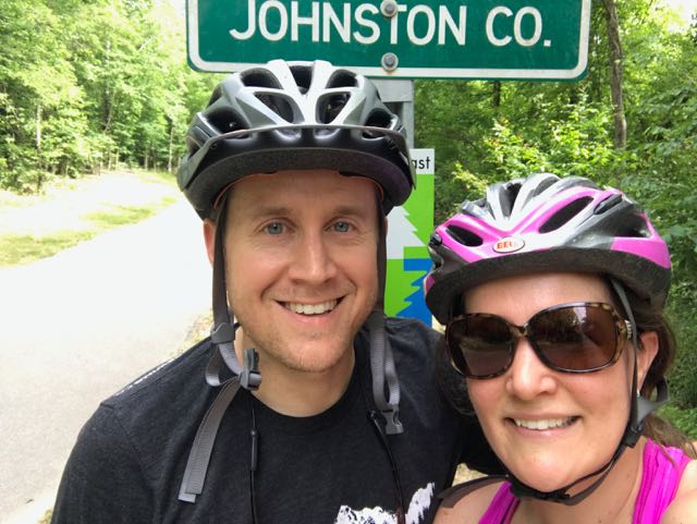 Over Memorial Day weekend, my sweet in-laws watched the girls while Bill and I enjoyed a biking and beers day date. Wanting to explore a new (to us) portion of the greenway, we headed to the southern portion of the Neuse River Trail near the Wake/Johnston County border. In all, we biked 15-miles (out and back total), crossed two counties, followed a river, detoured around an unpassable bridge, passed a historic bridge, and saw some art before grabbing beers at Deep River Brewing – a pretty awesome afternoon!
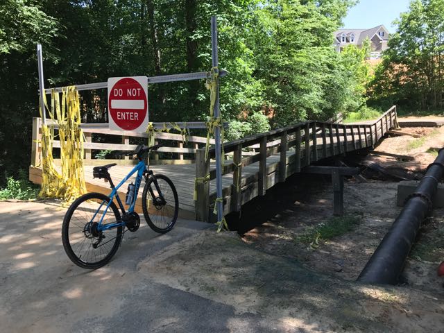 Continuing on Clayton’s greenway (technically called Clayton River Walk on the Neuse), we arrived at the Riverwood neighborhood where we found the bridge damaged and unpassable. At the time we didn’t see signage showing a detour route so I jumped onto the Town of Clayton website. I learned that last fall’s Hurricane Matthew caused near record flood levels for the Neuse River and took out the bridge. The town’s website shows a
 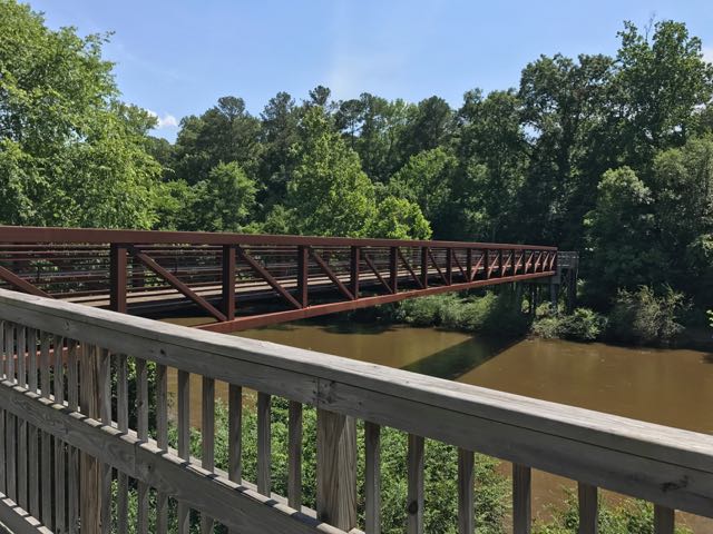 After biking the hilly detour through the neighborhood we met up with the trail and continued south. The trail remains mostly flat and sunny with clear views of the river. We passed a large sandy access spot for the river, complete with benches. Then, we biked under Covered Bridge Rd with a history that dates back to 1863 when it was first commissioned as a ferry replacement. Historians believe the bridge was covered around 1883 and most recently replaced in its current concrete form in 1980.
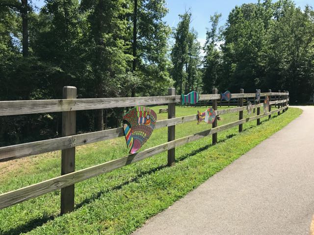 After safely maneuvering through the sand and dirt construction zone, the 1.25-mile paved trail leads away from the river towards North O’Neil St. Along the way we passed beautiful community art displays of hand-painted wooden fish. Then we biked by a public art garden featuring butterfly-shaped bike racks, benches, totem pole and a little free library. The trail also showcases information signs about forest animals in the area before passing a developing neighborhood and ending at a large greenway access parking lot at


 Looking for a fun family bike ride over the holiday weekend? Discover the
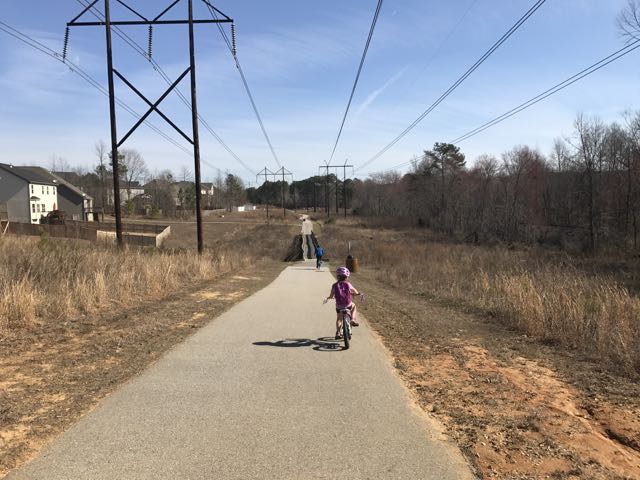
 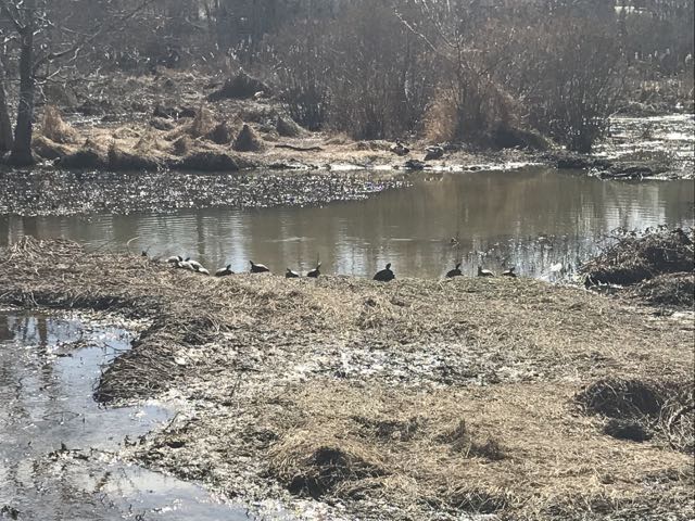 We maneuvered through the neighborhood sidewalks and carefully crossed Hodge Rd to continue on Mingo Creek Trail. Shortly after, we biked along the half-mile causeway, which was sandwiched between marshy areas and residential homes. We stopped on the causeway to watch the turtle and duck families sunning in the water. A great heron (or egret) also caught our eye.


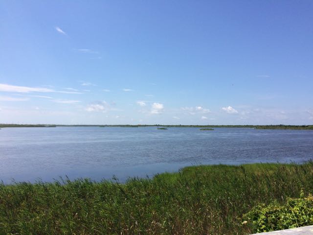 When we were in Nags Head last month we spent the last full day exploring Pea Island National Wildlife Refuge, which is located on a barrier island of the Outer Banks in NC. The Pea Island National Wildlife Refuge is part of a larger national wildlife refuge system with more than 500 units that was founded by President Teddy Roosevelt in 1903 to conserve the nation’s natural living treasures. The Pea Island Refuge was established in 1938 to provide a resting and winter habitat for migratory waterfowl. It features a visitor center, the North Pond Wildlife trail (which is part of the larger Charles Kuralt Trail), and 13 miles of beaches. We did a little bit of everything just before the big storms rolled in, making the trip a perfect last day adventure!
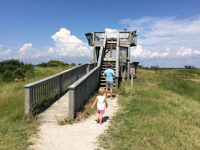 After exploring the visitor center we headed to the
 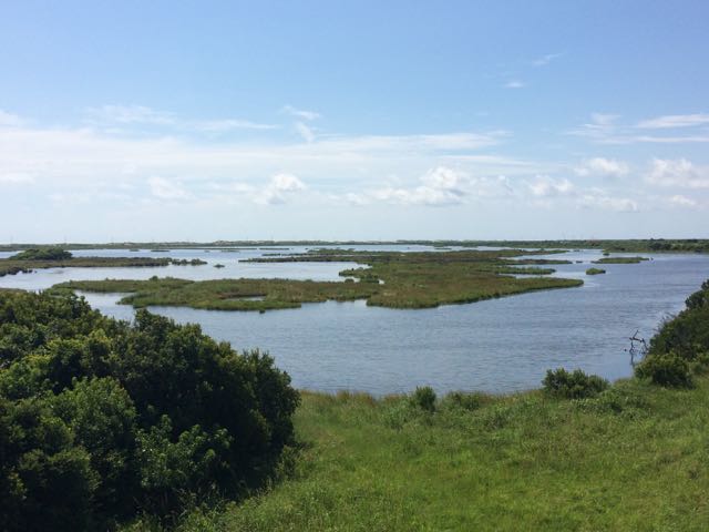 The North Pond Wildlife Trail is part of a larger grouping of trails that make up the Charles Kuralt Trail. It was established to encourage people to enjoy the wild lands and recognize this great NC native broadcast journalist who loved exploring remote places. The


 While we were in the NC mountains, Bill and I scooted out for a day date hike and beers in Blowing Rock. We hiked the
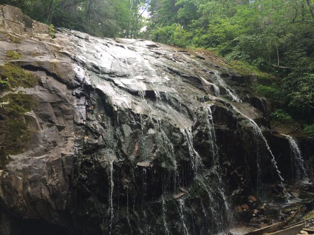
 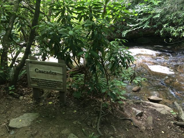 We arrived at the first waterfall, the Cascades, a little past halfway down the trail. The creek water gently flows over these moderately sloped rocks, allowing hikers to cautiously climb up the rocks to higher ground. We stopped to take in the sights and sounds before moving farther down the trail. On our next stop we hiked to the base of the trail at Glen Marie Falls. We climbed up large boulders sandwiched between small streams to get higher views of the mountains in the distance. Again, we stopped for several minutes to take in the quiet sights and sounds.


 We were very fortunate to spend a few weekends in the NC mountains this summer. On our second mountain trip we met up with my in-laws and stayed in a beautiful mountain cabin near the Appalachian Ski Mountain between Boone and Blowing Rock. On a tip from friends, we headed out to the
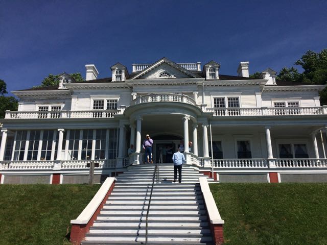
  After spending over an hour at the park, we turned left out of Moses Cone Memorial Park and headed 10 miles south to the Linn Cove Viaduct (MP 304). At an elevation of 4,100 ft, the Linn Cove Viaduct is a concrete bridge engineering marvel snaking around Grandfather Mountain; it is over 1,200 ft long and consists of 153 concrete sections weighing 50 tons each. Construction of the Linn Cove Viaduct was completed in 1983, cementing the final link of the Blue Ridge Parkway.


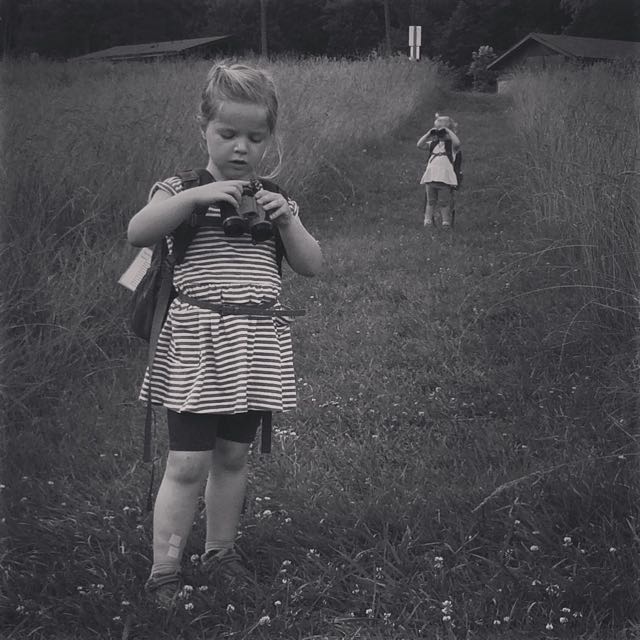
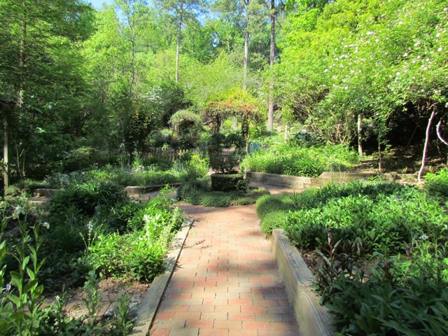
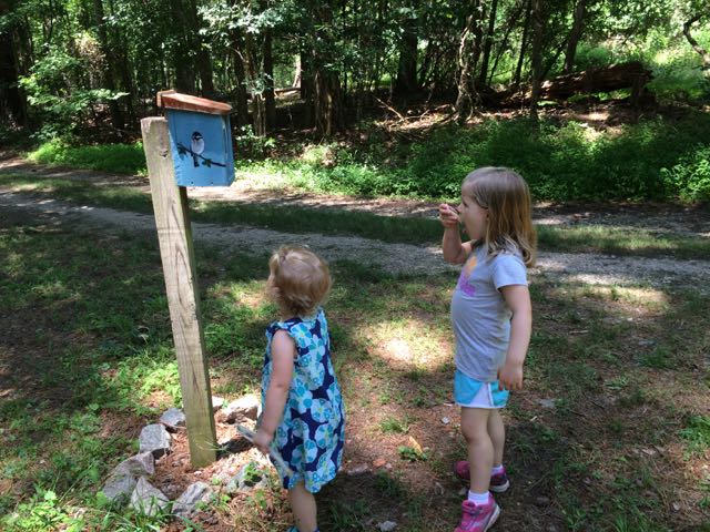 Once the girls finished in the natural play area, we walked across the parking lot and open field area to the bird and butterfly garden. The butterfly garden has a short trail surrounded by natural butterfly habitats of lilac, Queen Anne’s Lace, daylilies, eastern blue star and more. The butterfly garden leads into the shaded bird garden that features a mulched trail with several feeders, bird houses, and informational guides. We heard and saw a lot of birds flying in and around the gardens, but my bird identification skills are pretty pathetic – maybe some adult birding classes are in my future!


 On a cloudy summer day we headed to Annie Louise Wilkerson Nature Preserve Park to explore the nature playground and do some light hiking. It’d been awhile since we’d
 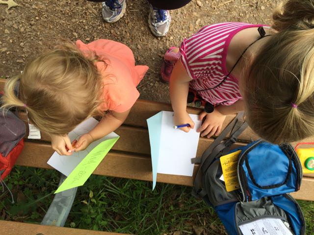 After our short hike we walked through Dr. Wilkerson’s former home, which has been renovated into an Education Center for the purpose of being a nature park research center. The front room is a mini museum of Dr. Wilkerson, highlighting her career and time she spent on the farm. We didn’t visit the other parts of the center, but the


 When the weather hovered in the high-70s on Christmas Eve, my family headed to a newly opened section of greenway for some exercise before filling up on holiday libations and rich foods. East Fork Mine Creek is a 2.5 mile north-south paved trail that runs along Mine Creek near Lynn Rd to the north side of Strickland Rd. We drove to one of the entrances of the trail near the intersection of
 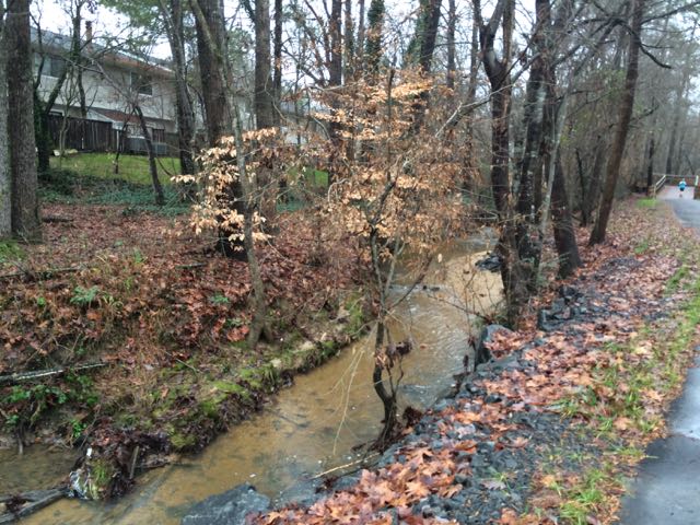 We continued north on the trail until we came to Old Deer Trail, a neighborhood street in the Summerfield subdivision. We crossed over Old Deer Trail and followed the Capital Area Greenway signs as we winded our way through this cute, low-traffic neighborhood. We passed a few other bikers and walkers along the way before coming to Strickland Rd. We crossed Running Cedar Trail, heading east on Strickland Rd where we also passed West Millbrook Middle School and mile marker 2.5, the end of East Fork Mine Creek Rd. At this point of the trail there is a well marked pedestrian crossing area designated for crossing over busy Strickland Rd. My aunt and I opted to head back to the car while the rest of the group crossed Strickland Rd to extend their run on the connecting Honeycutt Creek Trail (more on this hilly trail in a future post).


