Knightdale Station Park

img_4518

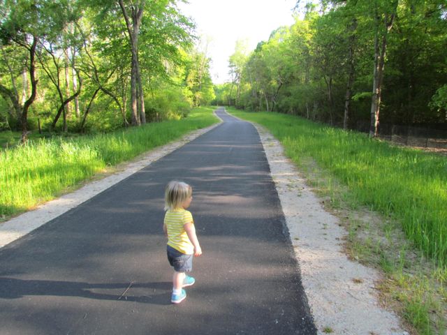
We are fortunate to have a great group of moms and kiddos through Stroller Strides of Midtown Raleigh to explore local parks with and a trip Knightdale Station Park last fall is no exception.  Knightdale Station Park is located at 810 North 1st Ave just outside 540 and south of US-64 business in Knightdale.

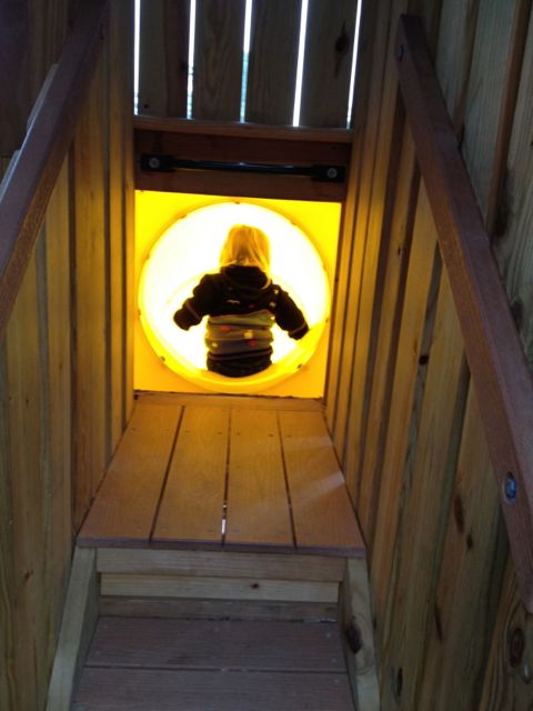
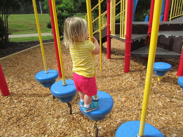
This park has a bit of everything – walking trails, large playground areas for kiddos under 2, ages 2-5 and ages 5-12, a dog park, and athletic fields.  We spent most of our time exploring the various playground areas, where all boast a farming/barn theme.  The playground area designed for ages 5-12 has a large play silo with a steep enclosed slide.  A spiral staircase is enclosed in the play silo, so if you have adventurous younger children, make sure they use extra caution.  Other than the play silo, this large playground has monkey bars, wide wheelchair-accessible ramps, smaller slides, and other climbing structures.  The nearby tot playground for ages 2-5 is a train with tunnels, slides and climbing structures.  It’s rather small for a tot playground, but the adjacent corral with bouncy horses and spinning cups provides some more activities for the young ones.

img_4530
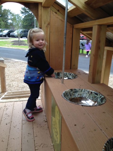
Ashley’s favorite play structure at this park was the play chicken coop designed for ages under 2.  She loved throwing mulch down the egg shoot for her friend to catch at the bottom.  This play area is covered and great for early walkers as kids can access it by a small ramp or short steps.

Scattered around the playground areas are benches, tot swings, regular swings, a large faux tire swing, mushroom stools, twirling structures, and sandbox with large tractor tire.  The different playground areas are joined by concrete sidewalk paths and covered with shredded bark.  A large pavilion with picnic tables and separate restroom building are also near the playground as is a walking/running trail.  Finally this park also has several athletic fields and an off-leash dog park with separate small and large dog areas.

For more information about this park and future plans visit the Town of Knightdale website.

Thumbs up: unique farming themed play areas, all ages incorporated into play areas, walking trails adjacent to playground

Thumbs down: climbing enclosed staircase in silo is a bit scary for little ones, young landscaping yields little shade

Neuse River Greenway: MP 15-17 & Milburnie Dam

img_4437

While I was training for the City of Oaks 10k last fall, it gave us a chance to try out several trails during my longer runs on the weekend.   One Saturday we headed over to the Neuse River Greenway near Anderson Point Park for a 4 mile run.  The Neuse River Greenway runs through Anderson Point Park and since I had explored part of the trail south of the park, we decided to park in the small lot prior to the entrance to Anderson Point Park and run north.

The parking lot at 22 Anderson Point Dr is rather large and serves for access to the greenway, overflow parking to the park, and canoe launch access to the river.  After parking, we headed north on the greenway and shortly saw mile marker 17 and signs for Mingo Creek Trail, which is maintained by the Town of Knightdale.

Along our 4 mile run (2 miles out and back) we passed over several pedestrian bridges, ran under New Bern Ave, passed a good amount of bikers and runners and discovered the beautiful Milburnie Dam.  The nearby greenway bridge provides great straight-on views of the dam, which has been out of commission since the 80s.  Milburnie Dam was first built in the mid-1850s as a power source for a paper mill.  From powering a paper mill, streetcars, and gristmill this dam has seen several changes since its inception according to the on-site information guide.  While the dam hasn’t been in use since the 1980s, it has since created a vibrant habitat for several animals.  In researching more about the dam it seems that removal of the dam has been debated for the last decade so its future use is unknown.  In the meantime, be sure to visit this great spot for some amazing photo opportunities…yet another reason why running on the greenway can provide beautiful surprises.

There is a small parking lot for quicker access to Milburnie Dam near the intersection of Old Milburnie Rd and Loch Haven Rd.

Check out Raleigh Nature’s blog post for more information on the Milburnie Dam.

Thumbs up: beautiful views of Milburnie Dam, relatively flat and shady greenway, having a playground near the greenway

Thumbs down: nothing to report

Abbotts Creek Trail

img_4309

It might be snowmaggedon part 2 in Raleigh right now, but months ago it was a beautifully warm day for a run in North Raleigh along Abbotts Creek Trail.  Abbotts Creek Trail is 2.9 miles and connects Simms Branch Trail with the Neuse River Trail.  We parked on-street near the intersection of Falls River Ave and Ashmead Ln.  Abbotts Creek Trail is connected by the sidewalk near where we parked so after some walking back and forth, we got our bearings and headed north on Falls River Ave where we shortly caught up with Abbotts Creek Trail.  Again, I’d love some directional signage throughout the greenways.

Abbotts Creek Trail is a wide, flat, and paved trail that runs between the Bedford at Falls River subdivision to the north and Abbotts Creek to the south.  It nicely carves a path through a moderately wooded forest (great for shadiness in the hot NC summer).  Along our run we passed several bikers and joggers, crossed multiple bridges, and explored the blue heron habitat.  While we didn’t see any blue herons, we did see evidence of their nests, which were easy to identify with help from the information guides.  Near the habitat are several benches, great for resting while doing some bird watching.

img_4316When we reached the end of Abbotts Creek Trail we turned left north onto the Neuse River Trail for a bit before turning around.  While on the Upper Neuse River Trail we passed the 2 3/4 mile mark and were impressed with the information guides about the floodplains and benches along the way.  Our out and back run was a total of 3.2 miles and I look forward to getting back up here again to explore the southern half of Abbotts Creek Trail, which I think leads to the North Wake Landfill District Park.

Thumbs up: flat and wide trail, lots of shade, fun nature stops along the way, busy foot traffic

Thumbs down: signage

Lake Lynn Trail

img_3803
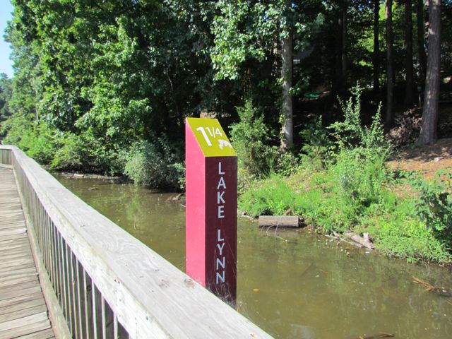
When I decided to run the City of Oaks 10k this past November, I used my toddler-free Tuesdays and Thursdays (thanks to preschool) to do my longer runs at Lake Lynn Trail. During these times I only had Claire with me, which meant I could run longer with the single BOB stroller. Pushing a double BOB stroller is exhausting!

Lake Lynn Trail is part of the Hare Snipe Creek Trail and about a 2.15 mile loop around Lake Lynn in North Raleigh. There are two entrances from where you can access the trail – one at Lake Lynn Community Center (7921 Ray Road) and one near the intersection at Lynn Rd and Leesville Rd.  Both entrances have large parking lots with easy access to the trail.  If you’re trying to get a good run in and need to avoid the playground, be sure to use the Lynn Rd entrance.  The Lynn Rd entrance is also where the mile marker starts at 0.

One of the main reasons I enjoy the Lake Lynn loop so much is that it’s a relatively flat trail that follows along the perimeter of the lake, offering nice views.  I knew the City of Oaks 10k would be pretty hilly (and it certainly was) but I was banking on the fact that I’d survive the race since all my runs were completed pushing at least one child in a stroller.  I also enjoy this loop because there’s a good amount of traffic so I feel safe when running by myself, although it can get rather crowded at peak times (mornings, weekends, and I’m sure evenings too).

Lake Lynn trail is paved with large sections of wooden boardwalk near the northern part of the trail.  It’s pretty noisy on the boardwalk so if you’re planning for little ones to sleep on this run, they will probably wake up when you reach the boardwalk.  The water level is pretty low near the boardwalk and has become a popular hangout for children feeding the ducks and geese so you may have to play Frogger™ to get around that area.  But, please remember to follow all city regulations and DO NOT FEED THE GEESE….they are a nuisance and will survive just fine without the extra feedings.  Instead, take the kids around the trail and look for the sweet sunning turtle families.  There are also several apartment complexes located around the lake, so it’d be a great place to live for anyone looking to be near the greenway.

Thumbs up: relatively flat and shady trail, great views along lake, sunning turtles

Thumbs down: paved portion of trail is bumpy with tree roots, bottleneck of patrons feeding ducks, entrance from Lynn Rd is initially hard to spot

Baileywick Park

img_3239The playground at Baileywick Park was closed this past winter so we finally made a visit in late May.  Baileywick Park is located in Northwest Raleigh at 9501 Baileywick Rd.  Upon entering the park you pass access to the Baileywick greenway trail and eventually come to a large parking lot that provides access to all of the park’s amenities.  We parked near the bathroom facilities and started with a visit to the playground.

The playground consists of an expansive jungle gym for ages 5-12, a smaller jungle gym for ages 2-5, four tot swings, four regular swings, a sand box with diggers, and several teeter totters.  The base of the playground is covered in wood chips and there are several benches scattered around the playground.  The playground for ages 5-12 has several slides that are of medium height, multiple climbing options, monkey bars, bridges and more.  The tot playground has several slides, matching games, and a few different climbing ladders.

Adjacent to the playground is a large open field, restrooms, a large shelter with eight picnic tables, an area shaded with trees (no picnic tables though), a covered bench area, and two lighted baseball fields.  A paved walking trail is also nearby, which leads to another shelter with two picnic tables and an open field.  This park is also equipped with the Big Belly solar trash and recycling compactors, which has provided great savings for the city.  These have been installed in several places throughout Raleigh and it’s great to see them at the parks.  Learn more about the Big Belly solar compactors in this N&O article from earlier this year.

Thumbs up: open fields, numerous benches, several swings, climbing options on large playground, nearby walking trail, landscaping around playground (several hardwoods and crape myrtles)

Thumbs down: full-sun playground area is very hot

Neuse River Trail Opening

img_3079

A couple of months ago we attended the Neuse River Trail grand opening at Anderson Point Park located at 20 Anderson Point Dr.  Most grand openings we attend are usually low-key and only involve a few important speakers, but this celebration was full of food trucks, live music, crafts for kids, local vendors and more.  As typical, we sat through 5 minutes of the grand opening speeches and then played on the playground before hitting up the food, vendors and crafts.

The Neuse River Trail is located on the eastern side of Raleigh paralleling the Neuse River with 7 bridges over the river throughout the trail; it  begins at Falls Dam Lake and continues south past the WRAL Soccer Park, Buffaloe Rd Park, Milburnie Park, Anderson Pointe Park and to the Johnston County line.  The new section of trail added 20 additional miles, bringing the total distance of this paved trail to 27.5 miles.  The Neuse River Trail allows for easy connections west to Crabtree Creek Trail or Walnut Creek Trail and is a great connection between the municipalities of Wake Forest, Raleigh, Knightdale, and Johnston County.  Part of the trail is also a segment of the Mountains to Sea Trail that extends from the Great Smokey Mountains to the Outer Banks.

img_3085After devouring some delicious pizza from my favorite local food truck, Klausie’s, Ashley and I headed south on the trail for about a mile before her patience and the time got the best of us.  The parts of the trail we walked were gorgeous – the trails are 10ft wide, the views of the river are amazing, and the bridges make for exciting photo ops.

To access the Neuse River Trail near Anderson Point Park, the parking spots are either inside the park or at the parking lot near the canoe put-in at 22 Anderson Point Dr. At this location, you’ll be near mile marker 17 of 27.5.  I can’t wait to return and explore more of the trail on bike next time!

Additional Resources:

Thumbs up: condition of trail, scenic views of river, photo ops, bridges

Thumbs down: signage to trails from within park

Museum Park Blue Loop Opening

img_3025About a month ago we attended the Museum Park’s Blue Loop opening at the NC Museum of Art.  It was the perfect spring morning to spend with friends while walking the new trail and enjoying live bluegrass music.  The Blue Loop is a one-mile trail that includes a new cut-through between the pond and Lowe’s Park Pavilion and extends through a wooded section on the southwestern side of Museum Park.  It was made possible by Blue Cross Blue Shield of North Carolina.

The FREE celebration featured live music from Big Medicine Bluegrass Band and the A&T Drumline, healthy snacks from local food trucks, and a celebratory lap around the Blue Loop.  Special guests included Raleigh Mayor Nancy McFarlane, NCMA Director Lawrence Wheeler, and Blue Cross and Blue Shield of North Carolina CEO Brad Wilson.

The NC Museum of Art is located at 2110 Blue Ridge Rd.  View the Museum Park map for a complete look at the Blue Loop.

Thumbs up:  lots of shade and open space, wide paths, rolling hills (perfect for a challenging run/walk)

Thumbs down: nothing to report

Shelley Lake Playground

img_2656With our weekly trips (if not more frequent) to Shelley Lake for Stroller Strides classes, I finally took pictures of the playground area.  Shelley Park is conveniently located in central North Raleigh at 1400 W Millbrook Rd.  There are two entrances on Millbrook Road – one large parking lot near the Sertoma Arts Center/playground and the other just down the street with a smaller parking lot for jumping right on the walking trail around Shelley Lake.  To reach the playground, park in the Sertoma Arts Center parking lot and walk down the paved trail where you’ll see the playground on the right.

The playground area is rather large with separate jungle gyms for ages 2-5 and 5-12 that are covered with wood chips.  The tot playground has several slides, a few climbing structures, and nearby teeter totters in the sandy area.  The youth playground has a climbing wall, steeper slides, a suspension bridge, an enclosed slide, and several climbing structures.  There are also four tot swings and four regular swings in the large sandy areas.

Other than the playground the park has picnic tables, basketball courts, a walking/running trail around the lake, and an arts center with lots of programs for people of all ages.  Ashley took a Mini Monet art class when she was about 18 months old and had a great time – while there wasn’t a lot of painting, it was a great introductory class to colors, shapes, sensory objects and following directions!

As most parks indicate, please lock and hide all valuables or take them with you – I have a friend whose car was broken into at this park.

Thumbs up: tons of picnic tables, suspension bridge on large jungle gym, shady, variety of slides

Thumbs down: not much for non-walking kids to play on, frequent trash around basketball courts (c’mon folks, throw your trash away in the nearby trashcans)

Hokies 3.2 Memorial Run on Crabtree Creek Trail

img_1767
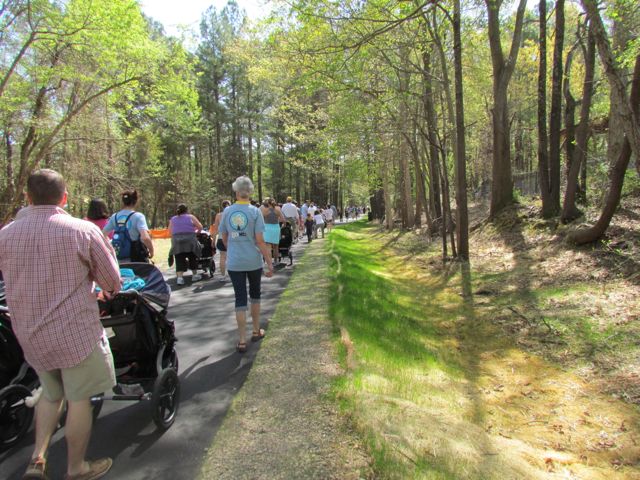
This past weekend, we explored part of the Crabtree Creek Trail greenway with over 50 fellow RTP Hokies for our annual Hokies 3.2 Memorial Run.  Our friends Becca and Brent organized the run, which started and finished at Big Boss Brewing Co.  It was an absolutely gorgeous day for the run and such a great reminder that Hokies are awesome! We even started the race with some Enter Sandman blasting from the car radio!

img_1770
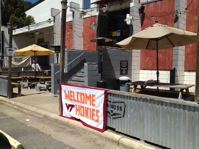
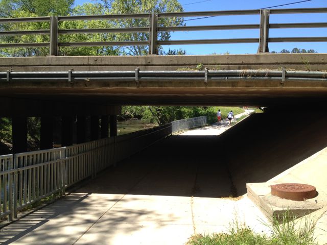
Like I said, we started the race at Big Boss Brewing Co, which is located at 1249 Wicker Drive in Raleigh.  Btw, they started a weekly run club about a year ago that you should check out! We headed north on Laurelbrook St and then made a left onto Hodges St, which runs parallel with the greenway.  Just east of Atlantic Ave, we jumped onto the Crabtree Creek Trail greenway and headed west.  This section of the greenway parallels Crabtree Creek so you have a nice view of the rapid flowing creek and several major overpasses and train tracks to cross under.  Being that we were pushing a stroller and not in our usual William & Kate shape, we lost sight of the group a few times on the way out.  Luckily some of the trail became familiar to me and at the fork in the road we headed right instead of left towards Kiwanis Park. We ran until we reached Oxford St and then turned around and headed back for a total of 3.2 miles.

Overall, this stretch of the greenway is nicely shaded, paved, and flat!  And, the best part of all was finishing the race with some much needed local beers at Big Boss with some awesome Hokies!  Ut Prosim!

Thumbs up: flat and shaded greenway, passing by the RTP Hokies hangout Carolina Ale House @ Creekside Dr, cold water and beer at Big Boss

Thumbs down: lack of signage or maps at forks in the greenway

Maymont Park

A few weeks ago we headed to Richmond to visit our college friends, Kelly and Drew.  On Saturday, while the boys were out exploring the local watering holes, the girls made a trip to Maymont Park.  Being a Virginia native and having lots of family in the Richmond area, I was floored when I heard Richmond has wild animals…in the city!  There is so much to do here, but we focused on feeding the animals at the petting zoo and visiting the Virginia wildlife in the animal exhibits.

Maymont is 100 acres of rolling hills, gardens, animals, and historical buildings to explore.  According to their website, a wealthy Richmond couple, James and Sallie Dooley, left their gorgeous estate to the City of Richmond as a special place for people to enjoy.  The park officially opened to the public in March 1926.  As I mentioned, we only had time to experience the animals at the park, but there is the mansion, carriage house, numerous gardens, and even a mausoleum to explore.

We entered at the Spottswood Entrance, which is at the corner of Spottswood Rd and Shirley Ln.  This is the entrance closest to the Children’s Farm with paved trails to the wildlife exhibits.  Here is a map of Maymont, which is helpful in deciding where to park based on which exhibits you want to experience.

After parking the car, we immediately headed for the Children’s Farm.  It’s a self-guided exhibit and they suggest a $2 per person donation.  We saw peacocks walking around, lots of sheep, wild looking bird-like animals in the barn, bunnies, goats, donkeys, pigs, etc.  All of the animals were extremely friendly and welcomed our yummy treats!

Once we finished with the petting zoo, we continued down the paved trail to the wildlife exhibits.  Here we saw a hawk, white-tailed deer, a gray fox (sadly circling the perimeter of his habitat), vultures, owls, a bald eagle, a black bear, and buffalo.  The poor bald eagle had an injured wing and the black bear enjoyed his high-security home (in response to the 2006 incident where two black bears bit a small child).   Even though this isn’t the same eagle as is in Maymont, here is a cool live eagle-cam on two eagles and their newly hatched chicks along the James River.

Meandering through the trail, you’ll cross a small stream several times and see signs for the butterfly trail.  This was the beginning of March, so several of the daffodils were in bloom. The trails through the park are also great for running on, as we saw lots of people jogging that day.  In the far distance you can see the mansion and other buildings.  Several of these can be rented for events, whether for a wedding, corporate event, or birthday party.

So, next time we’re in town we’ll totally check out the other features of the park and maybe even do a guided tour of a mansion.  If you have kids and are looking for something fun and cheap to do, definitely check out Maymont and all it has to offer.

Thumbs up: proximity of wildlife in city, petting zoo, rolling hills landscape, buffalo exhibit,

Thumbs down: gray fox exhibit, black bear exhibit