E. Carroll Joyner Park

IMG_4982With our red wagon and balance bike in hand, we headed out on a clear, sunny winter day to explore E. Carroll Joyner Park in Wake Forest.  E. Carroll Joyner park is located about 20 minutes from Raleigh, just off Rte. 1 at 701 Harris Rd.  Upon arriving into the park you immediately notice the expansive rolling fields and stone ribbon wall.  Follow the main road towards the back of the park where you’ll find the parking lot.

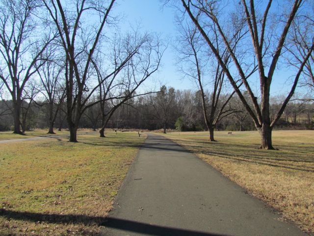
After parking we studied the information board to better understand the park’s layout.  With over 100 acres, this park has a lot to offer: three miles of paved trails, grass amphitheater, a pecan grove, farm buildings, a perennial garden, and a performance garden.  We spent most of our time walking and biking on the paved trails, which proved to be great balance bike practice for Ashley; the rolling trails are wide with gradual declines and park benches and swings along the way for resting.  The trails have great visibility, which is necessary for inexperienced young bikers who swerve all over the trail.

IMG_4994
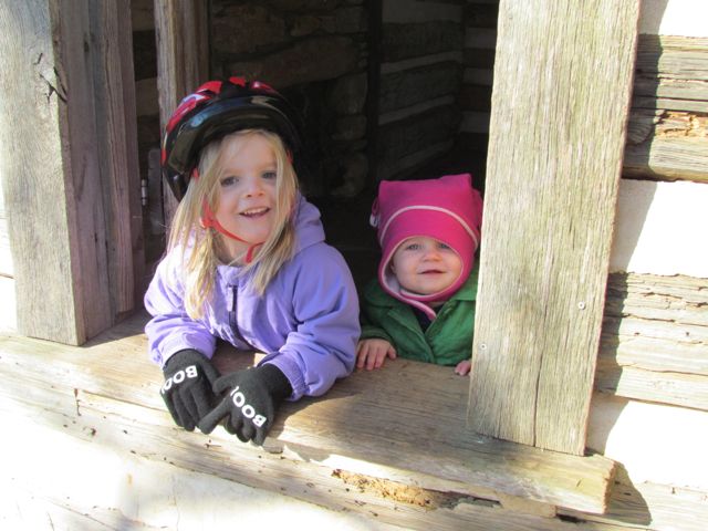
Along our walk/ride we passed several beautiful settings including the refurbished farm buildings.  This park was originally a working farm as recently as the 1940s, owned by the Walker family who grew produce to sell to local merchants.  It was sold to E. Carroll Joyner who raised cattle until the 1990s and then bought by the Town of Wake Forest in 2003 and opened as a public park in 2009.  The original farm buildings include a tobacco barn, log cabin, chicken coop and mule barn.  The girls had a fantastic time exploring the different buildings, especially the chicken coop.  Several of these buildings and the nearby settings also offer great photo opportunities.

After exploring the old buildings we followed the trails south around the pond.  We continued along the greenway past the pond, but after consulting the GPS we turned around since it was going to take much longer to get back to the parking via the greenway.

Before heading to the car we stopped for a short picnic at one of the bench swings and then stopped for a quick bathroom break in the very clean and comfortable public restrooms.  Make this park a must-visit for 2015 – whether walking, biking, running or out for some photography this park is your setting!  It’s also part of the Kids in Parks Track Trails program which encourages kids to have fun outdoor adventures.

Thumbs up: trails, photo ops, farm buildings, gardens, beautiful settings

Thumbs down:  greenway signage

House Creek Trail: MP 1.25 to 2.9

IMG_8471
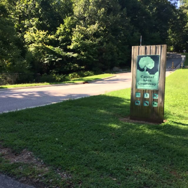
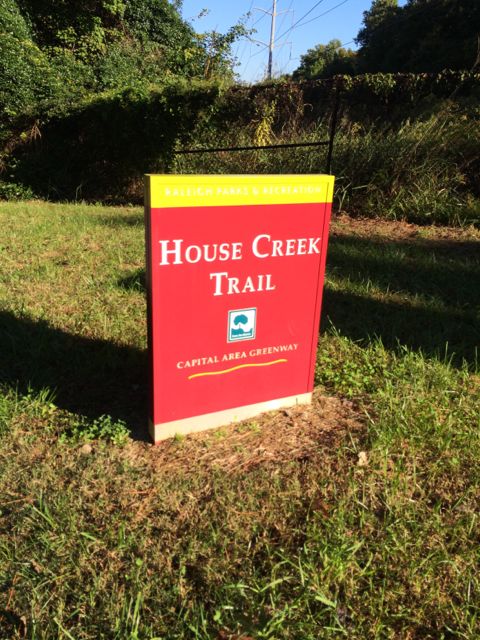
Even though the House Creek Trail was completed only 2 years ago, the trail’s history dates back to 1973 when it was a mere 350ft unpaved foot path and the foundation of the Capital Area Greenway.  House Creek Trail is a north/south connection between Reedy Creek Trail (near Meredith College/Wade Ave) and Crabtree Creek Trail (near Crabtree Valley Mall).  Having explored all other parts of House Creek Trail, I was excited to visit this last stretch and get some more mileage in before the City of Oaks 10k back in November.

I parked in the residential area (Leonard St/Ridge Rd intersection) behind the Ridgewood Shopping Center and then walked on the sidewalk toward Wade Ave to start at the end of the trail, which is mile marker 2.9.  The trail parallels Wade Ave for awhile before heading straight uphill towards the NC Museum of Art.  Before crossing the 440-beltline pedestrian bridge, bare right at the House Creek Trail sign and proceed with caution down the steep hill.

IMG_8497
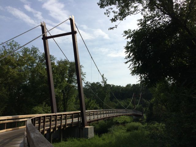
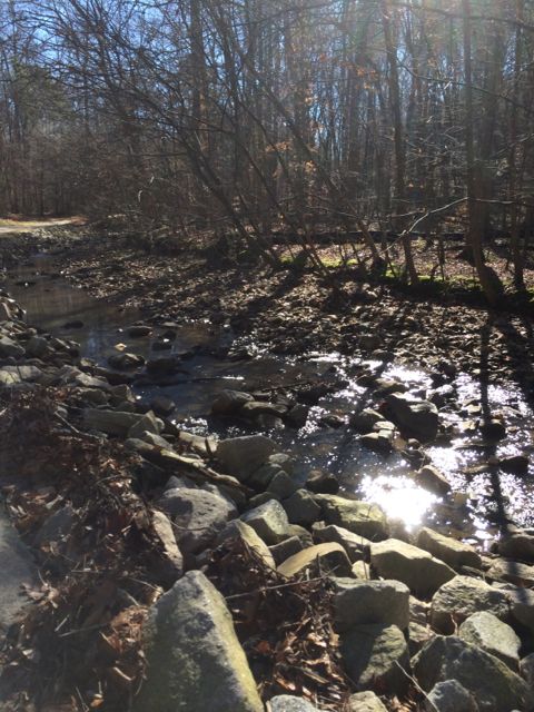
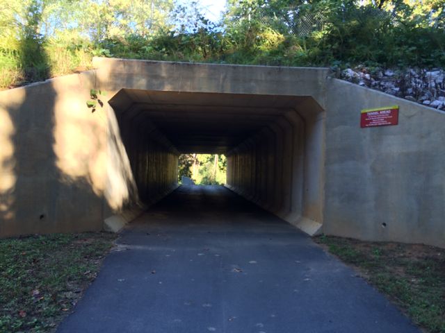
This greenway parallels the eastern side of the 440-beltline until the pedestrian crossover at Glen Eden Rd.  Even though you can hear and see the 440-beltline traffic, with the expansive tree lines on both sides of the trail, I sometimes felt like I was miles away in middle earth.  Occasionally I passed other bikers and walkers, but for the most part on this chilly October morning it was just me and Claire.  Before coming to the Lake Boone Trail tunnel, we passed the small Horton St apartment complex and a designated greenway parking lot located behind Martin Middle School.  It was around this time (mile post 2.0) that I also spotted a random basketball pole and hoop in the nearby creek, making me question the history of this area.

Continuing on, we spent some more time going uphill and navigated through the tunnel underneath Lake Boone Trail.  There are huge rock piles and large drain pipes here to help with drainage since this is a rather hilly spot.  We continued on a bit further and came upon an information plaque highlighting the original House Creek Trail and more details of the history of the Capital Area Greenway.  This part of the trail is relatively flat, which was a comforting change (see my elevation change photo below) so we continued on until the tunnel at Glen Eden Rd (approx mile post 1.25) where we turned around.

Having explored all of House Creek Trail now, I can say that I enjoy the flatter stretch of the trail from Glen Eden Rd to Crabtree Valley Mall, even though this probably better prepared me for the hilly City of Oaks run!

More Resources:

Thumbs up: scenery, safety, wide trails

Thumbs down: beware of the hills

Western Regional Park in Howard County, MD

IMG_8379This Fall, we visited Bill’s parents in Howard County, MD and made a morning trip to the nearby Western Regional Park.  Western Regional Park is located at 14800 Carrs Mill Road in Woodbine.  This park is a true symbol of where sports and recreation meet in the countryside.  Nestled among the scenic hills and nearby farms are playgrounds, walking trails, recreation fields, a community center, and lots more!

Upon arriving at the park, we drove to the back of the park near the large spiderweb climbing structure, since this was the highly anticipated play area.  Everyone (including grandparents) had a blast on this climbing area.  It consists of four tall poles connected through a series of spiderweb tightrope material.  Ashley had a blast shimmying around the climbing area and pretending the rubberized ground was “hot lava”.  Also nearby are some climbing rocks and spinning wheels, which we all enjoyed.  Down from the parking lot are smaller football fields, a multipurpose grass field for lacrosse or baseball, and a small pavilion with charcoal grill.

IMG_8396After exhausting our climbing skills, we explored the nearby paved trail in search for the other playground.  At the end of our short walk we saw a large lighted multipurpose artificial turf field with field hockey, soccer and football goals, a large open field, small mobile concessions, fenced-in basketball, community center, baseball fields, a line of porta-johns, tennis courts, and a playground.  Unfortunately the playground was being resurfaced while we were there so it was closed, but looked like it offered a lot for all ages and was fenced in!  The multipurpose field conditions were pristine – the grass was a luscious green color and very well maintained.  Another interesting feature of this park is the natural area preserved next to the sports fields; I imagine the spectators enjoy some depth to the typically flat parks.

Unfortunately we didn’t have enough time to explore all of this park, but in looking online there are more than 4 miles of walking trails (including horse trails), a thorough listing of common flora and fauna, and a nearby library.  For more information about this park, including maps and a full list of amenities visit the Howard County website.

Thumbs up: gorgeous condition of fields, natural area near sports fields, spiderweb climbing area, paved sidewalks between amenities

Thumbs down: signage around park

Lake Lynn Playground Update

IMG_8311

I spent some time again this fall running around Lake Lynn with the girls while training for the City of Oaks 10k race.  After a few laps around the lake we spent time at the playground so they could get their own exercise.  We were pleasantly surprised to find a few updates to the playground area.

Lake Lynn Park & Community Center is located in North Raleigh and has two entrances.  If the kids are with me I’ll park at the main entrance near the community center and playground off Ray Rd, but if I’m going there for a solo run I’ll park at the smaller entrance with immediate access to the trails off Lynn Rd.

The tot playground area has a new climbing area with a vertical climbing bridge sandwiched between two rock walls, which was a big hit for Ashley.  The older tot swings and small tot jungle gym and bigger kid playground haven’t changed.  Adjacent to the playground is a new large pavilion with about 12 picnic tables, making it a great spot for group gatherings and birthday parties!  The nearby bocce ball courts also seemed to have gotten a small facelift and there seem to be several more picnic tables scattered around the perimeter of the playground.  There’s a lot of other amenities at this park (baseball fields, tennis courts, batting cages), but having a playground area near a covered picnic spot and restrooms is usually what we’re looking for these days!  Most recently we enjoyed a Halloween party with our Stroller Strides friends where kids of all ages enjoyed the playgrounds and there was easy access to the nearby pavilion and community center.

More Resources:

Thumbs up: proximity of playground area to pavilion/community center

Thumbs down: nothing new to report

Simms Branch Trail

IMG_7570

Oh, Summer! What began as a daunting three months of partially empty calendars quickly filled with pool trips, swimming lessons, park time with friends, family visits, and so much more.  One August morning Ashley started another week-long stint at a City of Raleigh summer camp.  I’ve been so pleased with her introduction into the city summer camps and can’t wait for her to continue with them through the years.
IMG_7586So, after a Monday morning camp drop-off at Greystone Rec Center, Claire and I researched nearby greenways to explore using the RGreenway app.  After some deliberation, we drove east for a run along Simms Branch Trail. We parked along a residential street at 9410 Cub Trail (parking spot #4 on the Capital Greenway map) near the Falls of Neuse and Durant Rd intersection.  The greenway entrance was clearly marked so we set off on this relatively flat and shaded trail.  We winded through various residential areas and a small stream to the south of the trail.  We passed a few school yards along the way and had to cross a few residential streets and small bridges before coming to the end of the trail, which is just past the entrance for Durant Nature Park.  This out and back trail is about 3.25 total miles.

After our run we headed over to the super kid-friendly Lafayette Village shopping center to experience Jubala coffee (another recommendation from fellow blogger TriangleExplorer).  Claire and I shared some delicious homemade biscuits and I enjoyed a fresh cup of coffee.

Thumbs up: proximity to residential areas, nearby stream, easy access, shady

Thumbs down: nothing to report

Neuse River Trail: MP 13.25 to 15 & Suspension Bridge

IMG_7529

While I’ll be at the beach over Labor Day week, I wanted to share a must-do item for exploring Raleigh over the holiday weekend.  If you’re looking for some exercise, flora, fauna and beautiful scenery, this portion of the Neuse River Trail is it – it has a suspension bridge, croaking frogs, majestic herons, and an old dam!

Most recently we explored the Neuse River Trail from milepost 13.25 to 15.  We parked in the small paved residential lot at 2894 Abington Ln in east Raleigh.  After a short run down to the trail, we came to the compass in the greenway and decided to head north for a bit in search of the huge suspension bridge (by looking at the online greenway map, it looks like you cross the river just north of here).   Within 1/4 of mile we came upon the suspension bridge at milepost 13.5, which seems to come out of the middle of nowhere!  It seems so unique and breathtaking to me to have a suspension bridge on the greenway; I’m pretty sure I got goosebumps (granted it was 100+ degrees outside) and felt very sentimental for my city!

IMG_7513

We ran another 1/4 mile north until milepost 13.25 and then turned around and headed south.  We ran back over the suspension bridge where we saw some fisherman casting lines.  Further along we passed residential homes to the west and wetlands to the east with several overpasses in between and white barn fencing in certain areas that gave this trail a farm-like feeling.  There are more stretches of sunny parts along this trail than what I’m used to, I think mostly due to the neighborhood developments; it added some intensity to this hot summer run so don’t forget extra water!

We ran south until the Milburnie Dam, which we have explored in the past.  Again, it’s amazing to see what parts of Raleigh you’ll miss if you don’t get on foot!  So get out and explore this weekend!

More Resources:

Thumbs up: beautiful views, wetlands with information signs, suspension bridge, parking lot with access to trail, mile markers

Thumbs down: nothing to report

MacDonald Woods Park in Cary

img_6023

We had a jam-packed spring break staycation this year with trips to local parks, dance class, and a visit to Fearrington.  The beautiful weather stayed around all week and one day we met some dear friends in Cary at MacDonald Woods Park.

MacDonald Woods Park was our second choice for a park after we learned that Marla Dorrel Park was closed for renovations; lucky for us, MacDonald Woods Park was a short 2 mile car ride from Marla Dorrel.  MacDonald Woods Park is located at 1601 Seabrook Ave and is connected to Marla Dorrel Park via the Hinshaw Greenway, which is part of the pedestrian bridge that crosses US-64 highway. This park has on-street parking and sits below the road so it seems rather hidden at first, but based on the amount of people it’s a popular spot!

img_6008
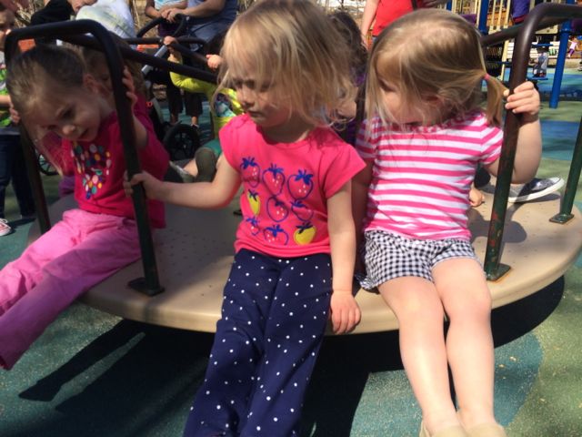
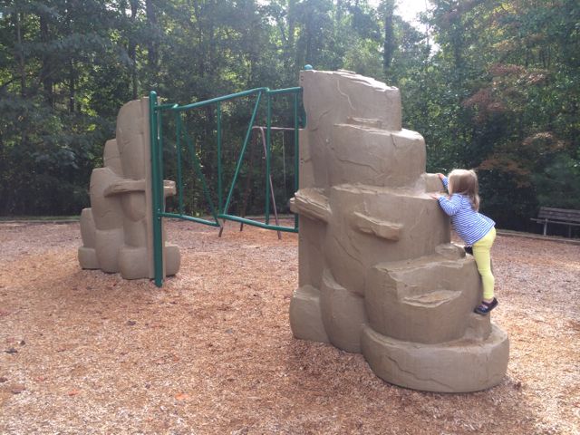
MacDonald Woods Park has playground areas for the 2-5 and 5-12 age groups with two swings for both groups. The 5-12 age playground is rather large with several ladders and slides, monkey bars, and climbing wall with rope. The loop-shaped ladder was by far a challenging favorite for this duo. The younger playground is very small with only 2 slides, steps and a platform ladder. There are a few bouncy rides and a small low-to-the-ground structure for early walkers. A small elevated sandbox is located between the two playground areas. But, by far, the best feature of this park is the merry-go-round. Yes, that’s right…they have a merry-go-round! Go Cary! Of all the parks we’ve been to this was a first so you can imagine the confusion when the girls first saw it. Having never been on a merry-go-round they watched several groups of people get on and off before getting on with a group of toddler girls. These sweet maniacs quickly caught on as to why you hold on to the bars but also moved into more challenging feats such as dangling their feet over the edge. That proved to be rather anxiety-ridden for us but they had fun and no one went flying off the thing, so it was a success!

After some playground time we had a picnic in the grassy area near the basketball court and then explored the nearby paved trails to the bridge and open grassy field. After some more trail exploring the girls were pretty exhausted so we headed home. I’m not sure if it was the fact that kids were out for Spring Break but I’ve got to think this park is naturally popular with its fun features and entrance to Hinshaw Greenway.

Additional resources: Hinshaw Greenway, MacDonald Woods Park

Thumbs up: merry-go-round, nearby creek to explore, landscaping
Thumbs down: small tot playground, few picnic tables

Optimist Park: Tutus & Picnics

img_5806
Stretching her ballerina toes after class

Awhile back a dear friend of mine and I signed our girls up for a preschool dance class at Optimist Park through the City of Raleigh.  It ended up being the perfect Monday morning activity, which led into extended play time and lunch at the playground.  It was the first activity (other than regular preschool) where the girls were on their own, so it was fun to have a buddy to learn some new skills with (we still talk about plies over here)!

Optimist Park is located in North Raleigh in a subdivision off Six Forks Rd at 5900 Whittier Dr.  It’s an older park with a community center, playground, seasonal and year-round pools, tennis courts, baseball fields, and greenway access for Mine Creek Trail, Snelling Branch Trail and Shelley Lake.

img_5782
A glimpse into the dance class

Dance class was held in the community center in a room that did not have easy access for parents to view their kids “dancing”.  So, to sneak peeks we’d have to poke our heads in and try not to disturb their learning.  Once dance class ended we headed over to the playground for some more play time and a picnic.

Again, Optimist is an older park so the playground has a more classic look with brown and orange painted metal.  The playground area is covered in a sandy surface and has a large jungle gym for the 5-12 age group that our 3 year olds and even 15 month old enjoyed.  There are several slides, a tunnel, and a few climbing ladders.  In the same area are

the springy cars and 4-person teeter totter.  The playground sits adjacent to a creek that has a short fence, which no one really explored even the 15 month old, but do take caution.  Benches are scattered throughout and the picnic tables and swing set are nearby.  This area is pretty shady, even with the few leaves on the trees.  If you follow the paved trail, you’ll come to eight lighted tennis courts that are adjacent to the student parking lot at Sanderson High.

img_5793
From the dance floor to the sandbox

While Optimist Park might not be a destination spot, it sure made for a great post-dance class play time and picnic spot!

Years ago Ashley and I ran the Snelling Branch Trail from Optimist Park and I never posted about it! To get to the greenway access, you’ll want to start in the smaller parking lot off Northclift Dr that is behind the Sanderson High baseball field.  Follow the signs and run behind the baseball field and you’ll come to North Hills Dr, which you’ll cross over.  Continue a little further and you’ll come to the Shelley Lake Trail where you can turn left to go south and see Shelley Lake very quickly or turn right to go north and discover the Mine Creek Trails or northern end of Shelley Lake loop.  We turned right and then made another right onto Mine Creek Trail where we crossed over North Hills Dr again, went under a tunnel for Lynn Rd, and eventually turned around near the intersection of Longstreet and Bent Creek Dr.  There’s a flowing creek along the way and we even passed a random playground.  According to the City of Raleigh website there’s a current project to extend East Fork Mine Creek Trail to Honeycutt Park.  That’ll be a good reason to get back here soon for more current pictures!

Thumbs up: quiet/not crowded, great picnic spots, fun beginner dance class, convenience of having park features close in proximity, greenway access

Thumbs down: older facilities, lack of true dance studio for watching kiddos

Photos from the Greenway exploration in Feb 2012:

North Wake Landfill District Park

img_5576

A playground at the landfill…say what?!  Yes, the North Wake landfill closed in 2008 and local residents worked with the county to repurpose the closed landfill into a park which now features paved trails, mountain biking trails, a large playground area, pavilion, and access to Abbotts Creek Trail (part of Neuse River Greenway).  North Wake Landfill District Park is located at 9300 Deponie Drive off Durant Rd in north Raleigh.  When you first turn off from Durant Rd, it’ll feel like the landfill is still open because you have to wind through some of the old parts of the dump, but follow the signs for the park.

We spent most of our time exploring the playground area and paved trails that access the nearby greenway. While the playground area has many unique features, I strongly disliked the layout where it is adjacent to a steep hill that my adventurous 3-year old decided to conquer at great speeds, despite strict instruction NOT to do so. So, after recovering from a near heart attack when she sprinted down the steep hill (and received a short timeout) we had a nice time exploring the play areas.

The playground has two areas – one for ages 2-5 and one for ages 5-12. In my opinion this park is definitely more of a “big kid” park. The younger playground area has several climbing structures that are more appropriate for an older and more confident 2-year old. It also has a few slides, two tot swings, and a music feature but it’s a taller playground with little room for playing on.

img_5596
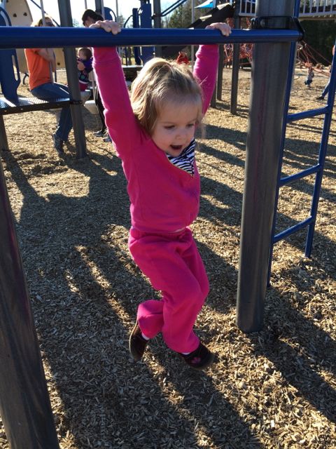
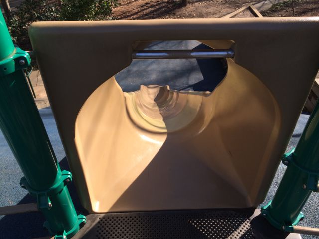
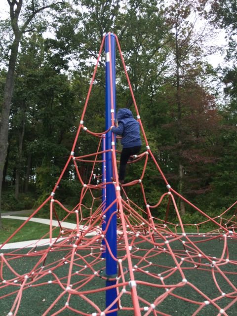
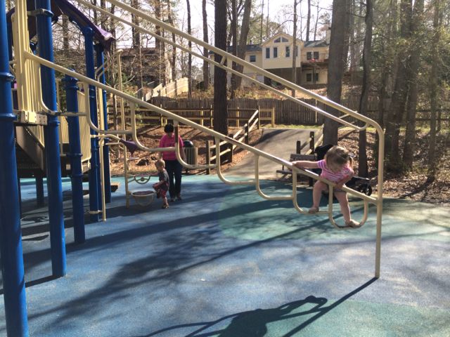
The bigger kid playground is any young climber’s dream.  There are huge spider web ropes that connect to the playground along with a sideways rock wall.  The playground also has several monkey bars, slides, twisty ladders, climbing stepping stones and more!

Both playground areas are covered in a thick wood chip surface and are adjacent to several picnic tables, the public restrooms and water fountains.  Also nearby is the large Sycamore pavilion with seating for up to 100, according to the Wake County website.

Descend along the paved trail from the playground to reach access to the western side of Abbotts Creek Trail.  Inside the park there are also several mountain biking trails, a mountain biking skills area, and paved walking trails.  I’d like to come back and walk or bike the short Top of the Hill trail, which takes you 469ft above sea level for great views of the surrounding area.  There is little shade at this park, so plan accordingly!

For more information about this park, visit the Wake County Parks website.  I found the park brochure with map to be very helpful.

Thumbs up: repurposing a landfill into a useable recreation space, variety of climbing activities for older kids, proximity and plethora of picnic areas

Thumbs down: steep hill near playground area, lack of park map inside park (didn’t know about most of the walking or bike trails until going online after getting home)

North Cary Park & Black Creek Greenway

img_5029This past winter has been one of the longest I’ve seen since moving to Raleigh over 11 years ago so when the temps hovered above 45 degrees in January we headed to North Cary Park with a friend and her girls for a short run and playground time.  North Cary Park is located at 1100 Norwell Blvd in Cary off of Cary Pkwy.  It’s a very large park situated along the northern end of Black Creek Greenway.  Before having kids we used to bike through Umstead Park on the Reedy Creek Trail and connect to Black Creek Greenway at Lake Crabtree.  This was a fun way to extend our mileage and explore the Town of Cary greenway system.

But, back to our recent trip.  After arriving at North Cary Park we winded through the park’s slightly confusing trails and eventually met up with Black Creek Greenway where we headed south.  The trail itself is a paved 7.1 total miles and winds between various neighborhoods and the creek.  We passed several bikers and runners along the way so we felt very safe.  We ran until the 2.25 mile mark of the greenway and then headed back.  The creek will make for some fun water playtime in the warm summer months.

img_5043

After running, we had some sweet, patient toddlers who needed to get exercise on the playground.  This playground area has a large sandbox area, several slides built into the small hills, a rock climbing area, tot swings, regular swings, a jungle gym for ages 5-12, and a small rubberized area great for the crawlers and early walkers.  With the dense landscaping and so many park features that are spread out, it made it harder for us to keep track of the toddlers while also tending to the babies.  After lots of toddler wrangling we were able to enjoy some time in the sandbox area, which has several benches along the perimeter.  Claire even enjoyed her first tot swing and Ashley was able to practice her potty training at the nearby restrooms, complete with a toddler-height sink.

Other than the playground and greenway, this park also has a large pavilion with a dozen tables overlooking 4 sand volleyball courts named after Julie Robison, 2 basketball courts, and a soccer field.  Benches and picnic tables are scattered throughout the playground area and before heading down to the greenway.  With so many friends with kiddos who train for running races, this is a great place to run solo or with kids combined with a playground visit!

More resources:

Thumbs up: variety of park features, safety of greenway, rubberized option for infants/early walkers, running/playground combo for those with strollers and kids

Thumbs down: confusing signage leading down to greenway trails, playground features being so spread out making it harder to keep an eye on independent toddlers