
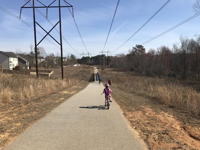
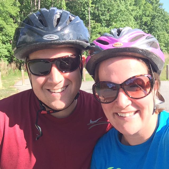
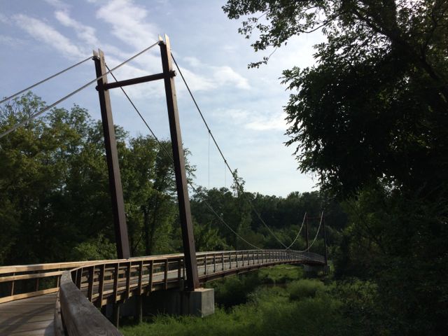
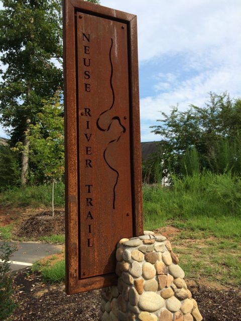
 Over Memorial Day weekend, my sweet in-laws watched the girls while Bill and I enjoyed a biking and beers day date. Wanting to explore a new (to us) portion of the greenway, we headed to the southern portion of the Neuse River Trail near the Wake/Johnston County border. In all, we biked 15-miles (out and back total), crossed two counties, followed a river, detoured around an unpassable bridge, passed a historic bridge, and saw some art before grabbing beers at Deep River Brewing – a pretty awesome afternoon!
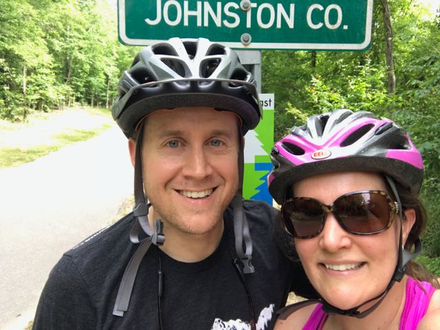
We parked in the greenway access parking lot at 6008 Mial Plantation Rd and turned left heading south toward Johnston County. We immediately crossed under Mial Plantation Rd bridge and passed the MP 26.25 sign. The trail is mostly flat with beautiful views of the rural fields separated by white split-rail fence. Shortly after, we biked past the Wake/Johnston Co line at MP 27.5, creating a fun selfie spot. The Town of Clayton maintains the greenway past the Wake County line with a portion of it affiliated with the East Coast Greenway.
Clayton River Walk on the Neuse
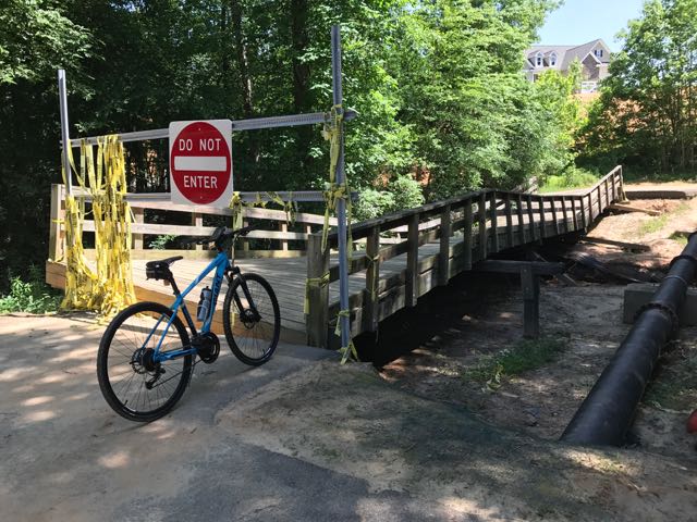 Continuing on Clayton’s greenway (technically called Clayton River Walk on the Neuse), we arrived at the Riverwood neighborhood where we found the bridge damaged and unpassable. At the time we didn’t see signage showing a detour route so I jumped onto the Town of Clayton website. I learned that last fall’s Hurricane Matthew caused near record flood levels for the Neuse River and took out the bridge. The town’s website shows a detour route through the Riverwood neighborhood that adds an extra five minutes via biking. The Town of Clayton is currently working with FEMA to replace the bridge, and there is no estimated completion timeframe.
 After biking the hilly detour through the neighborhood we met up with the trail and continued south. The trail remains mostly flat and sunny with clear views of the river. We passed a large sandy access spot for the river, complete with benches. Then, we biked under Covered Bridge Rd with a history that dates back to 1863 when it was first commissioned as a ferry replacement. Historians believe the bridge was covered around 1883 and most recently replaced in its current concrete form in 1980.
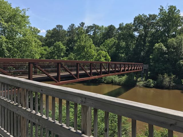
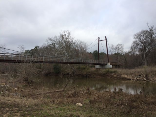
Shortly after passing Covered Bridge Rd, we passed MP 31 and crossed a large pedestrian bridge over the Neuse River. We enjoyed seeing so many benches and picnic tables donated by the Rotary Club of Clayton. About 1/2 mile later, we made a sharp right turn through a construction zone to stay on Clayton’s greenway, officially called Sam’s Branch Greenway at this point.
Sam’s Branch Greenway
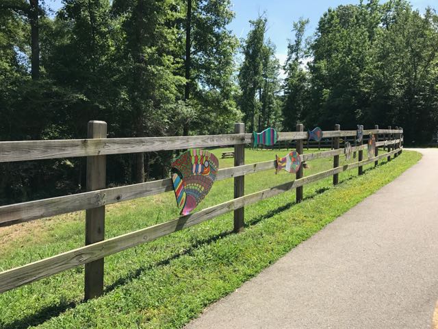 After safely maneuvering through the sand and dirt construction zone, the 1.25-mile paved trail leads away from the river towards North O’Neil St. Along the way we passed beautiful community art displays of hand-painted wooden fish. Then we biked by a public art garden featuring butterfly-shaped bike racks, benches, totem pole and a little free library. The trail also showcases information signs about forest animals in the area before passing a developing neighborhood and ending at a large greenway access parking lot at 1358 N O’Neil St.
Even though N O’Neil St is one of the main arteries leading to downtown Clayton (and Deep River Brewing) we aren’t adventurous enough to bike on main roads yet. So, we turned around and biked the 7.5 mile return trip to Mial Plantation Rd. We noticed better detour signage around the damaged bridge on our way home.
Despite the detour and construction we passed, it’s pretty amazing you can bike nearly 33 miles one-way from Falls Lake Dam to Sam’s Branch Greenway trailhead. With greenway connections to the Town of Knightdale (via Mingo Creek Trail) and future connections to the Town of Wake Forest greenways, people all over the area have so much access to outdoor adventures.
Helpful References
- Town of Clayton Greenways
- Riverwood neighborhood detour
- Neuse River Trail map
Milepost Points of Reference
- Falls Lake Dam – MP 0.0
- Mial Plantation Rd greenway parking – MP 26.25
- Wake/Johnston County line – MP 27.5
- Covered Bridge Rd & Clayton River Walk on the Neuse trailhead – MP 31
- Sam’s Branch Greenway trailhead – MP 32.5
Thumbs up: donated benches and picnic tables sprinkled along the way, public art displays, scenic views along river, greenway access points, jurisdictional connections
Thumbs down: detour signage coming from the north, construction zone near intersection of Clayton River Walk on the Neuse and Sam’s Branch Greenway


 Looking for a fun family bike ride over the holiday weekend? Discover the
 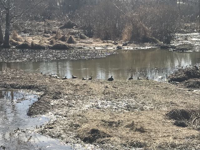 We maneuvered through the neighborhood sidewalks and carefully crossed Hodge Rd to continue on Mingo Creek Trail. Shortly after, we biked along the half-mile causeway, which was sandwiched between marshy areas and residential homes. We stopped on the causeway to watch the turtle and duck families sunning in the water. A great heron (or egret) also caught our eye.


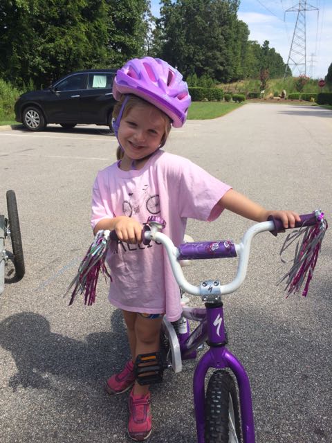
 If you can’t tell by the themes of some of my latest blog posts, biking has been our family’s new passion. Having a bike hitch, bike trailer and at least one child biking on her own really opens up the family bike outings to beyond the driveway or cul-de-sac. Even though Bill is usually the one to strap the bikes onto the hitch and gather all the gear, I’ve made it a point to learn how to do it on my own in hopes that I could take the girls out by myself. Feeling rather confident about strapping all the bikes onto the hitch, remembering all the gear and snacks, I took the girls for a bike ride on Abbotts Creek Trail one summer morning in August.
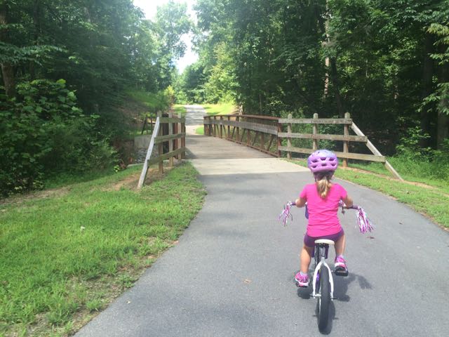 The bike ride back to the car was successful and even a bit adorable as my stop-and-smell-the-flowers daughter took advantage of light greenway traffic with her simultaneous bike ride swaying and singing. Despite the hot weather, the girls made the trip so much fun and were so patient with me as I carefully installed the bike equipment back onto the car.
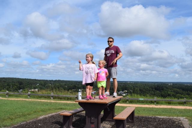 We biked to the bottom of the trail that leads to the top of the landfill, parked our bikes and walked to the top. I’m the only one in our family who has ever been to the top of the landfill, so I was excited to share the views with everyone. The little ones took turns exclaiming their discomfort for walking up the hill, but it’s such a short walk (less than 1/4 mile) that they pushed through it.


 Last summer Bill and I biked by this
 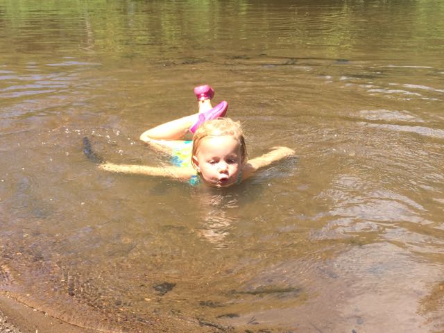 It hadn’t rained recently so the beachy area was actually wider and longer than I’ve seen it at other times and the river flowed slowly. The water was pretty warm except in the middle of the river, which was over our heads in several spots. We didn’t bring life jackets with us and the water wasn’t very clear so the girls mostly played near the shore line looking for tadpoles, playing in the sand/mud, or splashing in the water with the other young family that was there. While we were there a few paddle boarders passed by including a father and young daughter out for a ride (next summer’s bucket list goal).


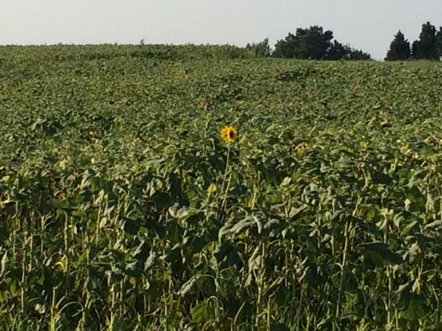 Near the end of July we ventured to the southern section of the Neuse River Trail in hopes of finding the beautiful field of sunflowers that were in bloom (from a hot tip by
 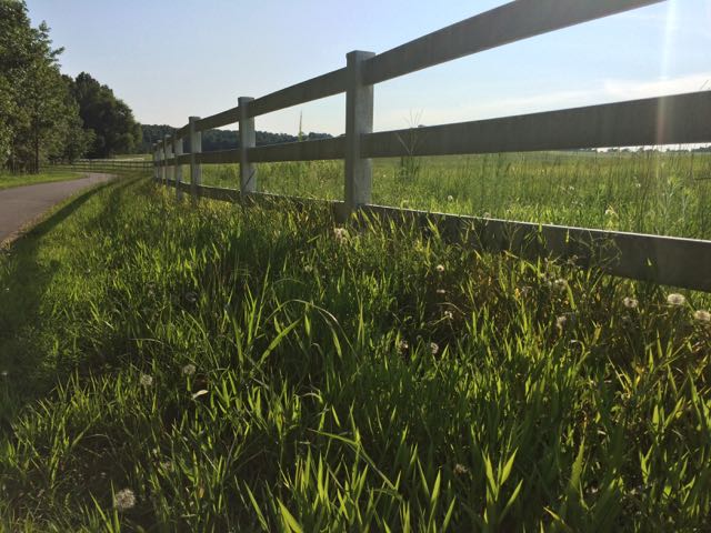 We continued south along the greenway and caught a closer glimpse of a few sunflowers still in bloom. We turned around when we reached mile post 23.75 near the
 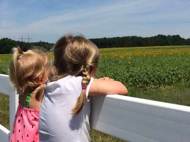 2016 Update:


 On the heels of family visiting at the end of May, my aunt offered to watch the girls while Bill and I headed out for a date night. Instead of gorging ourselves at a new restaurant, we decided to dust off our bikes and chomp away at another segment of the Neuse River Trail between the Bedford neighborhood and US-401 (followed by beers at a new brewery,
 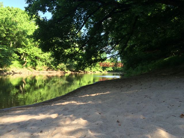 milepost 3.5 – look over the river to spot old gas or electricity lines running across an old steel bridge


 Towards the end of March we headed out to Neuse River Trail to explore the area surrounding Horseshoe Farm Nature Preserve, in anticipation of the
 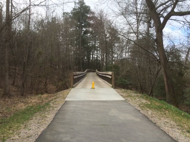 This portion of the greenway continues to be relatively flat and shady. The areas surrounding the greenway are mostly dense forest to one side with the river to the other. We saw quite a few fisherman on both banks of the river with most of them concentrated in spots near US-401. Our run back to the car was much faster than the run out so we took advantage of happy little faces and retrieved a balance bike, scooter and helmets from the car and let the girls ride on the greenway. It wasn’t a busy morning on the trail, so the girls had a carefree time riding. Ashley biked south on the greenway all the way to milepost 9 where we crossed over a small bridge with a shallow creek below, perfect for spotting turtles. Claire enjoyed her first scooter ride where we pushed her from behind as she cruised along. They were troopers for such a long morning run of about 4 miles and then some bike time.


 For the few days it’s been sunny and above 40 degrees this winter you could easily find us at a park or greenway soaking up the fresh air. Even though we’ve explored a lot of the southern end of the Neuse River Trail, we hadn’t run along the northern portion (aka Upper Neuse Greenway) until this winter. It’s a great location to get some exercise and then have a picnic along the shores of the dam.
 On this particular day the water level was elevated, so it was relaxing to hear the rushing water flow over a screaming 18-month old (yes, she screamed for about 95% of our run). Regardless, this trail is great in that it parallels the river offering great water views and glimpses of the native flora and fauna. We saw herons, beautiful budding red berry bushes (maybe winterberry shrubs) and tall native grasses. We passed under Falls of Neuse Rd and over small bridges. We also passed by the Bedford at Falls River neighborhood with greenway access to Falls River Ave and then turned around at the 1.5 mile mark, which is by the fork in the trail; keep left to stay on the greenway or stay straight for another access point to Falls River Ave and a greenway parking lot. The steady stream of foot traffic and proximity to made me feel secure about returning on my own and the relatively flat, wide trail might make it ideal for kiddo balance biking!


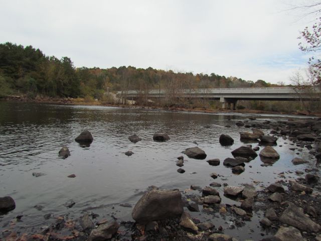 This fall we wanted to further explore Falls Lake so we set off with intentions to start closer to the dam and finish
 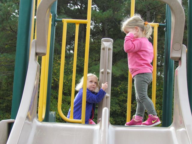 The playground is designed for ages 5-12 and includes a few slides, climbing structures, tic-tac-toe, and several nearby picnic tables and benches. It’s a small playground, but the perfect size for a park with so many more activities. After taking in the views from the top of the dam, we walked down the unpaved trail adjacent to the playground where we got up close and personal with the beginning of the Neuse River. The girls enjoyed throwing rocks in the water while we saw fishermen and birds. There’s also a small parking lot, canoe launch, restrooms, information map, picnic tables, and access to the start of the Neuse River Trail greenway at the bottom of the dam.


