Optimist Park: Tutus & Picnics

img_5806
Stretching her ballerina toes after class

Awhile back a dear friend of mine and I signed our girls up for a preschool dance class at Optimist Park through the City of Raleigh.  It ended up being the perfect Monday morning activity, which led into extended play time and lunch at the playground.  It was the first activity (other than regular preschool) where the girls were on their own, so it was fun to have a buddy to learn some new skills with (we still talk about plies over here)!

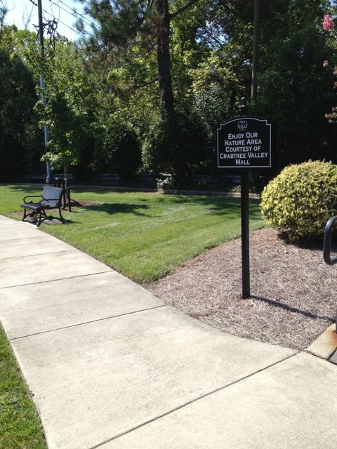
Optimist Park is located in North Raleigh in a subdivision off Six Forks Rd at 5900 Whittier Dr.  It’s an older park with a community center, playground, seasonal and year-round pools, tennis courts, baseball fields, and greenway access for Mine Creek Trail, Snelling Branch Trail and Shelley Lake.

img_5782
A glimpse into the dance class

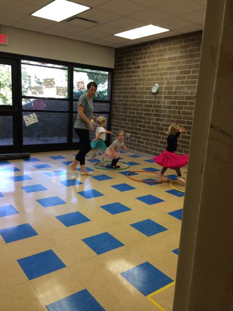
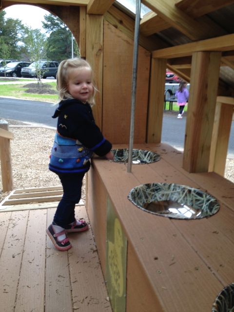
Dance class was held in the community center in a room that did not have easy access for parents to view their kids “dancing”.  So, to sneak peeks we’d have to poke our heads in and try not to disturb their learning.  Once dance class ended we headed over to the playground for some more play time and a picnic.

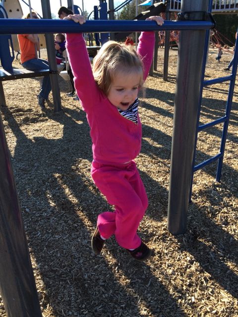
Again, Optimist is an older park so the playground has a more classic look with brown and orange painted metal.  The playground area is covered in a sandy surface and has a large jungle gym for the 5-12 age group that our 3 year olds and even 15 month old enjoyed.  There are several slides, a tunnel, and a few climbing ladders.  In the same area are

the springy cars and 4-person teeter totter.  The playground sits adjacent to a creek that has a short fence, which no one really explored even the 15 month old, but do take caution.  Benches are scattered throughout and the picnic tables and swing set are nearby.  This area is pretty shady, even with the few leaves on the trees.  If you follow the paved trail, you’ll come to eight lighted tennis courts that are adjacent to the student parking lot at Sanderson High.

img_5793
From the dance floor to the sandbox

While Optimist Park might not be a destination spot, it sure made for a great post-dance class play time and picnic spot!

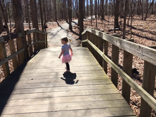
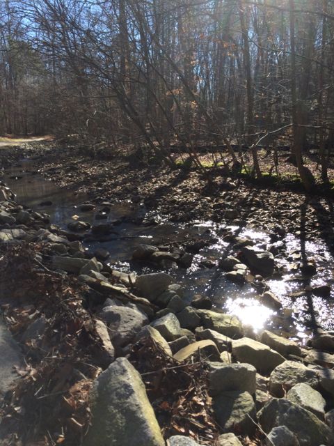
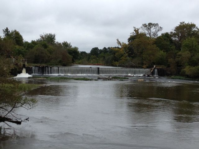
Years ago Ashley and I ran the Snelling Branch Trail from Optimist Park and I never posted about it! To get to the greenway access, you’ll want to start in the smaller parking lot off Northclift Dr that is behind the Sanderson High baseball field.  Follow the signs and run behind the baseball field and you’ll come to North Hills Dr, which you’ll cross over.  Continue a little further and you’ll come to the Shelley Lake Trail where you can turn left to go south and see Shelley Lake very quickly or turn right to go north and discover the Mine Creek Trails or northern end of Shelley Lake loop.  We turned right and then made another right onto Mine Creek Trail where we crossed over North Hills Dr again, went under a tunnel for Lynn Rd, and eventually turned around near the intersection of Longstreet and Bent Creek Dr.  There’s a flowing creek along the way and we even passed a random playground.  According to the City of Raleigh website there’s a current project to extend East Fork Mine Creek Trail to Honeycutt Park.  That’ll be a good reason to get back here soon for more current pictures!

Thumbs up: quiet/not crowded, great picnic spots, fun beginner dance class, convenience of having park features close in proximity, greenway access

Thumbs down: older facilities, lack of true dance studio for watching kiddos

Photos from the Greenway exploration in Feb 2012:

North Wake Landfill District Park

img_5576

A playground at the landfill…say what?!  Yes, the North Wake landfill closed in 2008 and local residents worked with the county to repurpose the closed landfill into a park which now features paved trails, mountain biking trails, a large playground area, pavilion, and access to Abbotts Creek Trail (part of Neuse River Greenway).  North Wake Landfill District Park is located at 9300 Deponie Drive off Durant Rd in north Raleigh.  When you first turn off from Durant Rd, it’ll feel like the landfill is still open because you have to wind through some of the old parts of the dump, but follow the signs for the park.

We spent most of our time exploring the playground area and paved trails that access the nearby greenway. While the playground area has many unique features, I strongly disliked the layout where it is adjacent to a steep hill that my adventurous 3-year old decided to conquer at great speeds, despite strict instruction NOT to do so. So, after recovering from a near heart attack when she sprinted down the steep hill (and received a short timeout) we had a nice time exploring the play areas.

The playground has two areas – one for ages 2-5 and one for ages 5-12. In my opinion this park is definitely more of a “big kid” park. The younger playground area has several climbing structures that are more appropriate for an older and more confident 2-year old. It also has a few slides, two tot swings, and a music feature but it’s a taller playground with little room for playing on.

img_5596
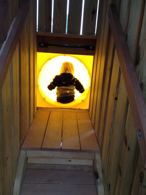
The bigger kid playground is any young climber’s dream.  There are huge spider web ropes that connect to the playground along with a sideways rock wall.  The playground also has several monkey bars, slides, twisty ladders, climbing stepping stones and more!

Both playground areas are covered in a thick wood chip surface and are adjacent to several picnic tables, the public restrooms and water fountains.  Also nearby is the large Sycamore pavilion with seating for up to 100, according to the Wake County website.

Descend along the paved trail from the playground to reach access to the western side of Abbotts Creek Trail.  Inside the park there are also several mountain biking trails, a mountain biking skills area, and paved walking trails.  I’d like to come back and walk or bike the short Top of the Hill trail, which takes you 469ft above sea level for great views of the surrounding area.  There is little shade at this park, so plan accordingly!

For more information about this park, visit the Wake County Parks website.  I found the park brochure with map to be very helpful.

Thumbs up: repurposing a landfill into a useable recreation space, variety of climbing activities for older kids, proximity and plethora of picnic areas

Thumbs down: steep hill near playground area, lack of park map inside park (didn’t know about most of the walking or bike trails until going online after getting home)

Prairie Ridge Ecostation

img_5501

A few weeks ago Claire finally got her own special park day where we took advantage of an early Spring day and headed to the Prairie Ridge Ecostation, which is NC Museum of Natural Science’s outdoor learning space.  Even though the science museum is located downtown, this outdoor gem of 45 acres is located down the street from the NC Museum of Art at 1671 Gold Star Drive in Raleigh.

The Prairie Ridge Ecostation is an outdoor oasis of walking trails, play spaces, nature programs, animal habitats, gardens, and more!  This particular day we spent the morning with friends listening to the storytime program, walking the trails, and exploring the outdoor buildings/gardens.  After parking, we headed on the paved trail (with the small signage) through the woods and eventually found the outdoor storytime spot at the amphitheater.  I love the idea of outdoor storytime, but with the noise from the nearby road and a novice story teller, it did not make for optimal conditions. So, even though several of the smaller kids lost interest, there is plenty of adjacent natural play areas: tunnels and slides, sifting, digging, stacking, balancing, jumping on tree trunks and more!

img_5519Next, we passed by several picnic tables and open spaces on our way to the grassy walking trail.  The trail follows along the stream and then crosses into the lowland forest and piedmont prairie areas.  Near the piedmont prairie area is a building that overlooks the pond that is made for bird watching.  The kids had a great time looking for birds and playing in the building.  After we arrived back at the beginning of the trail (about 1/2 mile total) we visited the Green Building, which is used mostly for educational programs but also has restrooms and a back deck great for picnics. Since we didn’t pack a picnic we continued to explore the grounds and settled in the Nature Neighborhood Garden.  The garden features NC native plants, dry stream beds for collecting run-off water, a koi pond and more.  Claire and I enjoyed some quiet time on the benches under the pavilion before heading out.

This outdoor expansion to the science museum is a must-explore spot for any family; wear old clothes, pack a picnic lunch, bring a carrier for any non-walking children and plan to get dirty!

Resources:

Thumbs up: outdoor learning opportunities, play space, picnic spots, bird watching

Thumbs down: story time program is in its infancy

North Cary Park & Black Creek Greenway

img_5029This past winter has been one of the longest I’ve seen since moving to Raleigh over 11 years ago so when the temps hovered above 45 degrees in January we headed to North Cary Park with a friend and her girls for a short run and playground time.  North Cary Park is located at 1100 Norwell Blvd in Cary off of Cary Pkwy.  It’s a very large park situated along the northern end of Black Creek Greenway.  Before having kids we used to bike through Umstead Park on the Reedy Creek Trail and connect to Black Creek Greenway at Lake Crabtree.  This was a fun way to extend our mileage and explore the Town of Cary greenway system.

But, back to our recent trip.  After arriving at North Cary Park we winded through the park’s slightly confusing trails and eventually met up with Black Creek Greenway where we headed south.  The trail itself is a paved 7.1 total miles and winds between various neighborhoods and the creek.  We passed several bikers and runners along the way so we felt very safe.  We ran until the 2.25 mile mark of the greenway and then headed back.  The creek will make for some fun water playtime in the warm summer months.

img_5043

After running, we had some sweet, patient toddlers who needed to get exercise on the playground.  This playground area has a large sandbox area, several slides built into the small hills, a rock climbing area, tot swings, regular swings, a jungle gym for ages 5-12, and a small rubberized area great for the crawlers and early walkers.  With the dense landscaping and so many park features that are spread out, it made it harder for us to keep track of the toddlers while also tending to the babies.  After lots of toddler wrangling we were able to enjoy some time in the sandbox area, which has several benches along the perimeter.  Claire even enjoyed her first tot swing and Ashley was able to practice her potty training at the nearby restrooms, complete with a toddler-height sink.

Other than the playground and greenway, this park also has a large pavilion with a dozen tables overlooking 4 sand volleyball courts named after Julie Robison, 2 basketball courts, and a soccer field.  Benches and picnic tables are scattered throughout the playground area and before heading down to the greenway.  With so many friends with kiddos who train for running races, this is a great place to run solo or with kids combined with a playground visit!

More resources:

Thumbs up: variety of park features, safety of greenway, rubberized option for infants/early walkers, running/playground combo for those with strollers and kids

Thumbs down: confusing signage leading down to greenway trails, playground features being so spread out making it harder to keep an eye on independent toddlers

Falls Lake Hike Day Hike A: Raven Ridge Rd towards Dam

img_4946Every New Year’s Day, NC hosts First Day Hikes all over their state parks to promote a healthy start to the year. Even though the organized First Day Hikes didn’t exactly work with our kiddo schedules we drove up for a short hike of our own near Falls Lake.

Falls Lake is a state recreation area just 10 miles north of Raleigh with 7 individual parks, a 12,000-acre lake and 26,000 acres of woodlands.  For our hike, we chose one of the southeastern fingers to explore.  The portion of the trail we hiked is from Day Hike A (from Shinleaf Rec Area to Falls Lake Dam) of the Mountains to Sea Trail.  Mark Edelstein provides a very detailed description of the hiking trails through Falls Lake, which I used to help navigate the area.  We hiked a portion of this trail heading west to east.

img_4947
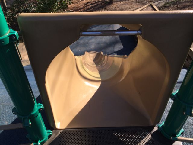
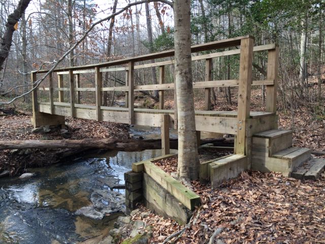
To find the gravel pull-off parking area (noted at the 3.5mi mark in Section 1) we drove north on Falls of Neuse Rd and turned left on Raven Ridge Rd and parked along the side of the road shortly after passing Annie Wilkerson Nature Park.  After getting everyone strapped in their gear, we set off by following the small sign pointing east towards Falls Lake Dam, which is 3.5 miles away.

This is a very moderate hike with small hills and a fairly wide trail throughout.  It is a heavily wooded area, giving a lot of shade to the trail.  Most of this section also closely follows much of the lake, so there are several lake inhabitants and small waterfalls to discover along the way (great for puddle stomping during summer time).  We also passed a trail entrance into Annie Louise Wilkerson Nature Park, which happened to be closed for the New Year holiday, but would be fun to incorporate into a short hike.

We only hiked about 2.4 total miles that day and didn’t make it to Falls Lake Dam, but I’m looking forward to starting at the dam and heading west on our next hike through Falls Lake.

Resources:

  • list of day hikes through Falls Lake as compiled by the Mountains to Sea Trail campaign
  • Detailed hiking descriptions from Falls Lake Dam to Raven Ridge Rd
  • Falls Lake map (although not detailed enough for hiking trails)

Thumbs up: views along stream, clear hiking signage along trail, great shade

Thumbs down: planning a hike in Falls Lake using NC Parks online resources (use the Mountains to Sea Trail site instead)

Knightdale Station Park

img_4518

We are fortunate to have a great group of moms and kiddos through Stroller Strides of Midtown Raleigh to explore local parks with and a trip Knightdale Station Park last fall is no exception.  Knightdale Station Park is located at 810 North 1st Ave just outside 540 and south of US-64 business in Knightdale.

This park has a bit of everything – walking trails, large playground areas for kiddos under 2, ages 2-5 and ages 5-12, a dog park, and athletic fields.  We spent most of our time exploring the various playground areas, where all boast a farming/barn theme.  The playground area designed for ages 5-12 has a large play silo with a steep enclosed slide.  A spiral staircase is enclosed in the play silo, so if you have adventurous younger children, make sure they use extra caution.  Other than the play silo, this large playground has monkey bars, wide wheelchair-accessible ramps, smaller slides, and other climbing structures.  The nearby tot playground for ages 2-5 is a train with tunnels, slides and climbing structures.  It’s rather small for a tot playground, but the adjacent corral with bouncy horses and spinning cups provides some more activities for the young ones.

img_4530Ashley’s favorite play structure at this park was the play chicken coop designed for ages under 2.  She loved throwing mulch down the egg shoot for her friend to catch at the bottom.  This play area is covered and great for early walkers as kids can access it by a small ramp or short steps.

Scattered around the playground areas are benches, tot swings, regular swings, a large faux tire swing, mushroom stools, twirling structures, and sandbox with large tractor tire.  The different playground areas are joined by concrete sidewalk paths and covered with shredded bark.  A large pavilion with picnic tables and separate restroom building are also near the playground as is a walking/running trail.  Finally this park also has several athletic fields and an off-leash dog park with separate small and large dog areas.

For more information about this park and future plans visit the Town of Knightdale website.

Thumbs up: unique farming themed play areas, all ages incorporated into play areas, walking trails adjacent to playground

Thumbs down: climbing enclosed staircase in silo is a bit scary for little ones, young landscaping yields little shade

Neuse River Greenway: MP 15-17 & Milburnie Dam

img_4437

While I was training for the City of Oaks 10k last fall, it gave us a chance to try out several trails during my longer runs on the weekend.   One Saturday we headed over to the Neuse River Greenway near Anderson Point Park for a 4 mile run.  The Neuse River Greenway runs through Anderson Point Park and since I had explored part of the trail south of the park, we decided to park in the small lot prior to the entrance to Anderson Point Park and run north.

The parking lot at 22 Anderson Point Dr is rather large and serves for access to the greenway, overflow parking to the park, and canoe launch access to the river.  After parking, we headed north on the greenway and shortly saw mile marker 17 and signs for Mingo Creek Trail, which is maintained by the Town of Knightdale.

Along our 4 mile run (2 miles out and back) we passed over several pedestrian bridges, ran under New Bern Ave, passed a good amount of bikers and runners and discovered the beautiful Milburnie Dam.  The nearby greenway bridge provides great straight-on views of the dam, which has been out of commission since the 80s.  Milburnie Dam was first built in the mid-1850s as a power source for a paper mill.  From powering a paper mill, streetcars, and gristmill this dam has seen several changes since its inception according to the on-site information guide.  While the dam hasn’t been in use since the 1980s, it has since created a vibrant habitat for several animals.  In researching more about the dam it seems that removal of the dam has been debated for the last decade so its future use is unknown.  In the meantime, be sure to visit this great spot for some amazing photo opportunities…yet another reason why running on the greenway can provide beautiful surprises.

There is a small parking lot for quicker access to Milburnie Dam near the intersection of Old Milburnie Rd and Loch Haven Rd.

Check out Raleigh Nature’s blog post for more information on the Milburnie Dam.

Thumbs up: beautiful views of Milburnie Dam, relatively flat and shady greenway, having a playground near the greenway

Thumbs down: nothing to report

Umstead Park: Pott’s Branch Trail

img_4165
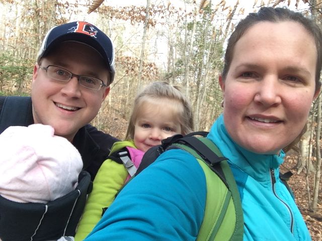
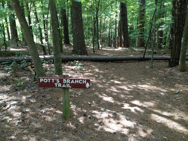
At the end of last summer we ventured out for some hiking at Umstead Park.  Since Claire was only about a month old at the time, we wanted to keep it pretty easy so we explored Pott’s Branch Trail, which is only 1.6 miles and easy on the difficulty scale.  To get to Pott’s Branch Trail, use the park entrance at 8801 Glenwood Ave and continue straight to the back of the park where you’ll come to a large parking lot.  We parked in the larger, two-level parking lot and after a lot of configuring backpacks and bjorns we set off to find the trail head.

img_4155
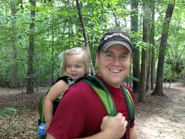
For some reason, even for two directionally-sound people we had a hard time finding the trail head for Pott’s Branch Trail.  From what I remember the signage was horrible and after a lot of stumbling around, we eventually found it.  Lucky for us, this is small looped trail so regardless of where we got on, we’d eventually get back to the parking lot.

Raleigh had a very wet summer last year and the trail was evidence of such.  Portions of the trail parallel a small stream, which had debris filled branches indicative of higher water levels.  There were also some large downed trees and muddy areas, which made us think the stream must have risen over the bank in areas.

The trail itself was very easy; other than a few downed trees that we walked around and large tree roots along the way, the trail is very flat and comfortable for most any fitness level.  Along the way, you’ll pass a large wooden deck, picnic table and small grill, and roads in the very far distance.  Since this trail is on the opposite side of the road from Big Lake, you won’t see any large bodies of water, but the flowing stream offers some interesting views and holds the attention of toddlers!

Thumbs up: quick and easy hike, nearby stream, wide and shady trail

Thumbs down: poor signage from the parking lot to trail head

Sal’s Branch Trail Photo Update

Labor Day weekend my sister and brother-in-law visited so we headed back to Umstead Park where we hiked Sal’s Branch Trail again.  Be sure to read my first review of that trail, but again, I love that it’s a good distance (2.75 miles) and has nice views of Big Lake.  We got such an early start on the hike that we were able to grab lunch to go from Moe’s and visit the nearby Gizmo Brew Works for some much needed beers and a picnic lunch! Gizmo Brew Works is nestled in an industrial park off Glenwood Ave and has an array of inside seating (couches, tables) and some picnic tables outside. Albeit, probably not designed to bring kids, but we made it work! They don’t serve food, but we’re fine with us bringing outside food so plan accordingly.

Helpful Links:

Update: Crabtree Creek Trail near Crabtree Valley Mall

img_4136

When Claire was about a month old, I felt good enough to go on a short jog so I returned to an area I was very familiar with – House Creek Trail.  We parked at Glen Eden Pilot Park and made our way down House Creek Trail towards Crabtree Valley Mall, which is a distance of 1 mile. What was supposed to be a short out and back jog turned into a longer outing with a visit to the mall because the girls were being so well behaved.

When we got to the end of House Creek Trail, we crossed over Blue Ridge Rd and then turned left onto Crabtree Creek Trail, which parallels Crabtree Valley Ave behind the mall.  It seems as if the pedestrian access to the mall has gotten much better since the last time we jogged this trail.  There’s a pedestrian bridge over the creek and some nearby grassy areas that would make a good place to walk a dog or have a picnic.  All of this great pedestrian access will come in handy when the mixed-use project across from the mall is complete.  When we were there last summer, a lot of dirt was being moved around, so I’m sure it’s made much more progress since then.  For more information about this mixed-use project read the article by Triangle Business Journal.

The other in-progress project we passed while on the House Creek Trail is the large Marshall Park apartment unit community.  This is the project you can see from the belt line with the massive brick retaining wall.

Before returning to our car, Ashley enjoyed some play time at the Glen Eden Pilot Park playground, which was more suitable for her now that she’s a little bit older.

Lake Lynn Trail

img_3803
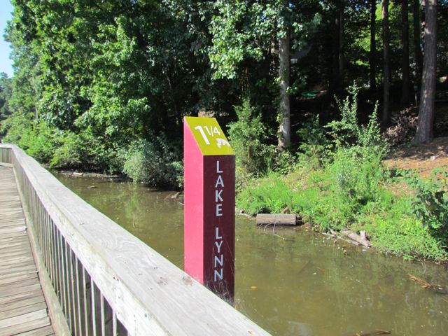
When I decided to run the City of Oaks 10k this past November, I used my toddler-free Tuesdays and Thursdays (thanks to preschool) to do my longer runs at Lake Lynn Trail. During these times I only had Claire with me, which meant I could run longer with the single BOB stroller. Pushing a double BOB stroller is exhausting!

Lake Lynn Trail is part of the Hare Snipe Creek Trail and about a 2.15 mile loop around Lake Lynn in North Raleigh. There are two entrances from where you can access the trail – one at Lake Lynn Community Center (7921 Ray Road) and one near the intersection at Lynn Rd and Leesville Rd.  Both entrances have large parking lots with easy access to the trail.  If you’re trying to get a good run in and need to avoid the playground, be sure to use the Lynn Rd entrance.  The Lynn Rd entrance is also where the mile marker starts at 0.

One of the main reasons I enjoy the Lake Lynn loop so much is that it’s a relatively flat trail that follows along the perimeter of the lake, offering nice views.  I knew the City of Oaks 10k would be pretty hilly (and it certainly was) but I was banking on the fact that I’d survive the race since all my runs were completed pushing at least one child in a stroller.  I also enjoy this loop because there’s a good amount of traffic so I feel safe when running by myself, although it can get rather crowded at peak times (mornings, weekends, and I’m sure evenings too).

Lake Lynn trail is paved with large sections of wooden boardwalk near the northern part of the trail.  It’s pretty noisy on the boardwalk so if you’re planning for little ones to sleep on this run, they will probably wake up when you reach the boardwalk.  The water level is pretty low near the boardwalk and has become a popular hangout for children feeding the ducks and geese so you may have to play Frogger™ to get around that area.  But, please remember to follow all city regulations and DO NOT FEED THE GEESE….they are a nuisance and will survive just fine without the extra feedings.  Instead, take the kids around the trail and look for the sweet sunning turtle families.  There are also several apartment complexes located around the lake, so it’d be a great place to live for anyone looking to be near the greenway.

Thumbs up: relatively flat and shady trail, great views along lake, sunning turtles

Thumbs down: paved portion of trail is bumpy with tree roots, bottleneck of patrons feeding ducks, entrance from Lynn Rd is initially hard to spot