
I love North Carolina’s weather. The distinct seasons provide a general schedule I can count on each year. Each season lasts long enough that I don’t tire before the next season begins. Then, sometime in early March the weather consistently warms up, the daffodils start to bloom, and the sun stretches beyond 6:00pm. That’s my signal to put away the snow gear, bust out the springtime table runner, finish birthday planning for my oldest, and welcome spring time.
The other weekend we took advantage of the gorgeous spring weather and headed to Durant Nature Preserve for a hike. We’ve visited Durant Nature Preserve several times over the years (see previous blog posts) but it had been awhile since our last trip. For this visit, we brought fishing nets, our collapsible bucket, and rain boots to play in the streams. Despite predictable resistance to hiking, the girls ended up having the best time!
Border Trail
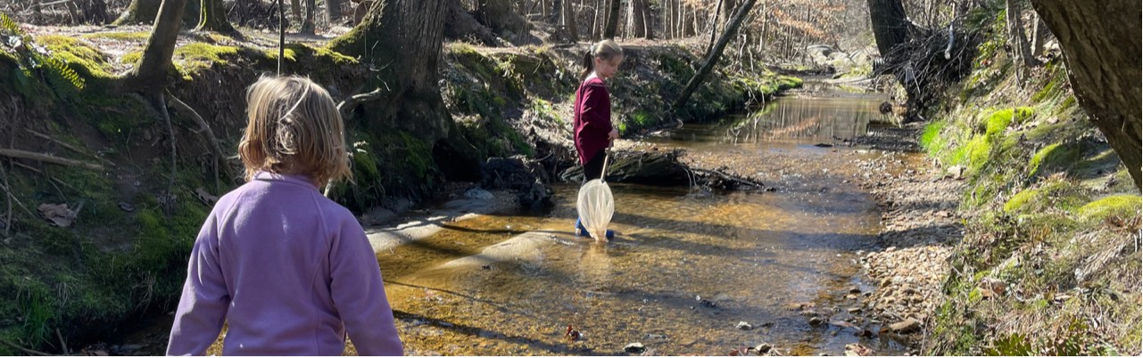
We parked at the north entrance and set off on the White House Rd Trail (see park map). Despite grumpy moods (including a short sit-in) and warning signs about muddy trail conditions we pushed on. From the White House Rd Trail we veered right onto the Border Trail, which circumnavigates the park. The Border Trail leads downhill to the creek, where at the bottom you turn left to stay on the trail. The creek sits between the wooded Border Trail on the park’s side and the paved Simms Branch Trail on the far side. Simms Branch Trail connects to Abbotts Creek greenway trail which connects to Raleigh’s longest greenway trail, the Neuse River Trail. Despite being close to a residential neighborhood the trail feels miles away. We only heard the crunching of our boots on the leaves and the trickle of the water.
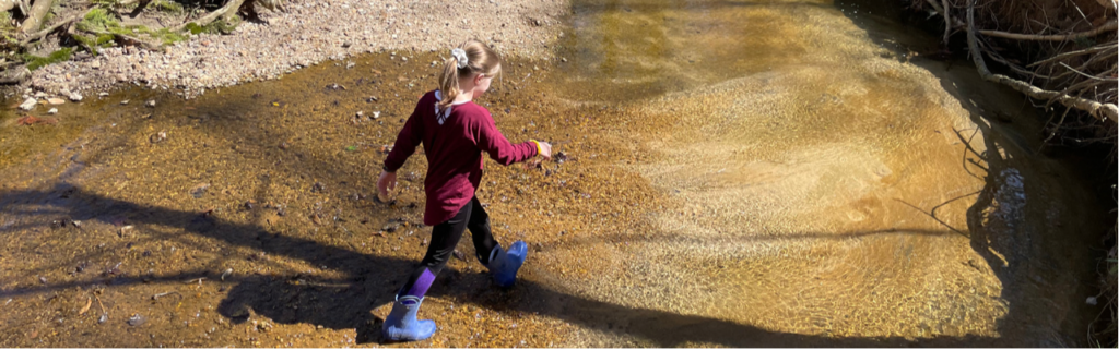
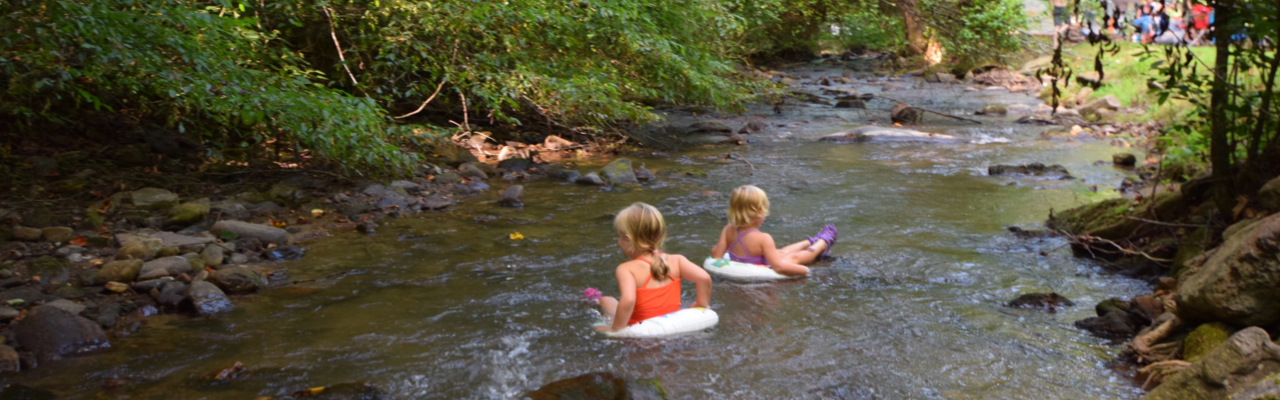
Family hiking success (for us) increases if water is involved. As soon as my kids feasted their eyes (and boots) on the creek, their hiking attitudes instantly transformed! Despite being a sunny day the water was super cold. Since the Border Trail parallels the creek, they flipped between walking on the unpaved trail and the creek. They’d scamper down the creek bank, walk through the water or hop across rocks, and then pull themselves back up the creek bank if the water level threatened to flood their boots. This type of hiking continued until we reached Whale Rocks.
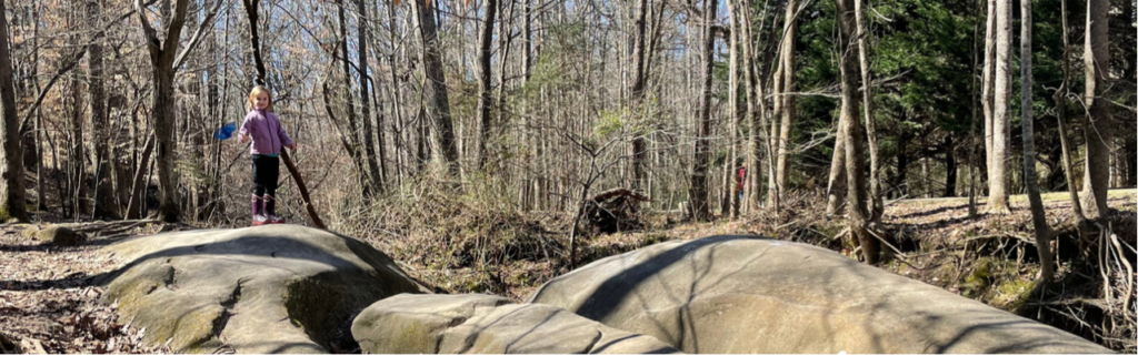
Whale Rocks is a stop along the Border Trail that boasts large rock formations as big as, well, whales. My kids loved jumping from whale rock to whale rock and timing themselves to see how long it took to climb from the creek bed to the rocks and back.
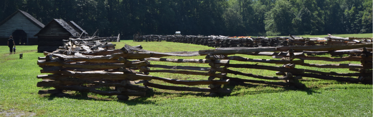
After hiking with the whales we continued on the Border Trail bouncing between walking in the creek and walking on the trail. This trail is mostly flat and features many hardwood trees and rock outcrops. We found dry creek beds and natural sand pits along the way that made for fun imaginary fossil dig play. They also enjoyed climbing across several of the trees that laid across the creek.
When we hiked about halfway around the Border Trail we turned left to follow Order of the Arrow Trail to the lake. Order of the Arrow Trail is a wide, flat trail surrounded by many pine trees. At the fork in the trail we turned left to stay on the trail and continue towards the lake. When the trail intersected with White House Rd, we turned right onto White House Rd. Then we turned left on Lakeside Trail, following the north side of the lake. The map posted along the trails was a helpful guide.
The north side of Lakeside Trail parallels the edge of the lake providing gorgeous views. The girls enjoyed walking along the shore line to spot turtles, lizards, and minnows. We also saw and heard several red-tailed hawks. We walked past campsites, benches, the closed boat house, and the fishing docks before ending at the playground.
Secret Creek Trail
After playing on the playground we followed the Secret Creek Trail, which begins across from the playground. We originally discovered this trail about 3 years ago when my now 4th grader attended a field trip at Durant Nature Preserve. To this day, it was one of her most memorable fields trips. She caught (and released) tadpoles and dragonfly nymphs, and had an awesome time exploring the Secret Creek Trail with classmates.
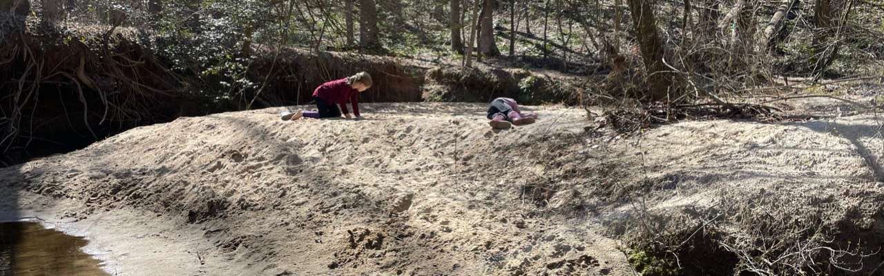
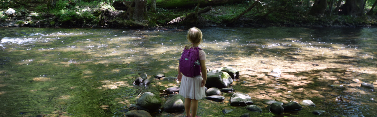
Secret Creek Trail is an easy trail with a few small hills along the 1/2 mile hike. The trail parallels a section of the creek that has gentle banks and small waterfalls throughout. In past visits we’ve seen a family of deer behind the park office and huge turtles resting in the creek under the large trees. Again, we flip flopped between walking on the trail and walking in the water. The trail’s canopy provides a lot of coverage, making it a cooler walk during warm weather. We also discovered some large sandy spots great for picnics, digging, and relaxing. Secret Creek Trail finishes at Camp Durant Rd, so you have to walk up the hill along the road to return to the main parking lot.
After we finished our hike, we headed to Char Grill for some much needed lunch! As we ate we recounted how fun the hike was and how we can’t wait to explore it again during the warmer weather months!
Thumbs up: improved trail markings and maps, rocking climbing at Whale Rocks, easy access for exploring the creek
Thumbs down: nothing to report


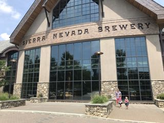 After exhausting the outside area, we dragged the girls (who were pretty willing) through the hallway that showcases their production areas. We glanced at the huge multi-story storage tanks, watched the bottle filling/cleaning process, and saw the packaging area. The girls mildly enjoyed watching the mechanics of how everything worked. Having toured only craft brewery operations, we were blown away by the grandness of everything at Sierra Nevada. I can’t wait to go back!
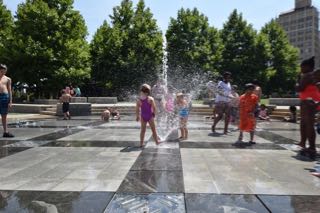 Since we had a little time to kill before checking into our cabin we headed to downtown Asheville to let the girls run off some energy in the water fountains at
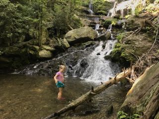
 After recovering from our big hike and nearly rain-soaked picnic, we rallied to explore


 For our next Winnie adventure we headed to the beautiful Blue Ridge Mountains near Marion, NC. We stayed at the
 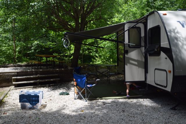 The Mountain Stream RV Resort was the perfect spot for camping. They have 40 camp sites situated around a loop gravel road with a grassy median. A cool, clear mountain stream runs behind more than half of the campsites. We stayed in one of their prime spots near the back of the campsite with easy kid-friendly access to the stream. We loved splashing in the water, walking upstream, and sitting at the campsite listening to the babbling stream.
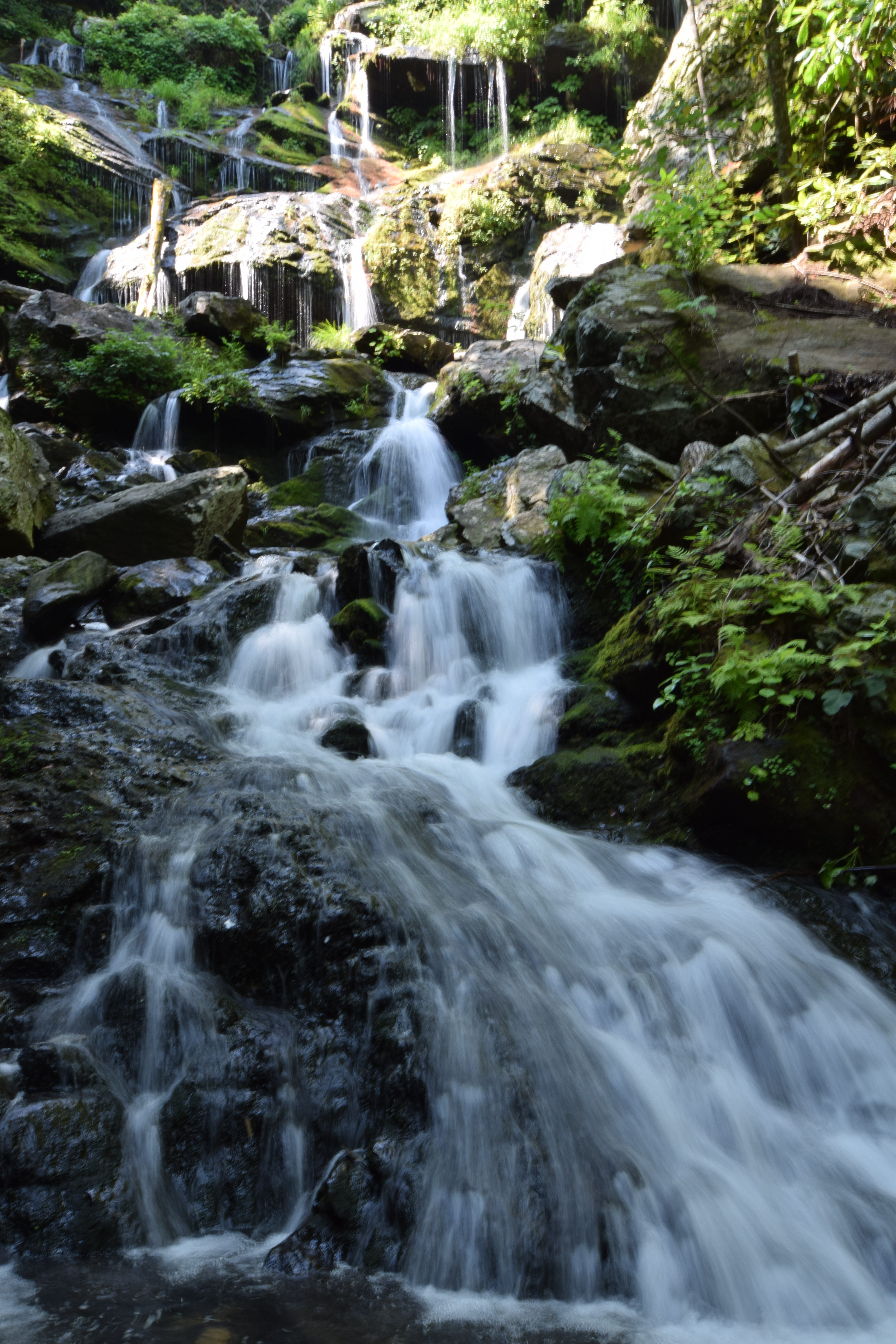
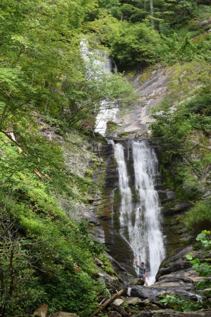 We spent all day Saturday hiking waterfalls in the Pisgah National Forest and exploring interesting places off the Blue Ridge Parkway. First, we explored the Tom’s Creek Falls, located about 20 minutes northeast of our campsite. Tom’s Creek Falls trailhead is about 1.3 miles from the
 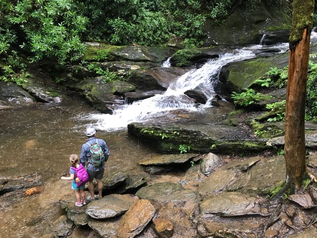 After leaving Tom’s Creek Falls, we drove about 45 minutes northwest to the Roaring Fork Falls trailhead. Roaring Fork Falls trailhead is located near the


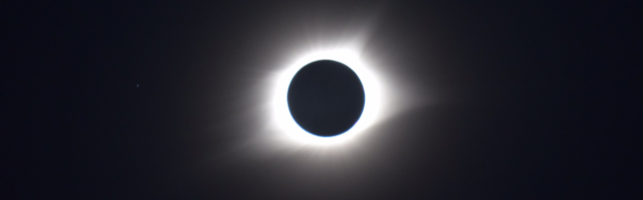
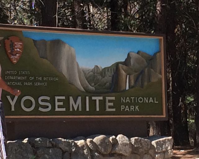 Who’s up for a last minute visit to Yosemite with young kids during the super busy summer months? We are! Capitalizing on our successful Norther Ca trip, we rolled the dice on our final full day and drove our family two hours west to explore Yosemite for the day. With plans to rendezvous at my uncle’s rural 1910s family cabin situated on original Yosemite roads, we left early in the morning with a full tank of gas, fully charged iPads, open minds, and lots of food.
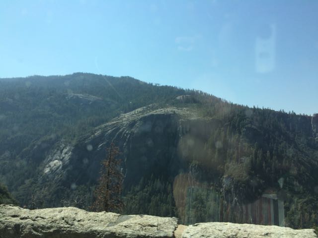 Since the Yosemite trip was last minute, intermittent cell service limited my mobile-friendly research as we drove through harrowing switchbacks and rural towns. Following my aunt and uncle’s advice, we headed to the popular Valley area of Yosemite in hopes that we could catch glances of El Capitan, Half Dome and some of the waterfalls. Driving from Sonora, Ca we drove along 120 East through Groveland and the Big Oak Flat Entrance. The drive through Yosemite starts out hilly with dense conifers and then becomes hillier with sparse shrubs, dead underbrush, sand, rocks and old dying pine trees. Then, suddenly before crossing into the big tunnel, the massive granite rocks explode before your eyes. You catch really quick (yet far away) views of El Capitan and Half Dome before going through the tunnel. After the tunnel you wind through switchbacks catching different views of the granite formations. Yosemite is enormous – it takes at least 40 minutes to drive from the main entrance to the bottom of the park.
 Knowing the park would be busy, we aimed for short hikes easy in difficulty and with easy access. Using the simple
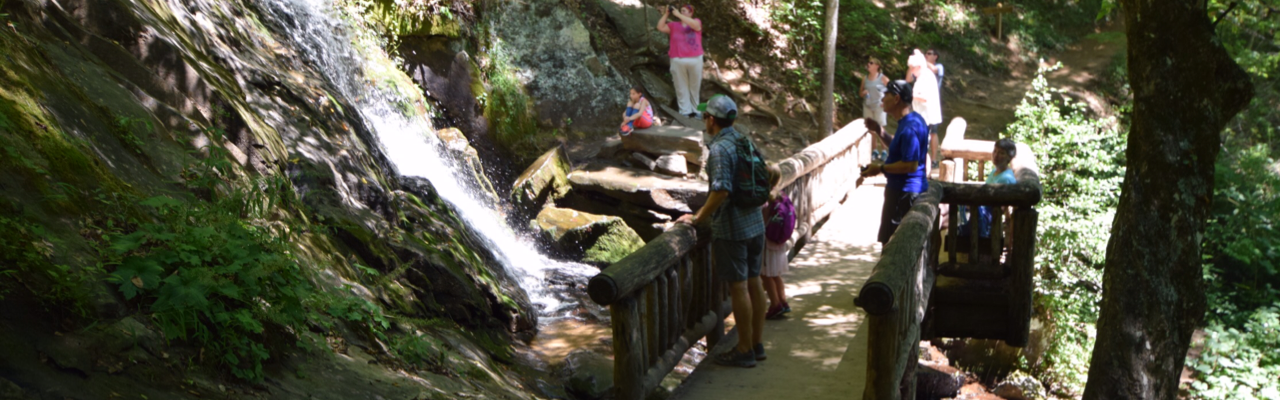
  Lower Yosemite Falls Trail is a one mile paved trail with little elevation change making it an easy walk for everyone. The path is mostly shaded with giant sequoias and huge slabs of granite rock making for nice photo backdrops. About half mile into our walk we arrived at the observation bridge of the falls. Lower Yosemite is the bottom waterfall section of the three-part Yosemite Falls. Unfortunately, with it being late summer the waterfall sprayed a mere trickle, but we tried to imagine the
 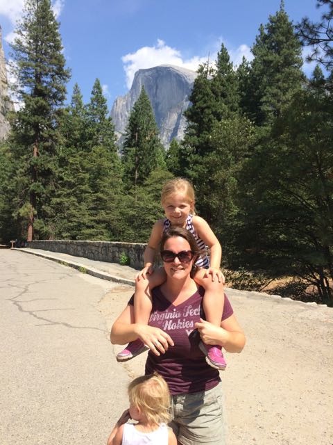 Wanting to get closer to Half Dome I quickly researched places within the valley to catch a glimpse. I learned the meadows behind the Majestic Yosemite Hotel (formerly known as the Ahwahnee Hotel) provide good views of the massive mountains, so we rode the shuttle bus to stop #3 outside the hotel. The hotel was built nearly a century ago with the design influences of Art Deco, Native American, Middle Eastern, and Arts & Crafts Movement. We walked to the back of the hotel, through a small path and turned left on the pedestrian path. Before crossing over the pedestrian bridge we arrived at the best spot we could find with a good glimpse of Half Dome (elevation 8800ft) in the background. Even from so far away it’s amazing to imagine people (including my crazy aunt) hike the 16-mile round trip.


 While we were in the NC mountains, Bill and I scooted out for a day date hike and beers in Blowing Rock. We hiked the
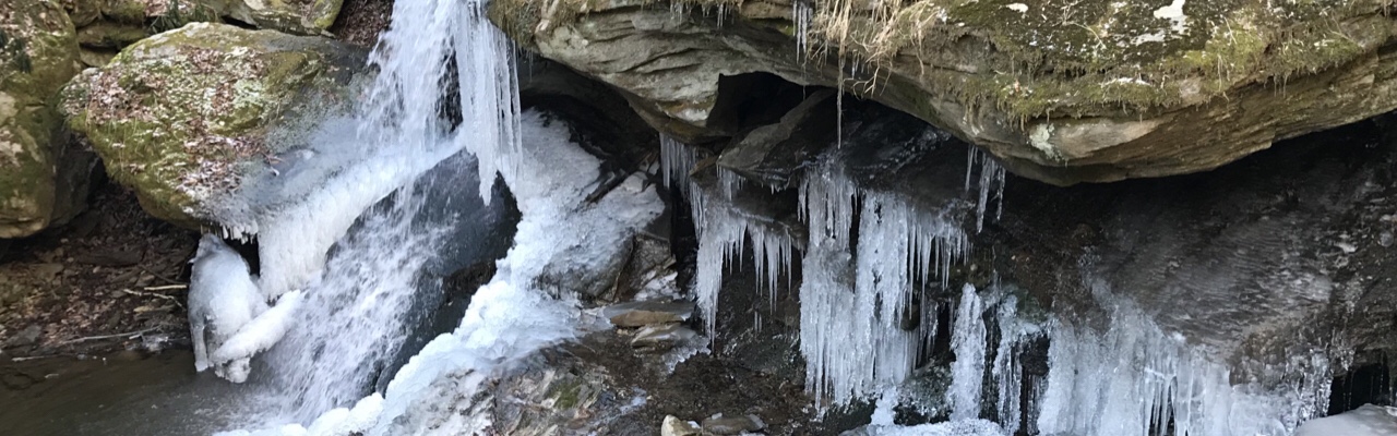
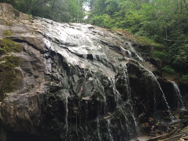
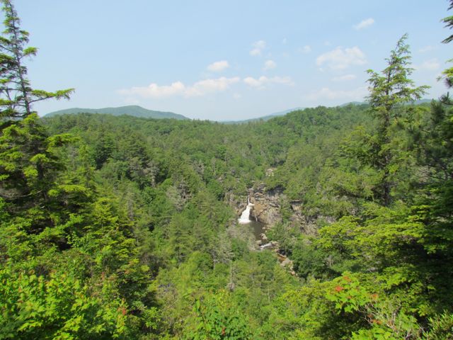
 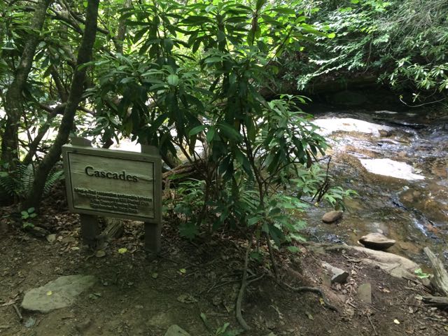 We arrived at the first waterfall, the Cascades, a little past halfway down the trail. The creek water gently flows over these moderately sloped rocks, allowing hikers to cautiously climb up the rocks to higher ground. We stopped to take in the sights and sounds before moving farther down the trail. On our next stop we hiked to the base of the trail at Glen Marie Falls. We climbed up large boulders sandwiched between small streams to get higher views of the mountains in the distance. Again, we stopped for several minutes to take in the quiet sights and sounds.


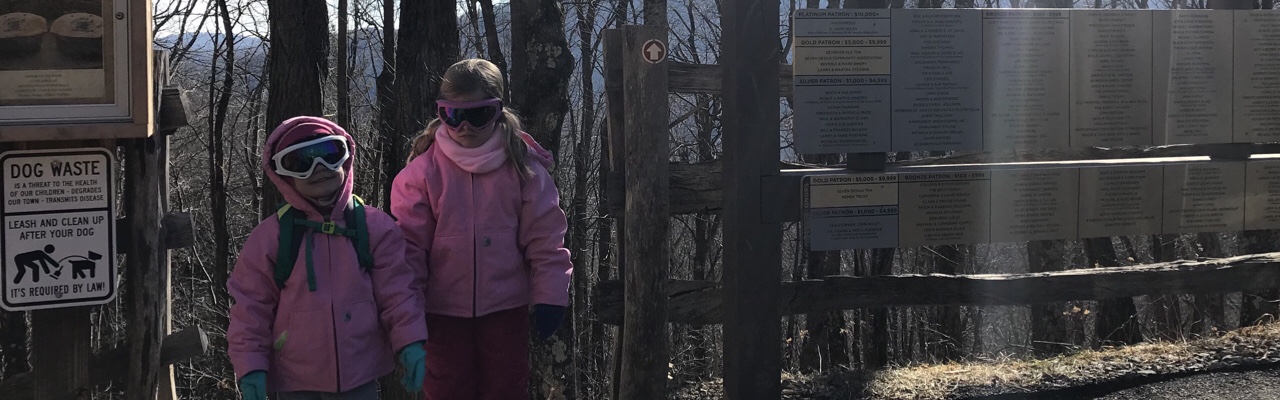
 For Memorial Day weekend we headed out to the Grandfather Mountain area on the annual


