
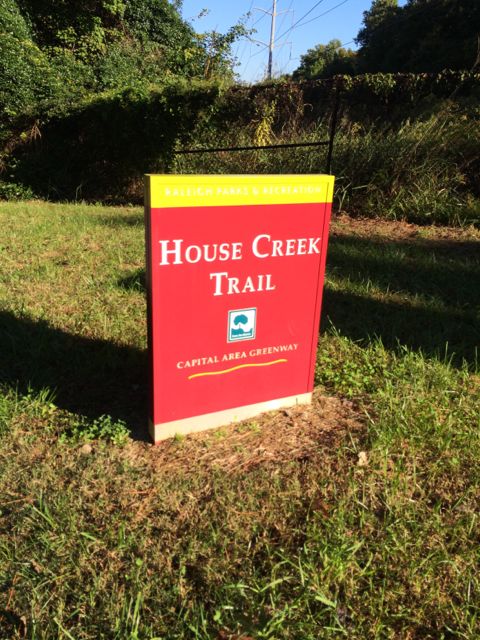
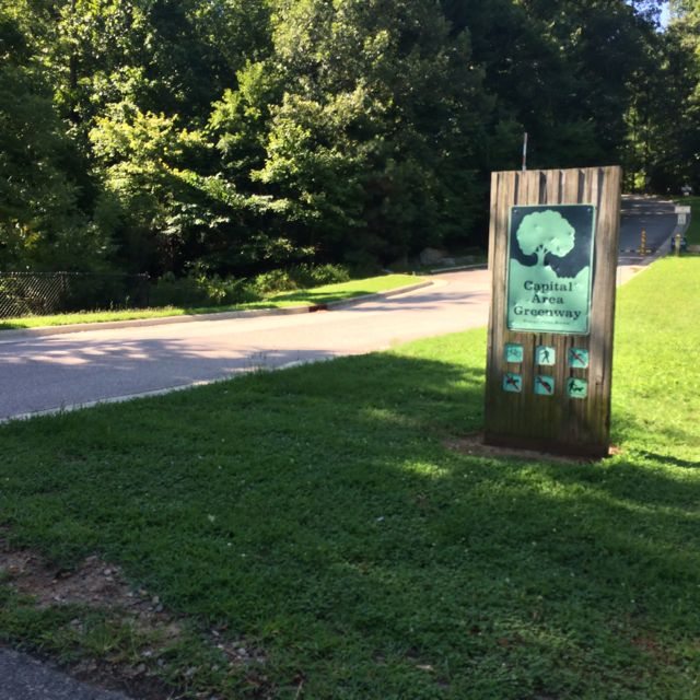
 Even though the House Creek Trail was completed only 2 years ago, the trail’s history dates back to 1973 when it was a mere 350ft unpaved foot path and the foundation of the Capital Area Greenway. House Creek Trail is a north/south connection between Reedy Creek Trail (near Meredith College/Wade Ave) and Crabtree Creek Trail (near Crabtree Valley Mall). Having explored all other parts of House Creek Trail, I was excited to visit this last stretch and get some more mileage in before the City of Oaks 10k back in November.
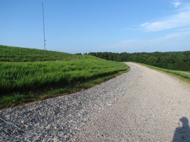
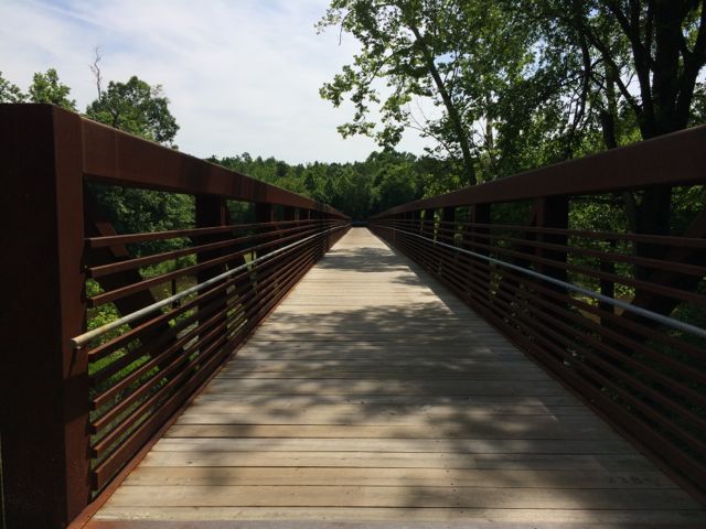
I parked in the residential area (Leonard St/Ridge Rd intersection) behind the Ridgewood Shopping Center and then walked on the sidewalk toward Wade Ave to start at the end of the trail, which is mile marker 2.9. The trail parallels Wade Ave for awhile before heading straight uphill towards the NC Museum of Art. Before crossing the 440-beltline pedestrian bridge, bare right at the House Creek Trail sign and proceed with caution down the steep hill.
 This greenway parallels the eastern side of the 440-beltline until the pedestrian crossover at Glen Eden Rd. Even though you can hear and see the 440-beltline traffic, with the expansive tree lines on both sides of the trail, I sometimes felt like I was miles away in middle earth. Occasionally I passed other bikers and walkers, but for the most part on this chilly October morning it was just me and Claire. Before coming to the Lake Boone Trail tunnel, we passed the small Horton St apartment complex and a designated greenway parking lot located behind Martin Middle School. It was around this time (mile post 2.0) that I also spotted a random basketball pole and hoop in the nearby creek, making me question the history of this area.
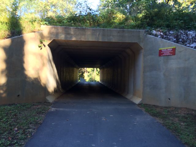
Continuing on, we spent some more time going uphill and navigated through the tunnel underneath Lake Boone Trail. There are huge rock piles and large drain pipes here to help with drainage since this is a rather hilly spot. We continued on a bit further and came upon an information plaque highlighting the original House Creek Trail and more details of the history of the Capital Area Greenway. This part of the trail is relatively flat, which was a comforting change (see my elevation change photo below) so we continued on until the tunnel at Glen Eden Rd (approx mile post 1.25) where we turned around.
Having explored all of House Creek Trail now, I can say that I enjoy the flatter stretch of the trail from Glen Eden Rd to Crabtree Valley Mall, even though this probably better prepared me for the hilly City of Oaks run!
More Resources:
- previous review of House Creek Trail: MP 0 to 1.5
- Marshall Memorial Park along House Creek Trail
Thumbs up: scenery, safety, wide trails
Thumbs down: beware of the hills


 This Fall, we visited Bill’s parents in Howard County, MD and made a morning trip to the nearby Western Regional Park. Western Regional Park is located at
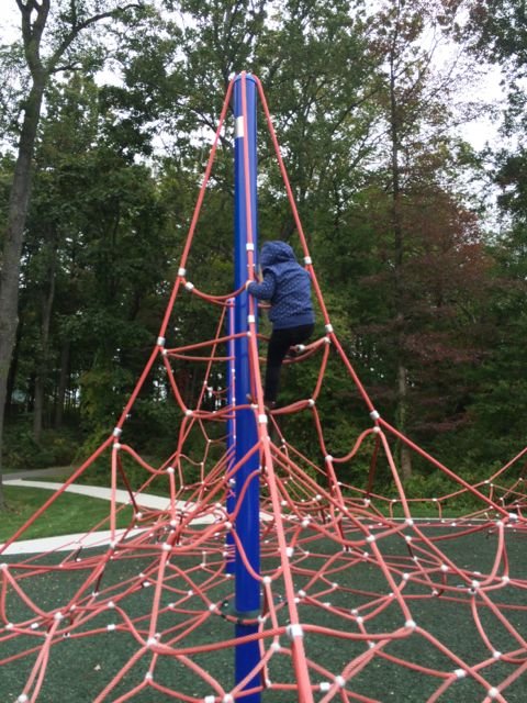
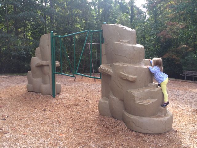
  After exhausting our climbing skills, we explored the nearby paved trail in search for the other playground. At the end of our short walk we saw a large lighted multipurpose artificial turf field with field hockey, soccer and football goals, a large open field, small mobile concessions, fenced-in basketball, community center, baseball fields, a line of porta-johns, tennis courts, and a playground. Unfortunately the playground was being resurfaced while we were there so it was closed, but looked like it offered a lot for all ages and was fenced in! The multipurpose field conditions were pristine – the grass was a luscious green color and very well maintained. Another interesting feature of this park is the natural area preserved next to the sports fields; I imagine the spectators enjoy some depth to the typically flat parks.


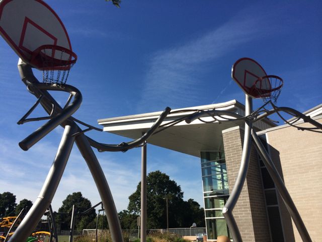
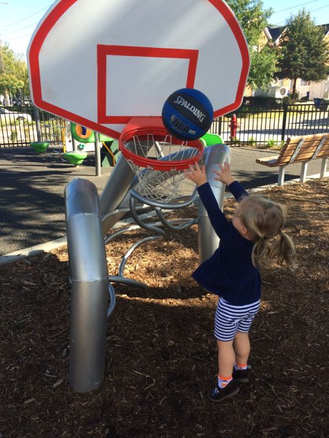 There’s also a separate smaller basketball art sculpture for the younger kids. The girls had such fun shooting baskets and watching the ball spiral down the ramp. If you forget your basketball or don’t have one, the friendly staff at the community center will let your borrow their ball.


 So, after a Monday morning camp drop-off at Greystone Rec Center, Claire and I researched nearby greenways to explore using the


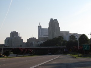
 After about an hour of exploring and taking photos of downtown Raleigh, I headed back to North Raleigh to capture photos from one of the highest places of elevation in Raleigh – Top of the Hill trail in North Wake Landfill District Park. I’ve visited this park before,
 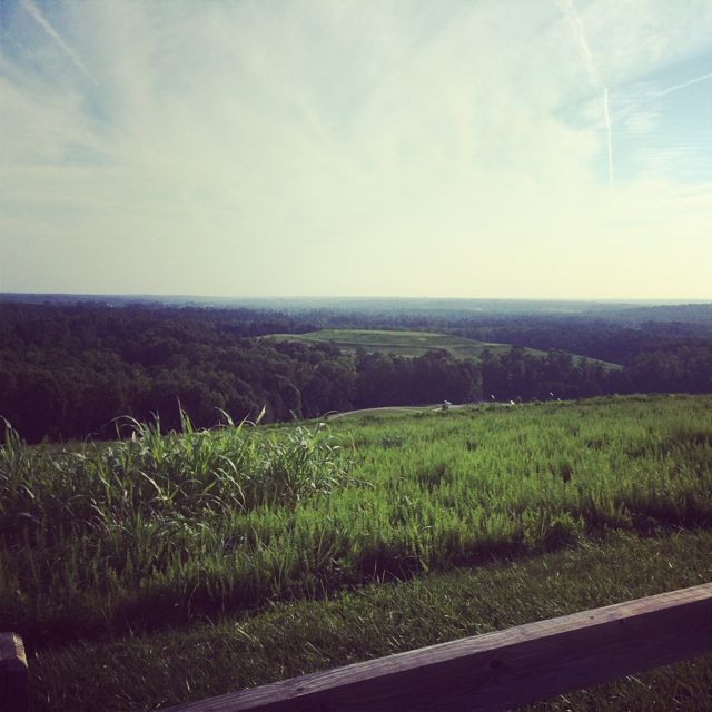 Other than great views from the top, there are several picnic tables, benches, and a bike rack. Even though my downtown Raleigh pictures didn’t turn out as well as I would’ve liked, the whole experience certainly fueled my desire to practice and learn more about photography.


 The playground area has two playgrounds – one for ages 2-5 and one for ages 5-12 with a large oak tree and mulched area in between that provided great morning shade for the smaller-age playground. The smaller-age playground has a rubber surface with two tot swings, ladders, climbing structures, one slide, and some fine motor twisty toys and noise makers. The age 5-12 playground also has a rubber surface with several climbing structures, rope ladders, monkey bars, a slide without side rails, and two regular swings. A big hit for the kids was also the stationary board with pretend car gauges and noises.
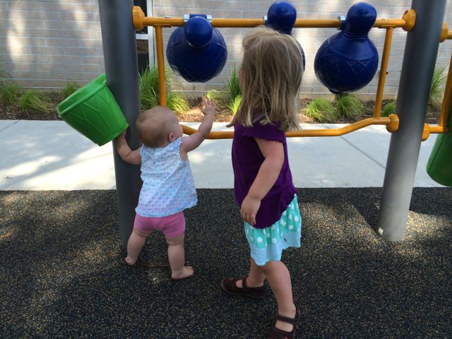 In addition to the community center and playground, this park also has outdoor full court basketball with nearby benches, a large fenced-in open field for soccer and baseball (and a poor attempt at kite flying), and great views of the freight trains coming and going. Combine this park visit with a trip to Tyler’s Taproom or Bad Daddy’s in Seaboard Station and you’ve got a pretty fantastic outing!


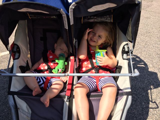
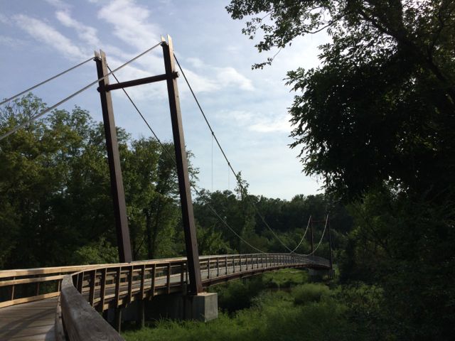
 We turned right heading south onto the Neuse River Trail and we shortly came upon the 11.5 mile marker and a large bridge that crossed the Neuse River. It had rained a lot in Raleigh over the weeks leading up to Memorial Day weekend, so the water levels were still pretty high and the river was flowing fast, which made for great toddler conversations.
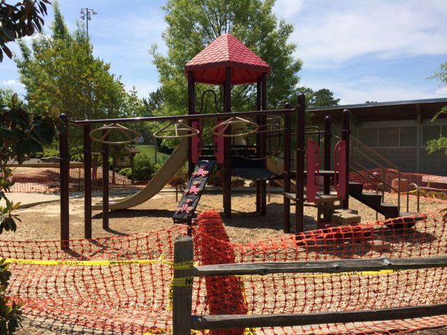 The run home felt much shorter with several less stops than the way out. When we arrived back into Buffaloe Road Park, we followed signs to the athletic park instead of to the aquatic center. With this option, we ran along the northern perimeter of the park and got to witness the massiveness of the baseball fields. When we got back to our car, we were pooped! Ashley made a final pit stop in the restroom facilities near the closed playground and then we headed out for some well deserved lunch. I look forward to taking the girls back to the park later this summer when the playground surface is finished.


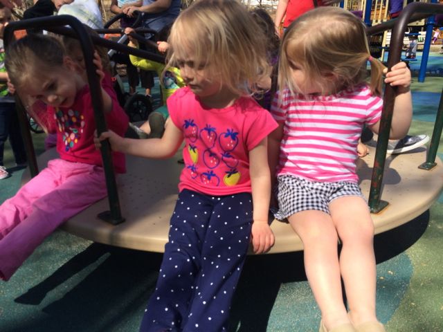
 MacDonald Woods Park has playground areas for the 2-5 and 5-12 age groups with two swings for both groups. The 5-12 age playground is rather large with several ladders and slides, monkey bars, and climbing wall with rope. The loop-shaped ladder was by far a challenging favorite for this duo. The younger playground is very small with only 2 slides, steps and a platform ladder. There are a few bouncy rides and a small low-to-the-ground structure for early walkers. A small elevated sandbox is located between the two playground areas. But, by far, the best feature of this park is the merry-go-round. Yes, that’s right…they have a merry-go-round! Go Cary! Of all the parks we’ve been to this was a first so you can imagine the confusion when the girls first saw it. Having never been on a merry-go-round they watched several groups of people get on and off before getting on with a group of toddler girls. These sweet maniacs quickly caught on as to why you hold on to the bars but also moved into more challenging feats such as dangling their feet over the edge. That proved to be rather anxiety-ridden for us but they had fun and no one went flying off the thing, so it was a success!


