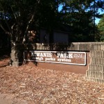
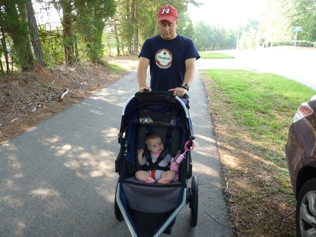
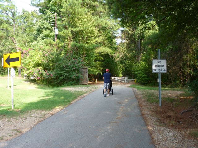
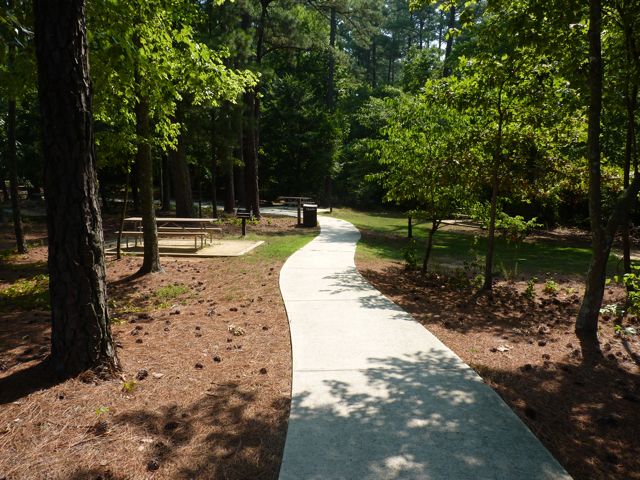
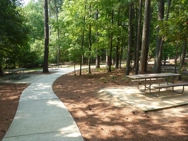
A few weeks ago we headed down to Lassiter Mill Park again to access the nearby greenway via Crabtree Creek Trail for a run. Little did we know that after a mile and half into our run, we would come to Kiwanis Park. It was a nice surprise and a good break from the run, as we weren’t anticipating either!
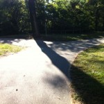
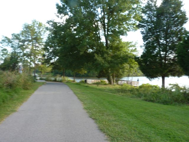
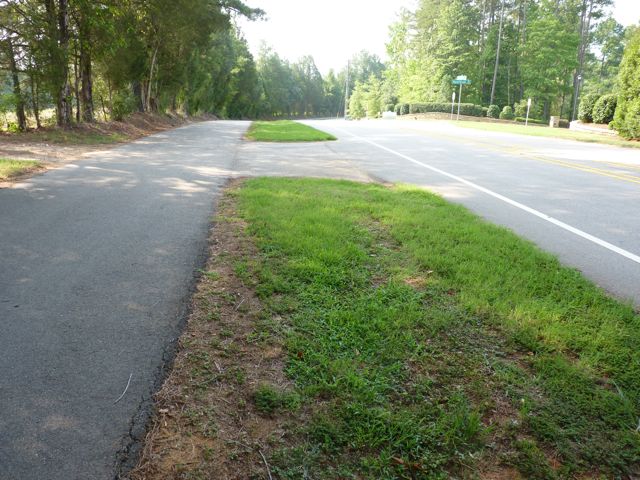
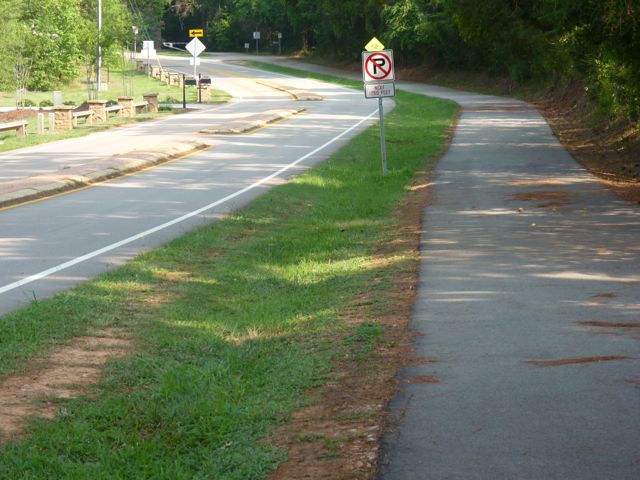
Following the greenway was a bit tricky in some places. If starting near Lassiter Mill Park, you’ll eventually come to Claremont Rd, where the greenway signs stop. Take a left onto Claremont Rd and then cross Anderson Dr where Claremont Rd turns into Oxford Rd. Stay on the sidewalks and you’ll shortly see the next portion of the greenway on your left, which will lead you straight to Kiwanis Park. Despite the trickiness of the greenway, this has turned out to be one of the favorite running trails in Raleigh. It is super FLAT and the bridges and scenery you pass make the running seem effortless at times.
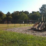
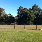
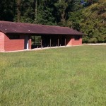
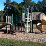
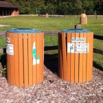
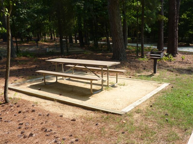
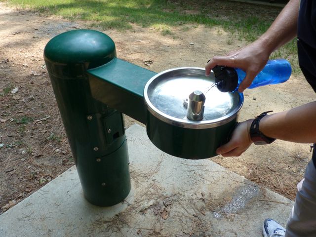
The Kiwanis Park is located at 2525 Noble Rd just inside the beltline. It has a playground area with a jungle gym, but no swings. There are also several large open fields, mostly used for playing soccer. There is a sand volleyball court, baseball fields, and a basketball court. The nearby community center is not staffed and is available for rent. The large pavilion has several picnic tables and restrooms.
Even though you can get to the park by car, why not make this a greenway/park/brunch adventure with the kids! 1) Run/walk 1.5 miles with the stroller on the greenway to the park, 2) let them burn up some energy on the playground while you rest from your run/walk, 3) then run/walk 1.5 miles back followed by 4) yummy brunch at Nofo at the Pig!
Thumbs up: flat portion of greenway, scenery along greenway, playground, open fields at park, recreational sports
Thumbs down: signage along parts of greenway, no swings on playground
This post originally appeared on southwestraleigh.com, where you can learn more about what a great place South West Raleigh is to live, work, and play.
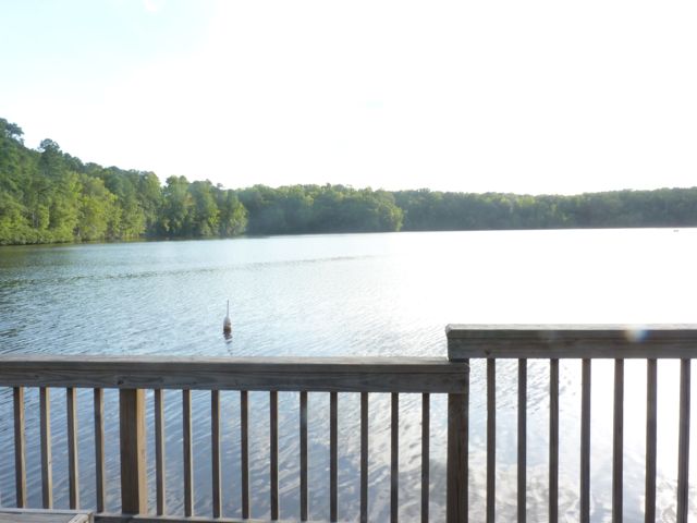
The last time I was at Lake Raleigh (unknowingly) was during last year’s Polar Plunge 5k race with the Raleigh Jaycees. The race started near the lake, meandered through Centennial Campus, and then ended back at the lake where several people plunged into Lake Raleigh…in February! All for a good cause nonetheless.
Visiting Lake Raleigh on a cool-summer-almost-Fall-time day is a much more practical way to explore the lake.
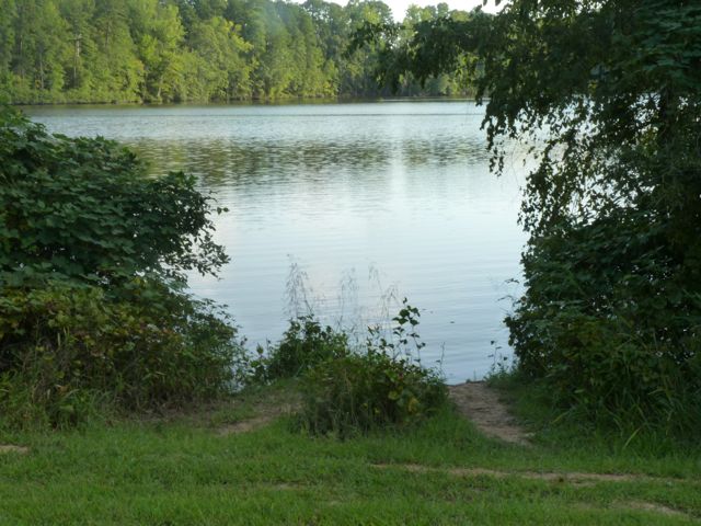
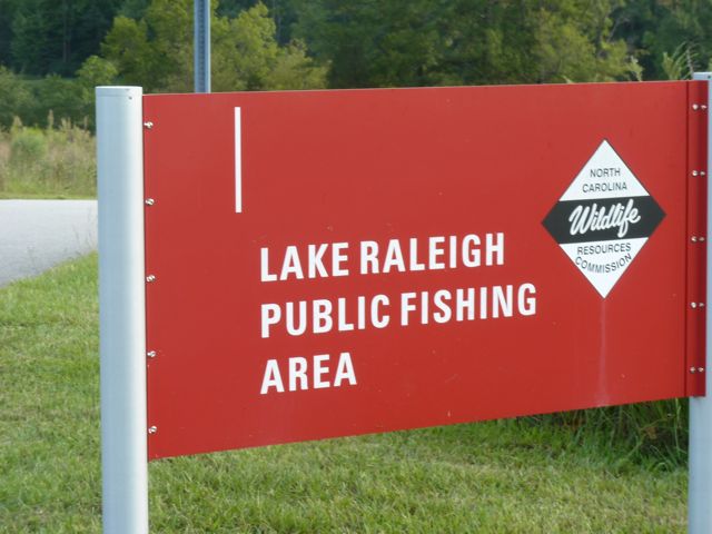
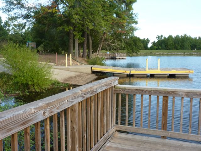
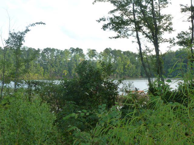
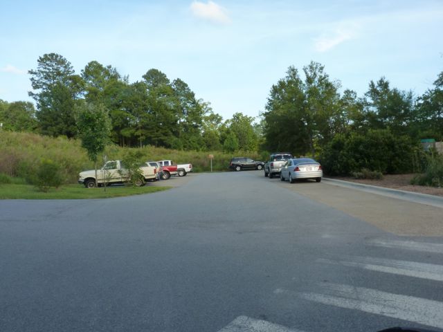
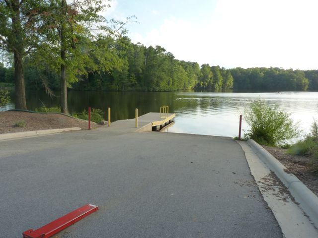
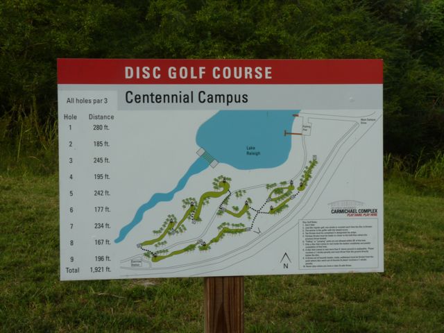
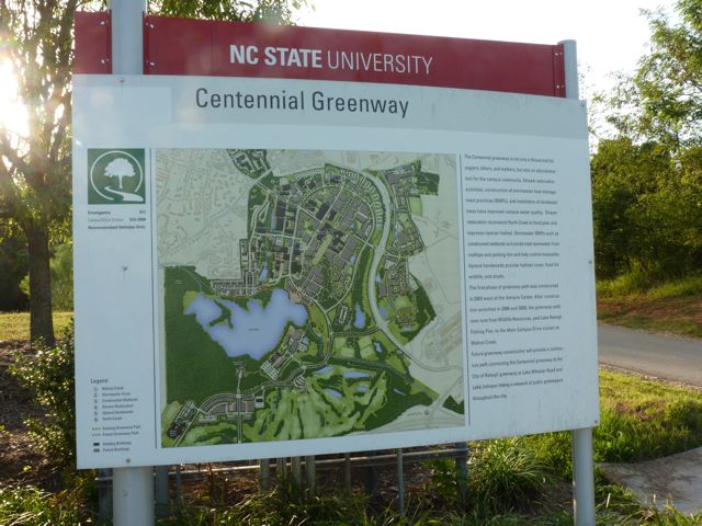
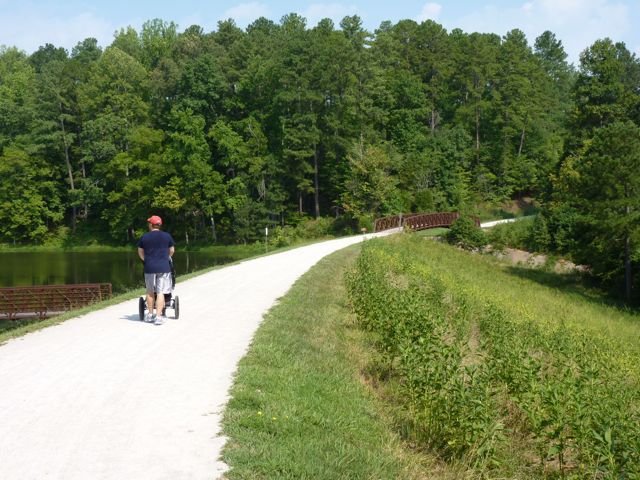
Open to the public, Lake Raleigh is located on NC State’s Centennial Campus, nestled between college buildings, corporate/government/non-profit partners, and residential space. Like any place you visit on a college campus, parking can be challenging. There is a small parking lot at Lake Raleigh but it requires an NC State parking permit Mon-Fri from 7am – 5pm. You can pick up a $15.00 visitor day pass at the Transportation Department – 2721 Sullivan Drive, Administrative Services 1 bldg. Alternately, use the Park Mobile App and pay for parking at the Poulton Deck (across the street from Hunt Library) on Partners Way. The cost is $3.00 for the 1st hour; $2.00 every hour after that or maximum of $15.25 for the whole day.
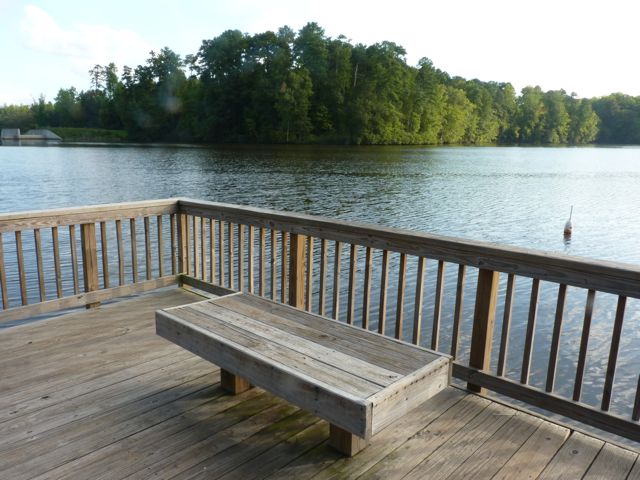
A quiet fishing spot down from the piers
Fishing is permitted in marked areas and non-motorized car-top boats such as kayaks or canoes are also allowed in the lake. There are two fishing piers near the entrance with long benches, perfect for enjoying the views or waiting for a bite. The paved trail is part of the Centennial Greenway, which is a work-in-progress.
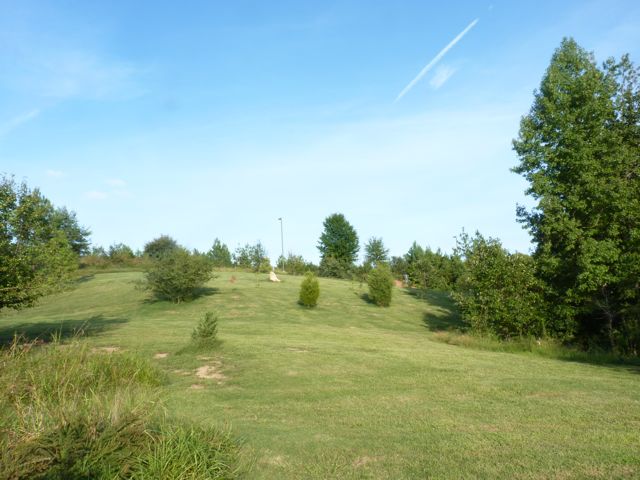
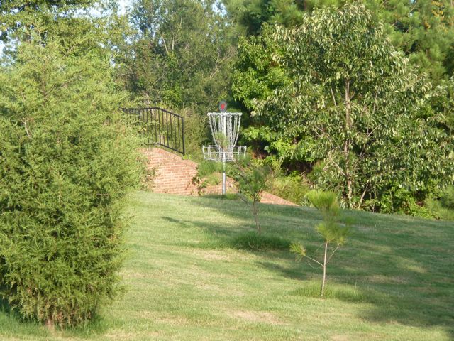
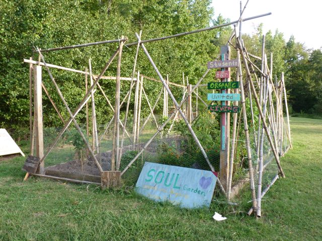
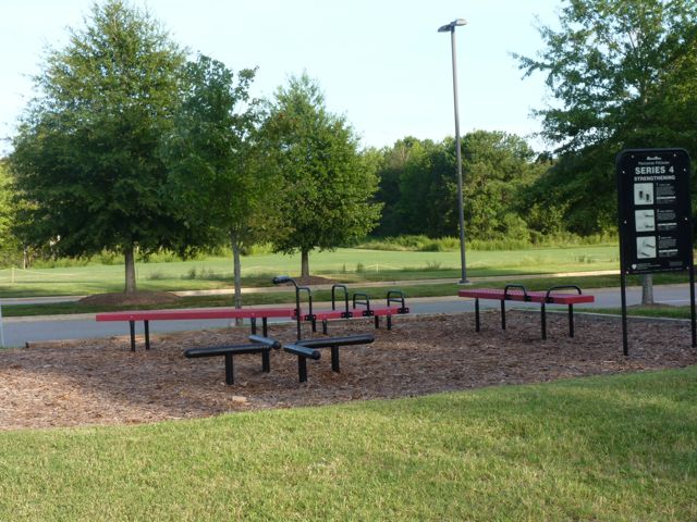
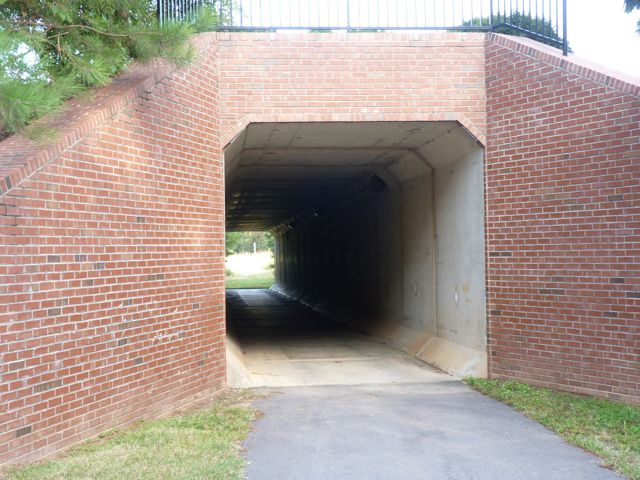
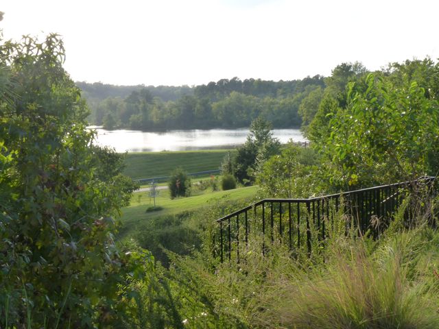
The trail extends in both directions past the main entrance, but does not loop around the lake. If you walk to the right, you’ll pass other popular fishing spots, wetlands, The Shores residential area, and a bridge perfect for taking photos. If you walk to the left, you’ll pass gorgeous views of the lake, the SOUL community garden, the 9-hole par 3 frisbee golf course, and an exercise station before coming to the tunnel under Main Campus Dr.
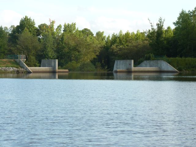
As noted above, the trail is part of the Centennial Greenway, which is a fitness trail and educational tool for the campus community. Little mowing is done around Lake Raleigh to allow the natural plants to thrive. Future development of the greenway will connect Centennial Greenway to the Capital Area Greenway at Lake Wheeler Rd and Lake Johnson.
The Museum Park is located on the grounds of the NC Museum of Art at 2110 Blue Ridge Rd just outside the beltline. Part of the trail through the park is shared with the Reedy Creek Trail greenway, which connects Meredith College to Umstead Park and Schenck Forest. The museum was renovated a few years ago and besides biking the greenway past the museum, I hadn’t really stopped to visit this park. So, we parked in the museum parking lot and followed the paved trail towards the very easy-to-read information board.
The information board highlights four different walking paths to take and breaks it out by distance, walking time, calories burned, and features you’ll see along the way. Because it was a very hot Sunday and we had the stroller, we opted for the one-mile Ambler path, which allowed us to explore several works of art on the paved trail close to the museum. For those planning ahead, here is a map of the park.
Information plaque with details about the park
Paved trail around the park
View of the East building
Here are the works of art we passed along the Ambler path:
Wind Machine by Vollis Simpson
Collapse I by Ledelle Moe
Gyre by Thomas Sayre
Close up of Gyre filled with concrete and covered in dirt residue
Another view of Gyre
Bill & Ashley under the Gyre
The Conversationalist by Chakaia Booker
Lowe’s Pavilion by Mike Cindric and Vincent Petrarc
Another view of Lowe’s Pavilion, made of steel, wood, aluminum, and concrete
A photographer’s dream shoot, the Museum Park has a gorgeous landscape of rolling hills with a sprinkle of wooded forests between the East Museum Building and the outdoor works of art.
Looking down at the Gyre artwork
Looking back towards the Wind Machine artwork
Greenway to Meredith College
Part of the unpaved trail on the Museum Park grounds
An unpaved pathway through the park
Great shady pathway for a picnic on the bench
Next, we explored one of the newer (to me, at least) features of the park, The Pond area. With over 20,000 plants installed, this area helps with runoff, water pollution, and settling for sediment. The terraced landscaping and even spacing of the plants had an Asian design feel to it, but what do I know! Here’s a list of the various plants installed and some pictures to detail the beauty of this area:
What outdoor museum would be complete without an amphitheater and outdoor movie screen?! The NC Museum of Art holds several outdoor concerts and movies throughout the summer months. Having finally made it to an outdoor movie last summer to see The Fantastic Mr. Fox, I can attest to how much fun they are. So, bring a picnic dinner, lawn chairs or blanket, and some cash (for the beer/wine tent) and you’ve got the perfect, cheap summer night planned! Btw, The Social Network movie is playing tonight at 8:30pm.
Some of the seating areas for outdoor movies
Looking towards the amphitheater
Overall, this park offers much more than any average park. Whether just passing by on the greenway, planning a trip to the indoor museum, or watching a movie or concert be sure to plan enough time to explore the artwork in the Museum Park.
Thumbs up: picnic spots, rolling hills, outdoor artwork, outdoor movies/concerts, The Pond landscaping, information plaques/maps, parking
A couple weeks ago I found myself in a terrifying position: at home alone with the baby for 36 hours. I hadn’t done that before. My lovely wife, the creator of this blog, was at the Britney Spears concert in Washington DC (I’m afraid I’m not joking) with her sister and some other troublemakers.
I asked my wife, “What do I do with the baby for that length of time?!” After an incredulous look followed by, “What do you think I do while you’re at work all week?” she politely suggested I take the baby to a yet unexplored park, take some pictures, and write a guest article on her blog. I did the first two at the end of July, and here I am mid-August completing the job.
My assignment was Lake Lynn Park. I had no idea there was a Lake Lynn. I knew Lynn Road from the shopping center with Goodwill and the movie theater that serves beer, but this lake was news to me. Turns out that it’s a great location for walking or running, and it’s teeming with fauna, considering its suburban location.
The park is squarely in north Raleigh, between 540 and 440 to the north and south, and Creedmoor Rd and Glenwood Ave to the east and west. I entered at 7921 Ray Rd and parked in a large, 90% empty parking lot on a Monday morning. (By the way, what were those 20 cars doing there? Don’t these people have jobs?) There is a large community center that looks like it’s used for things like summer camps, several lighted tennis courts, a lighted softball field, and a nice playground.
But, the real attraction is the lake and Lake Lynn Trail around it. The trail is alternately paved and a sort of boardwalk/causeway stretching over long sections of water. This segment of the greenway is part of the Hare Snip Creek Trail. I’ve heard it’s around 2 miles, but we didn’t make it to the halfway point before someone got fussy so we didn’t make it all the way around (I’ll leave who it was to your imagination).
There are waterfowl galore, including many stripes of duck and a camera-shy white swan. I even found a pair of adult turtles with their litter of babies sunning on a log, but they scattered when I was close enough for a photo. A little girl was feeding the ducks stale bread as we were leaving. I’m guessing this is a popular activity, due to the large duck population and their affinity to humans, hanging out within a few feet of a busy section of trail.
All in all, Ashley and I had a great time exploring this park. It’s another great Raleigh Parks facility, and ideal for going on a walk, feeding the ducks, or a short run with great scenery.
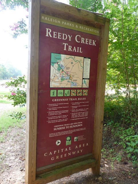
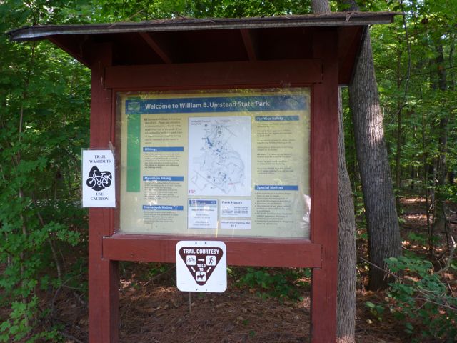
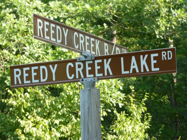
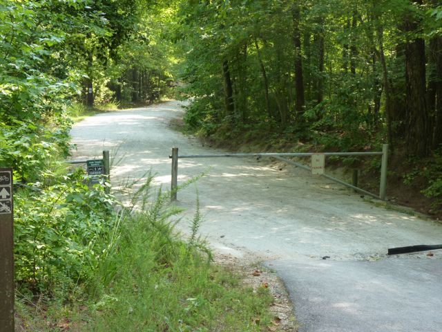
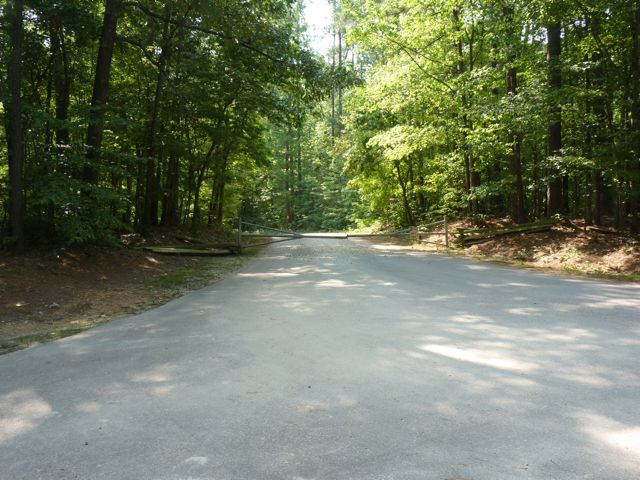
Two weekends ago we made a short drive to the Umstead Park entrance near the intersection of Reedy Creek Rd and Trenton Rd to try our new BOB stroller. We parked in the grassy median between the paved greenway trail and Reedy Creek Rd since there isn’t an actual parking lot. Be careful to abide by the parking signs.
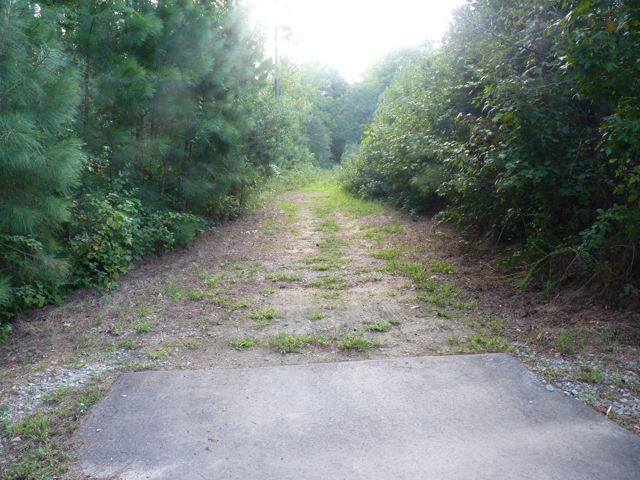
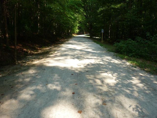
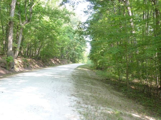
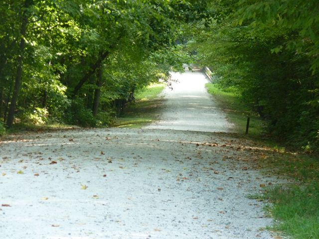
Once in the park, we decided to head straight and follow the Reedy Creek Trail, which we’ve biked several times in the past. It’s a wide, gravel, mostly shady trail that is great for walking, running, biking, and horse back riding. It’s a very long trail that eventually goes past the Airport Overlook, crosses I-40 west of Harrison Ave, and connects with the Black Creek Greenway. Even though we didn’t see any horses that day, we’ve definitely seen them on cooler days. The new stroller glided over the gravel trail, but we did have to be more careful when going over washout areas.
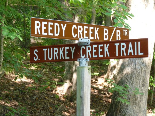
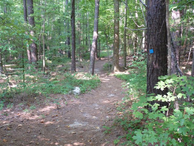
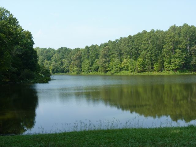
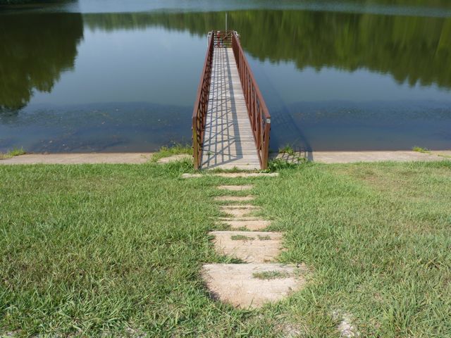
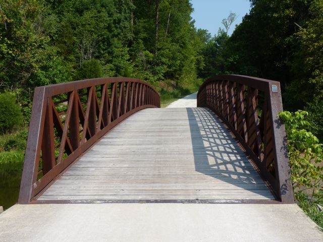
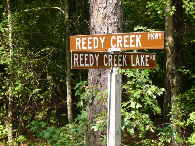
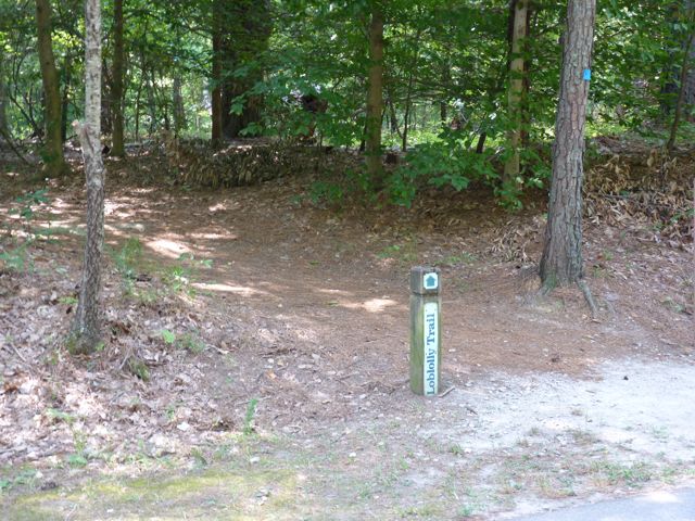
Along Reedy Creek Trail, you’ll pass access to other popular trails such as the Loblolly Trail (heavily wooded trail for hiking) and Reedy Creek Lake Trail (access to the Harrison Ave entrance of Umstead Park). Knowing the Reedy Creek Lake Trail is a relatively short walk and passes by Reedy Creek Lake we made a sharp left turn onto Reedy Creek Lake Trail. You’ll immediately pass by Reedy Creek Lake, which is great for photo ops but swimming is prohibited. Horses are not allowed any further on this trail either. Here is a 360 degree video taken along the trail by the lake.
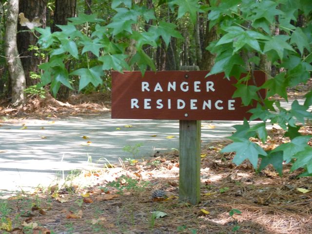
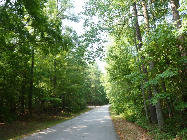
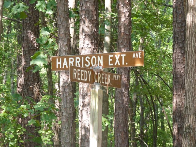
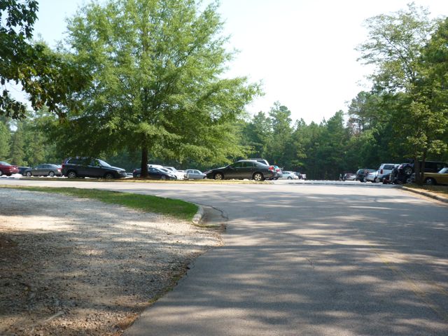
Continuing on the trail is a long, steep hill that eventually flattens out. It’s quite shady and also a gravel path, perfect for using the new stroller. Eventually you’ll come to the trail head at the paved Reedy Creek Pkwy, which leads to the Harrison Ave entrance of Umstead Park. Follow Reedy Creek Pkwy where you’ll pass the Park Ranger’s residence and eventually come to the large Harrison Ave parking lot. We needed to refill our water bottles, so once in the parking lot we stopped at the first shelter on the left, Shelter #2. We followed the paved sidewalk where we passed several picnic tables, charcoal grills, recycling areas, a water fountain, and a large pavilion for Shelter #2.
After a water refill, we quickly began our hike back to beat the encroaching heat! This has to be one of my favorite trails in Raleigh. It’s a great combination of shade, scenery, and steepness. Even though we walked most of the hike, the steep hills made for an exhausting workout. To extend your ride/walk further start by parking at the NC Museum of Art and following Reedy Creek Rd across Blue Ridge Rd and Edwards Mill Rd before arriving at Umstead Park.
Distances:
1.1 miles from Reedy Creek Rd entrance to Reedy Creek Lake
1.7 miles from Reedy Creek Rd entrance to Reedy Creek Pkwy
2.4 miles from Reedy Creek Rd entrance to Harrison Ave entrance
Thumbs up: wide, shady trails, helpful maps, scenic views, good combination of steep hills and flat roads, access to other trails, signs and maps
Thumbs down: little parking near Reedy Creek Rd entrance
Parking in the grassy median
In our new stroller
Some grassy medians show no parking signs
Heading into the park
Entrance sign
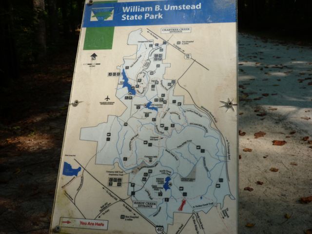
Park map
Shady, gravel trail
Signs near the entrance
Another view of the trail
Smaller maps near other trail’s access
Loblolly Trail access
Another access way
Washout on the trail
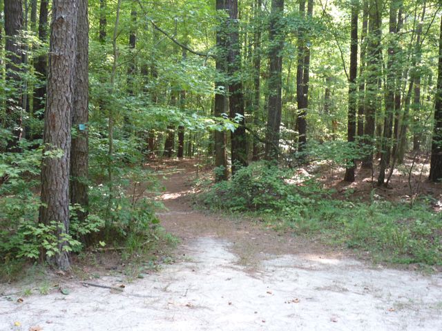
Intersection of Reedy Creek Lake Trail and Reedy Creek Trail
Looking back towards the trail
Reedy Creek Lake
Full sunny view of the path near the lake
Stairway toward the lake
Bridge over the dam
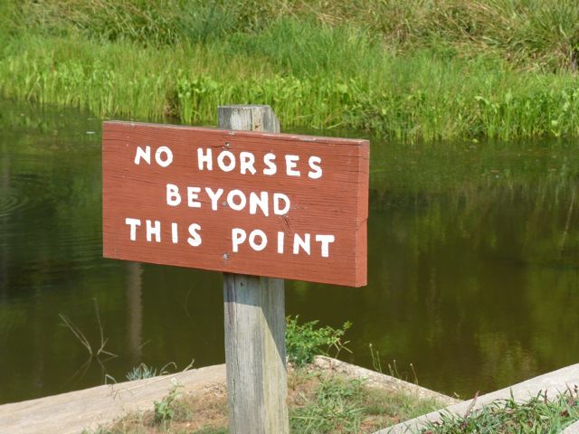
Horses prohibited beyond the bridge
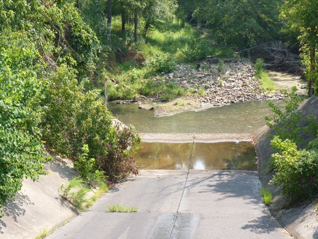
Water level looks to be a little low
Trail head near Reedy Creek Pkwy
More helpful signs
Park ranger’s residence
Paved streets towards Harrison Ave
Another access point for Loblolly Trail near Harrison Ave entrance
My mom visited this past weekend so on Friday morning we headed out to Anderson Point Park at 20 Anderson Point Dr in east Raleigh. This park is bordered by 264/64 bypass on the north, the Neuse River to the east and Crabtree Creek on the west. From the park you can also access the greenway via the Neuse River Trail which is over 4.5 miles of unpaved trails. Here’s a satellite view of Anderson Point Park from Google Maps.
When you arrive at the park, go around the cul-de-sac to the far left to the parking lot. From there we found a very helpful park map detailing all the features. We then walked by the Large Shelter and headed left along the main trail, which is about 3/4 mile loop. The shelter is a large pavilion with several picnic tables, restrooms, and an adjacent open field with a back stop.
Main entrance sign
Informational board near parking lot
Parking lot
Large Shelter pavilion
Restrooms at Large Shelter
Open field with backstop near Large Shelter
Another view of the open field
Walking along the paved trail we first came to the amphitheater. It’s a beautiful stone-terraced amphitheater with lush green grass at each level. At the bottom is a large tree surrounded by a stone wall with benches and swings along the perimeter. The tree provides great shade for picnics or reading on a hot day. My mom did comment on how difficult it might be to see any type of performance at the bottom due to the hedges at each terraced level.
Amphitheater
Large shade tree and benches
Ashley with her Cici
Looking from the top of the amphitheater
Back on the trail we followed the spiral pathway up to the scenic overlook. There’s a circular flower garden at the top surrounded by a stone wall perfect for sitting and enjoying the views of the park. There are also several covered swings at the top great for relaxing and taking in the scenery.
Pic of the paved trail
Flower garden at the top
Shaded benches at the top
View from the top overlooking the park
Continuing on, we passed bluebird trails and bird houses that attract martin birds. Luckily my mom, who is a bird enthusiast, was with us to identify the bird houses. The surrounding natural vegetation still allows for great views of the park.
Houses along the bluebird trail
Martin birdhouses
Next, we came upon a large open field with a backstop across from the Retreat Cottage. The cottage can be rented for conferences and events and contains a small nearby parking lot to use.
Open field with backstop near cottage
Sign outside cottage
Retreat Cottage for rent
Close to the cottage is the Small Shelter, which is a covered pavilion with several picnic tables and restrooms. It has an adjacent open field surrounded by crape myrtles and magnolias. Nearby there is also an information board with details about renting the various shelters, open fields, and Retreat Cottage.
Small Shelter with picnic tables
Restrooms near Small Shelter
Open field near Small Shelter
Beautiful crape myrtles and stone work near open field
Next on the trail is the largest playground I’ve ever seen. Part of the playground is covered in a mulch base and part is a sandy base. There is a large jungle gym, multiple swing sets, and several teeter totters with plenty of seating along the perimeter and sloped, grassy hill. The entire playground area is full sun, so be sure take a break at the nearby water fountain. The Small Shelter would be perfect for birthday parties with the playground being so close!
Looking down at the playground
Slides down the grassy hill
Large jungle gym
Swing sets
Another view of the jungle gym
Sandy area with teeter totters
Water fountain
Continuing on, we arrived near the entrance, which has several shade trees and swings overlooking a large part of the park. The signs are helpful in directing you to the various parts of the park.
Shade trees and swings near entrance
Benches at the entrance
Signage near the front
We followed the trail back to the parking lot and headed out of the park, but not without stopping at the canoe launch that we passed on our way in. Park in the lot there to get on the Neuse River Trail or head down the gravel road to the launch area for the Neuse River.
Canoe Launch sign from Anderson Point Dr
Gravel lot near put-in area
Launch area
Looking north up the Neuse River
Looking south towards the railroad tracks and 264/64 bypass
This is a great open park with lots of unique amenities surrounded by a paved trail that is perfect for walking the dogs and babies or going for a run. We had a fun morning with lots of exploring, so we finished off our adventure with cupcakes from The Cupcake Shoppe!
Yummy red velvet
Thumbs up: scenic overlook, shelters, open fields, access to greenway, canoe launch area, playground, beauty of amphitheater, birding
For our next greenway trip we visited the portion of Reedy Creek Trail that begins at Meredith College and extends to the I-440 pedestrian bridge. There is not a parking lot on the Meredith College side, but there is plenty of street parking on the nearby neighborhood streets. The intersection is busy so use the crosswalks. We live about 1/2 mile from Meredith College so we walked to the trail and began our journey.
The trail begins near the soccer complex on Meredith’s campus at the intersection of Hillsborough St and Gorman St. It is rather wide and paved so it’s perfect for strolling the babies or hitching them behind a bike. You won’t find any picnic tables or benches along the trail with the exception of a bench when you reach the pedestrian bridge. It’s also a pretty popular trail as it provides access to the NC Art Museum where you can then toggle over to Umstead Park.
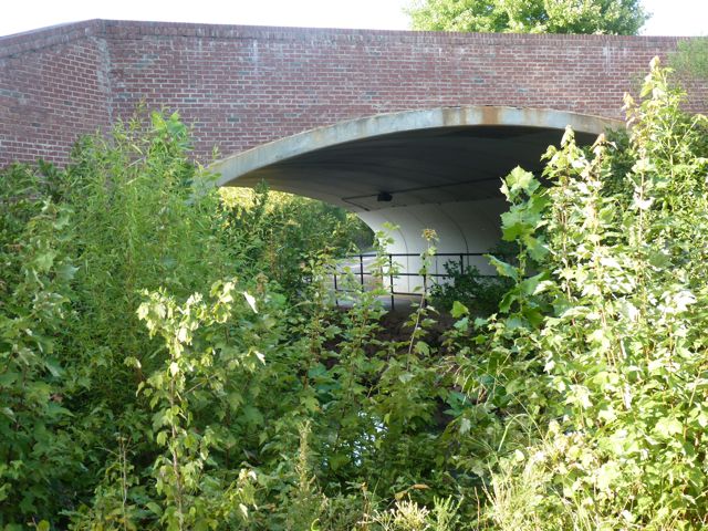
The distance from Meredith to the pedestrian bridge is 1.3 miles. There’s not much to look at along the way except for the few glimpses of the college campus to the right. The left side of the trail is heavy brush, which helps conceal the noises from neighboring I-440. After you pass the old soccer field, you’ll go up a steep hill and through a tunnel (Wade Ave is above) and then immediately up another steep hill to the entrance of the pedestrian bridge. Be careful of the current construction around the tunnel.
Small bits of shade throughout
A small bridge you pass near campus
The old soccer field on campus
A steep hill you cover just before the tunnel
Current construction in the tunnel
Another steep hill up to the bridge (this pic is looking back towards the tunnel)
The pedestrian bridge is an amazing engineering structure that connects the campus to the Museum Park. Construction was completed in 2005. Once you cross the pedestrian bridge you enter the Museum Park preserved by the NC Museum of Art. We had been long enough by this time so we headed back. If you continue on the trail you’ll eventually come to the Art Museum, but we’ll save that portion of the trail for another day.
Arriving at the bridge
One of the few benches along the trail
Ashley before crossing the bridge
Looking out towards I-440
On the other side of the bridge looking into the Museum Park
This would make a great trail to visit for the upcoming weekend! Happy Fourth of July!
Thumbs up: pedestrian bridge access, wide paved path, views of campus, map of greenway near entrance
Thumbs down: noisiness near I-440, lack of benches along trail
Shelley Lake is a large park in the North Raleigh area. It is located at 1400 W Millbrook Rd and is a popular place to walk and run, especially in the evenings. The lake is surrounded by a portion of the Bent Creek greenway trail that is 2.08 miles. The Lake Park trail (unpaved .42 miles) also connects off the greenway. A lot of the trail is shaded, but there are also long stretches of full sun. When you pull into the parking lot follow the snaking trail to the left where you’ll connect to the greenway.
As we walked around the trail we came across several different things this park has to offer.
The parking lot off Millbrook Rd and signage about the park
Condition of the trail
Pier and boat house
Access to the fishing pier
Restrooms on one side and scenic views on the other
Water fountain outside the restrooms
Beautiful viewing area overlooking lake
Continuing on, you’ll notice that the signage throughout the park is pretty thorough. This park has a lot to offer and it could be easy to get lost along the way. Luckily we didn’t have to leave bread crumbs to help us get back to the parking lot. The signs direct you to the Lake Park Drive (the unpaved section of the greenway), the Sertoma Arts Center, restrooms, and the Shelley Lake Trail around the lake. We didn’t venture up to the Arts Center, but it has a plethora of adult and youth art classes available.
As you continue on the trail, you’ll come across a wooden bridge where you can stop to take pictures and visit with the ducks and geese. Here are some pictures of Ashley with her own Duckie Wubbanub.
In addition to the amenities listed above this park also contains benches along the trail, workout stations, large open fields, and additional access to the other portions of the greenway trail. Here are some more spectacular views of the lake and open fields.
Thumbs up: spectacular views, great jogging trail, signage, access to other greenway trails, art center
Thumbs down: popular spot so it’ll be busy, litter in the lake
Continuing on our greenway adventures, my next stop with the honey badger was to the portion of Crabtree Creek Trail directly behind Crabtree Valley Mall. I’ve been to the mall a trillion times and was always curious about this trail. So we parked in the gravel lot near the McDonald’s on Crabtree Valley Ave and headed north on the paved trail.
Views of the trail looking towards the gravel parking lot
Crabtree Creek with turtles basking in the sun
Pedestrian access to the mall (I’m sure the hotel-goers are thankful for that).
Heading north on the trail
Trail marker and Edwards Mill Rd bridge (a bit noisy)
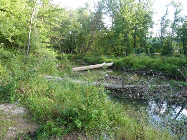
The swampy creek on the other side of Edwards Mill Rd
This part of the trail itself is in good shape with benches placed throughout, but a portion of it is located along side an abandoned lot with rusty construction debris. I think this is near where the infamous Soleil building was supposed to be. Since I was by myself on this trip it made me a bit uneasy so after a mile into our stroll I turned around and headed back.
Despite walking in the middle of the day, the traffic on nearby roads was pretty steady making our walk more noisy than peaceful. In the future I would recommend bringing a buddy to walk with and walking in the morning hours.
Thumbs up: paved trail, access to mall
Thumbs down: noise, construction debris, darkness under bridge, general uneasiness
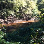
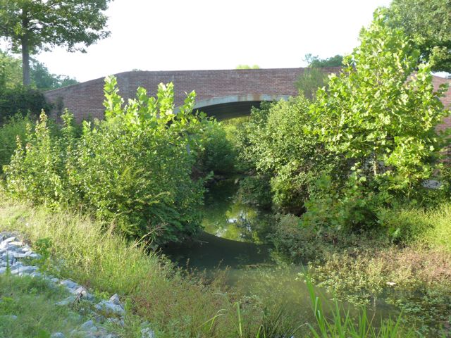
Lassiter Mill Park is a hidden gem of a park. It is located inside the belt line at the intersection of Lassiter Mill Rd & Lassiter Falls Circle and is home to a beautiful dam where Crabtree Creek flows through. You can see remnants of the old working mill on the far side of the creek. There is also a plaque with information about the mill on the bank of the water.
Ashley sitting near the information plaque for the old mill
View of the dam from the bank of the creek
Old mill on the opposite side of the creek
This is a great spot to bring a picnic lunch and eat in the open fields or on one of the few picnic tables. For the adventurers, shimmy down the rocky stairs for a closer view of the water. I wouldn’t recommend doing this with a baby unless you have a helper (thanks Bill). There are also plenty of spots for fishing and signs along the water displaying fishing rules and regulations.
Bill with Ashley on the rocks near the dam
Ashley and I looking across the dam
Another view of the dam
Parking is rather limited so come early.
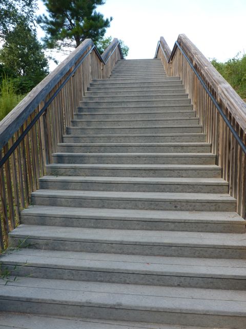
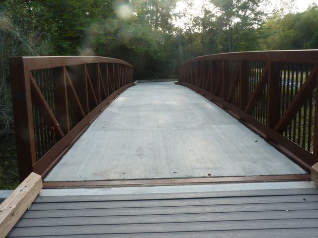
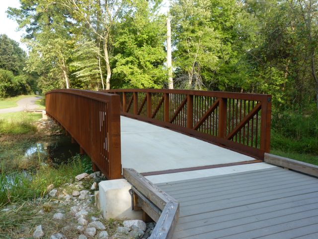
After you’ve finished exploring the park, walk on the paved path towards Lassiter Mill Road and make a left. After the bridge, cross the street where you’ll find access to the Crabtree Creek Trail, which is perfect for biking, walking, or running with the Bob Stroller. We walked for about a mile on this paved section and then had a picnic on one of the many benches along the greenway. There is an open field with picnic tables but we weren’t up to pushing the stroller through medium-height grass. Along the way we also walked over a beautiful bridge that would make for great photo ops!
The open area with a few picnic tables
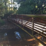
The bridge we crossed over is great for photo ops
Crabtree Creek Trail is paved and wide – perfect for all adventures!

 A few weeks ago we headed down to Lassiter Mill Park again to access the nearby greenway via Crabtree Creek Trail for a run. Little did we know that after a mile and half into our run, we would come to Kiwanis Park. It was a nice surprise and a good break from the run, as we weren’t anticipating either!