
“Of all the paths you take in life, make sure a few of them are dirt.”
John Muir
My mom was always a big believer in the healing powers of being outdoors. She didn’t do much hiking or camping, but she was really into gardening and birding. She used to joke about telling my teachers that I needed more fresh air and sunshine instead of homework and projects. Over the years, we’ve tried instilling this in our kids by trying to spend a lot of time outdoors. When it comes to hiking our kids might push (a lot) at first, but in the end their bodies naturally pull and they have a wonderful time. Therefore, we’ll keep pushing!
In light of all the local closings (including Wake County Public Schools) because of coronavirus, I’ve compiled a list of the Top 10 Short Hikes in Raleigh to do with kids. The weather forecast is looking soggy, but don’t let that stop you from suiting up in boots, raincoats and umbrellas. Finally, before heading to a park check with the individual parks to verify their operating status and follow any CDC guidelines.
Top 10 Short Hikes in Raleigh
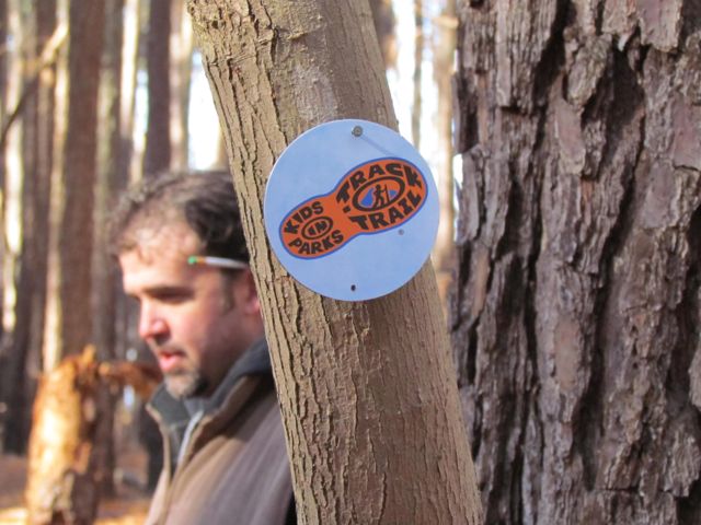
- Umstead Park: Oak Rock Trail (northwest Raleigh) – this unpaved trail is about 1/2 mile long and meanders through the forest. It’s also part of the Kids in Parks TRACK trails system of family-friendly hikes. Bring water shoes, fishing nets and buckets if you want to further explore the shallow stream that crosses the trail. TRACK trails also offers several printable activities by season to incorporate while hiking.
- Horseshoe Farm Nature Preserve (northeast Raleigh) – features 1/2 mile natural hiking trail that runs along the tree line of the park. With over 140 acres of park land, this nature preserve is full of sun and also a great spot for flying kites, having picnics, and accessing the Neuse River Greenway.
- Top of the Hill Trail @ North Wake Landfill Park (north Raleigh) – features 1/4 mile walk up the gravel trail to the top of the old landfill. Once on the top, you have beautiful 360-degree views and can even see downtown Raleigh on clear days. Surrounding the bottom of the hill is a paved pedestrian path great for biking, running, scootering, etc.
- Museum Art Park @ NC Art Museum (west Raleigh) – features miles of paved and natural walking trails in full sun and through the woods. Our favorite things include sliding down the piggie slide, finding art in the forest (as of a few weeks ago the Hobbit House exhibit was closed and under construction), jumping over the streams, and walking along the Reedy Creek Greenway and pedestrian bridge.
- Durant Nature Preserve: White House Road & South Lakeside Trail (north Raleigh) – features a one-mile hike through the woods crossing streams and has lake views. Another fun shaded hike is Secret Creek Trail which starts opposite the playground. It follows a stream where we’ve regularly seen huge snapping turtles, deer and birds. If your kids love exploring aquatic habitats, bring their nets and buckets to this park! Try scooping with nets near the dock to find tadpoles and dragonfly nypmhs!
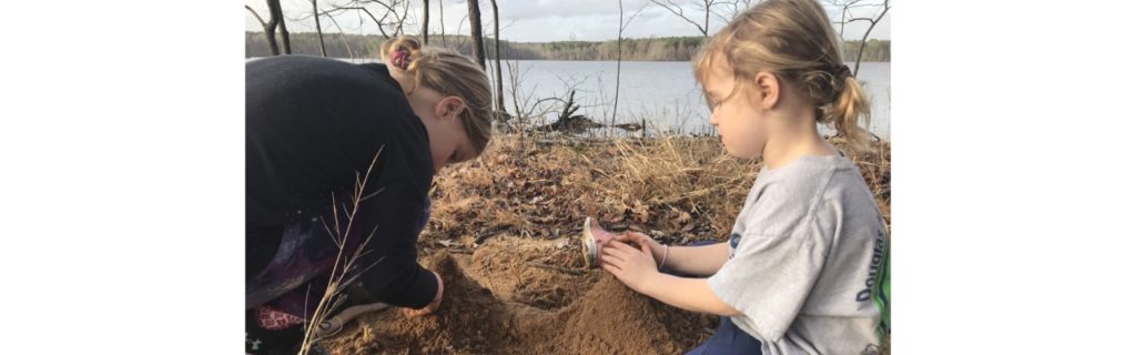
- Falls Lake Day Hike M Little Creek Bridge (north Raleigh) – a few months ago we hiked a portion of this more adventurous Mountains-to-Sea trail. First, we parked at the dead end of Santee Rd. Then, we hiked west across the Little Creek Bridge, which is a narrow footbridge crossing Falls Lake. After crossing the bridge we back tracked to continue on the trail in the eastern direction. The trail parallels the water and is a little hilly. We turned around after about 1.5 miles, making our whole hike about 3 miles long. Though I never blogged about this hike, I’m sharing some pictures below. It’s a must-do hike with beautiful lake views, interesting old artifacts, and


- Hiking Trails @ Blue Jay Point County Park (north Raleigh) – features easy, shaded trails that start near the visitor center and the playground area. Trails feature beautiful views of Falls Lake and lots of open green space throughout the park.
- Pott’s Branch Trail @ Umstead Park (northwest Raleigh) – relatively easy 1.6 mile hiking trail through the shaded woods. Bring your water shoes if you want to explore the small stream that parallels a portion of the stream. You access this trail from the entrance at Glenwood Ave.
- Loblolly Trail @ Umstead Park (west Raleigh) – beautiful out and back hike (5.4 mile round-trip distance) through the woods, so you can shorten this hike to the needs of your companions. You access this trail from the entrance at Reedy Creek Rd. The trailhead is located in the back right section of the parking lot. Though I never wrote a blog post about this trail, I’ve hiked it a few times solo and with family over the past two years. Its terrain varies with a few hills and streams to cross. The scenic Davie Pond


- Loop Trail @ Anderson Point Park – features a half-mile paved loop trail in the middle of the park. Great park for walking, biking, having picnics and accessing the Neuse River Greenway or Crabtree Creek Greenway.
Beyond Raleigh
If you’re looking for a quick day trip idea, here’s a few trails we’ve explored within an hour from Raleigh:
- Eno State Park’s Cox Mountain Trail (near Durham)
- Raven Rock State Park’s Loop Trail (about 45 mins south of Raleigh)
- Jordan Lake State Park’s New Hope Overlook Trail (near Pittsboro)
Bonus Fun
If your family hasn’t tried geocaching yet, now is the time! Our girls have recently gotten into it and especially enjoy doing it with friends. Geocaching is essentially treasure hunting in nature and all you need is your phone with GPS enabled. Geocaches are usually stored in a small container and hold a paper log of people who’ve previously found it. Sometimes the container holds small collectible items and the geocache owner might offer a trinket to you if you leave a trinket.
To begin geocaching, first you need to download the free Geocaching app. Then, scroll around the map and pick a geocache to find. Then, hunt for the geocache by following its GPS coordinates and descriptions. Finally, log the item as found in the app and sign the log book – it’s that simple! We love explore open public spaces with multiple geocaches nearby. Geocaches are everywhere – even in urban areas like downtown Raleigh. Eastgate Park is a great spot to start for geocaching, plus you can try to find the Star Wars themed geocache we added a few weeks ago!
Some additional lists I’ve compiled over the years are our favorite bike riding spots (for preschoolers), our favorite picnic spots, and drop-in rainy day to do with art ideas.
When talking with a friend earlier this week she remarked that maybe families will embrace the time together talking, reading, and playing. I love the simplicity of that thought, and will try to remember it as the days go on. Whether that time is indoors or outdoors may your families be in good health and positive spirit!
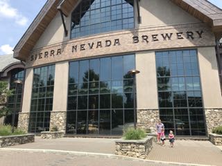 After exhausting the outside area, we dragged the girls (who were pretty willing) through the hallway that showcases their production areas. We glanced at the huge multi-story storage tanks, watched the bottle filling/cleaning process, and saw the packaging area. The girls mildly enjoyed watching the mechanics of how everything worked. Having toured only craft brewery operations, we were blown away by the grandness of everything at Sierra Nevada. I can’t wait to go back!
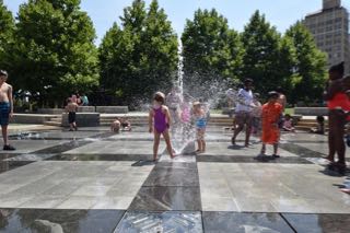 Since we had a little time to kill before checking into our cabin we headed to downtown Asheville to let the girls run off some energy in the water fountains at
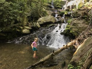
 After recovering from our big hike and nearly rain-soaked picnic, we rallied to explore


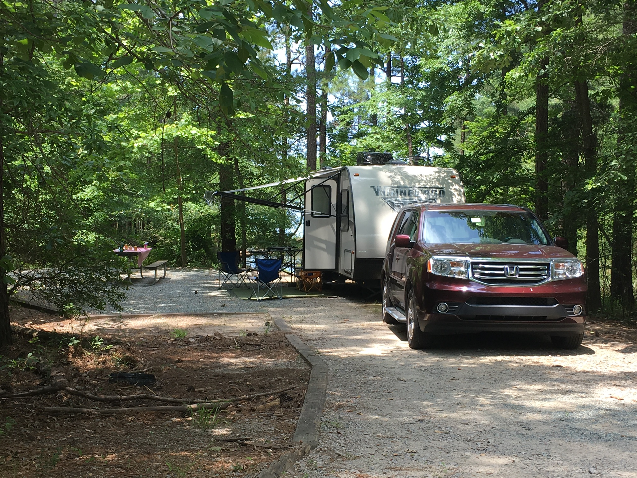
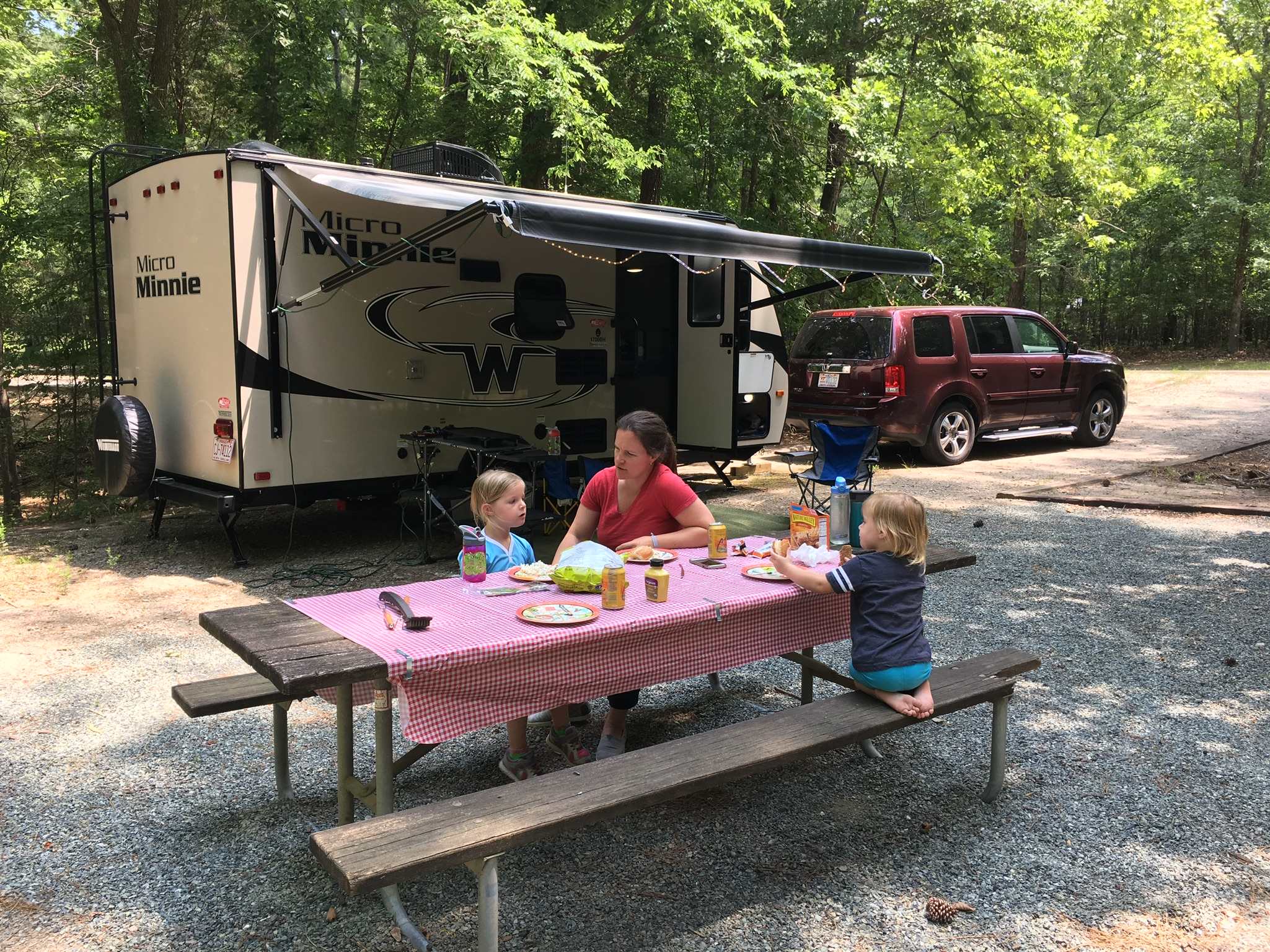 Our partially shaded campsite featured a flat gravel pad, picnic table and grill. There’s a short walk to the water, which we were hoping to use for fishing access, but unfortunately there was more poison ivy than we wanted to dodge. We found another access to the water, but the low-lying trees made casting difficult for the girls. Surprisingly, we didn’t have any neighbors during our entire stay. Though the girls were sad because they couldn’t play with new friends, it also meant they could run around like maniacs without worrying about traffic.
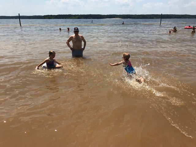 After lunch we headed to the recreation area to cool off in the beach. The recreation area at Loop E features a large sandy shoreline with designated swimming area. The water was refreshing and the boats racing by made fun waves for the girls. The girls loved catching the waves with their inner tubes and building sand castles on the shore. They enjoyed racing into the water and diving into the calm water. Even though the water was a little murky, they didn’t seem to mind.
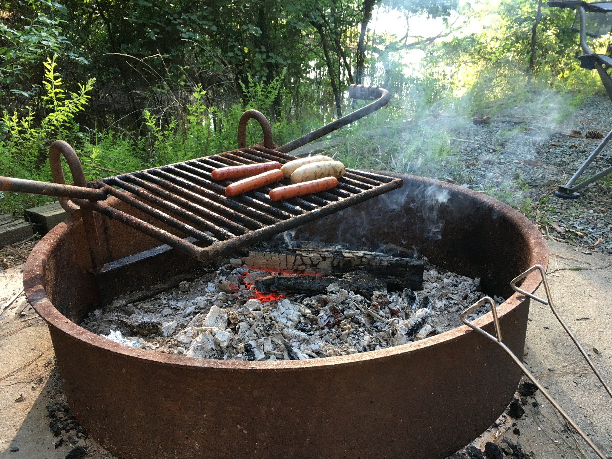 After playing at the beach we headed back to our campsite for showers and dinner prep. The girls helped shuck corn for grilling on the fire pit while I made mac n cheese on the trailer range. We grilled chicken sausages, corn on the cob, hot dogs and cinnamon sugar filled apples for dessert.


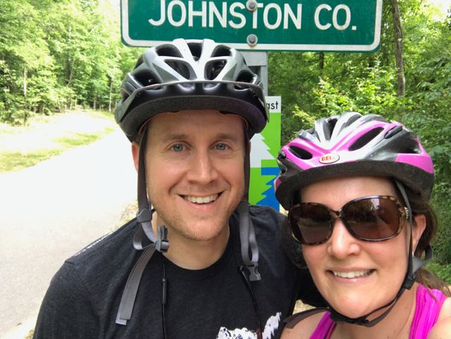 Over Memorial Day weekend, my sweet in-laws watched the girls while Bill and I enjoyed a biking and beers day date. Wanting to explore a new (to us) portion of the greenway, we headed to the southern portion of the Neuse River Trail near the Wake/Johnston County border. In all, we biked 15-miles (out and back total), crossed two counties, followed a river, detoured around an unpassable bridge, passed a historic bridge, and saw some art before grabbing beers at Deep River Brewing – a pretty awesome afternoon!
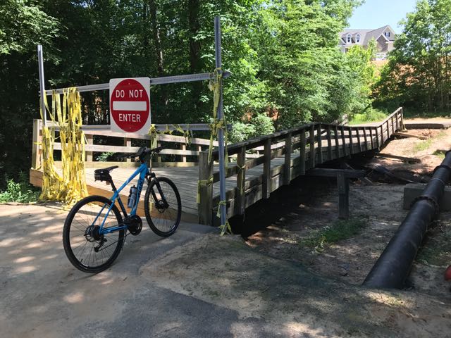 Continuing on Clayton’s greenway (technically called Clayton River Walk on the Neuse), we arrived at the Riverwood neighborhood where we found the bridge damaged and unpassable. At the time we didn’t see signage showing a detour route so I jumped onto the Town of Clayton website. I learned that last fall’s Hurricane Matthew caused near record flood levels for the Neuse River and took out the bridge. The town’s website shows a
 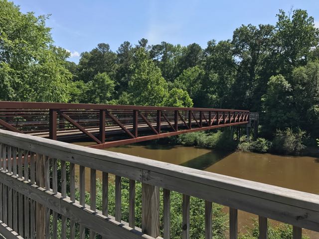 After biking the hilly detour through the neighborhood we met up with the trail and continued south. The trail remains mostly flat and sunny with clear views of the river. We passed a large sandy access spot for the river, complete with benches. Then, we biked under Covered Bridge Rd with a history that dates back to 1863 when it was first commissioned as a ferry replacement. Historians believe the bridge was covered around 1883 and most recently replaced in its current concrete form in 1980.
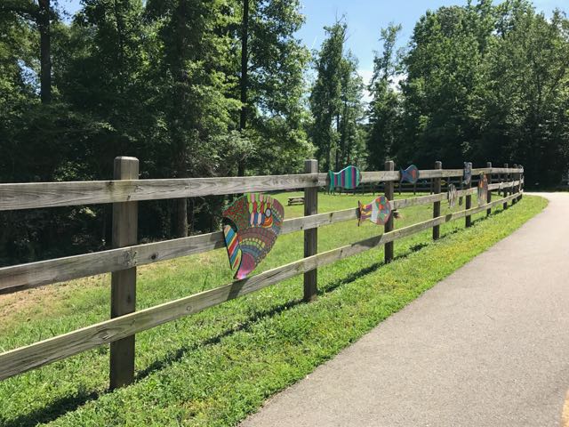 After safely maneuvering through the sand and dirt construction zone, the 1.25-mile paved trail leads away from the river towards North O’Neil St. Along the way we passed beautiful community art displays of hand-painted wooden fish. Then we biked by a public art garden featuring butterfly-shaped bike racks, benches, totem pole and a little free library. The trail also showcases information signs about forest animals in the area before passing a developing neighborhood and ending at a large greenway access parking lot at


 Looking for a fun family bike ride over the holiday weekend? Discover the
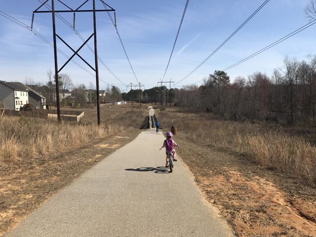
 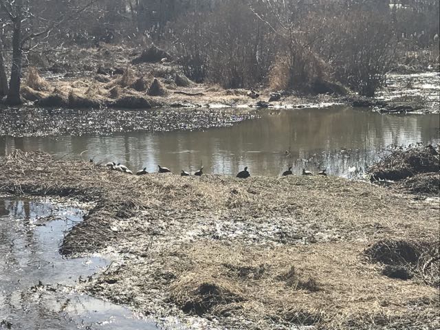 We maneuvered through the neighborhood sidewalks and carefully crossed Hodge Rd to continue on Mingo Creek Trail. Shortly after, we biked along the half-mile causeway, which was sandwiched between marshy areas and residential homes. We stopped on the causeway to watch the turtle and duck families sunning in the water. A great heron (or egret) also caught our eye.


 Lace up your hiking boots and head outside on New Year’s Day for an organized hike in a local park. Every state park in NC (city parks are catching on, too) organizes
  Falls Lake State Recreation Area – scavenger hunt with hike along Rolling View Track Trail (0.75 miles); start times at 10am, 11am, 12pm, 1pm; pre-registration is required; prepare for natural surface walking;
  Umstead State Park – 1.3 mile hike along Pott’s Branch Trail; start location: small parking lot by Pott’s Branch trailhead (Hwy 70/Glenwood Ave); 9am start time;
 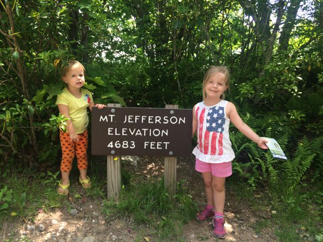 On the way home from our mountain trip in West Jefferson we decided to take advantage of the close proximity to Mount Jefferson and pay a visit. Mount Jefferson State Natural Area is located just east of US 221 at
 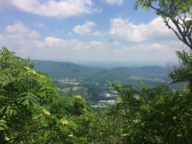 We walked through the picnic area and followed the short Summit Trail (0.3 miles) up the mountain. Although the website lists this trail as strenuous, we felt it was more on the moderate side. Due to our haste planning half of us wore flip flops, but could easily walk the gravel trail. The gravel path is wide and shady giving a cool mountain feel to the hike. Along the way we saw butterflies, rhododendrons, mountain laurel and red-starred flowers; though stop by the park office for official plant and animal checklists. We visited the bathrooms along the way, which were super convenient and an easy walk from the main path. We passed access to the Kids TRACK trail, which is part of the longer Rhododendron Trail (1.1 miles). Near the top we turned left to the Mount Jefferson summit, which has an elevation of 4683 feet. I climbed out a little further to catch the beautiful views of the Blue Ridge Mountains.


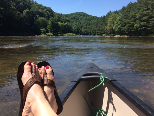 Last month good friends invited our family to their mountain cabin along the South Fork of the New River near West Jefferson, NC. Though this was my first time on this river in NC, being back on the New River reminded me of past trips whitewater rafting through
 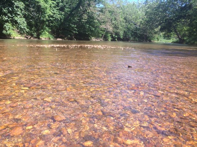 After an exhilarating drive down one-lane gravel roads in an old Chevy truck with a canoe in tow we arrived at a small put-in near the intersection of


 Two months ago our family headed west to Dobson, NC to visit old neighbors and friends whose son was having a first birthday. Wanting to extend the trip so we could explore more of the Yadkin Valley area, we made it a three-day trip so we could visit Pilot Mountain State Park, the nearby towns, and vineyards. Having passed Pilot Mountain dozens of times via US-52 on our way to Blacksburg, VA we had always wanted to explore this area.
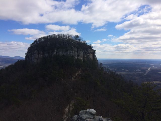 After a restful sleep on Thursday night we got up early and headed for Pilot Mountain State Park. We made a beginner’s mistake by going to the Bean Shoals Access of Pilot Mountain and after a 20 minute detour we found the main entrance to the park (
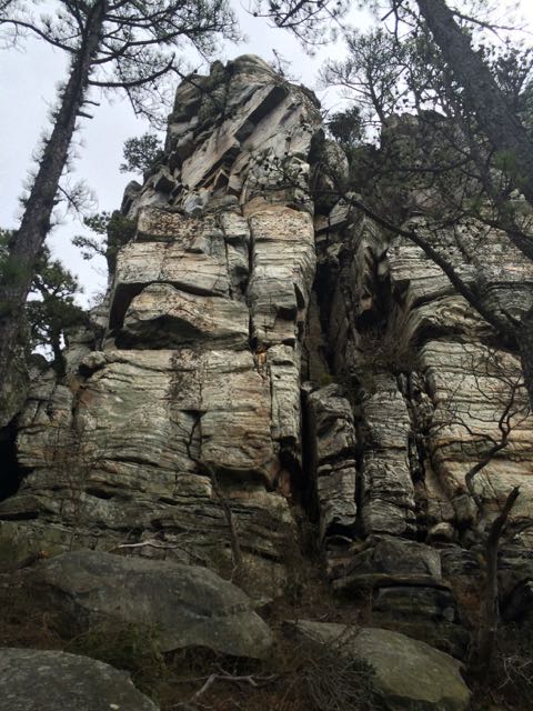 Jomeokee Trail is a short 0.8 mile looped hike around the base of big pinnacle sitting at 2400 ft elevation. To the Saura Indians, the earliest known inhabitants of the area, the mountain was known as Jomeokee, the “Great Guide” or “Pilot.” We headed around the trail counterclockwise, climbing up and down rock steps. There was little up and down terrain on the trail, but the cliff views were impressive to say the least. The trail can get rather narrow and offers some really up close views of the 200 ft Big Pinnacle. After making it about halfway around the base, our crew decided to call it a success and head back, given the cliff views were getting a little too hairy and too close for comfort (there are no railings).


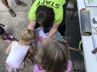
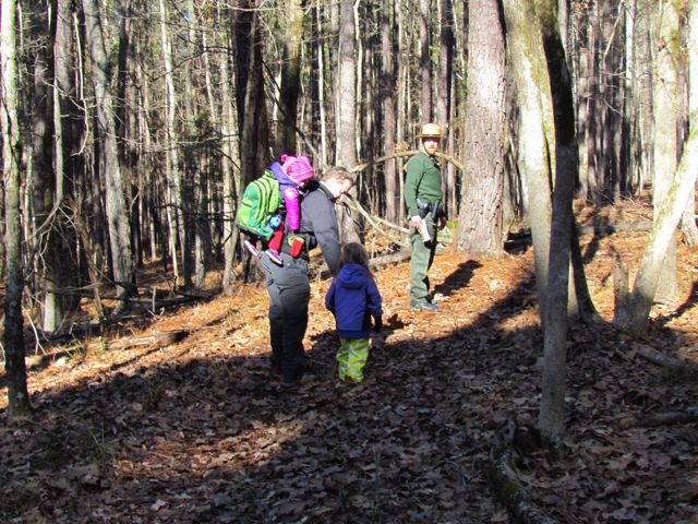
 Once the families gathered at the trail head, the park rangers explained more about the short .75 mile hike and gave each child a scavenger hunt brochure of things to look for along the way. Ashley was a little too young for the scavenger hunt, but the older kids had a great time. They also explained the


