
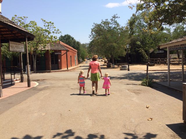
 For part two of our northern California park visits we visited the Columbia State Historical Park. Columbia is a real working town that was restored to its 1850s gold-rush business district. Visitors travel back in time to the gold-rushing days where business staff dress in period clothing so visitors can experience stage coach rides, mine for gold, and much more!
Columbia State Historical Park is located at 11255 Jackson St, off highway 49 in Tuolumne County, Ca. Columbia has seen its ups and downs since its cry of “Gold” in 1850 – it survived multiple fires, water supply troubles, and population decline. In 1853 Columbia was one of the largest cities in California with a population of nearly 30,000. When the town became a state park in 1949, restoration efforts preserved the buildings and history.
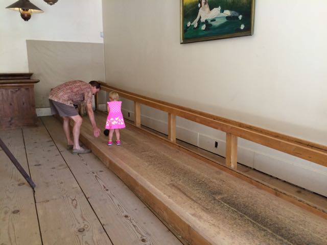 Strolling down Main Street, we first stopped at Parrott’s Blacksmith Shop to watch the workers forge iron into handmade goods. They make interesting outdoor art, decorative indoor items, horseshoes, unique furniture and more! Then we visited the museums, including the interactive old-fashioned bowling alley. The dentist office exhibit gave us lots of “eeks” as we glimpsed into some of the old fashioned tools and supplies used to clean and pull teeth.
Then we visited Nelson’s Candy Kitchen, a fifth-generation owned and operated candy store. My aunt and uncle are personal friends with the current owner, Janice Nelson, who was extremely kind and patient to give us a personal tour of the candy making. Needless to say, the girls’ bright eyes didn’t miss a moment of this tour! The shop uses a lot of the same recipes and equipment from when Janice’s family opened the store in the late 1800s. During the tour we talked to some of the candy makers who prepped milk chocolate chocolate turkeys for the busy Thanksgiving season. They dressed in period clothing and hand mixed all of the milk chocolate. The smells were priceless!
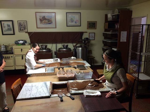 Janice showed us how they mixed and rolled the jelly candies, candy canes, and ribbon candies. The process is very exact and relies on the mechanical workings of old machines, molds, and ovens. We were so grateful for Janice’s personal tour of her beloved candy shop – it was so neat to learn about candy making and hear her personal stories about the shop. No candy store visit would be complete without buying some nibbles. The girls loved gawking at all the sparkly candies and squealed in delight while tasting the different jelly candy and chocolates. My personal favorite was the salted chocolate almonds while the girls loved the flavored jelly candies.
To come down off our sugar high we continued walking down Main Street towards the old Wells Fargo building. Sadly we didn’t have time to pan for gold or ride the old-fashioned stage coach, but we did quickly walk through the old Wells Fargo office that features original scales, maps of stage coach routes, and other banking exhibits. If you’re looking for a fun way to spend an afternoon or a few overnights exploring the gold-rush days, be sure to visit the small town activities and special events of Columbia. I only wish we had more time to explore the local businesses, especially the saloon!
Thumbs up: uniquely restored businesses, museum exhibits, kid-friendly activities/exhibits, town’s friendliness
Thumbs down: nothing to report


 And so begins my multi-part series on public parks we explored in Northern Ca. At the end of the summer we took the girls on a huge adventure to visit my aunt and uncle in Northern California. It’s unfortunate we waited so many years before visiting them – we made amazing memories this trip and I’m so glad we shared it with our kids.
 After exploring the park we visited retails shops in downtown Murphys and ate a yummy lunch at


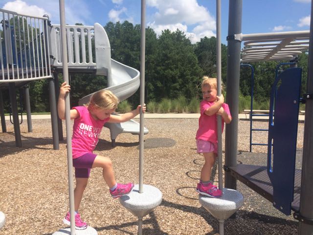
 Over the past few years I’ve continually heard about the amazing “dragon” park in Cary with great play areas for all kids. Well, we finally ventured to the super popular Marla Dorrel Park, which features the
  Beyond this playground is another play structure with graduated levels of difficulty that feature wheelchair ramp access, twisty slides, arched ladders, a fun rolling slide, interactive play items and so much more. Tot swings, traditional swings and chair swings are also located nearby including a swinging platform with wheelchair accessible ramps. The playground surface is mostly sand so bring your sand toys or enjoy the diggers; but wide paved sidewalks wind throughout making it easy to access all areas. They even have wheelchair-accessible sand tables along the pathways!


 If you can’t tell by the themes of some of my latest blog posts, biking has been our family’s new passion. Having a bike hitch, bike trailer and at least one child biking on her own really opens up the family bike outings to beyond the driveway or cul-de-sac. Even though Bill is usually the one to strap the bikes onto the hitch and gather all the gear, I’ve made it a point to learn how to do it on my own in hopes that I could take the girls out by myself. Feeling rather confident about strapping all the bikes onto the hitch, remembering all the gear and snacks, I took the girls for a bike ride on Abbotts Creek Trail one summer morning in August.
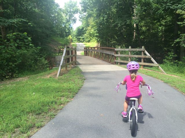 The bike ride back to the car was successful and even a bit adorable as my stop-and-smell-the-flowers daughter took advantage of light greenway traffic with her simultaneous bike ride swaying and singing. Despite the hot weather, the girls made the trip so much fun and were so patient with me as I carefully installed the bike equipment back onto the car.
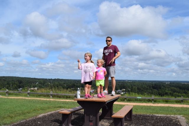 We biked to the bottom of the trail that leads to the top of the landfill, parked our bikes and walked to the top. I’m the only one in our family who has ever been to the top of the landfill, so I was excited to share the views with everyone. The little ones took turns exclaiming their discomfort for walking up the hill, but it’s such a short walk (less than 1/4 mile) that they pushed through it.


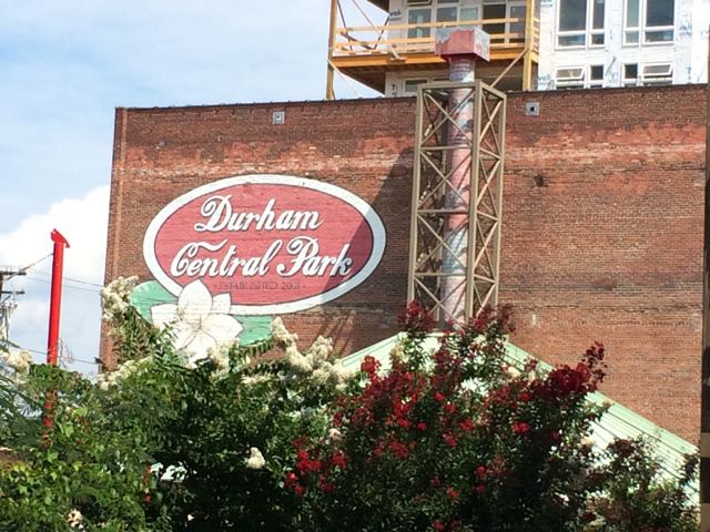 Part of my summer bucket list for the past few years included a trip to the Durham Farmers’ Market. Unfortunately, we never made time to visit Durham during the summer (unless it was for a Bulls game) until this summer. A few weeks ago we had an atypically quiet weekend at home so we decided to head out to the
 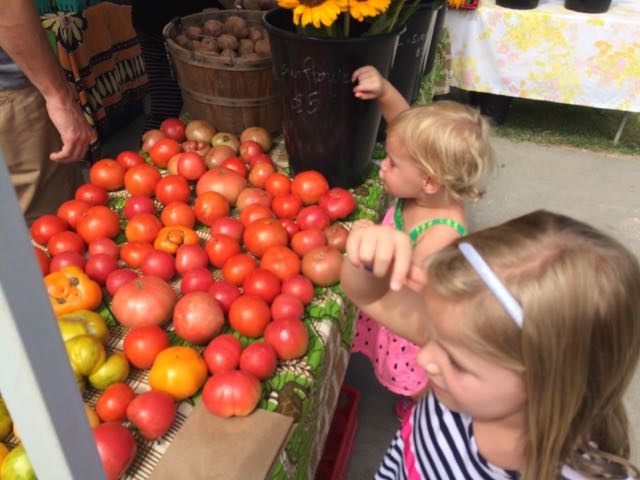 After exploring the main area, we walked across the street to the mini food truck rodeo area, where we bought some fresh tea and loco-pop popsicles. There were tons of vendors at the market selling clothing, unique handmade items, cold drinks, household items and more. After window shopping we walked across the bridge at the intersection of Foster and Hunt St where it dumped us out into the large lawn area, also part of Durham Central Park. We walked up the hill to scope out the skateboard park, which is also located across from a police station. After watching the skaters for awhile we headed back down the hill past the Leaf open-air performance area to the fabulous playground area, Mt. Merrill.
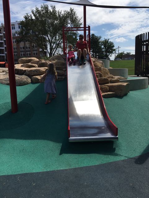 The playground features amphitheater-style rock climbing, two slides, climbing net, and some shade sails. I especially loved the cute bird cut-outs perched on top of the poles. There are also some benches sprinkled along the nearby sidewalk and some shady spots in front of the playground by the wooded area. We grabbed a few of those shady spots and had a quick picnic with our edamame and blackberries. The girls loved jumping back and forth between having a snack and playing on the playground. It was neat and unusual to see large boulders used as a climbing element in a playground.


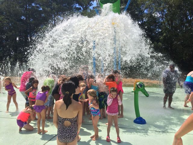 When we didn’t travel this summer, we explored lots of different places in Raleigh – the library, nature parks, the pool, and trampoline parks. After feeling like we exhausted places in Raleigh, we mixed things up and visited different places outside Raleigh. First on our stop was the
 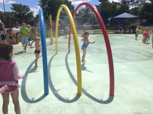 The splash pad costs $2 per child for non-residents (cash only) and is free for Fuquay-Varina residents with a Resident Splash Card. During the summer, the splash pad opened at 11am so there was quite an initial rush and it was at capacity by the time we got there at 11:15am. After about 15-20 minutes the attendant called for everyone inside the splash pad to exit while the next group entered. This juggling of guests continued for a few cycles before the crowds naturally evened out.


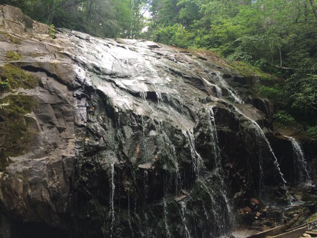 While we were in the NC mountains, Bill and I scooted out for a day date hike and beers in Blowing Rock. We hiked the
 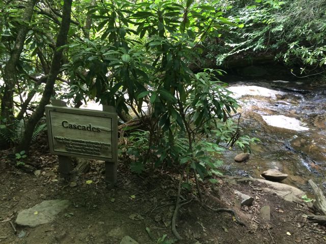 We arrived at the first waterfall, the Cascades, a little past halfway down the trail. The creek water gently flows over these moderately sloped rocks, allowing hikers to cautiously climb up the rocks to higher ground. We stopped to take in the sights and sounds before moving farther down the trail. On our next stop we hiked to the base of the trail at Glen Marie Falls. We climbed up large boulders sandwiched between small streams to get higher views of the mountains in the distance. Again, we stopped for several minutes to take in the quiet sights and sounds.


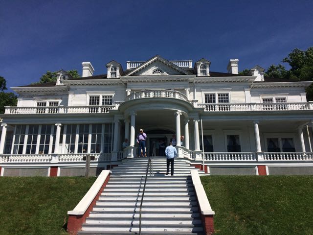 We were very fortunate to spend a few weekends in the NC mountains this summer. On our second mountain trip we met up with my in-laws and stayed in a beautiful mountain cabin near the Appalachian Ski Mountain between Boone and Blowing Rock. On a tip from friends, we headed out to the
  After spending over an hour at the park, we turned left out of Moses Cone Memorial Park and headed 10 miles south to the Linn Cove Viaduct (MP 304). At an elevation of 4,100 ft, the Linn Cove Viaduct is a concrete bridge engineering marvel snaking around Grandfather Mountain; it is over 1,200 ft long and consists of 153 concrete sections weighing 50 tons each. Construction of the Linn Cove Viaduct was completed in 1983, cementing the final link of the Blue Ridge Parkway.


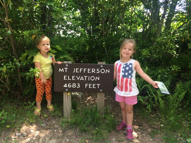 On the way home from our mountain trip in West Jefferson we decided to take advantage of the close proximity to Mount Jefferson and pay a visit. Mount Jefferson State Natural Area is located just east of US 221 at
 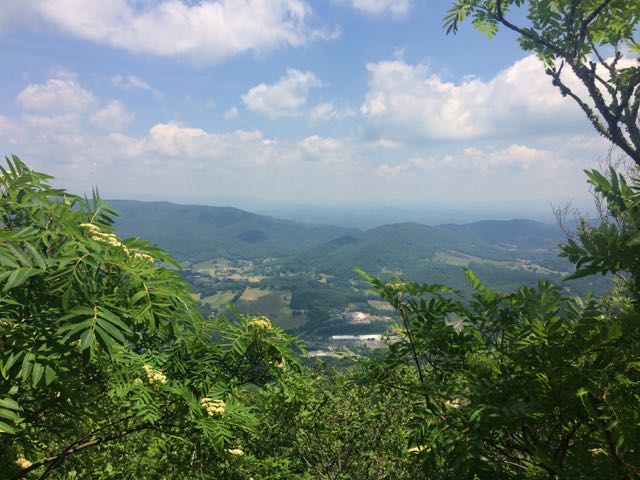 We walked through the picnic area and followed the short Summit Trail (0.3 miles) up the mountain. Although the website lists this trail as strenuous, we felt it was more on the moderate side. Due to our haste planning half of us wore flip flops, but could easily walk the gravel trail. The gravel path is wide and shady giving a cool mountain feel to the hike. Along the way we saw butterflies, rhododendrons, mountain laurel and red-starred flowers; though stop by the park office for official plant and animal checklists. We visited the bathrooms along the way, which were super convenient and an easy walk from the main path. We passed access to the Kids TRACK trail, which is part of the longer Rhododendron Trail (1.1 miles). Near the top we turned left to the Mount Jefferson summit, which has an elevation of 4683 feet. I climbed out a little further to catch the beautiful views of the Blue Ridge Mountains.


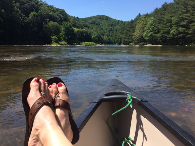 Last month good friends invited our family to their mountain cabin along the South Fork of the New River near West Jefferson, NC. Though this was my first time on this river in NC, being back on the New River reminded me of past trips whitewater rafting through
 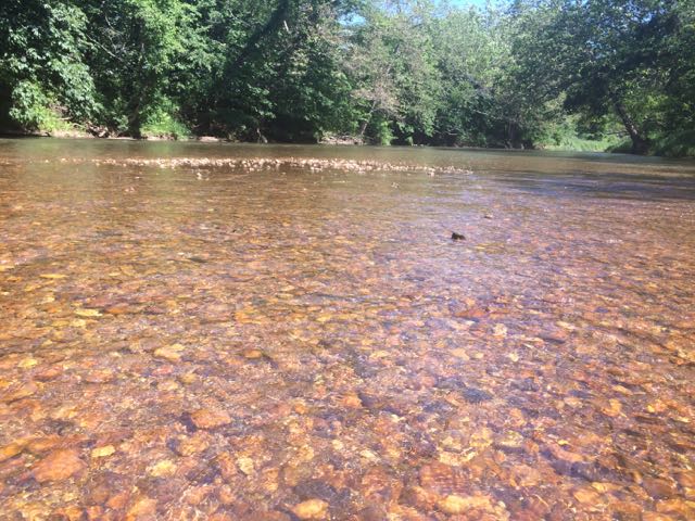 After an exhilarating drive down one-lane gravel roads in an old Chevy truck with a canoe in tow we arrived at a small put-in near the intersection of


