Grandfather Mountain Profile Trail

img_1603Oh, boy!  It’s been a few weeks since I last posted about our trip to Grandfather Mountain: partly because I’ve been busy with other things, but mostly because I’m still wrapping my head around conquering the Profile Trail and Calloway Peak.  Yes, I used the word “conquered” when describing this hike.

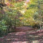
On day 2 of our trip to Western NC, we headed with a few friends to the Profile Trail of Grandfather Mountain.  It’s located just a few miles west of the Grandfather Mountain campground we stayed at and is free to visit, unlike the other entrances to Grandfather Mountain and the Swinging Bridge.

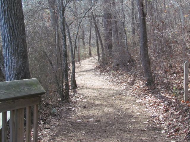
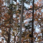
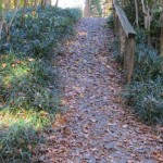
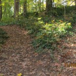
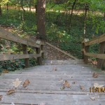
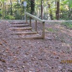
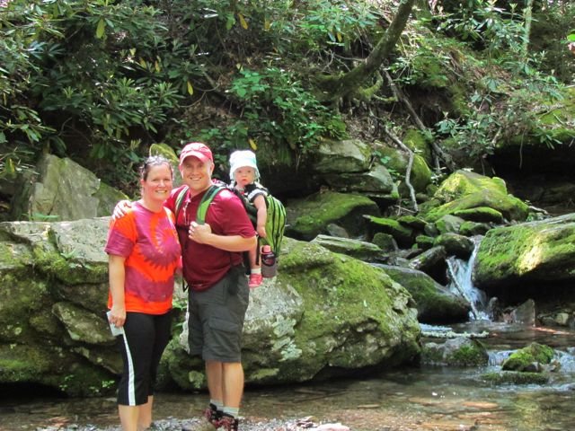
The trail length from NC 105 to the top at Calloway Peak is about 3.5 miles and 2000 ft ascent.  We had Ashley in our new Craigslist Kelty backpack for the trip so it took us about 4.5 hours to do the 7 mile round trip.  The first 1.7 miles until you get to Foscoe View is steep, but relatively easy.  In the beginning you cross several streams, which are great for a cool dip.  The trail is very narrow with lots of roots along the surface so you have to constantly be aware of your footing.

img_1621
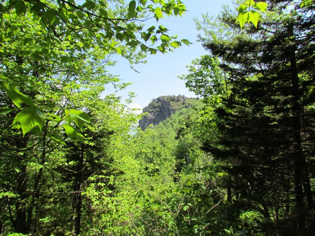
At 2.3 miles you reach Profile View, which offers a spectacular view of the Grandfather Profile. After you pass Profile View, the terrain gets much steeper and harder to ascend.  At 2.7 miles you reach Shanty Spring, which is known for being the “last sure water” spot.  We refilled here on the way back down the mountain as we did not come prepared with enough water.  Shanty Spring is a great rest area offering a lot of shade and a cool drink before ascending the strenuous path of boulders, which lies next.

The boulders we climbed after Shanty Spring were unlike any we’ve climbed before.  Having short legs didn’t help but, nonetheless, even a 6ft tall person would have to raise their legs to their waist to climb these boulders.  It felt like a straight climb for a solid 20 minutes and it was hard to stop your momentum once you started.

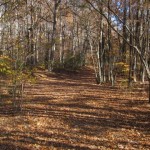
Finally we reached the fork in the trail and headed left towards Calloway Peak.  On the way down the mountain half our group headed right to cross the Mile High Swinging Bridge, which they said was unbelievable!  But, back at the fork in the trail we still had another .4 miles to go to reach the top!  Finally, this part of the trail started to level out and we felt like we were getting closer to the end.  The fir trees were smaller in height and we could see the sky!  Our first stop was at Watauga View, which offers beautiful views of the mountains and valleys.

img_1644
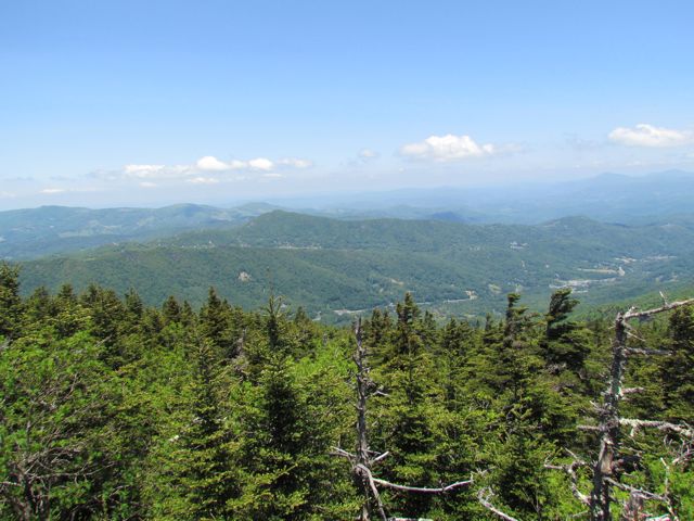
Continuing on, we headed to Calloway Peak, which includes climbing three different ladders suspended between large boulders.  It was unlike anything we’d climbed before, but so were the views at the top: the sky was so blue, the mountains so green and you could see for miles.

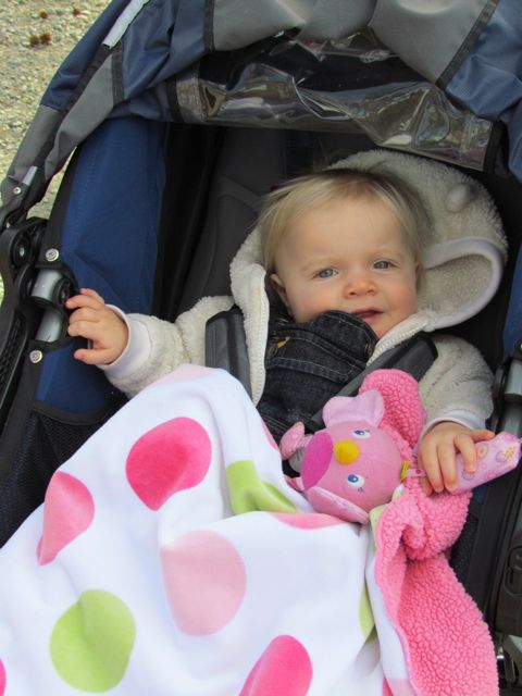
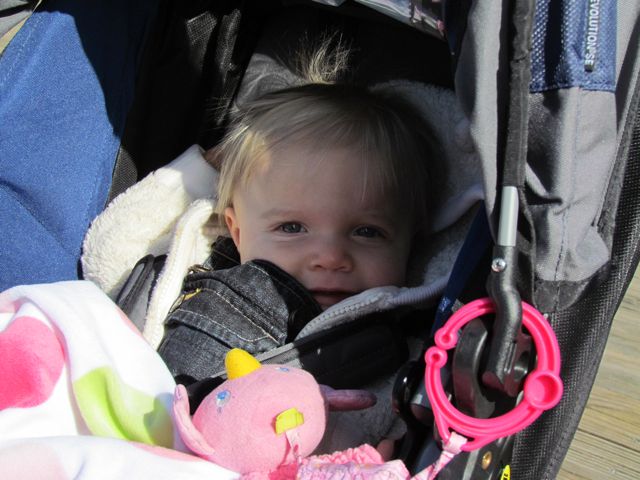
The hike down was much quicker than the hike up, but took a toll on our knees.  Having a 24lb baby and a 10lb pack didn’t help, but she was an angel for the full 7 miles and even took a quick nap at the top.  Lucky for us, we were hiking with great friends who encouraged us the entire time (had they not been there, we probably would’ve turned around at Foscoe View)!  Reaching the parking lot was relieving, to say the least!  Reaching the Lowe’s Food grocery store and celebrating with corked beverages and grilled double cheeseburgers was priceless!

Lessons Learned: pack at least 3 bottles of water per person, eat a large breakfast beforehand, pack sandwiches for lunch, hire a sherpa for baby

Thumbs Up: beautiful views, photo ops, great exercise, great day trip

Thumbs Down: hiking with baby strapped to your back, always looking down to avoid tripping

RDU Observation Park

This post is dedicated to all of the guys in my life (husband, dads, and grandfathers) who flew planes in the service or for fun or who love to spend hours at air shows or the National Air & Space Museum. 

We took advantage of last Thursday’s gorgeous weather and headed to the RDU Observation Park at RDU Airport.  Thinking I’d never spend more time at an airport than absolutely necessary, I wasn’t quite sure what to expect.  Surprisingly, it’s a pretty neat way to watch planes land and take-off provided, you don’t have a vested interest in the ones you’re watching take-off 😉 For those of you who have sprinted from one end of DFW to the other to catch a connection only to learn you missed it, may not enjoy spending additional time on airport authority owned property.  But, for those who are interested in the simplicity of an airport, going from one place to another, this is a fun place to visit!

First, be sure to take the simpler entrance into the General Aviation area from Lumley Rd, which you can get to from 540 or 70 and follow the signs to the Observation Park.  The park is actually located near the intersection of Business St and E International Dr closest to the Terminal 2 runways and the private jet hangars.

The park has a large parking lot with stairway and ramp access to an elevated and covered deck overlooking the Terminal 2 runways.  Along the deck railing there are educational guides with information about the different planes built over time, from the Wright Brothers plane to the Cessna CJ1 and beyond.  We had great views of the control tower and the take-off and landings of large commercial jets and smaller private planes.

The park also has a small, sandy playground area with climbing equipment, a kiddie-size runway, picnic tables, benches, open fields, public restrooms, and more aviation information guides.  Not far from the park is a cafe open from 8am-2pm.

Finally, if you find yourself at the airport with a few extra hours to spare, check out this helpful airport guide I stumbled upon at Stuck at the Airport.

Thumbs Up: beautiful views, picnic spots, aviation information guides

Thumbs Down: bad signage from Aviation Pkwy entrance

Historic Yates Mill County Park


This post originally appeared on Southwestraleigh.com where you can learn more about how to live, work, and play in the Creative District.

Even though the Historic Yates Mill County Park has only been open for less than six years, Yates Mill dates back to the early 1800’s and is the only gristmill still standing in Wake County.  Throughout the mill’s history it changed ownership about a dozen times and the park is now owned through a partnership between NC State, Yates Mill Associates, Wake County, and the NC Dept of Agr & Consumer Services.

Historic Yates Mill County Park is located at 4620 Lake Wheeler Rd, about 3 miles south of I-40/440.  After winding down a short entrance road you arrive at a large parking lot with a beautiful research and education center as the backdrop.  The A.E. Finley Education and Research Center is a beautiful stone and wood building that contains an exhibit hall, classrooms, auditorium, and back porch complete with rocking chairs overlooking the pond.  They offer programs for people of all ages and here are just a few upcoming events to highlight:

After you’ve finished exploring the Park Center, head to one of the trails for a walk out and around the pond.  We explored the Millpond Trail (1 mile), which loops around the pond offering breathtaking views of the wildlife, water, and flora.  On this trail, you’ll pass by the old mill and dam, boardwalks along the pond that are great for fishing, several picnic areas, the Field Classroom, and tree markers that correspond to the “Tree Identification Trail” brochure at the Park Center.  Even though it’s an unpaved path, it’s quite wide and flat but not suitable for strollers in all areas.  Being a beautiful sunny day, I passed quite a few people jogging the trail too.  Whatever you do, be sure to stop by the mill yard and dam and take tons of pictures!

The two other trails we didn’t have time for today are the High Ridge Trail and the Creekside Trail.  The trail map shows that High Ridge Trail is more strenuous and about .78 miles and connects up with the Millpond Trail.  Creekside Trail is an out and back unpaved trail that is 2 miles in total length.

This park is jam-packed with activities and sights, but also has several peaceful areas if you just want to relax a bit.  Try your luck fishing from one of the boardwalks, enjoy a picnic lunch at one of the many spots along the Millpond Trail, or take a nap in the rocking chairs on the back porch.  So, whether you came for excitement and learning or quiet time and reflection there’s something for everyone.

Thumbs up: photo ops, serenity, educational exhibits, pond, mill and dam

Thumbs down: trail maps don’t indicate whether paths are stroller-friendly (thanks to the sweet mom-daughter team that helped us out)

Eastgate Park

So, I’ve never had such a relaxing Thanksgiving week in a long time.  Our Thanksgiving holiday started by visiting Eastgate Park earlier this week. It was extra special because we were able to spend it with Bill, who took off for the holiday week. With us around I’m not sure it was much of a relaxing vacation for him, but we enjoyed having him around all week.

Eastgate Park is located at 4200 Quail Hollow Dr, not far from North Hills Mall.  The parking lot is located on Quail Hollow Dr, but side-street parking is also available on Wingate Dr.  After parking in the parking lot, you can head to the left towards Cooper’s Pond.  This a small pond with an small overlook area and opportunity for fishing or visiting with the fauna.  Around the pond, you’ll also find a cleared path and covered pavilion with picnic tables and charcoal grill.  The path this week was covered with large leaves, perfect for great photo ops!

Eastgate Park has an unstaffed community center that is available for rent and commonly used for recreational programs.  There is also a large open field with several soccer goals, basketball courts, and tennis courts.  We spent a lot of time at the playground area this particular day.  This playground is really nice for a few reasons: 1) the spongy surface, 2) the area is fenced in, and 3) both playground areas are near each other and have several swings.  Even though Ashley is only 8 months old, she thoroughly enjoyed crawling around on the spongy surface and swinging on the tot swings.  I consider both features to be crucial if you have a non-walking child!  Babies and mulch just do not mix!

The playground has swings, slides, and climbing areas.  There is also a sandbox and musical area in the smaller child playground.  Another great feature of this playground are the benches lined around the perimeter.  It’s a great place for parents to enjoy watching their children play.  Down from the playground is a collection of covered picnic tables and sidewalk games like four square and hopscotch.

Thumbs up: sidewalk access to park, pond area, photo ops, playgrounds, benches near playground

Thumbs down: unattractive community building

Edna Metz Wells Park

This post originally appeared on southwestraleigh.com, where you can learn more about what a great place South West Raleigh is to live, work, and play.

Looking for a park in the Creative District bursting with fall colors?  Then, make your next park visit to Edna Metz Wells Park, where urban and nature intersect. This is a small park on the edge of Cameron Village that you’ve probably passed by a dozen times on the way to Glenwood South and never paid much attention.  It’s located at the intersection of Smallwood Drive, W Johnson Street, and Peace Street at the southern edge of Cameron Village. W Johnson Street is one-way, so go around the block and park either on Park Drive or W Johnson Street.  In late 2010, a $340,000 stream enhancement project was completed at the park as part of an improvement plan for Pigeon House Branch, a watershed that drains much of the downtown area.

Edna Metz Wells Park has several walking trails that meander through the mature trees and over the stream.  Several small bridges cross the water and large boulders on the southern part of the stream aid in preventing further erosion.  The dense forest is full of pines, oaks, magnolias, and ferns, to name a few!  The leafy tree colors are magnificent right now, great for photo ops and picnic spots.

There are also a few open areas in the park, still mostly shaded with nearby benches.  This is a great park for taking in some nature in an urban setting.  The sounds from the stream provide a nice backdrop to the busy nearby streets.  The USGS stream gauging station at the park helps monitor water levels and flow rates for flood forecasting and other projects.

So, grab a lunch or dinner nearby at Noodles & Co or Piccola Italia and head to Edna Metz Wells Park for a nice stroll and picnic.

Thumbs up: photo ops, shady, walking trails, nature spot, beautiful neighborhood park

Thumbs down: lack of information on-site about park

Kiwanis Park & Crabtree Creek Trail

A few weeks ago we headed down to Lassiter Mill Park again to access the nearby greenway via Crabtree Creek Trail for a run. Little did we know that after a mile and half into our run, we would come to Kiwanis Park. It was a nice surprise and a good break from the run, as we weren’t anticipating either!

Following the greenway was a bit tricky in some places.  If starting near Lassiter Mill Park, you’ll  eventually come to Claremont Rd, where the greenway signs stop.  Take a left onto Claremont Rd and then cross Anderson Dr where Claremont Rd turns into Oxford Rd.  Stay on the sidewalks and you’ll shortly see the next portion of the greenway on your left, which will lead you straight to Kiwanis Park.  Despite the trickiness of the greenway, this has turned out to be one of the favorite running trails in Raleigh.  It is super FLAT and the bridges and scenery you pass make the running seem effortless at times.

The Kiwanis Park is located at 2525 Noble Rd just inside the beltline. It has a playground area with a jungle gym, but no swings. There are also several large open fields, mostly used for playing soccer. There is a sand volleyball court, baseball fields, and a basketball court. The nearby community center is not staffed and is available for rent.  The large pavilion has several picnic tables and restrooms.

Even though you can get to the park by car, why not make this a greenway/park/brunch adventure with the kids! 1) Run/walk 1.5 miles with the stroller on the greenway to the park, 2) let them burn up some energy on the playground while you rest from your run/walk, 3) then run/walk 1.5 miles back followed by 4) yummy brunch at Nofo at the Pig!

Thumbs up: flat portion of greenway, scenery along greenway, playground, open fields at park, recreational sports

Thumbs down: signage along parts of greenway, no swings on playground

Powell Drive Park

This post originally appeared on southwestraleigh.com, where you can learn more about what a great place South West Raleigh is to live, work, and play.

Powell Drive Park is another example of a Raleigh park that offers more features than meets the eye.  Drive past Powell Drive Park and you might only see the features closest to the road, such as the unattractive neighborhood building, playground area, and tennis courts.  You may not know that if you explore the park further, you’ll find a small pond surrounded by shade trees great for picnics and photos, pavilions perfect for small family outings, and a large open field for group recreational activities.

Powell Drive Park is located at 740 Powell Drive in the southwest Raleigh area.  It is located in the triangular region between Western Blvd, I-440, and I-40.  For those in the nearby neighborhoods, there are sidewalks and stairs for accessing the park.

Close to the parking lot is a small open field, a neighborhood center used for programs or available for rent, two lighted tennis courts, and a playground area.  The neighborhood center is not staffed, but you can learn more about the facility at the City of Raleigh’s website.  The playground area has a large jungle gym with mulch base, swing set, sandbox area, benches, and water fountain.

Follow the paved path from the parking lot past the playground and you’ll first come to the lighted basketball court.  Immediately past the basketball court is where the small pond surrounded by shade trees is located.  Several benches are located along the perimeter of the pond, which you can access by a cleared trail covered in pine needles.  At opposite ends of the pond are small steel bridges, which add architectural interest to the area.  Sadly, on this particular day, I didn’t see any evidence of ducks or turtles near the pond.

Continue on the paved path to access the large, open field where the backstop and soccer goals are located.  The open field is surrounded by a dense forest to the north and west and four small pavilions (one has a charcoal grill) and a less dense forest to the east and south.

With the busy school schedule and college/pro football season upon us, take some time out and grab the kids and stomp around the playground, enjoy a yummy picnic with a loved one, or round up some friends for a game of flag football at Powell Drive Park.

Thumbs up: playground area, shady picnic spots, photo ops around pond, large open field, small pavilions

Thumbs down: unattractive community building

Museum Park

The Museum Park is located on the grounds of the NC Museum of Art at 2110 Blue Ridge Rd just outside the beltline.  Part of the trail through the park is shared with the Reedy Creek Trail greenway, which connects Meredith College to Umstead Park and Schenck Forest.  The museum was renovated a few years ago and besides biking the greenway past the museum, I hadn’t really stopped to visit this park.  So, we parked in the museum parking lot and followed the paved trail towards the very easy-to-read information board.

The information board highlights four different walking paths to take and breaks it out by distance, walking time, calories burned, and features you’ll see along the way.  Because it was a very hot Sunday and we had the stroller, we opted for the one-mile Ambler path, which allowed us to explore several works of art on the paved trail close to the museum.  For those planning ahead, here is a map of the park.

Information plaque with details about the park
Paved trail around the park
View of the East building

Here are the works of art we passed along the Ambler path:

Wind Machine by Vollis Simpson
Collapse I by Ledelle Moe
Gyre by Thomas Sayre
Close up of Gyre filled with concrete and covered in dirt residue
Another view of Gyre
Bill & Ashley under the Gyre
The Conversationalist by Chakaia Booker
Lowe’s Pavilion by Mike Cindric and Vincent Petrarc
Another view of Lowe’s Pavilion, made of steel, wood, aluminum, and concrete

A photographer’s dream shoot, the Museum Park has a gorgeous landscape of rolling hills with a sprinkle of wooded forests between the East Museum Building and the outdoor works of art.

Looking down at the Gyre artwork
Looking back towards the Wind Machine artwork
Greenway to Meredith College
Part of the unpaved trail on the Museum Park grounds
An unpaved pathway through the park
Great shady pathway for a picnic on the bench

Next, we explored one of the newer (to me, at least) features of the park, The Pond area.  With over 20,000 plants installed, this area helps with runoff, water pollution, and settling for sediment.  The terraced landscaping and even spacing of the plants had an Asian design feel to it, but what do I know!  Here’s a list of the various plants installed and some pictures to detail the beauty of this area:

What outdoor museum would be complete without an amphitheater and outdoor movie screen?! The NC Museum of Art holds several outdoor concerts and movies throughout the summer months.  Having finally made it to an outdoor movie last summer to see The Fantastic Mr. Fox, I can attest to how much fun they are.  So, bring a picnic dinner, lawn chairs or blanket, and some cash (for the beer/wine tent) and you’ve got the perfect, cheap summer night planned!  Btw, The Social Network movie is playing tonight at 8:30pm.

Some of the seating areas for outdoor movies
Looking towards the amphitheater

Overall, this park offers much more than any average park.  Whether just passing by on the greenway, planning a trip to the indoor museum, or watching a movie or concert be sure to plan enough time to explore the artwork in the Museum Park.

Thumbs up: picnic spots, rolling hills, outdoor artwork, outdoor movies/concerts, The Pond landscaping, information plaques/maps, parking

Thumbs down: few pockets of shade

Trip to Southport, NC

I’ve only been to a handful of small towns in my life and this week I had the extreme pleasure of spending the week in Southport, NC for my brother’s wedding.  He is marrying the lovely Rachael Anderson today and I couldn’t be happier for them.

We had a lot of free time this week before the wedding festivities began so I took my sister, Ginni, and Ashley around downtown Southport for some exploring.

After we walked through the shops we headed to the Waterfront Park & River Walk area (corner of Howe St and Bay St), which is located on the Cape Fear River.  This is a beautiful spot to have a seat on a bench or swing and watch the boats come by.  There are several small pavilions with picnic tables, but be careful of the seagulls if packing a picnic lunch.

View of the Waterfront from the north
Map of the area detailing the various islands around Cape Fear River
Bike racks are available
Paved walkways make it easy for strollers
Pavilion with picnic tables
Benches along the Waterfront

Next to the Waterfront is City Pier, which is a popular spot for fishing.  The moderate breeze from the river also helps cool down the hot and muggy NC summer days!

Continuing north on Bay St, you’ll come to Southport Community Building, which is where my brother and Rachael are getting married today!  It has a gorgeous deck overlooking the river, which is where the ceremony will be held and a reception hall inside the building.  There is parallel parking available on both sides of Bay St and stairs to access the building from the street.

Views from the top deck
Southport Community Building

Continuing north, we enjoyed watching the large boats return from trips at sea.  The homes along the walk are also interesting to look at, especially given their historic, New England style.  Each home has a plaque near the front door listing when it was built; most are from the late 1800’s and early 1900’s.

Not having a final destination in mind, I was pleasantly surprised when we came upon another park along the river, Kingsley Park!  Kingsley Park is at the corner of Kingsley Dr and Bay St and is only about 1/4 mile from the Waterfront area.  This was an area where menhaden fishing boats used to dock decades ago.  Menhaden fish are caught in nets and are mostly used for their oil and ecological resources, as they have too many bones for human consumption.

Kingsley Park has several benches, paved sidewalks, information plaques detailing the menhaden fishing industry and Hurricane Hazel destruction from 1954, and a long pier into the river.

Kingsley Park
Benches in the park
Gardens around the park
View towards the river
Ashley and me on the pier
Ginni and Ashley on the pier
Information plaques about the fishing industry

Southport, NC is a fantastically quiet getaway with so much to do.  Whether you’re walking around downtown, shopping, taking in scenes of the river, or eating at one of the local restaurants you’ll have a great time.  From Raleigh, Southport is only 2.5 hours – perfect for a day trip and making wedding memories!  Congrats again to Brandon and Rachael…can’t wait to celebrate with you tonight!

Thumbs up: scenic views, photo ops, educational plaques, historic homes, river walk, piers, downtown atmosphere

Thumbs down: nothing to note 🙂

Rose Garden

For my first Mother’s Day we spent the weekend in Nags Head with great friends and the pups for our traditional Yuengling 5K race. When we got home on Sunday we walked down to the Rose Garden, which is just two blocks from our house. We were too late for their annual Mother’s Day brunch celebration (mimosas and yummy food) so we just walked around and enjoyed the fantastic sights, smells, and company.  The Rose Garden can also be rented for weddings and other events (hint: no money needed on decorations).


Wandering through the rows and rows of roses


Lovely shades of peach, hot pink, and light pink roses


The rose garden is located in the circular, below-street level area at 301 Pogue St.  Parking is limited to around the circle and the nearby neighborhood streets.  There are a few different entrances with stairs or you can walk down the paved entrance way near the theater. The grass height in the gardens is kept pretty low so you can easily push a stroller.

There are over 50 varieties of roses to touch (no snipping) and smell. One end of the garden has a beautiful pergola covered in white roses and the water feature and the other end has a gazebo with other varieties of shade-loving plants. There are benches and picnic tables covered with large shade trees for great picnic spots.

The pergola at one end covered with white roses
The other end of the garden
Some of the shade-loving hostas

You can’t visit the Rose Garden without scoping out the latest plays at Raleigh Little Theater, which is adjacent to the garden. RLT is a community theater that produces 11 shows each season. I’ve been to a few shows and know folks who work on the production so be sure to check them out!

Thumbs up: picnic spots, shade, sights/smells, photo ops, gardens, theater

Thumbs down: parking (at times)