
If you’re looking to get out of Raleigh for the weekend, but don’t want to drive to the beach or mountains, head to the river instead! Last fall we took a quick weekend Winnie trip to New Bern, NC. We camped, hiked, explored museums and historical homes and walked around downtown. And, we took our time leaving on Sunday because it’s such an easy drive home!
Camping in New Bern
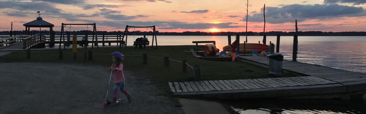
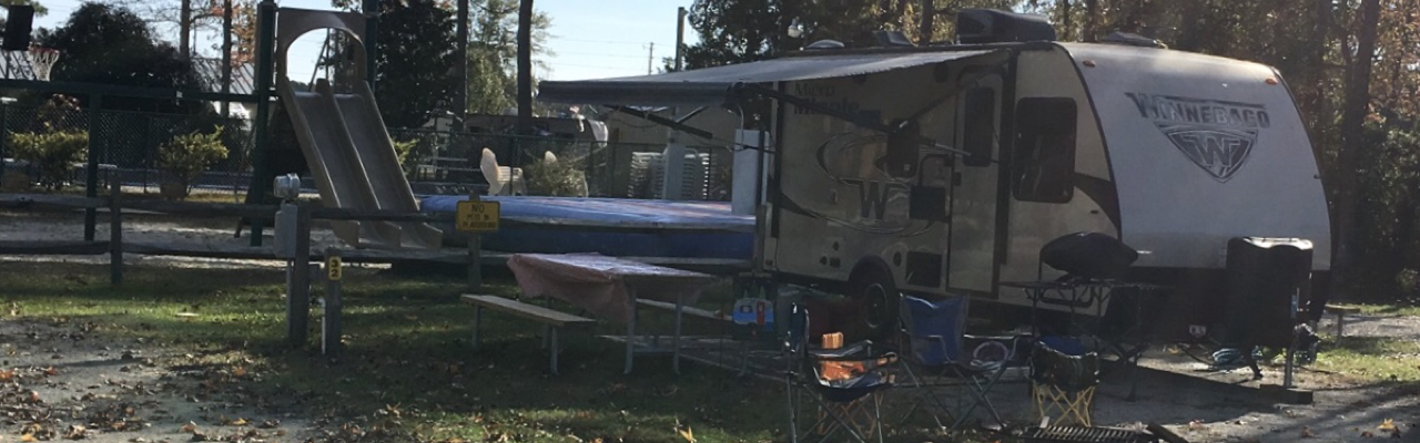 New Bern is located along the Neuse River about 2 hours east of Raleigh. The Neuse River near New Bern is much wider than near Raleigh and eventually dumps into the Pamlico Sound. We stayed at a fantastic KOA campground on a campsite adjacent to the playground. Though it was a super cold weekend with lows in the lower 40s, the Winnie’s heating system kept up and we slept very comfortably.
This was our first KOA camping experience and it was crawling with kids and activities. The campground features a big pirate ship playground, miniature golf, a huge jumping pillow, a catch and release pond, and breathtaking waterfront views of the Neuse River. Both evenings we followed the short path to the waterfront and sat on the swings to catch views of the sunsets.
The campground is less than 10 minutes from downtown New Bern so it was super convenient for the price. Other than RV rental sites, they also offer rental cabins and tent sites, which all looked very nice. When we come back to New Bern, we’ll definitely stay at this KOA campground again.
Exploring Downtown New Bern
The first night we headed into downtown New Bern for dinner and to explore the shops during the Art Walk. We enjoyed a delicious seafood dinner of steamed crab legs, oysters, and clams and the girls tried their first alligator bites at MJs Raw Bar & Grille. Then, we walked through some of the nearby shops, which all seemed to be super dog friendly.
As we walked around we noticed the frequency of large life-size fiberglass bears everywhere. The girls loved taking pictures with them, and after a quick Google search we learned the founder of New Bern named the city after his native city of Berne, Switzerland. Bern means “bear” so the bear symbol is shown on the city flag and local artists painted the fiberglass bears in honor of the city’s 300th anniversary in 2010.
Downtown New Bern is surrounded by the Trent River to the south and the Neuse River to the east. Though we didn’t make it down to the waterfront, we drove by a large waterfront park and several waterfront restaurants that looked fun for a future trip.
Hiking in Croatan National Forest
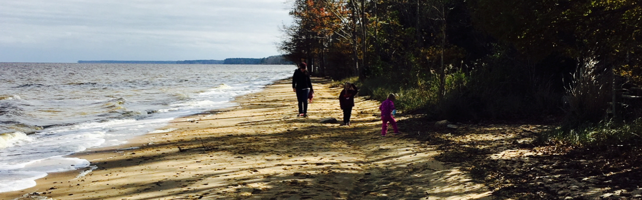
The next morning we headed out to Croatan National Forest for a quick hike along the river. We drove about 20 minutes south of New Bern along US-70 to the Flanners Beach/Neuse River Recreation Area located at the end of Flanners Beach Rd. This area features picnic areas, restrooms, ample parking, hiking, biking, and a nearby campground. The campground has about 40 wooded sites (some with electric hook-ups) that accommodate RVs and tents.
The trailhead for Flanners Beach/Neuse River Loop Trail begins near the campground area. The path starts out paved and then transitioned to unpaved dirt and gravel after we hiked further into the forest. Ash and Claire weren’t in a prime hiking mood, so we quickly made a scavenger hunt game with scrap paper in Ash’s hiking backpack. Searching for natural items of different colors definitely cheered them up!
This 2-mile loop trail features dense hardwoods, pines and ferns. The girls enjoyed picking up downed pieces of pine limbs and using them as sweepers to clear the pathways. The trail signage wasn’t very helpful, but having GPS on our phones helped us stay on the right loop. At one point we crossed a narrow wooden boardwalk over a marshy area before coming to beautiful views of the Neuse River. At the end we arrived back at the open recreation area and walked down the steps to explore the river’s shoreline. Being a cold morning, there weren’t many people out hiking and we had the beach to ourselves. The views from the shoreline were amazing; it’d be fun to explore this beach during the summer months.
Exploring Tryon Palace
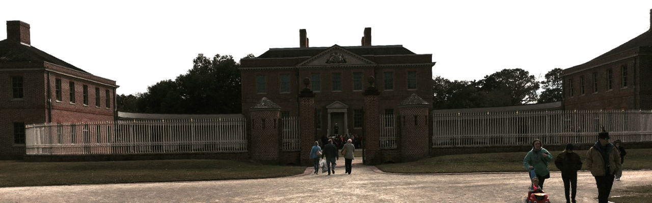
Later in the afternoon we headed back to downtown New Bern to explore Tryon Palace. Tryon Palace is a Georgian-style mansion built between 1767 and 1770. It served as the first capitol building of North Carolina and home to Royal Governor Tryon and his family. Tryon moved to New York a year later and a new Royal Governor moved in until the start of the Revolutionary War. Patriots made the palace their capitol and the General Assembly met there to draft North Carolina as a new state. Subsequent NC governors used the palace and even George Washington visited the palace in 1791.
After Raleigh became the capitol in 1794, the palace served as a boarding house, school and for other purposes. A fire broke out in 1798 causing major devastation to the main house. The house stood in disrepair until local residents started a movement in the 1930s to raise money and awareness about potential renovation. In 1959, the palace opened to the public.
We attended a guided tour of the main house, which are held hourly on a first-come, first-serve basis. A lot of the furnishings in the palace are English. The guided tour lasts about 45 minutes and the tour guides wear period dress. After the main house tour, we walked through the kitchen and stables, which showed cooking and stable demonstrations, respectively. Finally, we walked through the English-style gardens behind the main house. The guided tour was the perfect amount of time for our kids (ages 4 and 6 at the time). They really enjoyed seeing the cooking demonstrations and playing old-time games on the front lawn.
After Tryon Palace, we headed over to the Pepsi Family Center to virtually travel back in time to 1835. We learned about New Bern’s history through hands-on activities with sailing a ship, making foods, and sewing a quilt. The girls chose interesting patterns for their quilt squares and the computer “sewed” them together. Their favorite activity involved playing unique roles on the ship to help guide it to its destination.
Overall, we had such a fun weekend exploring New Bern, but I know we’ve just broken the ice with what the area has to offer. I was impressed with how family-friendly the historical places were and look forward to future excursions at New Bern. Next time, I’d love to explore the waterfront area and generally spend time on the water.
Additional Info:
- Upcoming Tryon Palace events including Outlander Series
- Craven Arts Council Art Walk in New Bern
- Visit New Bern
Thumbs up: unique history center, beautiful river views, great campground amenities and convenience to New Bern, hands-on activities at history center, bustling downtown New Bern, variety of family-friendly places/activities
Thumbs down: poor signage on the hike


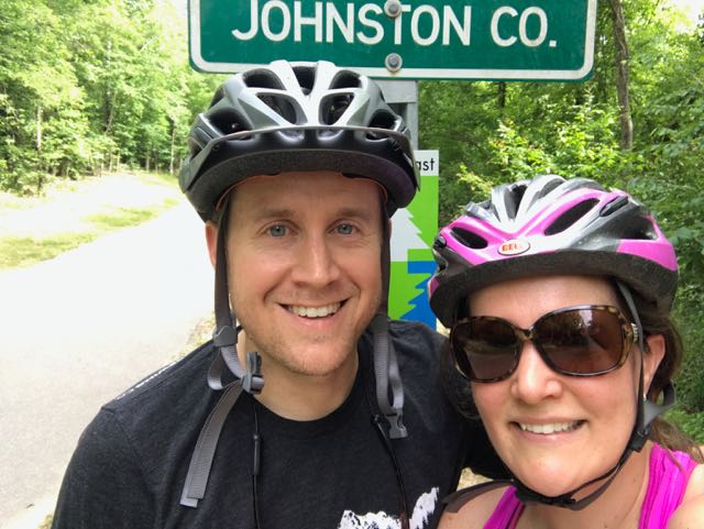 Over Memorial Day weekend, my sweet in-laws watched the girls while Bill and I enjoyed a biking and beers day date. Wanting to explore a new (to us) portion of the greenway, we headed to the southern portion of the Neuse River Trail near the Wake/Johnston County border. In all, we biked 15-miles (out and back total), crossed two counties, followed a river, detoured around an unpassable bridge, passed a historic bridge, and saw some art before grabbing beers at Deep River Brewing – a pretty awesome afternoon!
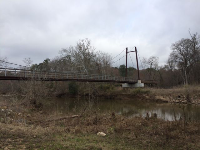
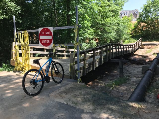 Continuing on Clayton’s greenway (technically called Clayton River Walk on the Neuse), we arrived at the Riverwood neighborhood where we found the bridge damaged and unpassable. At the time we didn’t see signage showing a detour route so I jumped onto the Town of Clayton website. I learned that last fall’s Hurricane Matthew caused near record flood levels for the Neuse River and took out the bridge. The town’s website shows a
 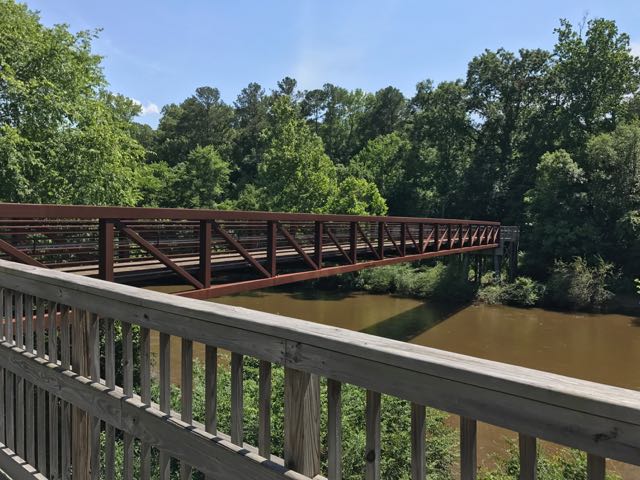 After biking the hilly detour through the neighborhood we met up with the trail and continued south. The trail remains mostly flat and sunny with clear views of the river. We passed a large sandy access spot for the river, complete with benches. Then, we biked under Covered Bridge Rd with a history that dates back to 1863 when it was first commissioned as a ferry replacement. Historians believe the bridge was covered around 1883 and most recently replaced in its current concrete form in 1980.
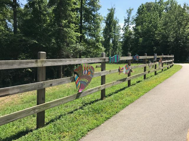 After safely maneuvering through the sand and dirt construction zone, the 1.25-mile paved trail leads away from the river towards North O’Neil St. Along the way we passed beautiful community art displays of hand-painted wooden fish. Then we biked by a public art garden featuring butterfly-shaped bike racks, benches, totem pole and a little free library. The trail also showcases information signs about forest animals in the area before passing a developing neighborhood and ending at a large greenway access parking lot at


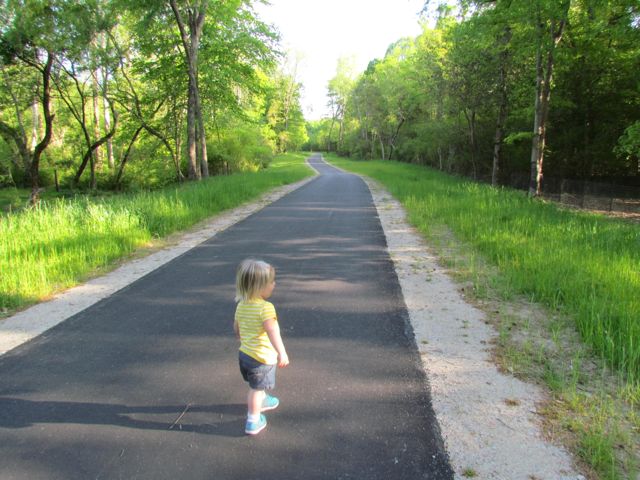
 Towards the end of March we headed out to Neuse River Trail to explore the area surrounding Horseshoe Farm Nature Preserve, in anticipation of the
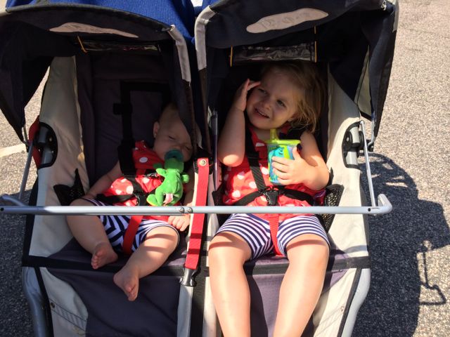
 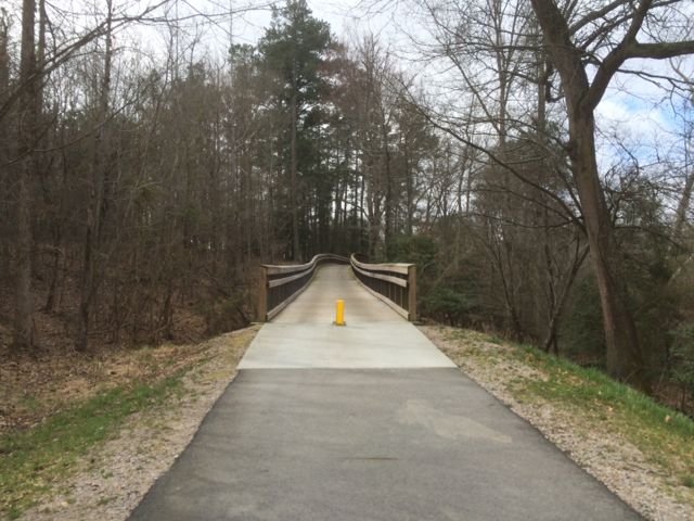 This portion of the greenway continues to be relatively flat and shady. The areas surrounding the greenway are mostly dense forest to one side with the river to the other. We saw quite a few fisherman on both banks of the river with most of them concentrated in spots near US-401. Our run back to the car was much faster than the run out so we took advantage of happy little faces and retrieved a balance bike, scooter and helmets from the car and let the girls ride on the greenway. It wasn’t a busy morning on the trail, so the girls had a carefree time riding. Ashley biked south on the greenway all the way to milepost 9 where we crossed over a small bridge with a shallow creek below, perfect for spotting turtles. Claire enjoyed her first scooter ride where we pushed her from behind as she cruised along. They were troopers for such a long morning run of about 4 miles and then some bike time.


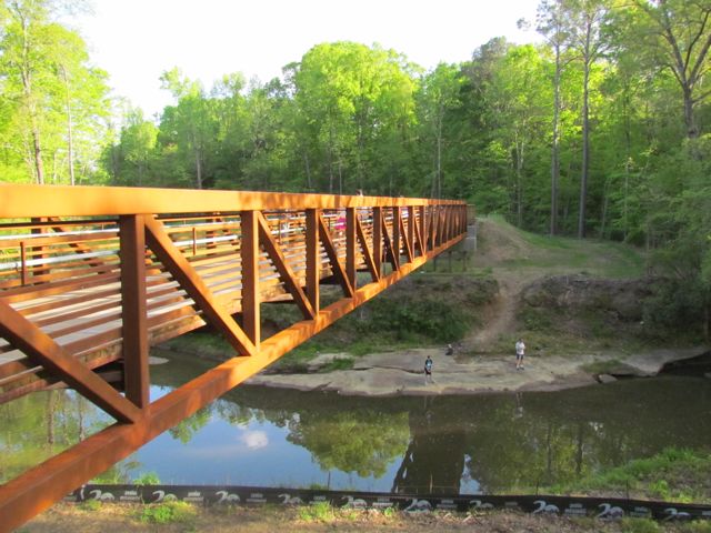
 This fall we wanted to further explore Falls Lake so we set off with intentions to start closer to the dam and finish
 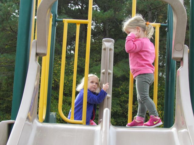 The playground is designed for ages 5-12 and includes a few slides, climbing structures, tic-tac-toe, and several nearby picnic tables and benches. It’s a small playground, but the perfect size for a park with so many more activities. After taking in the views from the top of the dam, we walked down the unpaved trail adjacent to the playground where we got up close and personal with the beginning of the Neuse River. The girls enjoyed throwing rocks in the water while we saw fishermen and birds. There’s also a small parking lot, canoe launch, restrooms, information map, picnic tables, and access to the start of the Neuse River Trail greenway at the bottom of the dam.


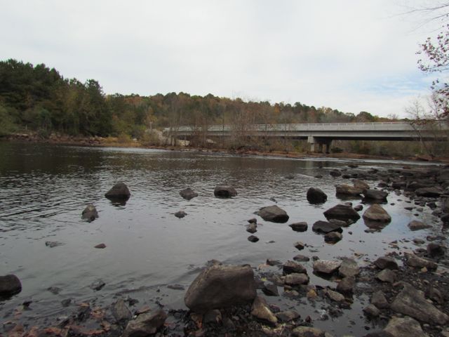
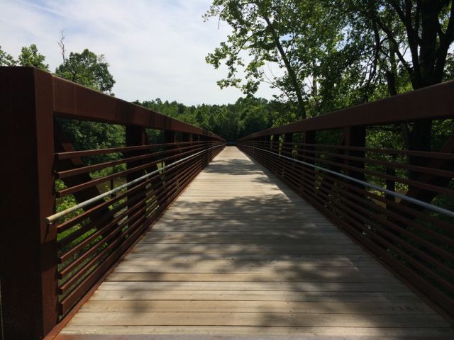 We turned right heading south onto the Neuse River Trail and we shortly came upon the 11.5 mile marker and a large bridge that crossed the Neuse River. It had rained a lot in Raleigh over the weeks leading up to Memorial Day weekend, so the water levels were still pretty high and the river was flowing fast, which made for great toddler conversations.
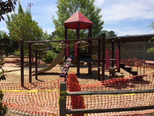 The run home felt much shorter with several less stops than the way out. When we arrived back into Buffaloe Road Park, we followed signs to the athletic park instead of to the aquatic center. With this option, we ran along the northern perimeter of the park and got to witness the massiveness of the baseball fields. When we got back to our car, we were pooped! Ashley made a final pit stop in the restroom facilities near the closed playground and then we headed out for some well deserved lunch. I look forward to taking the girls back to the park later this summer when the playground surface is finished.


 After devouring some delicious pizza from my favorite local food truck,


