
 With Fourth of July a week away, it’s only apropos that I recount last month’s trip to the historic Middle Peninsula area of Virginia. Not only is it full of small port towns vital to early trade, it’s also the home of the “most important map in American history.” But, before I get ahead of myself, I have to provide some background on why and how we visit that area.
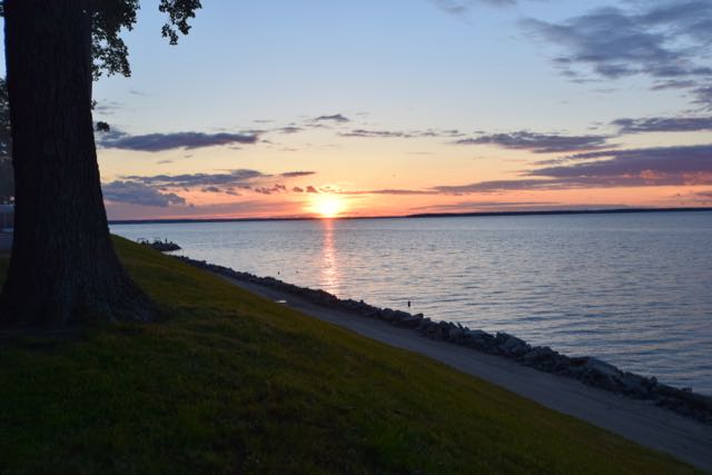
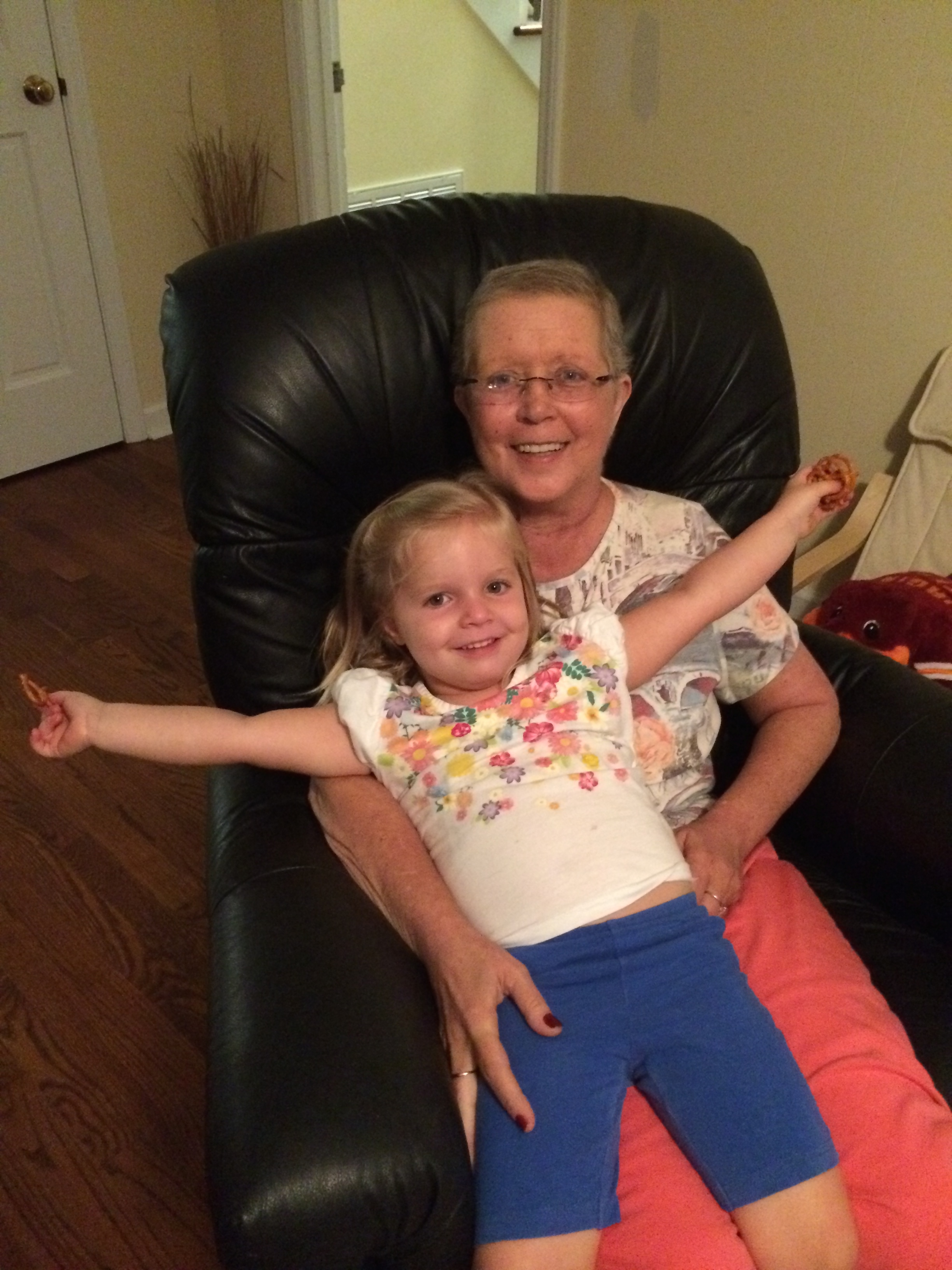
About five years ago my mom visited my uncle’s permanent waterfront trailer at the Grey’s Point RV resort in Topping, Va. Grey’s Point is the last stop before crossing the mammoth bridge over the Rappahannock River into Irvington and Kilmarnock. The river is extremely wide at this point and is close to where it joins with the Chesapeake Bay. Grey’s Point sits high above the river bank, offering amazing sunsets and views of the river. Needless to say, my mom fell in love with the area and idea of having a low maintenance waterfront retreat. So, she bought a permanent waterview trailer where my siblings and our kids made fun memories with her before she passed away. Since her passing, we still try to visit a few times each year, especially during the summer. The kids fell in love with the pool and golf cart rides, while Bill and I fell in love with the views and slower pace of life.
Town of Urbanna, Va
When we visited the area back in May, we took a day trip to the nearby town of Urbanna. Urbanna is a historic colonial port town with unique shops, art galleries, and marinas. In 1680, the House of Burgesses ordered Urbanna to be set-up as a port town for trading. The town was officially named Urbanna in 1705, meaning the “City of Anne” after England’s Queen Anne. We parked near the intersection of Cross St and Virginia St and walked around town checking out the shops. I purchased a handmade mortar and pestle at If It’s Wood & More before we walked to Urbanna’s Museum & Visitor Center.
James Mill Scottish Factor Store
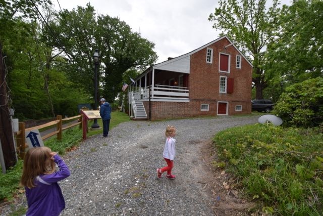
Urbanna’s Museum & Visitor Center, officially called the James Mill Scottish Factor Store, was built in 1766 and once served as a tobacco warehouse. Tobacco planters exchanged tobacco at the store for cash or credit towards imported European goods. They stored the tobacco in large barrels called hogsheads that weighed about 1,000 pounds. When the English ships arrived, men gently rolled the full hogsheads down the adjacent road to the port below. Imagine standing at the bottom of the road making sure the hogsheads didn’t fall into the water? Uh, no thank you!
Starting in the 1960s a preservation group renovated the James Mill Scottish Factor Store. Then, in 1997, the Town of Urbanna bought and refurbished the building. The museum exhibits highlight the town’s historic tobacco ties, its booming oyster industry, and the 1755 John Mitchell Map. The museum is small and not very kid-friendly, but the girls enjoyed touching the oyster shells, standing next to life-size colonial men cutouts and admiring the port and warehouse diorama. The diorama truly captured the tobacco trading operation!
1755 John Mitchell Map
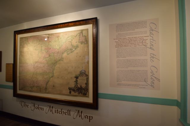 The friendly museum worker shared her personal upbringing in Urbanna and the importance of the 1755 John Mitchell Map. John Mitchell was born in 1711 in Lancaster County, and went on to study medicine in Scotland. He practiced medicine in the Urbanna area for a few years before relocating to London. According to The Unlikely Story of the Map that Helped Create our Nation, the Earl of Halifax commissioned Mitchell to create a map of the British and French North American territories. Mitchell finished the map in 1755 (after the start of the French and Indian war), thoroughly detailing territories, colonies, forts, geography, distances, and towns. Though the map had a slightly British view, it became known as the “most important map in American history” after the American Revolution ended. During the 1783 Treaty of Paris, negotiators used the map to determine boundaries between Canada and the United States.
The Town of Urbanna purchased this first edition map in 1979 for $7,500 not fully realizing its importance. Later valued at more than $500,000, the town properly restored and safeguarded this national treasure. Preserved behind glass, visitors can closely inspect the map details or take in all 24 sq-ft from a nearby bench.
Lunch on the Water
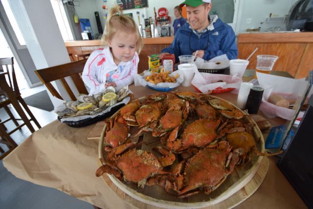 We worked up an appetite after taking in so much history, so we drove a few minutes away for fresh seafood on the water at Shores & Roark Seafood. Bill enjoyed freshly caught fish tacos, while the girls and I shared a dozen steamed local crabs and oysters. The food tasted fabulous and the restaurant’s waterfront atmosphere provided amazing views of the river. The restaurant is part seafood company, so you can watch your live catch before it reaches your plate!
I’m looking forward to spending my first Fourth of July weekend in our Winnebago in such a historic area. The towns of Urbanna and Irvington organize annual parades and celebrations and Grey’s Point will be busy with fun activities, too.
Later down the road I’d love to visit the nearby National Historic Register colonial plantations of Ralph Wormeley’s Rosegill and Christoper Robinson’s Hewick, and attend the Urbanna Oyster Festival.
Thumbs up: breathtaking river views, small-town charm, area’s rich history, local seafood, beautiful places to stay
Thumbs down: nothing to report


 Today would’ve been my Aunt Pam’s 59th birthday. For as far back as I can remember, she lived in a large ranch house off a very long gravel road in Carbondale, KS, but she grew up 30 minutes from there in
 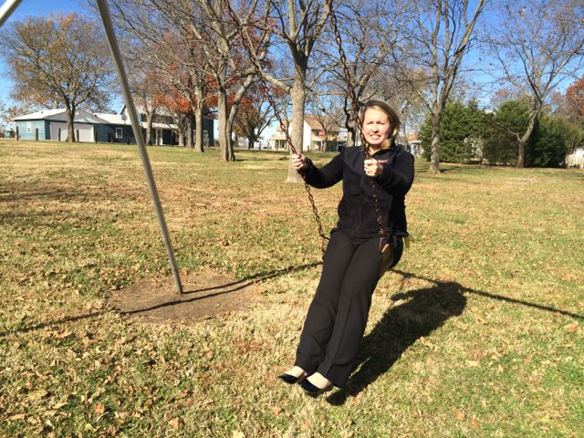 Despite Harveyville’s decrease in population over the years (my dad recalls a total population around 300 when he graduated high school in 1971), it was very comforting to explore a small town, especially one where my dad and aunt grew up in. Harveyville is all of 0.13 square miles, so it was hard to get lost. We drove to my dad and aunt’s childhood home, which is now home to the pastor who delivered my aunt’s funeral service. It’s a lovely two-story home with an enclosed front porch. My dad recalled the strangeness of having to visit the pastor at his home to discuss my aunt’s services, but I’m sure being in his childhood home again helped with the healing of losing his sister. While driving around Harveyville, I started to imagine a simpler life with simpler expectations, regular community/family gatherings, finishing high school with your same preschool friends, and working as a teenager in one of the local shops or farms.
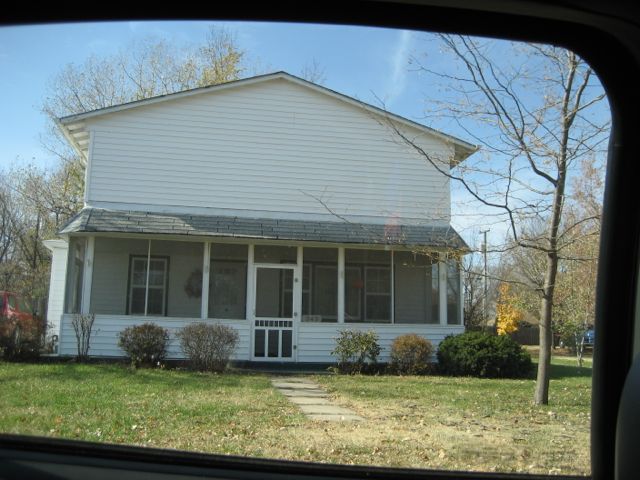 After seeing their childhood home, we passed the new church that was rebuilt after being flattened during the
  Just across from the park is Harveyville Grade School and Harveyville High School, where my dad was part of the last graduating class in 1971. It’s a beautiful brick building full of windows on the front with a large bell out front and a water tower in the grasslands behind the building. At a closer glimpse, I noticed dogs barking behind a fenced-in area attached to the high school. Being the curious type, I walked up the steps of the school and noticed the lobby was full of sewing materials and I heard voices coming from inside. I knocked on the front doors of the school and a sweet woman about my age greeted me at the door to tell me they were preparing for a weekend-long felting retreat. She gave me free reign to explore the school as she was super busy. Old classrooms were turned into shared guest rooms, bathrooms were updated to include showers, and the gorgeous gym contained all the tables, chairs and supplies needed for a felting retreat. The Harveyville Schools are now home to the


