Falls Lake: Rolling View Campground

Throughout my early childhood, my family spent several summers renting a weekly beach house in Cape Hatteras. We always went in mid-September because the pricing was just right for a large house that could fit grandparents, aunts, uncles and my family of five. Once we got busy with after school sports in middle school, our family stopped making the annual trip. So, when our family decided to head back to Cape Hatteras last summer after a 25-year hiatus, only a mandatory evacuation could stop us – and it did!

Hatteras Evacuation

Due to an unfortunate accident on Bonner Bridge, Dare County prompted a mandatory evacuation of Cape Hatteras island two days before our vacation was set to start. With family coming from CA, TN, and VA, my sister acted fast and found us an amazing last-minute house in Emerald Isle, starting a day later.

With the extra day’s wait and our kitchen in full demolition mode, we did what any sane family would do. We loaded up the Winnie for a nearby overnight trip to Falls Lake Rolling View Campground.
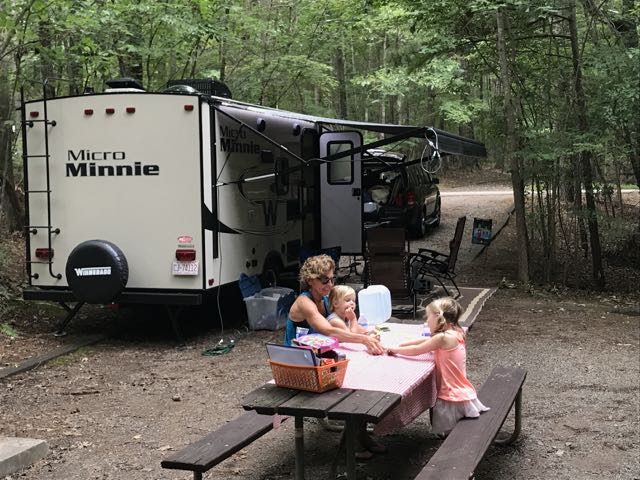
IMG_9853Falls Lake Rolling View Campground

Falls Lake Rolling View Campground is located at 4201 Baptist Rd, just north of 98/west of 50. Since my aunt arrived from CA the day before, she also ventured with us, excited to be the first overnight guest. We rented a back-up spot in Loop A, close to the bathrooms. Falls Lake does not have sewer hook-ups (as is the case of most state parks) so we used the surprisingly comfortable restrooms/showers. Overall, our shady camping spot was perfect for a late July Saturday.

Being only about 30 minutes from the house we arrived mid-morning to a quiet campground and swimming area. We enjoyed cooling off in the roped-off swimming area with the $5 tubes we purchased earlier in the season. Between splashing and exploring the nearby playground, the girls also played in the sandy beach. Overnight guests have access to the beach area with their rental fees. You can also just pay a “per car” fee to use the beach daily.
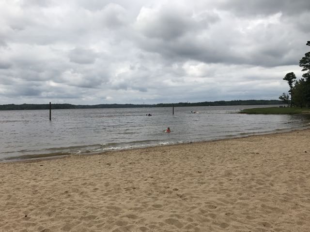
IMG_9858After a few hours at the beach, we headed back to the campsite for quick showers at the bath house. Then, we hiked a short trail through Loop B to access another playground. The girls spent at least an hour swinging on the tire swing – a big novelty to them. 

After the playground we explored the marina near the park entrance. The marina features boat launch facilities, a convenience store, snack bar, and water recreation rentals (kayaks and paddleboards). Then, we cooked hotdogs and sausages on the campfire and made mac n cheese on the stove. Though it sprinkled a bit, we quickly roasted some s’mores and had a nature scavenger hunt.

Early the next morning, we cooked a modest breakfast before packing up the trailer. We stopped at the dump house on the way out of the park, which was relatively quick and convenient. Then, thirty minutes later we arrived back at home with plenty of time to re-pack the car for Emerald Isle. Having Falls Lake within thirty minutes makes for fun family outings of all types – day, overnight, or multi-days!

Additional Resources

Thumbs up: peaceful campsite, fun beach area, clean bath house, playgrounds with tire swings, water recreation rentals at the marina, ease and convenience of renting, close proximity for last-minute trips

Thumbs down: nothing to report

Sweetgum Swamp Trail in Nags Head, NC

IMG_5624Believe it or not, Nags Head has hills and I’m not talking about the sand dunes near the beach or at Jockey’s Ridge State Park.  During our annual end-of-summer Nags Head beach trip we decided to break up our beach days with a hike in the Nags Head Woods Preserve.  We also make an annual trip to the Nags Head Woods Preserve every May for the Yuengling 5k race, but we’ve never had time to explore the woods other than the gravel race trail we run.  I should’ve remembered how hilly that race can be and then better prepared myself (and family), but what fun would planning be?!
Nags Head Woods Preserve is located at 701 West Ocean Acres Dr on the sound side of US-158.  We like to use the local dive bar, Mama Kwans, as a reference point for where to turn from the main road when heading to the woods area.  And, turning by Mama Kwans makes us reflect on crazy silly late-night bar stories that involve Bill ordering a bottle of Veuve Clicquot because, “I’m getting a raise next week!”  But, I digress!

Follow West Ocean Acres Dr through a small residential area until you arrive on a gravel path, which you’ll continue on for 1/4 mile.  You’ll then see a sign for the Nature Conservancy and a small parking lot for the woods.  The Nature Conservancy owns and operates the Nags Head Woods Preserve, which is over 1100 acres of wetlands, dunes, ponds and marshes.  According to their website, “Working with the towns and other partners, The Nature Conservancy has succeeded in protecting this fragile ecosystem, overseeing both terrestrial and marine research and monitoring programs and providing trails for visitors to enjoy.”

After unloading in the parking lot, we walked up the boardwalk and the little ones scoped out the murky ponds while we decided on a trail to hike.  Being overly optimistic we decided on Trail #2 – the 2.25 mile Sweetgum Swamp Trail; with three little people (and only one carrier) and five big people we figured we could handle the trail.

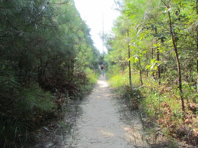
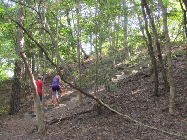
IMG_5631So, we set off on the trail and before you knew it we were in a dense forest just minutes from the beach.  The unpaved trail is covered in pine needles, but well marked; Ashley was even able to follow the trail markings to stay on the path.  After heading straight for awhile, we climbed steps up a steep hill to what felt like the ridge of a mountain – the trees were shorter and all of a sudden we were walking down a sandy hill.  I quickly learned that kids love sand unless they have to hike through it.  After several moments of juggling kids on shoulders and in carriers and distractions of the colorful flowers, berries, and butterflies, the sandy trail base was replaced with the preferred compact pine needle trail.  We took a right to stay onto the looped portion of the trail.  Along the way we passed by several swamps (complete with croaking frogs), more steep hills with steps, spooky Charleston-like trees, and several different plant communities.  Halfway around the trail loop is access to Trail #3 (Blueberry Ridge), but we decided to save that trail for another time.

The second half of our hike consisted of more kid juggling on shoulders and in the carrier just so we could make it back to the parking lot in one piece.  There was a lot of kiddo melting down, but in their defense it was a hot morning and we had walked almost 2 miles by this point.  When we got back to the sandy portion of the trail (that was downhill on the way in), all I could do was laugh because I knew the kiddo melting down was headed to a new level as they had to climb the steep sandy hill.

But, we all survived and cheered enthusiastically when we saw the Visitor Center signs.  It really only took us about 1 1/4 hrs to complete this hike.  After getting very hot and sweaty from our hike we rushed over to the Bonzer Shack for a hearty lunch and much-deserved beers and milks!  Despite this hike being too strenuous for our girls, I look forward to coming back to explore other trails in the future – bring on the beach hikes!

Additional Resources:

Thumbs up: adventurous hike with lots of plant and pond life to see, contrasting landscape at beach, signage, well-maintained trail

Thumbs down: better suited for older children, hilly hike for toddlers

Optimist Park: Tutus & Picnics

img_5806
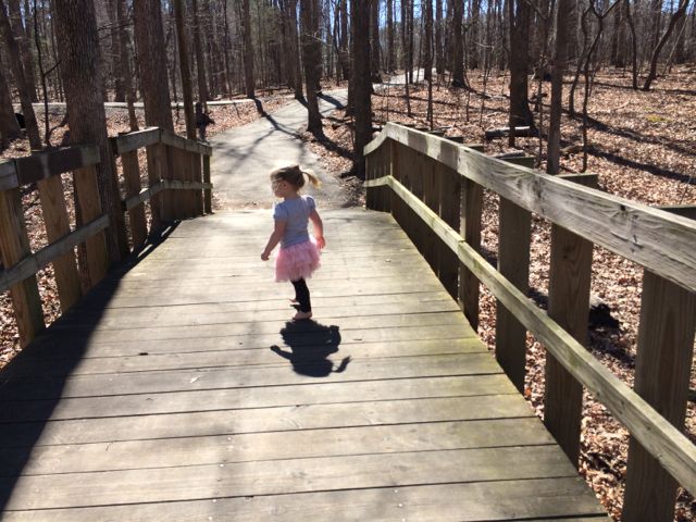
Stretching her ballerina toes after class

Awhile back a dear friend of mine and I signed our girls up for a preschool dance class at Optimist Park through the City of Raleigh.  It ended up being the perfect Monday morning activity, which led into extended play time and lunch at the playground.  It was the first activity (other than regular preschool) where the girls were on their own, so it was fun to have a buddy to learn some new skills with (we still talk about plies over here)!

Optimist Park is located in North Raleigh in a subdivision off Six Forks Rd at 5900 Whittier Dr.  It’s an older park with a community center, playground, seasonal and year-round pools, tennis courts, baseball fields, and greenway access for Mine Creek Trail, Snelling Branch Trail and Shelley Lake.

img_5782
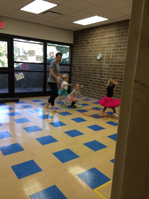
A glimpse into the dance class

Dance class was held in the community center in a room that did not have easy access for parents to view their kids “dancing”.  So, to sneak peeks we’d have to poke our heads in and try not to disturb their learning.  Once dance class ended we headed over to the playground for some more play time and a picnic.

Again, Optimist is an older park so the playground has a more classic look with brown and orange painted metal.  The playground area is covered in a sandy surface and has a large jungle gym for the 5-12 age group that our 3 year olds and even 15 month old enjoyed.  There are several slides, a tunnel, and a few climbing ladders.  In the same area are

the springy cars and 4-person teeter totter.  The playground sits adjacent to a creek that has a short fence, which no one really explored even the 15 month old, but do take caution.  Benches are scattered throughout and the picnic tables and swing set are nearby.  This area is pretty shady, even with the few leaves on the trees.  If you follow the paved trail, you’ll come to eight lighted tennis courts that are adjacent to the student parking lot at Sanderson High.

img_5793
From the dance floor to the sandbox

While Optimist Park might not be a destination spot, it sure made for a great post-dance class play time and picnic spot!

Years ago Ashley and I ran the Snelling Branch Trail from Optimist Park and I never posted about it! To get to the greenway access, you’ll want to start in the smaller parking lot off Northclift Dr that is behind the Sanderson High baseball field.  Follow the signs and run behind the baseball field and you’ll come to North Hills Dr, which you’ll cross over.  Continue a little further and you’ll come to the Shelley Lake Trail where you can turn left to go south and see Shelley Lake very quickly or turn right to go north and discover the Mine Creek Trails or northern end of Shelley Lake loop.  We turned right and then made another right onto Mine Creek Trail where we crossed over North Hills Dr again, went under a tunnel for Lynn Rd, and eventually turned around near the intersection of Longstreet and Bent Creek Dr.  There’s a flowing creek along the way and we even passed a random playground.  According to the City of Raleigh website there’s a current project to extend East Fork Mine Creek Trail to Honeycutt Park.  That’ll be a good reason to get back here soon for more current pictures!

Thumbs up: quiet/not crowded, great picnic spots, fun beginner dance class, convenience of having park features close in proximity, greenway access

Thumbs down: older facilities, lack of true dance studio for watching kiddos

Photos from the Greenway exploration in Feb 2012:

Williams Park

IMG_2957

Williams Park is a bustling playground in the center of North Raleigh adjacent to Lynn Road Elementary School.  It is located at 1525 Lynn Road and some of the photos are from when Ashley was much younger and some are from this Spring.  As you can see, having a friend to climb through tunnels with, chase through the soccer field, and swing with is the best way to spend an early Spring afternoon!
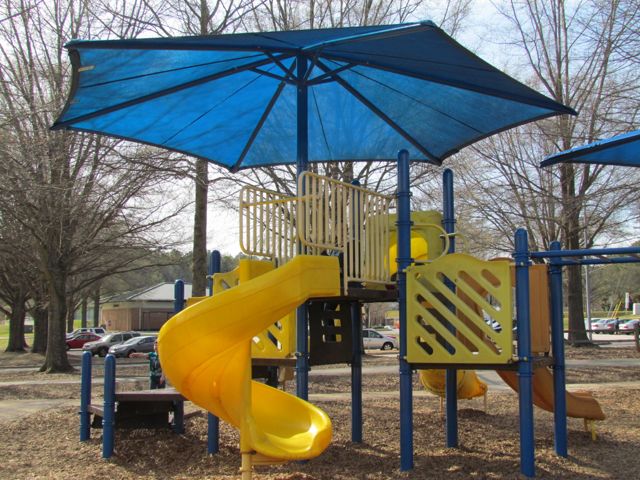
In addition to the large playground area (complete with shady canopies), Williams Park has a large open field with soccer goals surrounded by a short walking path, tot swings, sand volleyball courts, youth swings, tennis courts, a large shelter area, and some shaded sitting areas.  The playground surface is made of wood chips and sand.  The playground areas are a series of small climbing structures with slides that are connected by monkey bars.  For younger ones, that means lots of repetitive trips down the same slides or that they’ll need your help getting to the other play areas.  Since Ashley was just beginning to climb ladders at this time, she needed my help getting up to the higher slides too.

If you take a walk along the trail at the park, you’ll find a small plaque memorializing the park to Peter P. Williams Jr.  According to a News & Observer article, his father donated the land for the park in honor of his son.  I always enjoy when I can find some tidbits on the history of a park!

Thumbs up: great shade, close parent-sitting areas throughout the playground

Thumbs down: I’ve been here in the past and seen where drainage can be an issue