
 Over Memorial Day weekend, my sweet in-laws watched the girls while Bill and I enjoyed a biking and beers day date. Wanting to explore a new (to us) portion of the greenway, we headed to the southern portion of the Neuse River Trail near the Wake/Johnston County border. In all, we biked 15-miles (out and back total), crossed two counties, followed a river, detoured around an unpassable bridge, passed a historic bridge, and saw some art before grabbing beers at Deep River Brewing – a pretty awesome afternoon!
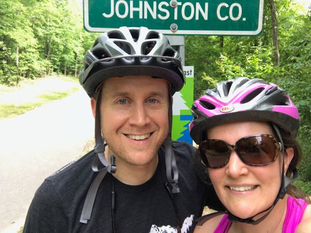
We parked in the greenway access parking lot at 6008 Mial Plantation Rd and turned left heading south toward Johnston County. We immediately crossed under Mial Plantation Rd bridge and passed the MP 26.25 sign. The trail is mostly flat with beautiful views of the rural fields separated by white split-rail fence. Shortly after, we biked past the Wake/Johnston Co line at MP 27.5, creating a fun selfie spot. The Town of Clayton maintains the greenway past the Wake County line with a portion of it affiliated with the East Coast Greenway.
Clayton River Walk on the Neuse
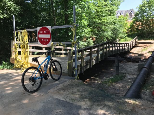 Continuing on Clayton’s greenway (technically called Clayton River Walk on the Neuse), we arrived at the Riverwood neighborhood where we found the bridge damaged and unpassable. At the time we didn’t see signage showing a detour route so I jumped onto the Town of Clayton website. I learned that last fall’s Hurricane Matthew caused near record flood levels for the Neuse River and took out the bridge. The town’s website shows a detour route through the Riverwood neighborhood that adds an extra five minutes via biking. The Town of Clayton is currently working with FEMA to replace the bridge, and there is no estimated completion timeframe.
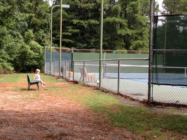
 After biking the hilly detour through the neighborhood we met up with the trail and continued south. The trail remains mostly flat and sunny with clear views of the river. We passed a large sandy access spot for the river, complete with benches. Then, we biked under Covered Bridge Rd with a history that dates back to 1863 when it was first commissioned as a ferry replacement. Historians believe the bridge was covered around 1883 and most recently replaced in its current concrete form in 1980.
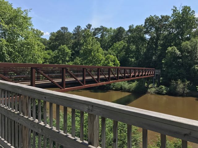
Shortly after passing Covered Bridge Rd, we passed MP 31 and crossed a large pedestrian bridge over the Neuse River. We enjoyed seeing so many benches and picnic tables donated by the Rotary Club of Clayton. About 1/2 mile later, we made a sharp right turn through a construction zone to stay on Clayton’s greenway, officially called Sam’s Branch Greenway at this point.
Sam’s Branch Greenway
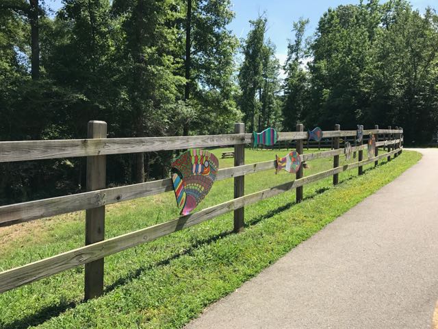 After safely maneuvering through the sand and dirt construction zone, the 1.25-mile paved trail leads away from the river towards North O’Neil St. Along the way we passed beautiful community art displays of hand-painted wooden fish. Then we biked by a public art garden featuring butterfly-shaped bike racks, benches, totem pole and a little free library. The trail also showcases information signs about forest animals in the area before passing a developing neighborhood and ending at a large greenway access parking lot at 1358 N O’Neil St.
Even though N O’Neil St is one of the main arteries leading to downtown Clayton (and Deep River Brewing) we aren’t adventurous enough to bike on main roads yet. So, we turned around and biked the 7.5 mile return trip to Mial Plantation Rd. We noticed better detour signage around the damaged bridge on our way home.
Despite the detour and construction we passed, it’s pretty amazing you can bike nearly 33 miles one-way from Falls Lake Dam to Sam’s Branch Greenway trailhead. With greenway connections to the Town of Knightdale (via Mingo Creek Trail) and future connections to the Town of Wake Forest greenways, people all over the area have so much access to outdoor adventures.
Helpful References
- Town of Clayton Greenways
- Riverwood neighborhood detour
- Neuse River Trail map
Milepost Points of Reference
- Falls Lake Dam – MP 0.0
- Mial Plantation Rd greenway parking – MP 26.25
- Wake/Johnston County line – MP 27.5
- Covered Bridge Rd & Clayton River Walk on the Neuse trailhead – MP 31
- Sam’s Branch Greenway trailhead – MP 32.5
Thumbs up: donated benches and picnic tables sprinkled along the way, public art displays, scenic views along river, greenway access points, jurisdictional connections
Thumbs down: detour signage coming from the north, construction zone near intersection of Clayton River Walk on the Neuse and Sam’s Branch Greenway


 In May, we travelled to Nags Head for our annual trip with friends (and family this year, too) to run the Nags Head Preserve Yuengling 5k race. This year the race weekend coincided with the grand opening of Dowdy Park, located at the intersection of
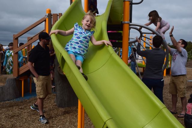
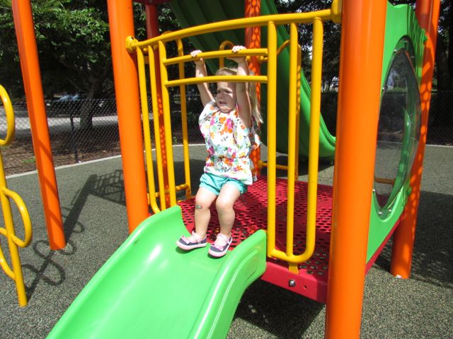
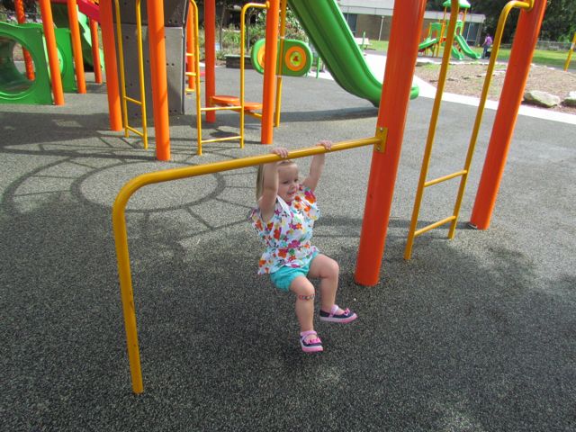
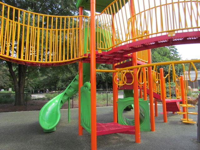
 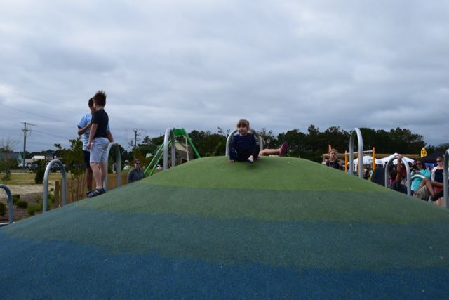 Dowdy Park features several play areas where kids can jump, run, swing, climb and slide until their hearts are content! The older kid playground has wide wheelchair-accessible ramps to musical and periscope play items. The ramp connects to stairs for climbing higher along a net bridge or to the ground via a rock wall. The other side of the net bridge features challenging ladders, a climbing tree stump and a fast, twisty slide. A colorful climbing hill with curved bars, musical instruments, balance beams, surfboards, bench swing, and merry-go-round are also located nearby. With the large festival and park attendance, it was overwhelming to keep track of multiple kids bouncing between so many activities.
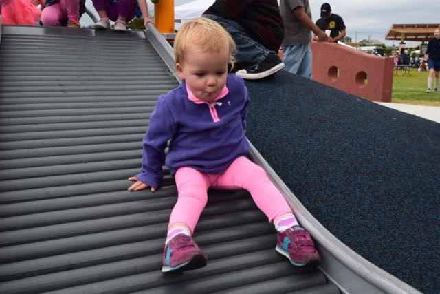 The smaller kid playground features short steps up to ramps connected to a double slide. All the kids thoroughly enjoyed the nearby rolling slide. They loved making rattling noises as they slid down the bumpy slide. Across from the small kid playground is a wheelchair-accessible ride. It allows folks in wheelchairs to reverse their chair onto a ramp and swing. And, a playground near the beach wouldn’t be complete without a little sand – just follow the sea turtle flipper prints! Short pier pilings line the sandbox area, which has a large climbing sea turtle in the middle.
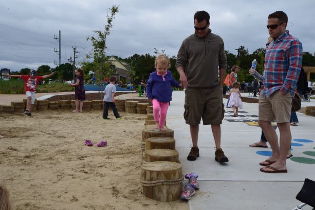 Also near this area are hopscotch and twister games, checkers tables, another climbing hill, picnic tables and benches. On this particular day vendors lined the perimeter of the open green space area. Park-goers filled the open green space area watching the performances under the covered pavilion. Throughout the park you’ll find pieces of art, such as the nautilus stamps shells, temporary art pole exhibit, and wooden paintings. Even though Dare County is mostly known for its beaches, I’ve always been impressed with the


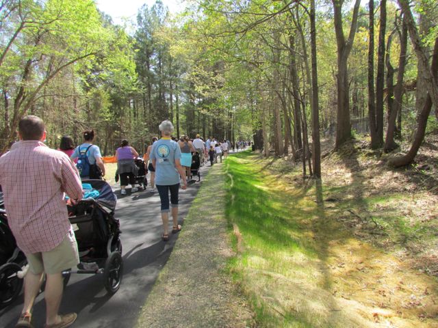
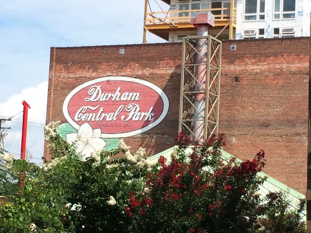 Part of my summer bucket list for the past few years included a trip to the Durham Farmers’ Market. Unfortunately, we never made time to visit Durham during the summer (unless it was for a Bulls game) until this summer. A few weeks ago we had an atypically quiet weekend at home so we decided to head out to the
 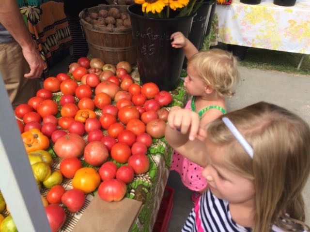 After exploring the main area, we walked across the street to the mini food truck rodeo area, where we bought some fresh tea and loco-pop popsicles. There were tons of vendors at the market selling clothing, unique handmade items, cold drinks, household items and more. After window shopping we walked across the bridge at the intersection of Foster and Hunt St where it dumped us out into the large lawn area, also part of Durham Central Park. We walked up the hill to scope out the skateboard park, which is also located across from a police station. After watching the skaters for awhile we headed back down the hill past the Leaf open-air performance area to the fabulous playground area, Mt. Merrill.
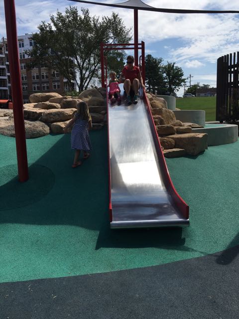 The playground features amphitheater-style rock climbing, two slides, climbing net, and some shade sails. I especially loved the cute bird cut-outs perched on top of the poles. There are also some benches sprinkled along the nearby sidewalk and some shady spots in front of the playground by the wooded area. We grabbed a few of those shady spots and had a quick picnic with our edamame and blackberries. The girls loved jumping back and forth between having a snack and playing on the playground. It was neat and unusual to see large boulders used as a climbing element in a playground.


 After our visit to


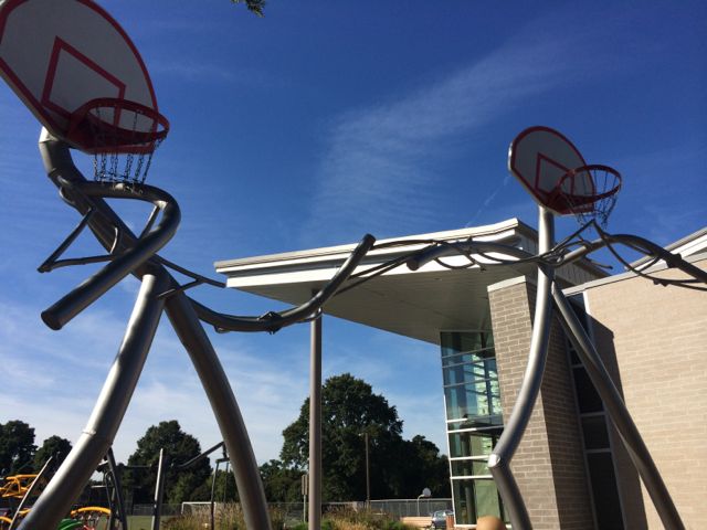
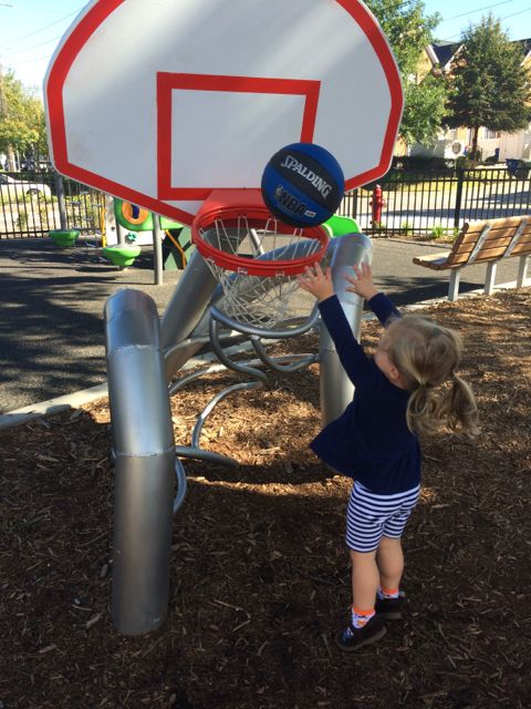 There’s also a separate smaller basketball art sculpture for the younger kids. The girls had such fun shooting baskets and watching the ball spiral down the ramp. If you forget your basketball or don’t have one, the friendly staff at the community center will let your borrow their ball.


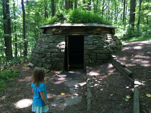 A few weeks ago, Bill planned a fun Sunday outing to explore the outdoor Cloud Chamber for the Trees & Sky exhibit (aka Hobbit House) at the
 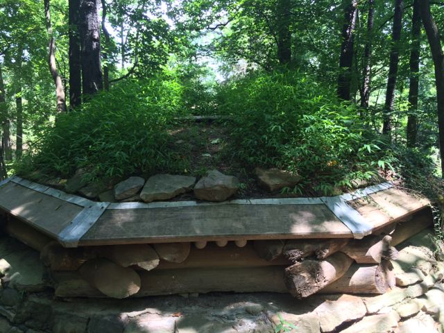 So, after a short walk through the wooded section we found the Cloud Chamber house, which looks like a replica of Bilbo Baggins’ house. It’s a short, circular house built into the side of the hill with large stones, some criss-crossed logs, and a green plant-based roof. It has a concrete floor and a heavy wooden door and the house’s neat feature is that it acts as a camera obscura. After entering the house, close the door and wait for your eyes to adjust to the darkness and you’ll see faint views of the sky as light is projected through an opening in the roof onto the floor of the house. Bill took Ashley into the house by themselves but didn’t stay long and then I went in by myself and witnessed puffs of sky inverted on the floor…it was neat to be able to look “down” onto the sky! And, I don’t think we’ll ever forget our trip to the Hobbit House with Ashley asking where are the “wobbits” every minute; poor girl was expecting to see some real life hobbits.
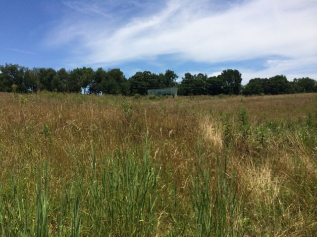 We then continued our walk along the loop trail where we also saw the Untitled exhibit by Ledelle Moe, which looked like a small concrete person concrete curled into a ball. After completing the loop trail we headed back to the gravel path and turned right. We headed downhill and came across the Whisper Bench exhibit, which was a fun interactive piece of art for Ashley. It’s two steel benches on opposite sides of the trail that are connected by an underground sound pipe. Ashley and Bill enjoyed talking back and forth to each other and I loved hearing the toddler giggles! After the Whisper Bench we continued on the very sunny gravel path that led us uphill and back to the paved trail near Lowe’s Pavilion. Finally, we stopped for a quick picnic lunch inside the pavilion before heading home for naps.


 About a month ago we attended the


