
 We were very fortunate to spend a few weekends in the NC mountains this summer. On our second mountain trip we met up with my in-laws and stayed in a beautiful mountain cabin near the Appalachian Ski Mountain between Boone and Blowing Rock. On a tip from friends, we headed out to the Blue Ridge Parkway and visited the Moses Cone Memorial Park & the Linn Cove Viaduct.
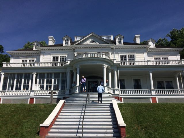
The Moses Cone Memorial Park is located along the Blue Ridge Parkway at MP 294, just a short drive from Blowing Rock. Moses Cone Memorial Park preserves the country estate of Moses Cone, who was a textile businessman and conservationist in the late 19th century. The park features 25 miles of hiking and bridle trails and Flat Top Manor, which is a 13,000 sq ft Colonial Style mansion. The bottom floor of the manor houses the Parkway Craft Center, which features handmade crafts by regional artists and a souvenir shop. We also had the pleasure of watching a pottery demonstration, which the craft center regularly schedules.
After the pottery demo and catching some breathtaking views outside the manor overlooking Bass Lake, we headed left of the house to walk the Figure 8 trail. This short 0.7 mile hike is great for families with small children or grandparents as it is well shaded and flat. Originally created by Moses Cone for his daily walks, this unpaved path meanders in a figure 8 shape through the property, making it a perfect walking trail to explore the variety of trees and flowers. Informational signs highlight the hickory, oak, maple, mountain laurel and black cherry trees along the trail. If you’re craving a longer or more strenuous hike, check out the map of trails around the park.
 After spending over an hour at the park, we turned left out of Moses Cone Memorial Park and headed 10 miles south to the Linn Cove Viaduct (MP 304). At an elevation of 4,100 ft, the Linn Cove Viaduct is a concrete bridge engineering marvel snaking around Grandfather Mountain; it is over 1,200 ft long and consists of 153 concrete sections weighing 50 tons each. Construction of the Linn Cove Viaduct was completed in 1983, cementing the final link of the Blue Ridge Parkway.
Coming from the north, we drove over the viaduct and then turned left into the Linn Cove Viaduct Visitor Center parking lot. We hiked the short 0.2 mile walk along the Tanawha Trail to the Linn Cove Viaduct observation deck. Along the short walk we saw several mountain springs and a variety of mountain flora. Walking underneath the viaduct gives you a sense of the bridge’s massiveness – each bridge segment spans several arm-lengths in width, and has enormous amounts of concrete supported by large piers. We then walked higher up the Tanawha trail to get an eye-level view of the viaduct and mountains in the distance. Though our trip to the viaduct was quick, everyone in our group (not just the engineers) really enjoyed and appreciated seeing such an engineering feat up close.
Additional Resources:
- Moses Cone Memorial Park Hiking Map
- Construction of the Linn Cove Viaduct
- Tanawha Trail and Hiking Map around Linn Cove Viaduct
Thumbs up: beautiful views from Moses Cone Park overlooking downtown Blowing Rock, access to close-up views of viaduct, infinite outside experiences along Blue Ridge Parkway
Thumbs down: manor house in desperate need of painting and renovations, bathroom facilities at Moses Cone Park


 On the way home from our mountain trip in West Jefferson we decided to take advantage of the close proximity to Mount Jefferson and pay a visit. Mount Jefferson State Natural Area is located just east of US 221 at
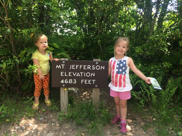
 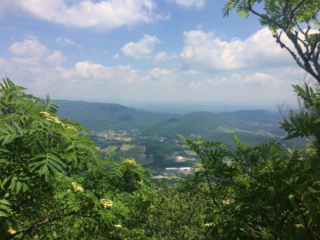 We walked through the picnic area and followed the short Summit Trail (0.3 miles) up the mountain. Although the website lists this trail as strenuous, we felt it was more on the moderate side. Due to our haste planning half of us wore flip flops, but could easily walk the gravel trail. The gravel path is wide and shady giving a cool mountain feel to the hike. Along the way we saw butterflies, rhododendrons, mountain laurel and red-starred flowers; though stop by the park office for official plant and animal checklists. We visited the bathrooms along the way, which were super convenient and an easy walk from the main path. We passed access to the Kids TRACK trail, which is part of the longer Rhododendron Trail (1.1 miles). Near the top we turned left to the Mount Jefferson summit, which has an elevation of 4683 feet. I climbed out a little further to catch the beautiful views of the Blue Ridge Mountains.


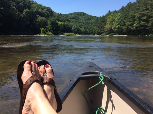 Last month good friends invited our family to their mountain cabin along the South Fork of the New River near West Jefferson, NC. Though this was my first time on this river in NC, being back on the New River reminded me of past trips whitewater rafting through
 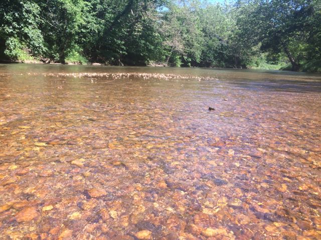 After an exhilarating drive down one-lane gravel roads in an old Chevy truck with a canoe in tow we arrived at a small put-in near the intersection of


