Over the years I’ve spent a bit of time biking (if you call it that) the Umstead Park trails between the NC Museum of Art and the Harrison Ave entrance. Having a new baby makes it a bit tough to get back into exercising, but when our hiking enthusiast friends from Hokie country, Greg and Randi, came to visit in May I made it a point to include Umstead Park in our weekend plans!
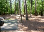
We were looking for a trail with some good views, shade, and moderate mileage, so we opted for Sal’s Branch Trail (only 2.75 miles). To get to Sal’s Branch Trail, turn into the park at 8801 Glenwood Avenue (Route 70) and continue on Umstead Parkway bearing right after the Visitor’s Center. We parked in the shady parking lot that is used for several of the hiking trails. We headed into the clearing above the parking lot in search of Sal’s Branch Trail. Despite walking around for awhile trying to find the beginning of the trail, we eventually found the trail head and began our adventure!
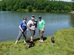
Shortly into our hike, we walked by Big Lake (no, I’m not making this name up). Feel free to fish or kayak, but don’t plan on any swimming as it’s not allowed.
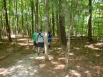
Once you pass Big Lake, your journey will take you on a moderately sloped and well cleared trail. There were quite a few roots to keep an eye on, but we were able to successfully hike the trail with a baby and BTs without tripping. This is a great trail to take with a baby or young children and dogs as you’ll pass the Visitor’s Center during your hike, which offers a great resting spot or quick bathroom stop (some of the nicest bathrooms I’ve seen). Besides the scenic views around Big Lake there’s not much else to see other than the typical NC vegetation along the trail. However, Sal’s Branch Trail is great for getting some exercise with the baby and doggies.


Here’s to our grandkids keeping fit and interesting, plus providing a benefit for the community by telling everyone about it. Way to go, Ashley, for having such a savvy mom!
Grandma Bev
Can someone post a PDF map or something of the actual trail? Thanks.
Here’s a link to the PDF map from the NC State Parks website – http://www.ncparks.gov/Visit/parks/wium/pics/parkmap.pdf. This is the only pdf I’m aware of. Google maps satellite view is somewhat helpful too.