
Like so many people at the end of last summer, we too, jumped on the total eclipse bandwagon and drove out to a remote part of NC to watch the phenomenon. It was a lot of firsts for our family – tailgating for science, visiting the Great Smoky Mountains, and exploring parts of NC west of Asheville. I’m not usually a follow-the-crowd type of gal, but my science lovin’ family wanted to be a part of it, so I was game too!
Timberlake Campground
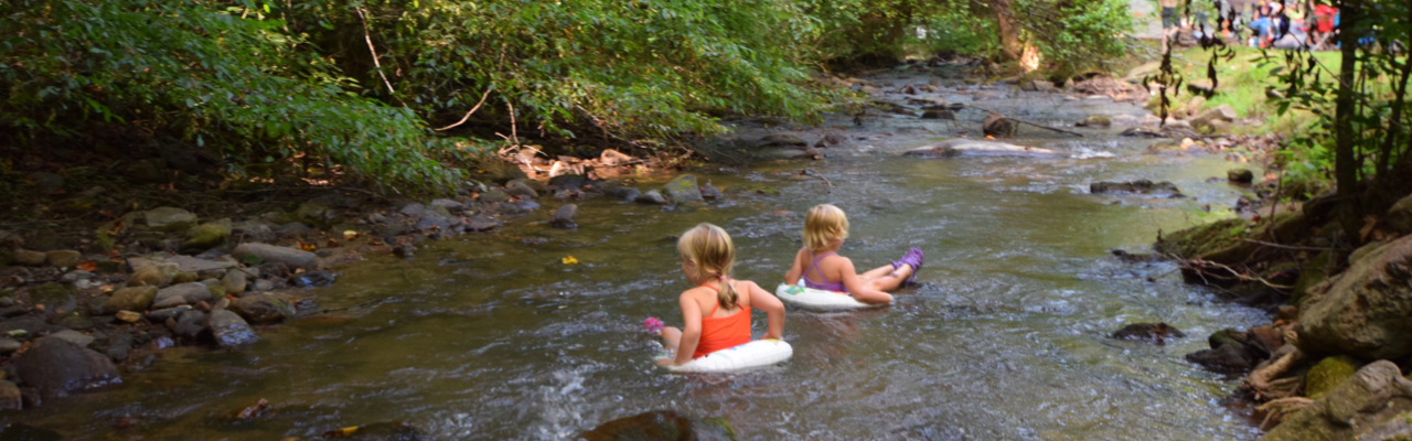
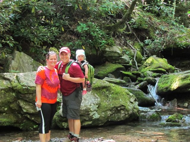
We wanted to stay within an easy drive to Andrews, NC (total eclipse central) and be close to the Smoky Mountains for hiking and exploring. So, we booked three nights at Timberlake Campground in Whittier, NC about 3 months ahead of time. Timberlake Campground is located at 3270 Conleys Creek Rd between Sylva and Bryson City. A sweet couple owns and lives on the campground property, which features 50 sites. We stayed in one of the water/electric sites across from the playground on the stream side. The site was perfect for us – lots of shade and next to a creek where the girls “tubed up” and down for hours! With my birthday being so close to our trip, I brought my new birthday ENO hammock, which was ah-mazing! We felt comfortable letting the girls ride their bikes up and around the loop near our campsite.
When the campground owners aren’t in the camp store they rely on the honest system for people to pay. They even gave us a tour of their farm and let us collect their blue chicken eggs. Bill enjoyed taking the girls fishing in the pond
Oconaluftee Museum
The first day we drove into Great Smoky National Park and visited the super popular Oconaluftee Visitor Center and Museum. The museum is located at the southern end of the Blue Ridge Parkway just past Cherokee, NC at 1194 Newfound Gap Rd.
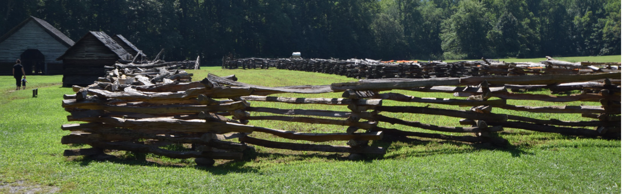
The Smoky Mountains get its name from the smoke-like mist coming off the mountains. The water vapor from the conifers mixes with the trees’ natural terpenes to give off the mist. It’s a beautiful site to see, especially early in the morning. We explored the indoor exhibits, which give some history and information about the history and early living conditions in the Smoky Mountains. Then, we spent most of our time exploring the outdoor exhibits. The outdoor exhibits give a glimpse into life on a mountain farm in the 19th century. They feature an old log cabin, spring house, barns, apple house and smoke house. The girls enjoyed walking through the different houses and pondering life before there was live streaming TV, air conditioning, and electricity.
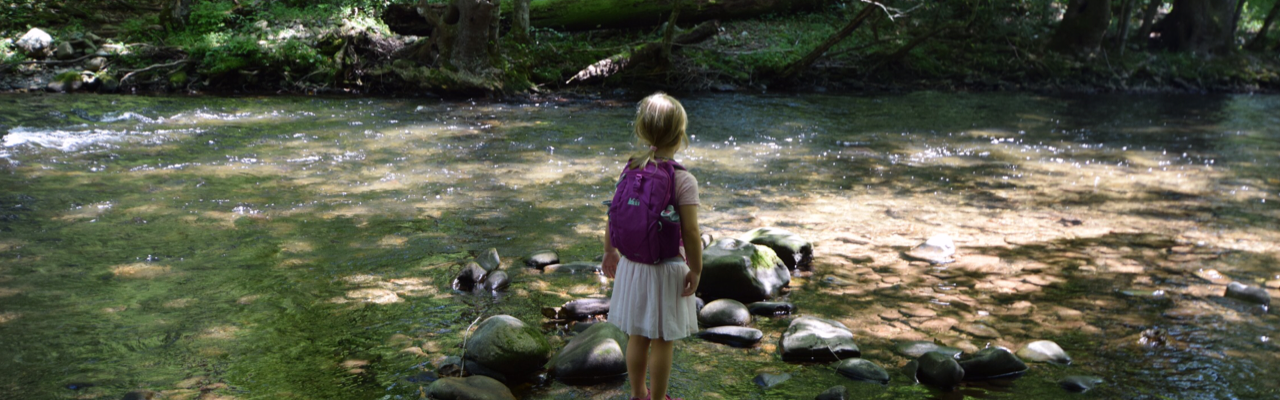
We also walked through the short walking trails down to the river, where we saw people fishing and tubing. The gentle river banks and shallow water allowed the girls to easily wade in and cool off.
Juney Whank Falls
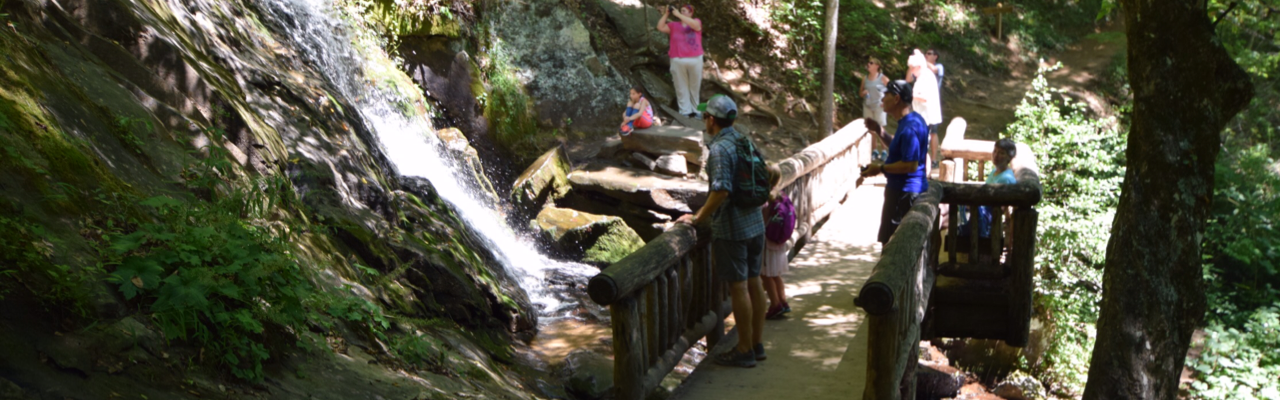
After leaving Oconaluftee Museum we headed south towards Bryson City to catch some waterfalls in a different section of the Smoky Mountains. As we drove to the park near Deep Creek we passed several tube rental companies. When we arrived at the park we were amazed to learn this park is a tubing mecca for the whole family! Deep Creek feeds from the Tuckasegee River, which runs through Bryson City. Had we realized the tubing option we would’ve planned better with bathing suits and towels. Though the park doesn’t offer tube rentals, there are plenty of places like Deep Creek Tube Center & Campground that rents tubes for $6/day and features camping and other outdoor activities.
Trying to divert our kids’ attention (and ours) away from tubing and back to hiking was no easy feat! But, we promised them a future trip, which we can’t wait to plan! The trailhead for Juney Whank Falls is located towards the back of the park. The trail was a short loop less than a mile long. When we arrived at the falls we were a little disappointed we couldn’t get into the water. We walked over a small footbridge to reach over and touch the falls as they cascaded down. The trail was a bit busy especially near the falls, so we quickly continued on the loop. We hiked the rest of the trail fairly easily except for the downhill ditch-like spot that we tip-toed over.
After the hike we longingly watched the tubers on repeat: float down the creek and walk back. Then, we drove back through Bryson City and stopped at Nantahala Brewery for some much deserved beers. As Bill ordered our beers, I took the girls to the nearby ice cream shop for their dessert. In all my time in NC, I’ve only ever heard Bryson City referred to as the place to go around Christmastime. Though it’d be cool to come back for the train ride, I’m dying to come back and take my kids tubing in summer!
Andrews, NC Total Solar Eclipse
The next day being the big total eclipse day, we awoke early and headed west on 74 through the Nantahala National Forest for Andrews, NC. The drive along 74 was beautiful – the road parallels the Nantahala River and is busting to the seams with outdoor adventure. We passed several ziplining/ropes courses, kayakers, white water rafters, paddleboarders and more. Again, I made a mental note of a family adventure place!
After driving about 1.5 hours we arrived mid-morning in Andrews, NC. For a very small town, this place was bustling on such a big day. We parked in a large farm field designated for the Total Eclipse Festival. Though the total eclipse wasn’t happening for several more hours, we lucked out with one of the last parking spots. Several folks set up their telescopes in the field in preparation – it was like tailgating with science nerds!
Then we walked to downtown Andrews to explore the pop-up art, food and live music. The girls made some cute candles and snacked on huge italian ices, while Bill and I enjoyed local BBQ. Around 1pm we grabbed some local beers and headed to the big open “eclipse watching” field. We set up our chairs and blankets while the girls ran around with several kids.
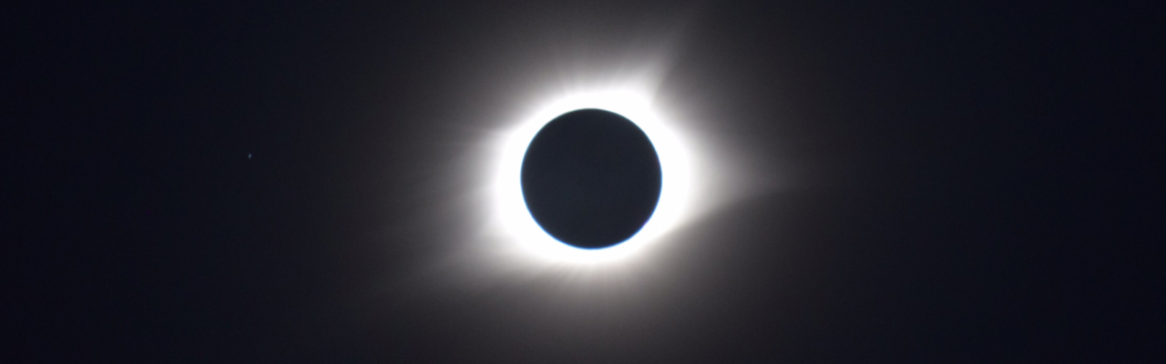
Around 1:00pm, the partial eclipse slowly began where we could see small chunks of the sun being eclipsed by the moon. Several people set up cameras with tripods and telescopes in the open field and hopped between taking shelter in the shade and grabbing a quick shot in the sky. Thanks to Bill we came prepared with a special solar filter for my camera. The girls loved wearing their special eclipse glasses and seeing the progression of the sun’s eclipse.
Around 2:30pm when the sun was just a small sliver, everyone descended into the middle of the field. The temperature dropped rapidly and the sky darkened. Suddenly all you could see was the sun’s corona creeping from behind the moon. It was quite a site to see, and it lasted more than 2 minutes! Then, just like that, everything went back to normal and the sun got bigger and bigger. We didn’t stick around to watch the sun’s complete return to normal so we could beat the traffic out of Andrews.
Watching the total solar eclipse was a really cool thing that I hope our kids remember. Planning the trip around the event motivated us to explore the very western parts of NC, for which I’m so thankful. I can’t wait to return to the Great Smoky Mountains and the Nantahala River for fun family outdoor water adventures!
Thumbs up: outdoor recreation activities, friendly campground owners, watching a total solar eclipse,
Thumbs down: busy and poor signage at Juney Whank Falls, lack of sufficient parking at Oconaluftee Museum
Juney Whank Falls


Oconaluftee Museum


Timberlake Campground


Total Solar Eclipse in Andrews, NC


 Oh, boy! It’s been a few weeks since I last posted about our trip to Grandfather Mountain: partly because I’ve been busy with other things, but mostly because I’m still wrapping my head around conquering the Profile Trail and Calloway Peak. Yes, I used the word “conquered” when describing this hike.
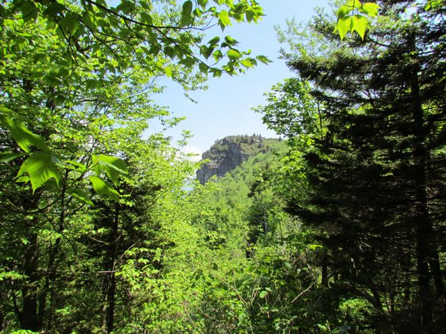 At 2.3 miles you reach Profile View, which offers a spectacular view of the Grandfather Profile. After you pass Profile View, the terrain gets much steeper and harder to ascend. At 2.7 miles you reach Shanty Spring, which is known for being the “last sure water” spot. We refilled here on the way back down the mountain as we did not come prepared with enough water. Shanty Spring is a great rest area offering a lot of shade and a cool drink before ascending the strenuous path of boulders, which lies next.
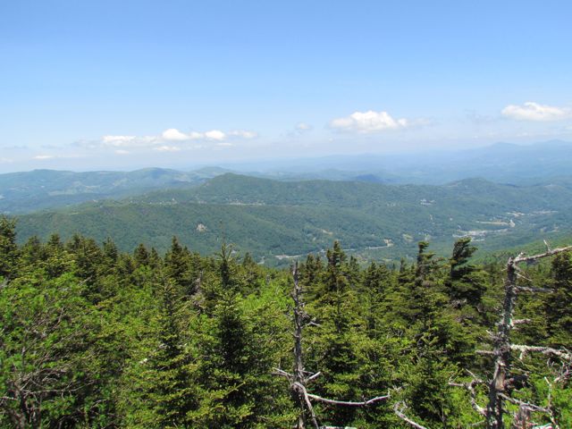 Continuing on, we headed to Calloway Peak, which includes climbing three different ladders suspended between large boulders. It was unlike anything we’d climbed before, but so were the views at the top: the sky was so blue, the mountains so green and you could see for miles.


