
 One sunny morning this winter we headed out to Cary for haircuts followed by a visit to the nearby Robert Godbold Park. I’m always impressed by the Town of Cary parks and despite being an older park it packed the fun.
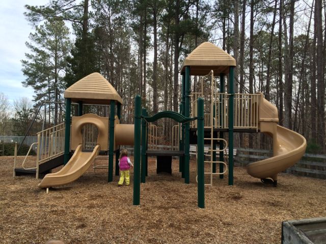
Robert Godbold Park is located at 2050 NW Maynard Rd between Harrison Ave and Chapel Hill Rd in Cary. It has several pockets of parking lots to choose from depending on what activity you’re looking for – basketball, tennis, playground/picnic, dog park, or skateboarding. We headed over to the playground, which has one large jungle gym over mulched surface. The jungle gym was safe enough for both ages (18months, almost 4yrs) to use – it has shorter steps to the smaller slides that are connected via a tunnel and more steps to the larger slide. The playground also has several climbing structures, a fireman pole, and monkey bars. Two tot swings, two regular swings, a small sandbox, and public restrooms are also located in or near the partially fenced-in playground area. Six tennis courts with picnic tables and a gazebo are within eyeshot of the playground too.
 After exhausting the playground we walked over to the basketball courts to run around some more. We had a quick snack on the nearby picnic tables and then ran through the woods a bit before walking to the adjacent skate park to check out all the construction. The skate park was temporarily closed for renovations, but according to the Sk8-Cary website it might have reopened by now.
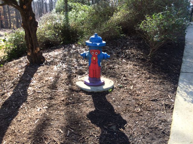
After the backhoes, diggers, and small motorized dump trucks lost their appeal we walked over to the dog park to visit with the pups. This off-leash dog park requires a membership and young kiddos aren’t allowed in so we watched from outside the gate. The girls also enjoyed the colorfully painted fire hydrants located outside the dog park.
If you’re accessing this park by foot, there’s a pedestrian crosswalk and sidewalks along both sides of NW Maynard Rd. This park is also located along the Black Creek Greenway with access to the Northwoods Greenway. In searching online for more information about the park’s namesake, Robert V. Godbold, I learned that he passed away in 2013, but seemed to have lived a full life – owned a general contracting company that built homes throughout the Triangle area, served on the Cary Town Council for 18 years, was a long-time church member, served on the Cary Volunteer Fire Dept for 20 years and was married for 58 years with a large family. It’s wonderful when the legacy of a community leader like Robert Godbold can live on through the happiness of a park. Read more about Robert Godbold’s obituary here.
More Resources
- Town of Cary’s Robert V. Godbold Park
- Town of Cary’s greenways
- Sk-8 Cary Skate Park
- Town of Cary’s dog park
Thumbs up: proximity of park’s amenities, safe pedestrian crossing over Maynard Rd
Thumbs down: nothing to report


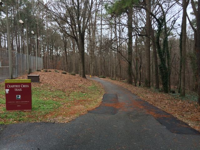 Have I mentioned that we spent a lot of time on the greenway this winter? So, here we are again, exploring a new (to us) portion of the Capital Area Greenway on the Crabtree Creek Trail from North Hills Park to Lassiter Mill Park (about 2.5 miles round trip). We started at the greenway entrance at North Hills Park (
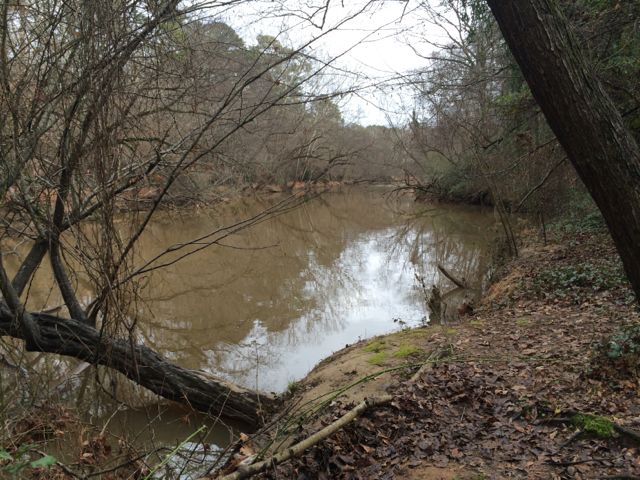 Then shortly after passing mile marker 11.5 the trail abruptly becomes unpaved and very narrow. In hindsight we should’ve taken one of the Alleghany Dr access paths, but there were no signs beforehand to indicate strollers or bikes wouldn’t be able to pass up ahead. So, we continued on the unpaved trail for a short time, all the while traversing over tree roots and narrowly squeezing between the creek and neighborhood roads above. When it seemed impossible for the double Bob to continue on, I ran up ahead to see how much further until Lassiter Mill Rd. At the end of the unpaved trail there is a set of stairs leading to Hertford Rd. Take a left onto Hertford Rd and follow it along behind Root Elementary School and then cut over to Lassiter Mill Rd. Turn left onto Lassiter Mill Rd where you’ll soon see Lassiter Mill on the left and Crabtree Creek Trail on the right.


 For the few days it’s been sunny and above 40 degrees this winter you could easily find us at a park or greenway soaking up the fresh air. Even though we’ve explored a lot of the southern end of the Neuse River Trail, we hadn’t run along the northern portion (aka Upper Neuse Greenway) until this winter. It’s a great location to get some exercise and then have a picnic along the shores of the dam.
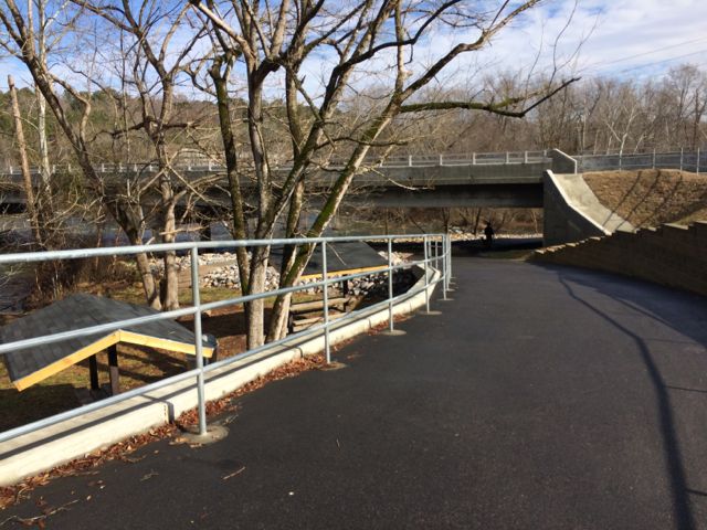
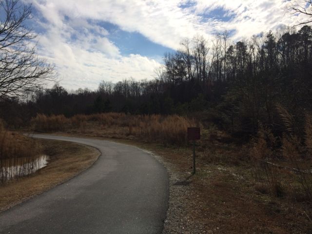 On this particular day the water level was elevated, so it was relaxing to hear the rushing water flow over a screaming 18-month old (yes, she screamed for about 95% of our run). Regardless, this trail is great in that it parallels the river offering great water views and glimpses of the native flora and fauna. We saw herons, beautiful budding red berry bushes (maybe winterberry shrubs) and tall native grasses. We passed under Falls of Neuse Rd and over small bridges. We also passed by the Bedford at Falls River neighborhood with greenway access to Falls River Ave and then turned around at the 1.5 mile mark, which is by the fork in the trail; keep left to stay on the greenway or stay straight for another access point to Falls River Ave and a greenway parking lot. The steady stream of foot traffic and proximity to made me feel secure about returning on my own and the relatively flat, wide trail might make it ideal for kiddo balance biking!


