
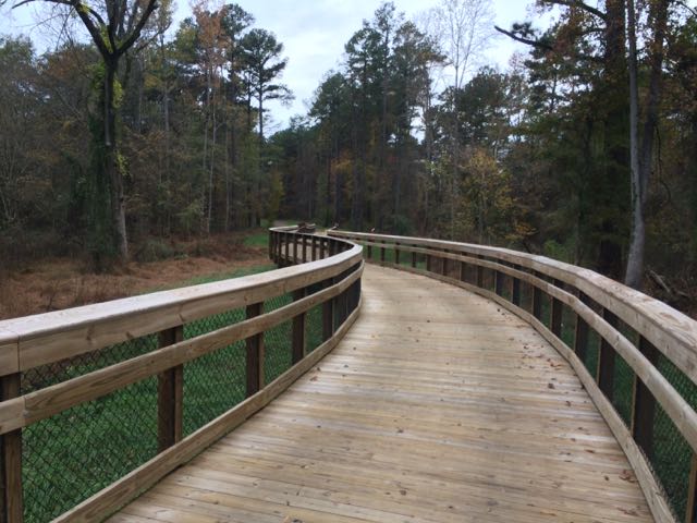
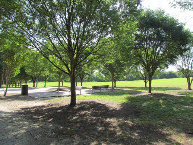
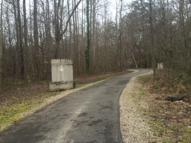
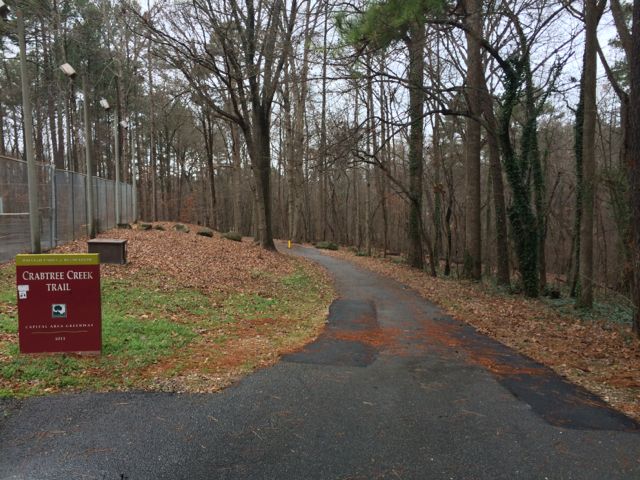
 Back in November we took advantage of my aunt visiting and went on a greenway biking day date! We biked along Crabtree Creek Trail from milepost 0 to 4.75, completing the final segment of this greenway that we had left to explore. We parked at Anderson Point Park and biked past the traffic circle near the park’s main entrance to the Crabtree Creek Trail greenway entrance and headed west (note: there are also signs for Neuse River Trail).
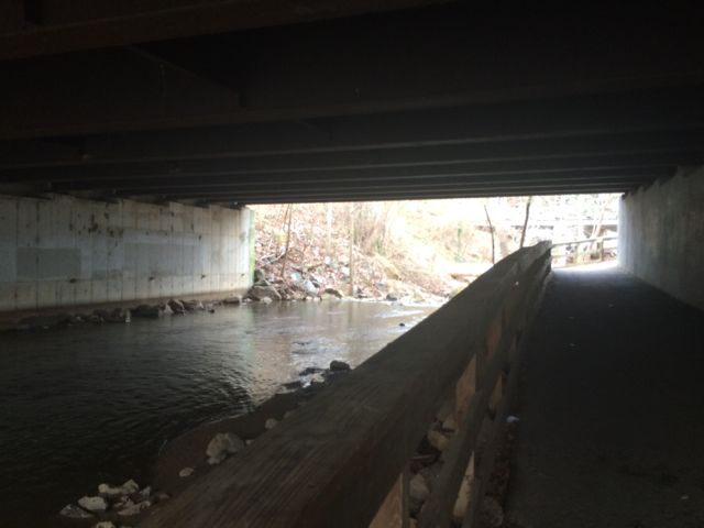
This portion of the greenway was pretty flat, but offered a lot to look at along the way. We biked almost 5 miles and crossed several bridges and went under several overpasses on this trail segment. From Anderson Point Park, we headed west where we biked under Rogers Ln and US-64, S New Hope Rd, I-440, New Bern Ave and then followed the sidewalk along Milburnie Rd before connecting up with more of the greenway. After Milburnie Rd, the trail was covered in leaves and got rather hilly. We saw some pretty water views from the high banks of Marsh Creek but also saw less desirable views of the abandoned nightclub, Envy.
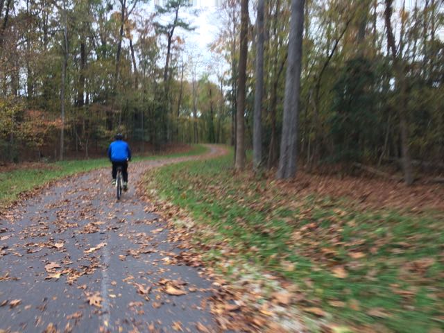 We biked until about mile marker 4.75 where we turned around at an abandoned commercial building with a gantry crane to ensure we returned to the park before sunset (note: just past this spot is Lockwood Park). The ride back was as refreshing and quiet as the ride in, covering more wooded areas than residential areas. We passed a few runners and bikers along the way, but this section of the trail definitely felt less travelled compared to others. After our bike ride, we quickly came home to change and then hopped back into the car for part 2 of our date at the new Cinebistro movie theater in Cary where we saw The Martian…a relaxing end to a fun date!
Thumbs up: road signage at highway overpasses, quiet/relaxing ride
Thumbs down: lack of signage about upcoming parks/playgrounds along bike route


 Before summer came to an end we headed back up to VA for a final party at my mom’s house before turning it over to new owners. To counteract the bushel of crabs (and beers) we were going to eat that weekend, we headed into downtown Fredericksburg on Saturday morning for a run and some playground time.
 The Canal Path is a paved 1.8 mile trail that parallels the canal until Princess Anne St where it then connects back with the Heritage Trail making a loop through downtown. The Canal Path is mostly shaded, making it a great way to escape the summer heat. We passed behind Mary Washington Hospital, ran under Route 1 again, ran by the Wetlands at Gayles Pond, and passed the


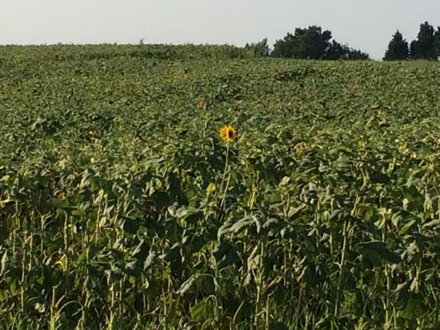 Near the end of July we ventured to the southern section of the Neuse River Trail in hopes of finding the beautiful field of sunflowers that were in bloom (from a hot tip by
 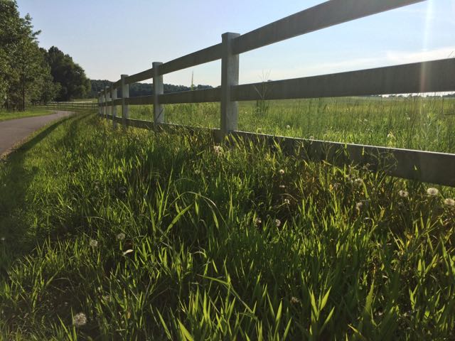 We continued south along the greenway and caught a closer glimpse of a few sunflowers still in bloom. We turned around when we reached mile post 23.75 near the
 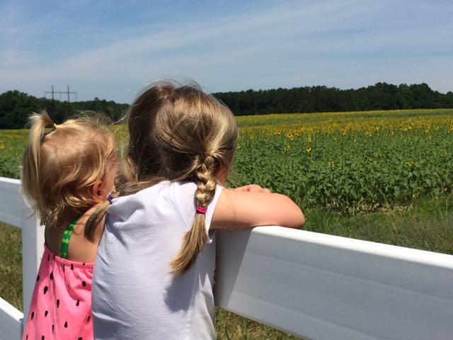 2016 Update:


 Sunday mornings in Raleigh with little ones require creativity! The few indoor play places that are open are usually crowded so that’s when we escape to the outdoors. One summer Sunday morning we decided to re-visit Historic Oak View Park in search of their vegetable garden and newer nature walking trails.
 We headed down the main trail path, which has a small gravel base, making it doable with a Bob stroller. After a short 100yd walk we came to the small pond, amphitheater, and gazebo. After playing in the gazebo we walked around the Hunnicut Trail, which is a 0.4 mile loop through the woods. It was a nicely shaded and flat gravel path making it an easy walk for little ones. The forest was alive with noises from hundreds of insects and birds. We passed an old vehicle gate, presumably evidence of the old working farm’s


 At the end of May family visited us for the weekend so we headed out on Sunday morning with my aunt, sis-in-law, and niece to explore a new park in northeast Raleigh, Spring Forest Road Park. I’d been wanting to check this place out ever since I heard earlier this year that it was going to be one of the parks to host the Hot Air Balloon Festival. With such a massive open area surrounded by a walking trail and shade trees it’s no wonder it was chosen for such a festival.
 We passed several small groups of folks walking that morning and noticed signs advertising walking programs held through the City of Raleigh/Wake County on their information boards. They also advertised several zumba and kickboxing evening classes held here, which sound like a fun place to meet up with neighbors and friends in the evening. The paved trail is 1/2 mile loop with a few small hills and passes through some shady spots. The surrounding open space must be one of the largest open fields in the whole park system, especially if it was large enough to house a hot air balloon festival. We also passed a baseball field before returning to the parking lot where the large pavilion with restrooms and tennis courts with backboards are located. Several types of flowers were in bloom and the trees were full of leaves throughout the park making you forget it’s just a short distance from busy Capital Blvd.


 Towards the end of March we headed out to Neuse River Trail to explore the area surrounding Horseshoe Farm Nature Preserve, in anticipation of the
  This portion of the greenway continues to be relatively flat and shady. The areas surrounding the greenway are mostly dense forest to one side with the river to the other. We saw quite a few fisherman on both banks of the river with most of them concentrated in spots near US-401. Our run back to the car was much faster than the run out so we took advantage of happy little faces and retrieved a balance bike, scooter and helmets from the car and let the girls ride on the greenway. It wasn’t a busy morning on the trail, so the girls had a carefree time riding. Ashley biked south on the greenway all the way to milepost 9 where we crossed over a small bridge with a shallow creek below, perfect for spotting turtles. Claire enjoyed her first scooter ride where we pushed her from behind as she cruised along. They were troopers for such a long morning run of about 4 miles and then some bike time.


 A few months ago my sister and her family were in town so we set out for another run on another (new to us) section of Crabtree Creek Trail. To ease the double stroller intensity we put Claire and baby Ava in the same stroller and let Ashley ride solo. We started at North Hills Park with the goal of running to the far western edge of Crabtree Creek Trail. As mentioned in


 Have I mentioned that we spent a lot of time on the greenway this winter? So, here we are again, exploring a new (to us) portion of the Capital Area Greenway on the Crabtree Creek Trail from North Hills Park to Lassiter Mill Park (about 2.5 miles round trip). We started at the greenway entrance at North Hills Park (
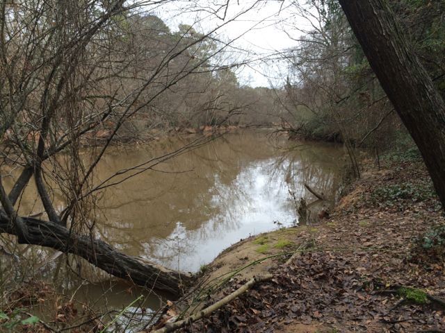 Then shortly after passing mile marker 11.5 the trail abruptly becomes unpaved and very narrow. In hindsight we should’ve taken one of the Alleghany Dr access paths, but there were no signs beforehand to indicate strollers or bikes wouldn’t be able to pass up ahead. So, we continued on the unpaved trail for a short time, all the while traversing over tree roots and narrowly squeezing between the creek and neighborhood roads above. When it seemed impossible for the double Bob to continue on, I ran up ahead to see how much further until Lassiter Mill Rd. At the end of the unpaved trail there is a set of stairs leading to Hertford Rd. Take a left onto Hertford Rd and follow it along behind Root Elementary School and then cut over to Lassiter Mill Rd. Turn left onto Lassiter Mill Rd where you’ll soon see Lassiter Mill on the left and Crabtree Creek Trail on the right.


 With our red wagon and balance bike in hand, we headed out on a clear, sunny winter day to explore
  Along our walk/ride we passed several beautiful settings including the refurbished farm buildings. This park was originally a working farm as recently as the 1940s, owned by the Walker family who grew produce to sell to local merchants. It was sold to E. Carroll Joyner who raised cattle until the 1990s and then bought by the Town of Wake Forest in 2003 and opened as a public park in 2009. The original farm buildings include a tobacco barn, log cabin, chicken coop and mule barn. The girls had a fantastic time exploring the different buildings, especially the chicken coop. Several of these buildings and the nearby settings also offer great photo opportunities.


