Neuse River Trail: MP 7.25 to 9 & Suspension Bridge

IMG_0632
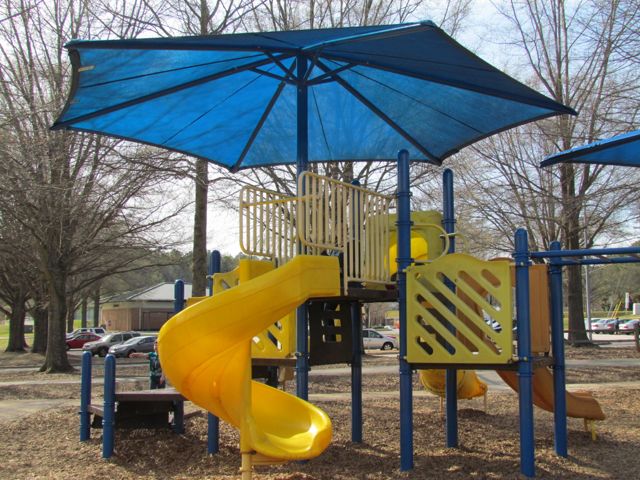
Towards the end of March we headed out to Neuse River Trail to explore the area surrounding Horseshoe Farm Nature Preserve, in anticipation of the new park opening sometime this spring/summer.  Using the RGreenway app, we mapped our starting location at the small parking lot at 198 Trailhead Ln outside I-540 and off US-401.  Knowing we wouldn’t pass a playground along our run, we brought the girls’ bikes and scooters to play on after our run.

We walked along the access trail to the main Neuse River Trail and turned left at the compass in the trail to head north towards Horseshoe Farm Nature Preserve.  After crossing over a wooden boardwalk we passed milepost 8 1/2.  The vegetation at this point in the year was very sparse, but showing signs of life to come (you’ll see a remarkable difference in a future Neuse River Trail post that I write).  We stopped every once in awhile to point out interesting things in nature to the girls – a rotting fallen tree, a wicked looking pale-as-a-ghost tree across the river, fallen gumballs, and pigeons resting under underpasses.

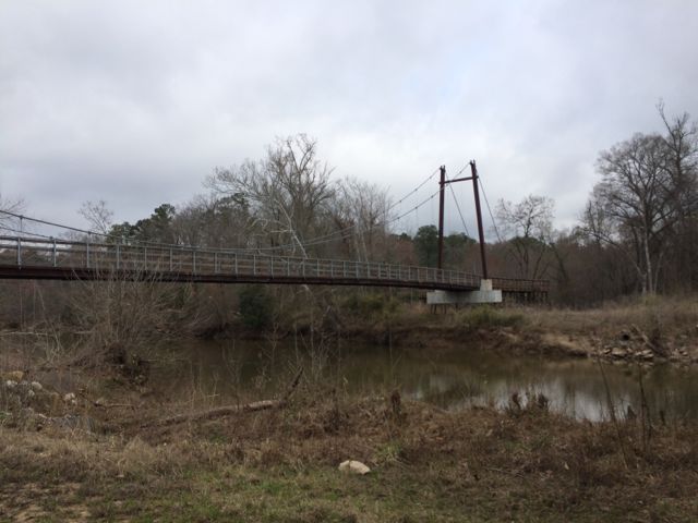
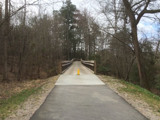
After running under US-401 we came to another amazing feat of steel, cables, and pillars – a massive suspension bridge spanning across the river with access to Horseshoe Farm Nature Preserve.  The other suspension bridge I’ve seen along Neuse River Trail is further south at milepost 13.5.  Even though signs indicate the park is closed for construction we looped around and over the bridge for a closer look.  After a short 1/4 mile run we stopped at the “Greenway Closed” signs on the edge of the park and headed back across the bridge and further north along the greenway.  We crossed over some more bridges before turning around near run-down barns around milepost 7 1/4.

IMG_0661
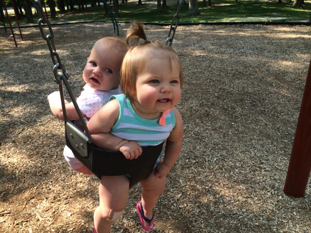
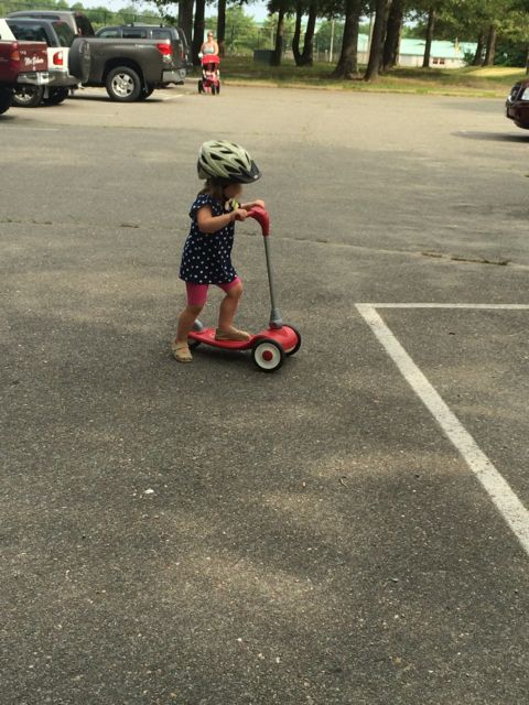
This portion of the greenway continues to be relatively flat and shady.  The areas surrounding the greenway are mostly dense forest to one side with the river to the other.  We saw quite a few fisherman on both banks of the river with most of them concentrated in spots near US-401.  Our run back to the car was much faster than the run out so we took advantage of happy little faces and retrieved a balance bike, scooter and helmets from the car and let the girls ride on the greenway.  It wasn’t a busy morning on the trail, so the girls had a carefree time riding.  Ashley biked south on the greenway all the way to milepost 9 where we crossed over a small bridge with a shallow creek below, perfect for spotting turtles.  Claire enjoyed her first scooter ride where we pushed her from behind as she cruised along.  They were troopers for such a long morning run of about 4 miles and then some bike time.

Upcoming event: Celebrate the completion of the Neuse River Trail on Thursday, June 4 at Anderson Point Park with live bands, food trucks, kids’ games and more

Thumbs up: suspension bridge, wide/flat trail, shady

Thumbs down: nothing to report

Simms Branch Trail

IMG_7570

Oh, Summer! What began as a daunting three months of partially empty calendars quickly filled with pool trips, swimming lessons, park time with friends, family visits, and so much more.  One August morning Ashley started another week-long stint at a City of Raleigh summer camp.  I’ve been so pleased with her introduction into the city summer camps and can’t wait for her to continue with them through the years.
IMG_7586So, after a Monday morning camp drop-off at Greystone Rec Center, Claire and I researched nearby greenways to explore using the RGreenway app.  After some deliberation, we drove east for a run along Simms Branch Trail. We parked along a residential street at 9410 Cub Trail (parking spot #4 on the Capital Greenway map) near the Falls of Neuse and Durant Rd intersection.  The greenway entrance was clearly marked so we set off on this relatively flat and shaded trail.  We winded through various residential areas and a small stream to the south of the trail.  We passed a few school yards along the way and had to cross a few residential streets and small bridges before coming to the end of the trail, which is just past the entrance for Durant Nature Park.  This out and back trail is about 3.25 total miles.

After our run we headed over to the super kid-friendly Lafayette Village shopping center to experience Jubala coffee (another recommendation from fellow blogger TriangleExplorer).  Claire and I shared some delicious homemade biscuits and I enjoyed a fresh cup of coffee.

Thumbs up: proximity to residential areas, nearby stream, easy access, shady

Thumbs down: nothing to report

Caroline County Park in Ladysmith, VA

IMG_6807

During a recent family visit to Ladysmith, VA I inquired about the local parks, to which I heard crickets in response.  After an unsatisfying trip to the Caroline Parks & Rec website, I talked to my sis-in-law who is a teacher in Caroline and she remembered there being swings near the high school.  So on Sunday before heading home to Raleigh my sister and I met up with my sis-in-law and her daughter at Caroline County Park.

Caroline County is a small county of less than 30,000 people, but one that is steadily growing in businesses and population.  Caroline County Park is located across the street from Caroline Middle School around 13690 Devils 3 Jump Rd.  For a small town with assumingly small recreation funds, I was pleasantly impressed with the features of this park; however, the general upkeep needed some attention.  The park has a large shelter pavilion with horseshoes, a shaded walking trail, a skateboarding park, a playground area with swings, baseball fields, tennis courts, soccer fields, public restrooms, and ample parking.

IMG_6770The pavilion area was great in that it could hold large family gatherings with nearby parking, but the amount of trash scattered throughout the area was disturbing.  In reality, the problem seemed to be that the trashcans were light enough to be tipped over by small animals so some heavy duty trashcans with lids would probably solve that problem.  The nearby horseshoe pit and sand volleyball court would probably get more use if they were raked and maintained more frequently.

The nearby playground area was the big hit for our little crew.  It has a tall double slide, large climbing structure, one tot swing, one handicapped-accessible swing, and several regular swings.  Claire enjoyed sharing the tot swing with her sweet cousin, Emma!  The playground area has great shade cover, but plan to bring mosquito repellent next time – we left with quite a few bites.

After the playground we headed over to the skateboard park area to check it out.  By this time the skateboarders had left so Ashley brought her new (to us) scooter in to wheel it around.  After the scooter lost its appeal, she enjoyed running up and down the skateboard ramps.

IMG_6813All in all, this park had several great features despite some maintenance needs.  And, it was nice to see so many people enjoying the soccer fields so early in the morning.  Hopefully as the county continues to grow, more people will visit the local parks and draw more attention to what fun kids can have here!

Thumbs up: playground area, variety of features, skateboard park, shadiness

Thumbs down: general maintenance, waste pickup, lack of informative Parks & Rec website advertising the great features of this park

Leesville Community Park

IMG_6315

On a Sunday morning in May we headed out to Leesville Community Park in hopes of finding a fun playground with some open space for flying a kite.  The playground was unlike any others we had ever been to before and we were able to find a small space for kite flying so it was a successful morning!

Leesville Community Park is located at 5105 Country Dr in North Raleigh and has a Wake County Library on the premises.  It has two playgrounds near each other – one for ages 2-5 and one for ages 5-12.  The smaller age playground is covered by a large shade tarp and is a series of one foot tall platforms for playing and climbing on so this playground is best for a steady climber or even a non-walker who likes to just stand and hold onto things.  Ashley had a blast playing with the spinning toys on the younger playground.

The older age playground is a series of metal or rope climbing structures, a very narrow slide, and a stand-up spinning structure.  It had yellow caution tape in a section where the rope ties were broken.  I’m so thankful Bill was with me this morning to assist Ashley as she spider-monkeyed the rope climbs while I could tend to Claire.  I was pretty nervous with Ashley being so high up, but she did great and even made it down the very narrow slide by herself.  However, I wouldn’t take both girls back to this park by myself because Ashley would require so much assistance on the older playground.

IMG_6299
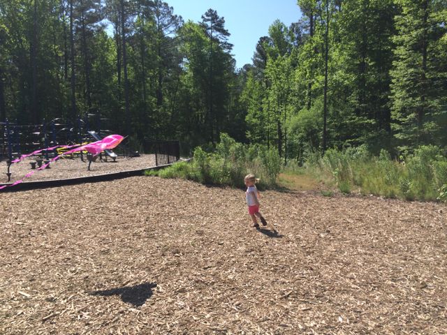
After some playground time we busted out our princess kite in the nearby open space.  We had the park to ourselves this morning which proved to be crucial when giving a 3-year old a kite – she ran all over the place instructing her kite to “C’mon on, kite!”  It was super cute watching her fly the kite, until she ran into some small, unnecessary stumps located in the middle of the open space.

After flying kites we explored the shady median between the parking lots, which featured a short dirt pathway with benches that lead to the Carlton family cemetery.  Finally we got some use out of the public restrooms, which were very comfortable for temporary trailer bathrooms.

Thumbs up: bathroom facilities, monkey bars at smaller age playground, library/park combo trip, shade tarp over smaller age playground

Thumbs down: lack of picnic tables, playground features require kids to be very able at climbing, park entrance was hard to spot (we drove right by), small jagged stumps in open field

Optimist Park: Tutus & Picnics

img_5806
Stretching her ballerina toes after class

Awhile back a dear friend of mine and I signed our girls up for a preschool dance class at Optimist Park through the City of Raleigh.  It ended up being the perfect Monday morning activity, which led into extended play time and lunch at the playground.  It was the first activity (other than regular preschool) where the girls were on their own, so it was fun to have a buddy to learn some new skills with (we still talk about plies over here)!

Optimist Park is located in North Raleigh in a subdivision off Six Forks Rd at 5900 Whittier Dr.  It’s an older park with a community center, playground, seasonal and year-round pools, tennis courts, baseball fields, and greenway access for Mine Creek Trail, Snelling Branch Trail and Shelley Lake.

img_5782
A glimpse into the dance class

Dance class was held in the community center in a room that did not have easy access for parents to view their kids “dancing”.  So, to sneak peeks we’d have to poke our heads in and try not to disturb their learning.  Once dance class ended we headed over to the playground for some more play time and a picnic.

Again, Optimist is an older park so the playground has a more classic look with brown and orange painted metal.  The playground area is covered in a sandy surface and has a large jungle gym for the 5-12 age group that our 3 year olds and even 15 month old enjoyed.  There are several slides, a tunnel, and a few climbing ladders.  In the same area are

the springy cars and 4-person teeter totter.  The playground sits adjacent to a creek that has a short fence, which no one really explored even the 15 month old, but do take caution.  Benches are scattered throughout and the picnic tables and swing set are nearby.  This area is pretty shady, even with the few leaves on the trees.  If you follow the paved trail, you’ll come to eight lighted tennis courts that are adjacent to the student parking lot at Sanderson High.

img_5793
From the dance floor to the sandbox

While Optimist Park might not be a destination spot, it sure made for a great post-dance class play time and picnic spot!

Years ago Ashley and I ran the Snelling Branch Trail from Optimist Park and I never posted about it! To get to the greenway access, you’ll want to start in the smaller parking lot off Northclift Dr that is behind the Sanderson High baseball field.  Follow the signs and run behind the baseball field and you’ll come to North Hills Dr, which you’ll cross over.  Continue a little further and you’ll come to the Shelley Lake Trail where you can turn left to go south and see Shelley Lake very quickly or turn right to go north and discover the Mine Creek Trails or northern end of Shelley Lake loop.  We turned right and then made another right onto Mine Creek Trail where we crossed over North Hills Dr again, went under a tunnel for Lynn Rd, and eventually turned around near the intersection of Longstreet and Bent Creek Dr.  There’s a flowing creek along the way and we even passed a random playground.  According to the City of Raleigh website there’s a current project to extend East Fork Mine Creek Trail to Honeycutt Park.  That’ll be a good reason to get back here soon for more current pictures!

Thumbs up: quiet/not crowded, great picnic spots, fun beginner dance class, convenience of having park features close in proximity, greenway access

Thumbs down: older facilities, lack of true dance studio for watching kiddos

Photos from the Greenway exploration in Feb 2012:

Falls Lake Hike Day Hike A: Raven Ridge Rd towards Dam

img_4946Every New Year’s Day, NC hosts First Day Hikes all over their state parks to promote a healthy start to the year. Even though the organized First Day Hikes didn’t exactly work with our kiddo schedules we drove up for a short hike of our own near Falls Lake.

Falls Lake is a state recreation area just 10 miles north of Raleigh with 7 individual parks, a 12,000-acre lake and 26,000 acres of woodlands.  For our hike, we chose one of the southeastern fingers to explore.  The portion of the trail we hiked is from Day Hike A (from Shinleaf Rec Area to Falls Lake Dam) of the Mountains to Sea Trail.  Mark Edelstein provides a very detailed description of the hiking trails through Falls Lake, which I used to help navigate the area.  We hiked a portion of this trail heading west to east.

img_4947
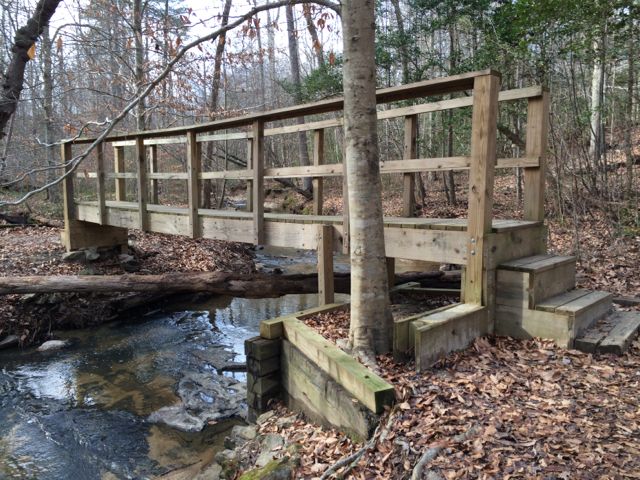
To find the gravel pull-off parking area (noted at the 3.5mi mark in Section 1) we drove north on Falls of Neuse Rd and turned left on Raven Ridge Rd and parked along the side of the road shortly after passing Annie Wilkerson Nature Park.  After getting everyone strapped in their gear, we set off by following the small sign pointing east towards Falls Lake Dam, which is 3.5 miles away.

This is a very moderate hike with small hills and a fairly wide trail throughout.  It is a heavily wooded area, giving a lot of shade to the trail.  Most of this section also closely follows much of the lake, so there are several lake inhabitants and small waterfalls to discover along the way (great for puddle stomping during summer time).  We also passed a trail entrance into Annie Louise Wilkerson Nature Park, which happened to be closed for the New Year holiday, but would be fun to incorporate into a short hike.

We only hiked about 2.4 total miles that day and didn’t make it to Falls Lake Dam, but I’m looking forward to starting at the dam and heading west on our next hike through Falls Lake.

Resources:

  • list of day hikes through Falls Lake as compiled by the Mountains to Sea Trail campaign
  • Detailed hiking descriptions from Falls Lake Dam to Raven Ridge Rd
  • Falls Lake map (although not detailed enough for hiking trails)

Thumbs up: views along stream, clear hiking signage along trail, great shade

Thumbs down: planning a hike in Falls Lake using NC Parks online resources (use the Mountains to Sea Trail site instead)

Umstead Park: Pott’s Branch Trail

img_4165
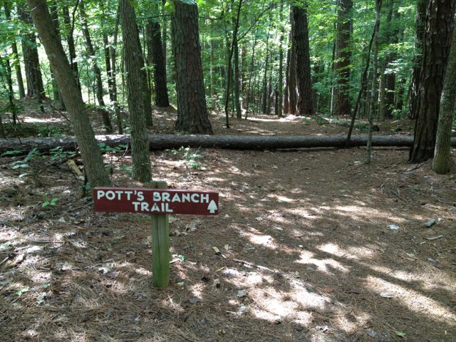
At the end of last summer we ventured out for some hiking at Umstead Park.  Since Claire was only about a month old at the time, we wanted to keep it pretty easy so we explored Pott’s Branch Trail, which is only 1.6 miles and easy on the difficulty scale.  To get to Pott’s Branch Trail, use the park entrance at 8801 Glenwood Ave and continue straight to the back of the park where you’ll come to a large parking lot.  We parked in the larger, two-level parking lot and after a lot of configuring backpacks and bjorns we set off to find the trail head.

img_4155
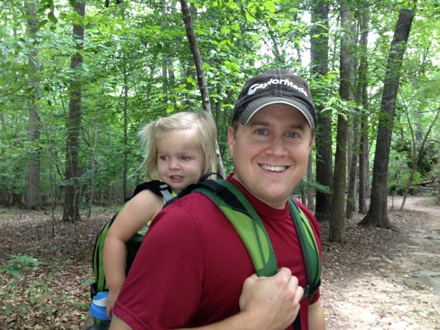
For some reason, even for two directionally-sound people we had a hard time finding the trail head for Pott’s Branch Trail.  From what I remember the signage was horrible and after a lot of stumbling around, we eventually found it.  Lucky for us, this is small looped trail so regardless of where we got on, we’d eventually get back to the parking lot.

Raleigh had a very wet summer last year and the trail was evidence of such.  Portions of the trail parallel a small stream, which had debris filled branches indicative of higher water levels.  There were also some large downed trees and muddy areas, which made us think the stream must have risen over the bank in areas.

The trail itself was very easy; other than a few downed trees that we walked around and large tree roots along the way, the trail is very flat and comfortable for most any fitness level.  Along the way, you’ll pass a large wooden deck, picnic table and small grill, and roads in the very far distance.  Since this trail is on the opposite side of the road from Big Lake, you won’t see any large bodies of water, but the flowing stream offers some interesting views and holds the attention of toddlers!

Thumbs up: quick and easy hike, nearby stream, wide and shady trail

Thumbs down: poor signage from the parking lot to trail head

Sal’s Branch Trail Photo Update

Labor Day weekend my sister and brother-in-law visited so we headed back to Umstead Park where we hiked Sal’s Branch Trail again.  Be sure to read my first review of that trail, but again, I love that it’s a good distance (2.75 miles) and has nice views of Big Lake.  We got such an early start on the hike that we were able to grab lunch to go from Moe’s and visit the nearby Gizmo Brew Works for some much needed beers and a picnic lunch! Gizmo Brew Works is nestled in an industrial park off Glenwood Ave and has an array of inside seating (couches, tables) and some picnic tables outside. Albeit, probably not designed to bring kids, but we made it work! They don’t serve food, but we’re fine with us bringing outside food so plan accordingly.

Helpful Links:

Lake Lynn Trail

img_3803
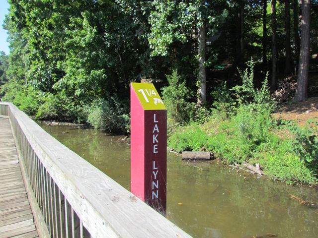
When I decided to run the City of Oaks 10k this past November, I used my toddler-free Tuesdays and Thursdays (thanks to preschool) to do my longer runs at Lake Lynn Trail. During these times I only had Claire with me, which meant I could run longer with the single BOB stroller. Pushing a double BOB stroller is exhausting!

Lake Lynn Trail is part of the Hare Snipe Creek Trail and about a 2.15 mile loop around Lake Lynn in North Raleigh. There are two entrances from where you can access the trail – one at Lake Lynn Community Center (7921 Ray Road) and one near the intersection at Lynn Rd and Leesville Rd.  Both entrances have large parking lots with easy access to the trail.  If you’re trying to get a good run in and need to avoid the playground, be sure to use the Lynn Rd entrance.  The Lynn Rd entrance is also where the mile marker starts at 0.

One of the main reasons I enjoy the Lake Lynn loop so much is that it’s a relatively flat trail that follows along the perimeter of the lake, offering nice views.  I knew the City of Oaks 10k would be pretty hilly (and it certainly was) but I was banking on the fact that I’d survive the race since all my runs were completed pushing at least one child in a stroller.  I also enjoy this loop because there’s a good amount of traffic so I feel safe when running by myself, although it can get rather crowded at peak times (mornings, weekends, and I’m sure evenings too).

Lake Lynn trail is paved with large sections of wooden boardwalk near the northern part of the trail.  It’s pretty noisy on the boardwalk so if you’re planning for little ones to sleep on this run, they will probably wake up when you reach the boardwalk.  The water level is pretty low near the boardwalk and has become a popular hangout for children feeding the ducks and geese so you may have to play Frogger™ to get around that area.  But, please remember to follow all city regulations and DO NOT FEED THE GEESE….they are a nuisance and will survive just fine without the extra feedings.  Instead, take the kids around the trail and look for the sweet sunning turtle families.  There are also several apartment complexes located around the lake, so it’d be a great place to live for anyone looking to be near the greenway.

Thumbs up: relatively flat and shady trail, great views along lake, sunning turtles

Thumbs down: paved portion of trail is bumpy with tree roots, bottleneck of patrons feeding ducks, entrance from Lynn Rd is initially hard to spot

Williams Park

IMG_2957

Williams Park is a bustling playground in the center of North Raleigh adjacent to Lynn Road Elementary School.  It is located at 1525 Lynn Road and some of the photos are from when Ashley was much younger and some are from this Spring.  As you can see, having a friend to climb through tunnels with, chase through the soccer field, and swing with is the best way to spend an early Spring afternoon!
In addition to the large playground area (complete with shady canopies), Williams Park has a large open field with soccer goals surrounded by a short walking path, tot swings, sand volleyball courts, youth swings, tennis courts, a large shelter area, and some shaded sitting areas.  The playground surface is made of wood chips and sand.  The playground areas are a series of small climbing structures with slides that are connected by monkey bars.  For younger ones, that means lots of repetitive trips down the same slides or that they’ll need your help getting to the other play areas.  Since Ashley was just beginning to climb ladders at this time, she needed my help getting up to the higher slides too.

If you take a walk along the trail at the park, you’ll find a small plaque memorializing the park to Peter P. Williams Jr.  According to a News & Observer article, his father donated the land for the park in honor of his son.  I always enjoy when I can find some tidbits on the history of a park!

Thumbs up: great shade, close parent-sitting areas throughout the playground

Thumbs down: I’ve been here in the past and seen where drainage can be an issue

Brookhaven Nature Park

img_2210
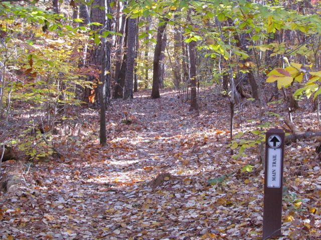
Fall is prime time for hiking, enjoying the great weather and taking in the leaves changing colors.  We recently visited Brookhaven Nature Park in the Brookhaven neighborhood at 5125 Berkeley St near Crabtree Valley Mall.  Brookhaven is a city park, but the Jr Woman’s Club of Raleigh helps maintain and beautify it.  After arriving at the park we explored the pavilion area and then headed off on the Main Trail, which is a narrow, unpaved path that criss-crosses several streams.  Part of the trail is labeled wheelchair-accessible, but the paved trail seemed rather uneven and the decline was rather steep (imho).  This time of year the trail was covered in rust-colored leaves so we took extra caution when hiking, especially with Ashley in the backpack.

For being in a North Raleigh neighborhood the trail is actually pretty hilly, so we were surprised by how much actual “hiking” we did.  Its peacefulness should also be noted, especially with its close proximity to so many busy Raleigh roads.  Along the hike we came across a small pond with a deck for taking in the views and scouting for fauna.  On this particular day the reflections on the pond made it look like the trees were sprouting from the water…it made for great pictures!  The deck also featured a few informational signs about the fauna in the area, snapping turtles and mallards.

After leaving the pond we followed the Main Trail some more and then took the Pine Tree Loop and Upland Forest Trails to increase our hiking distance, which actually only totaled about 1 mile.  Even though the hike was short overall it was a fun, quick way to explore a naturally hilly part of Raleigh.  Be sure to bring another adult with you to this trail and all trails; this park is not staffed and the trails are not heavily traveled with other visitors.

Thumbs up: photo ops, good hiking workout, peacefulness, proximity within city, shadiness

Thumbs down: confusing signage near end of the trail