
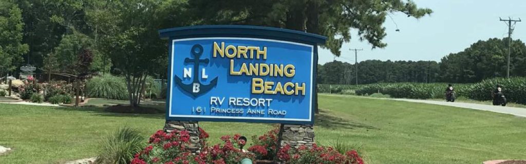
Last summer we met up with Virginia friends at a convenient campground with easy beach access. We needed a place with rental cottages and RV spots, and after researching places we decided on North Landing Beach RV Resort. If you haven’t been to North Landing Beach (aka the NLB), it’s a little slice of heaven you have to experience. With its family-friendly beach, mix of camping and cabin rentals, super fun on-site events and secluded location, this place has it all!
Getting There
North Landing Beach RV Resort is located about 20 miles south of Virginia Beach at 161 Princess Anne Rd just north of the VA/NC border. It’s part of a peninsula that stretches across the NC/VA border and sits between the North Landing River and a few bays that dump into the Currituck Sound. Usually when you hear Currituck Sound you think of the Duck/Carova areas of NC. However, this place is in VA, close to the remote coastal community of Knotts Island and a ferry ride from the Outer Banks.
Driving from Raleigh, it took about 3 hours to reach North Landing Beach. Because of the campground’s unique location we drove through small towns of Elizabeth City and Moyock, both we hadn’t previously seen. We felt perplexed seeing newer neighborhoods scattered among all the farmlands. After talking to locals in the area, we learned that many families live out this way and commute up to the VA Beach/Newport News area for work.
The Campground
After check-in, we meandered through the gravel roads underneath the pine trees to our campsite. Our campsite (spot #625) was by far one of the best spots in the park. Located next to a canal, we enjoyed lots of waterfront space so we had plenty of room to spread out for fishing and being loud exploring. We could also easily holler to our friends staying in a rental cottage across the canal.
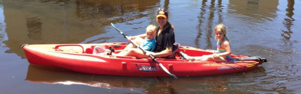
Speaking of rental cottages, our friends raved about the 2 bedroom cottage they stayed in for the weekend. It featured a full kitchen, small living area, full bathroom, two bedrooms, and deck overlooking the canal. Their location was convenient for using their kayak, being close to us, and having easy access to the beach.
After setting up our campsite, we explored the recreational amenities, community gathering spots, and beach areas. This campground features a large pool, a variety of sports courts, bounce house, putt-putt golf, kayak rentals, easy river beach access, and organized events/activities. We participated in the watermelon-eating contest, which was hilarious and brought out a competitive streak I hadn’t previously seen in my kids. We also rode on the super soaker float where we squirted campground guests with water guns! Watch out – some campers hid behind their RVs and soaked us with hoses!
On Saturday night we attended the low country boil and live music concert at the pavilion. The event was crowded, but the food line moved fairly quickly and the live music was greatly entertaining. The staff worked tirelessly to keep the food fresh, hot and delicious! We listened to the band play great cover music for at least an hour while our kids played independently nearby – win, win! Another night, we watched the private fireworks display set off by the campsite and it was unbelievable!
Play & Hike Outside
When we weren’t enjoying planned activities at the campground we spent most of our time at the beach. From our campsite, we walked less than five minutes to the beach. Being on a large river, the water was much calmer than the ocean, making it great for young families. The water was also pretty shallow, so the kids could swim out pretty far before needing to come in closer.
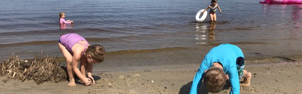
Since we visited over Father’s Day weekend, the dads enjoyed lots of fishing, though they didn’t catch much. The kids had recently started using nets to dredge up murk and look for tadpoles in bodies of fresh water. They brought their nets and buckets on this trip and although they didn’t find many tadpoles, they loved the hunt, especially with friends.
On Sunday morning we explored the nearby Charles Kurwalt trail on Mackay Island National Wildlife Refuge. The National Wildlife Refuge System manages lands and waters set aside to conserve America’s fish, wildlife, and plants. The Mackay Island refuge and surrounding waters support many species of resident and migratory fish and wildlife. We first stopped at the Charles Kuralt Overlook on the left-hand side of Marsh Causeway. The overlook provides beautiful views of the nearby marshes and that’s about all. Feeling disappointed, we continued south about 200 yards and found a roadside pull-off spot for the Great Marsh Trail.
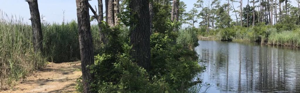
The Great Marsh Trail is an easy 0.3 loop trail around a marsh. Despite some whining from the kids, it was a beautiful hike. We heard lots of wildlife and spotted several turtles in the water. We saw berry bushes, cattails, and flowering trumpet vines. Mackay Island refuge features more hiking trails, a visitor center and a sure way to escape in nature.
During our campground stay we met several families who live nearby, which we thought was unusual. They mentioned they love staying at NLB on the weekends, a real tribute to the daydreaming and fun anyone can have here.
Thumbs Up:
- variety and uniqueness of fun activities and amenities
- mix of rental cottages and rv spots
- beautiful and calm river beach
- sunset views
Thumbs Down:
- nothing to report


 Dam, Plant & Reservoir
 Osceola Island


