Neuse River Trail: MP 11.5 – 13.25

IMG_6559

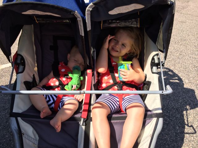
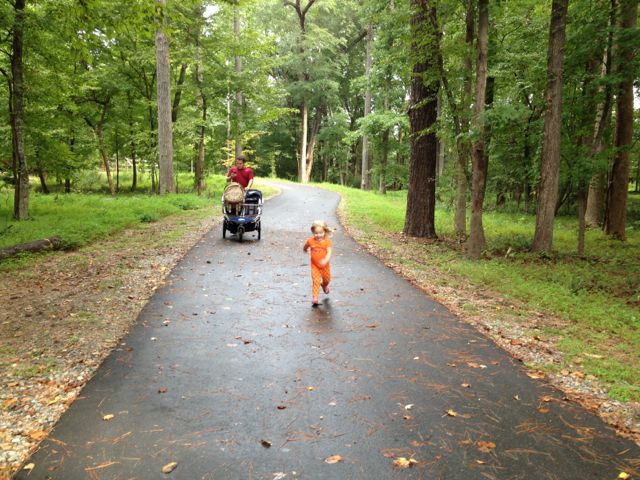
Over Memorial Day weekend, we headed out to Buffaloe Road Athletic Park to run along the Neuse River Trail and then have some playground time back at the park.  Unfortunately, the playground was closed for resurfacing so our short run turned into a much longer run and lucky for us the girls didn’t mind too much.

Buffaloe Road Athletic Park is located at 5812 Buffaloe Rd in east Raleigh.  We parked in the parking lot adjacent to the playground and headed out on the nearby trail.  With little signage to go by, we ran along the wooden boardwalk that dead ended at a small stream.  After getting turned around, we found a paved trail in the park and followed it along the perimeter of the park towards the aquatic center entrance.  We continued following the greenway signs, crossed the road before getting to the aquatic center main building, and finally found the Neuse River Trail after a few more right hand turns! Whew, we had a mile  (mostly uphill) under our belts already!   When you see the huge “traffic circle” feature in the trail, you know you’re there.  For future reference, we’ll park closer to the aquatic center if we need access to the greenway.

IMG_6589
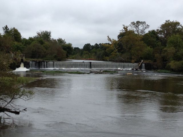
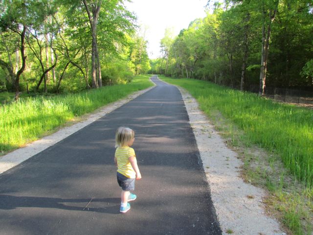
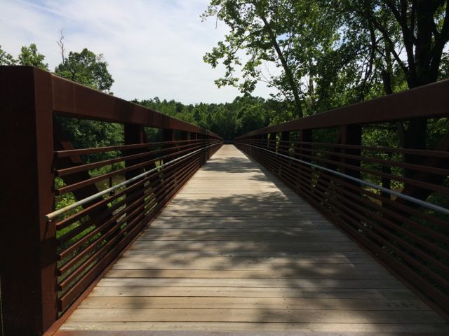
We turned right heading south onto the Neuse River Trail and we shortly came upon the 11.5 mile marker and a large bridge that crossed the Neuse River.  It had rained a lot in Raleigh over the weeks leading up to Memorial Day weekend, so the water levels were still pretty high and the river was flowing fast, which made for great toddler conversations.

There was quite a good bit of foot and bike traffic along the way so it was nice to see so many people using the greenway.  This portion of the greenway has a good variety of elevation – there are several flats parts mixed with some hilly parts.  We made several stops along the way for toddler nature potty stops and to admire the high water levels and nice houses across the river.  We even made it all the way south to where some good friends live across the river; even though we couldn’t see their house through the dense forest, our GPS showed where we were in comparison to their house so that was neat!  When looking back over the COR greenway map, we ran until just north of greenway parking #44 (2894 Abington Dr).

IMG_6611
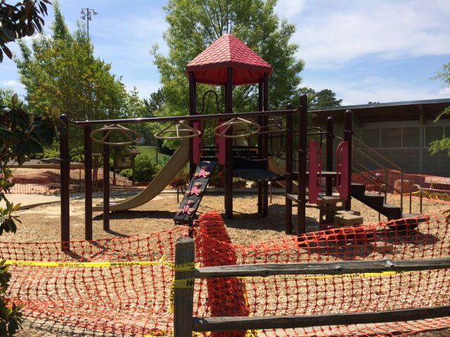
The run home felt much shorter with several less stops than the way out.  When we arrived back into Buffaloe Road Park, we followed signs to the athletic park instead of to the aquatic center.  With this option, we ran along the northern perimeter of the park and got to witness the massiveness of the baseball fields.  When we got back to our car, we were pooped! Ashley made a final pit stop in the restroom facilities near the closed playground and then we headed out for some well deserved lunch.  I look forward to taking the girls back to the park later this summer when the playground surface is finished.

More Resources:

Thumbs up: views along the greenway, condition of the greenway, photo ops, having playground and running options in one spot (despite playground being closed)

Thumbs down: no mention of playground being closed on COR website, lack of signage to greenway from playground

North Wake Landfill District Park

img_5576

A playground at the landfill…say what?!  Yes, the North Wake landfill closed in 2008 and local residents worked with the county to repurpose the closed landfill into a park which now features paved trails, mountain biking trails, a large playground area, pavilion, and access to Abbotts Creek Trail (part of Neuse River Greenway).  North Wake Landfill District Park is located at 9300 Deponie Drive off Durant Rd in north Raleigh.  When you first turn off from Durant Rd, it’ll feel like the landfill is still open because you have to wind through some of the old parts of the dump, but follow the signs for the park.

We spent most of our time exploring the playground area and paved trails that access the nearby greenway. While the playground area has many unique features, I strongly disliked the layout where it is adjacent to a steep hill that my adventurous 3-year old decided to conquer at great speeds, despite strict instruction NOT to do so. So, after recovering from a near heart attack when she sprinted down the steep hill (and received a short timeout) we had a nice time exploring the play areas.

The playground has two areas – one for ages 2-5 and one for ages 5-12. In my opinion this park is definitely more of a “big kid” park. The younger playground area has several climbing structures that are more appropriate for an older and more confident 2-year old. It also has a few slides, two tot swings, and a music feature but it’s a taller playground with little room for playing on.

img_5596The bigger kid playground is any young climber’s dream.  There are huge spider web ropes that connect to the playground along with a sideways rock wall.  The playground also has several monkey bars, slides, twisty ladders, climbing stepping stones and more!

Both playground areas are covered in a thick wood chip surface and are adjacent to several picnic tables, the public restrooms and water fountains.  Also nearby is the large Sycamore pavilion with seating for up to 100, according to the Wake County website.

Descend along the paved trail from the playground to reach access to the western side of Abbotts Creek Trail.  Inside the park there are also several mountain biking trails, a mountain biking skills area, and paved walking trails.  I’d like to come back and walk or bike the short Top of the Hill trail, which takes you 469ft above sea level for great views of the surrounding area.  There is little shade at this park, so plan accordingly!

For more information about this park, visit the Wake County Parks website.  I found the park brochure with map to be very helpful.

Thumbs up: repurposing a landfill into a useable recreation space, variety of climbing activities for older kids, proximity and plethora of picnic areas

Thumbs down: steep hill near playground area, lack of park map inside park (didn’t know about most of the walking or bike trails until going online after getting home)

Neuse River Greenway: MP 15-17 & Milburnie Dam

img_4437

While I was training for the City of Oaks 10k last fall, it gave us a chance to try out several trails during my longer runs on the weekend.   One Saturday we headed over to the Neuse River Greenway near Anderson Point Park for a 4 mile run.  The Neuse River Greenway runs through Anderson Point Park and since I had explored part of the trail south of the park, we decided to park in the small lot prior to the entrance to Anderson Point Park and run north.

The parking lot at 22 Anderson Point Dr is rather large and serves for access to the greenway, overflow parking to the park, and canoe launch access to the river.  After parking, we headed north on the greenway and shortly saw mile marker 17 and signs for Mingo Creek Trail, which is maintained by the Town of Knightdale.

Along our 4 mile run (2 miles out and back) we passed over several pedestrian bridges, ran under New Bern Ave, passed a good amount of bikers and runners and discovered the beautiful Milburnie Dam.  The nearby greenway bridge provides great straight-on views of the dam, which has been out of commission since the 80s.  Milburnie Dam was first built in the mid-1850s as a power source for a paper mill.  From powering a paper mill, streetcars, and gristmill this dam has seen several changes since its inception according to the on-site information guide.  While the dam hasn’t been in use since the 1980s, it has since created a vibrant habitat for several animals.  In researching more about the dam it seems that removal of the dam has been debated for the last decade so its future use is unknown.  In the meantime, be sure to visit this great spot for some amazing photo opportunities…yet another reason why running on the greenway can provide beautiful surprises.

There is a small parking lot for quicker access to Milburnie Dam near the intersection of Old Milburnie Rd and Loch Haven Rd.

Check out Raleigh Nature’s blog post for more information on the Milburnie Dam.

Thumbs up: beautiful views of Milburnie Dam, relatively flat and shady greenway, having a playground near the greenway

Thumbs down: nothing to report

Abbotts Creek Trail

img_4309

It might be snowmaggedon part 2 in Raleigh right now, but months ago it was a beautifully warm day for a run in North Raleigh along Abbotts Creek Trail.  Abbotts Creek Trail is 2.9 miles and connects Simms Branch Trail with the Neuse River Trail.  We parked on-street near the intersection of Falls River Ave and Ashmead Ln.  Abbotts Creek Trail is connected by the sidewalk near where we parked so after some walking back and forth, we got our bearings and headed north on Falls River Ave where we shortly caught up with Abbotts Creek Trail.  Again, I’d love some directional signage throughout the greenways.

Abbotts Creek Trail is a wide, flat, and paved trail that runs between the Bedford at Falls River subdivision to the north and Abbotts Creek to the south.  It nicely carves a path through a moderately wooded forest (great for shadiness in the hot NC summer).  Along our run we passed several bikers and joggers, crossed multiple bridges, and explored the blue heron habitat.  While we didn’t see any blue herons, we did see evidence of their nests, which were easy to identify with help from the information guides.  Near the habitat are several benches, great for resting while doing some bird watching.

img_4316When we reached the end of Abbotts Creek Trail we turned left north onto the Neuse River Trail for a bit before turning around.  While on the Upper Neuse River Trail we passed the 2 3/4 mile mark and were impressed with the information guides about the floodplains and benches along the way.  Our out and back run was a total of 3.2 miles and I look forward to getting back up here again to explore the southern half of Abbotts Creek Trail, which I think leads to the North Wake Landfill District Park.

Thumbs up: flat and wide trail, lots of shade, fun nature stops along the way, busy foot traffic

Thumbs down: signage

Neuse River Trail Opening

img_3079

A couple of months ago we attended the Neuse River Trail grand opening at Anderson Point Park located at 20 Anderson Point Dr.  Most grand openings we attend are usually low-key and only involve a few important speakers, but this celebration was full of food trucks, live music, crafts for kids, local vendors and more.  As typical, we sat through 5 minutes of the grand opening speeches and then played on the playground before hitting up the food, vendors and crafts.

The Neuse River Trail is located on the eastern side of Raleigh paralleling the Neuse River with 7 bridges over the river throughout the trail; it  begins at Falls Dam Lake and continues south past the WRAL Soccer Park, Buffaloe Rd Park, Milburnie Park, Anderson Pointe Park and to the Johnston County line.  The new section of trail added 20 additional miles, bringing the total distance of this paved trail to 27.5 miles.  The Neuse River Trail allows for easy connections west to Crabtree Creek Trail or Walnut Creek Trail and is a great connection between the municipalities of Wake Forest, Raleigh, Knightdale, and Johnston County.  Part of the trail is also a segment of the Mountains to Sea Trail that extends from the Great Smokey Mountains to the Outer Banks.

img_3085After devouring some delicious pizza from my favorite local food truck, Klausie’s, Ashley and I headed south on the trail for about a mile before her patience and the time got the best of us.  The parts of the trail we walked were gorgeous – the trails are 10ft wide, the views of the river are amazing, and the bridges make for exciting photo ops.

To access the Neuse River Trail near Anderson Point Park, the parking spots are either inside the park or at the parking lot near the canoe put-in at 22 Anderson Point Dr. At this location, you’ll be near mile marker 17 of 27.5.  I can’t wait to return and explore more of the trail on bike next time!

Additional Resources:

Thumbs up: condition of trail, scenic views of river, photo ops, bridges

Thumbs down: signage to trails from within park

Anderson Point Park

My mom visited this past weekend so on Friday morning we headed out to Anderson Point Park at 20 Anderson Point Dr in east Raleigh. This park is bordered by 264/64 bypass on the north, the Neuse River to the east and Crabtree Creek on the west. From the park you can also access the greenway via the Neuse River Trail which is over 4.5 miles of unpaved trails. Here’s a satellite view of Anderson Point Park from Google Maps.

When you arrive at the park, go around the cul-de-sac to the far left to the parking lot. From there we found a very helpful park map detailing all the features.  We then walked by the Large Shelter and headed left along the main trail, which is about 3/4 mile loop. The shelter is a large pavilion with several picnic tables, restrooms, and an adjacent open field with a back stop.

Main entrance sign
Informational board near parking lot
Parking lot
Large Shelter pavilion
Restrooms at Large Shelter
Open field with backstop near Large Shelter
Another view of the open field

Walking along the paved trail we first came to the amphitheater. It’s a beautiful stone-terraced amphitheater with lush green grass at each level. At the bottom is a large tree surrounded by a stone wall with benches and swings along the perimeter. The tree provides great shade for picnics or reading on a hot day.  My mom did comment on how difficult it might be to see any type of performance at the bottom due to the hedges at each terraced level.

Amphitheater
Large shade tree and benches
Ashley with her Cici
Looking from the top of the amphitheater

Back on the trail we followed the spiral pathway up to the scenic overlook. There’s a circular flower garden at the top surrounded by a stone wall perfect for sitting and enjoying the views of the park. There are also several covered swings at the top great for relaxing and taking in the scenery.

Pic of the paved trail
Flower garden at the top
Shaded benches at the top
View from the top overlooking the park

Continuing on, we passed bluebird trails and bird houses that attract martin birds. Luckily my mom, who is a bird enthusiast, was with us to identify the bird houses. The surrounding natural vegetation still allows for great views of the park.

Houses along the bluebird trail
Martin birdhouses

Next, we came upon a large open field with a backstop across from the Retreat Cottage. The cottage can be rented for conferences and events and contains a small nearby parking lot to use.

Open field with backstop near cottage
Sign outside cottage
Retreat Cottage for rent

Close to the cottage is the Small Shelter, which is a covered pavilion with several picnic tables and restrooms. It has an adjacent open field surrounded by crape myrtles and magnolias. Nearby there is also an information board with details about renting the various shelters, open fields, and Retreat Cottage.

Small Shelter with picnic tables
Restrooms near Small Shelter
Open field near Small Shelter
Beautiful crape myrtles and stone work near open field

Next on the trail is the largest playground I’ve ever seen. Part of the playground is covered in a mulch base and part is a sandy base. There is a large jungle gym, multiple swing sets, and several teeter totters with plenty of seating along the perimeter and sloped, grassy hill. The entire playground area is full sun, so be sure take a break at the nearby water fountain. The Small Shelter would be perfect for birthday parties with the playground being so close!

Looking down at the playground
Slides down the grassy hill
Large jungle gym
Swing sets
Another view of the jungle gym
Sandy area with teeter totters
Water fountain

Continuing on, we arrived near the entrance, which has several shade trees and swings overlooking a large part of the park.  The signs are helpful in directing you to the various parts of the park.

Shade trees and swings near entrance
Benches at the entrance
Signage near the front

We followed the trail back to the parking lot and headed out of the park, but not without stopping at the canoe launch that we passed on our way in.  Park in the lot there to get on the Neuse River Trail or head down the gravel road to the launch area for the Neuse River.

Canoe Launch sign from Anderson Point Dr
Gravel lot near put-in area
Launch area
Looking north up the Neuse River
Looking south towards the railroad tracks and 264/64 bypass

This is a great open park with lots of unique amenities surrounded by a paved trail that is perfect for walking the dogs and babies or going for a run.  We had a fun morning with lots of exploring, so we finished off our adventure with cupcakes from The Cupcake Shoppe!

Yummy red velvet

Thumbs up: scenic overlook, shelters, open fields, access to greenway, canoe launch area, playground, beauty of amphitheater, birding

Thumbs down: unsure of usage of amphitheater