
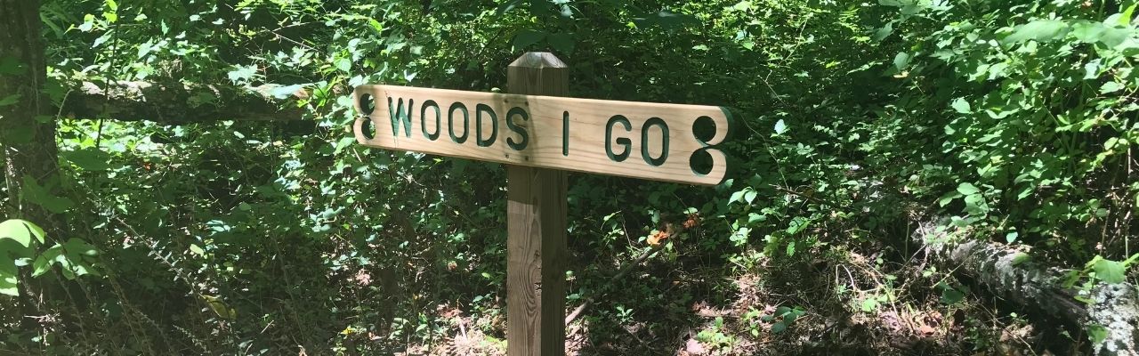
“Into the woods I go to lose my mind and find my soul.”
John Muir
A quiet and peaceful escape. It looks different to everyone. For myself, I love being outside exploring a path, whether it’s covered in water, leaves, rock, or sand. In 2019 we purchased a few acres of land with a small creek in the Elkin, NC area. Like the first settlers to the region, we were attracted to the area because of its great wilderness and close proximity to water. Probably less like the first settlers to the region, we fell in love with their mix of restaurants and watering holes. So, over the past two years we’ve spent a lot of time exploring the woods, rivers, and towns in the NC foothills. We settle the Winnie in during warm weather months to make weekend visits comfortable. One day we hope to build a small cabin on it, but for now we’re enjoying it as we camp for short getaways.
History
The earliest known visitors came to this region about 10,000 years ago attracted by the convergence of the Big Elkin Creek and Yadkin River. The Sioux Indians settled along the Yadkin River around 500 BC, and the first Europeans settled in the mid-1700s1. The region also owes a lot to the Gwyn and Chatham families who settled and started successful manufacturing businesses.
Richard Gwyn settled in the area and began a cotton mill, the Elkin Manufacturing Company, along the Big Elkin Creek in the mid-1850s. After serving in the Civil War, Thomas Chatham and his brother-in-law, Thomas Lenoir Gwyn, started woolen mill Chatham Manufacturing, most notable for making woolen blankets2. Years later the mill moved closer to the new railroad system, which also happened to be adjacent to the Yadkin River. After the large flood of 1916, Chatham rebuilt its mill in Elkin on higher ground.
Chatham Manufacturing survived the Great Depression and expanded into complimentary industries as the country’s needs changed throughout the World Wars. The business was a huge economic part of the town, employing over 3,500 people at its peak in the 1970s. A Danish company outbid a stockholder group in the late 1980s for ownership of Chatham Manufacturing, which led to its eventual demise. Sadly, the new company then became wrapped up in financial scandal and piece by piece they divided up and sold off Chatham Manufacturing3.
After researching the history of the area, I’m more intrigued than ever to walk the streets of Downtown Elkin more closely and hunt down old blankets from my childhood to see if they don the Chatham name. I feel like we’ve only scratched the surface of the Elkin area and I can’t wait to dig deeper!
Camping in Elkin
Sandy Creek Family Campground
Our favorite campground spot in the area is Sandy Creek Family Campground in Traphill. A friendly, local guy named Barry owns the campground, which used to be part of a dairy farm for his cheese making. The land sits along the banks of Big Sandy Creek, which typically boasts kid-friendly wading and tubing spots. The campground is also within walking distance to the southern edge of Stone Mountain State Park, where you can connect to the bridle trails and be at the Lower Falls in a few miles.

Sandy Creek Family Campground has electric and water hook-ups and a dump station along the road. The sites are all very flat, with lots of tent camping options near the creek. Barry works hard to greet each guest, keep the bath house clean and maintain the open field area with fun recreational toys. We’ve stayed here in spring, summer and late fall and my kids always have fun splashing in the water, playing in the sand and making friends with other visitors.
Stone Mountain State Park
Two years ago we camped with two additional families at the group tent site at Stone Mountain State Park. There are four group sites which feature a clean, convenient bath house and easy Upper Trailhead parking lot access. Stone Mountain State Park provides group, backpack camping, RV and tent spots. Each group site holds up to 25 people and comes with a concrete pad, fire ring, water access and table. The families had plenty of space to spread out their tents and the kids had plenty of room to run wild. Though, I plan to upgrade our backpacking tent to a larger size before trying to cram all four of us into one tent next time!
Additional Spots
When we’re not camping or glamping in this area, we highly recommend the Fairfield Inn or the Ridenour Ranch. The Fairfield Inn is a very clean hotel with a swimming pool, great breakfast buffet and close proximity to 77. We stayed at the hotel one fall season and they blew us away with their Halloween decorations.
Ridenour Ranch is a unique place to stay if you’re looking for that country feel. The rental house sits on a working alpaca farm. The owners renovated an old two-bedroom cabin and live in another house on the farm. We stayed here one summer for a few nights and thoroughly enjoyed the peacefulness of the house and visiting with all the animals.

Riverwalk RV Park is a new campground that opened earlier last summer in the Yadkin Valley area. We haven’t stayed there before, but judging their Instagram photos it looks like campers have a great time and the owners take great pride in maintaining it. Byrds Branch Campground is another camping option in Elkin adjacent to the Mountains to Sea Trail that connects to Carter Falls and Grassy Creek Vineyard.
Grassy Creek Vineyard is home to the Klondike Cabins. Klondike Cabins features unique rental cabins that have been preserved on the former Klondike Farm property. Full of rich local history dating back to the 1920s, I can’t wait to stay here during a visit to the area.
Food & Drink
Food
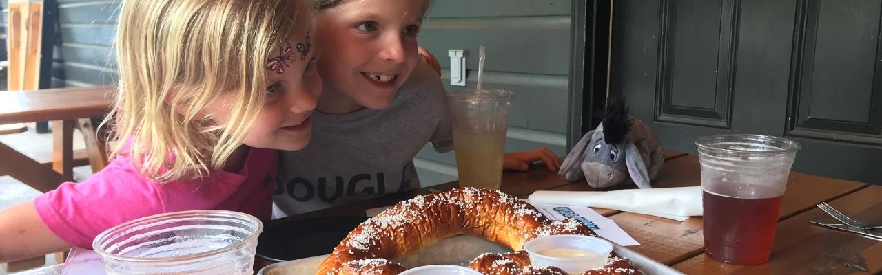
Since spending so much time in the Elkin area, we’ve gotten to know several local spots for eating and drinking. Skull Camp Brewing features the tenderest brisket and hugest homemade pretzels. They also have a great selection of craft beers – the Tr’ale B’red (Red Ale), Basin Creek Blonde, and Elkin IPA are some of my faves. Skull Camp has a huge facility with lots of outdoor patio area making it very kid-friendly and easy to socially distance.
We also recently dined at Angry Troll Brewing in downtown Elkin for the first time. We were really impressed with their wood fired pizzas, crispy chicken wings and selection of craft beers. Down the block from Angry Troll Brewing is Southern on Main restaurant. Southern on Main features a modern take on comfort food. We devoured their crispy brussels sprouts and fried green BLT. Their prices are very reasonable and their wine menu highlights several Yadkin Valley wineries.
If you’re looking for a more country setting, you can’t beat the fried chicken, potato wedges and slushies at Foothills Grocery & Deli in Thurmond. It’s a one-stop shop for gas, food and friendly service!
What is a trip to the mountains without a stop for ice cream! Creamy Dayz is located in a renovated gas station on Bridge St, not far from Downtown Elkin. Their ice cream is very tasty and they’re always experimenting with new flavors. We recently tried the cookie monster flavor, but haven’t yet tried unicorn poop! They’ve also updated their menu to include new offerings, including a donut ice cream sandwich!
Wines
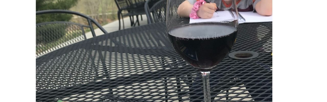
Situated in the foothills of the mountains, Elkin is also a hot spot for wine country. Located down the street from our camp spot is the striking Jones Von Drehle Winery. They are a family-owned vineyard and winery featuring delicious dry wines near the Blue Ridge Mountains. Over the summers I frequently ran over to grab a few bottles of their scrumptious rose. In the colder months, I’ve enjoyed pairing their cab sauv with a steak. Visitors can grab bottles to go or stay to enjoy a glass or tasting on their outdoor patio while overlooking the breathtaking vineyard. I recently joined their wine club and took home a delicious assortment of bottles.
Another great spot we’ve visited through recommendations of Raleigh friends is Elkin Creek Vineyard. Elkin Creek Vineyard is also located in a picturesque area with beautiful spots along the creek for an outdoor picnic. We visited Elkin Creek Vineyard pre-Covid so their full dining menu was available. Based on their website they’re still offering their famous pre-order wood-fired pizzas on Sunday. As always, you’ll want to call ahead early in the week to reserve your dough (no joke).
During Covid we had the fortunate chance to get away for the night (sans children) in Thurmond. We enjoyed our first trip to Grassy Creek Vineyard & Winery, complete with a wine flight and cozy conversation. The owners happily shared the history of their winery as we narrowed down which wines to try! The winery sits on beautiful farm land with outdoor seating, indoor seating, a hiking trailhead, and the Klondike cabin rentals.
Though only Bill has visited, he was a big fan of McRitchie Winery & Ciderworks. The folks were super friendly and the ciders were delicious. He’s more an IPA or cabernet sauvignon guy, but he also really enjoyed their cider.
We recently learned about the Elkin Vine Line, which offers transportation to five different groupings of wineries. You reserve a date/time/line, catch the bus in downtown Elkin and hop between the different wineries. Each bus line serves four wineries so it’s a fun and safe way to visit the vineyards.
Hiking in Elkin
Stone Mountain Hiking
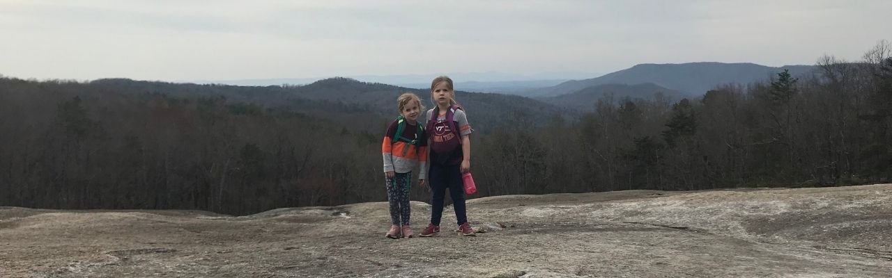
When I first hiked Stone Mountain, I felt as if I were an astronaut who landed on the moon. Stone Mountain features massive granite domes with craters large enough for your family to camp in. From the upper trailhead parking lot we hiked the Stone Mountain Loop Trail (summit side) to the summit (elevation 2,305 ft) and back. It starts off rocky and flat, and then becomes wooded and steep with several switchbacks. Along the way we crossed over the large domes of Stone Mountain’s face. We gingerly walked down the face a few yards to sit among the craters and gawk at the forests below, feeling like Armstrong, Aldrin and Collins. The entire loop trail is about 4.5 miles. If you only hike from the upper trailhead parking lot to the summit and back it’s about 2 miles. The views from the summit and along the way are gorgeous!
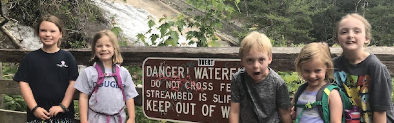
During our group camping visit to Stone Mountain we hiked to the Lower Falls from the upper trailhead parking lot. It was a hot summer day, so everyone loved playing in the Stone Mountain Falls. We came prepared with towels, bathing suits and water shoes. After playing in the water, some of the group hiked down to the Lower Falls which was about one mile away.
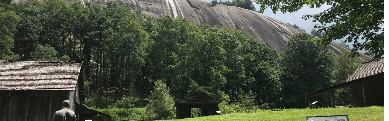
During a different summer visit to Stone Mountain we parked at the lower trailhead parking lot and hiked to the Hutchinson Homestead area. Hutchinson Homestead is a historic homestead from the mid-19th century that was recently restored. The farm features old buildings to learn what life was like during that time. The homestead sits below the huge granite outcrops, giving guests that jaw-dropping feeling from a different perspective.
Hiking at Grassy Creek Vineyard & Winery
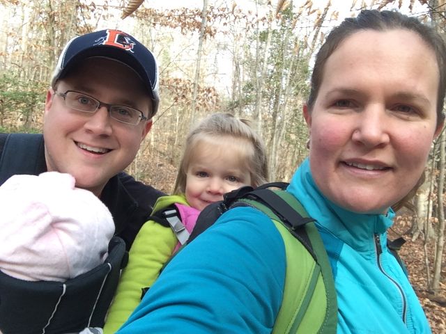
Last year during one of our many trips to the area we hiked from Grassy Creek Vineyard & Winery to Carter Falls. The trailhead is located adjacent to the vineyard parking lot and is about a total 5 mile out and back hike. After about 1/2 mile, the Grassy Creek Trail connects with the Mountains to Sea Trail segment 6. We headed westbound on the trail where we crossed a few bridges, hiked through pine forests, walked along old country roads and farms, and hiked by Byrd’s Campground.
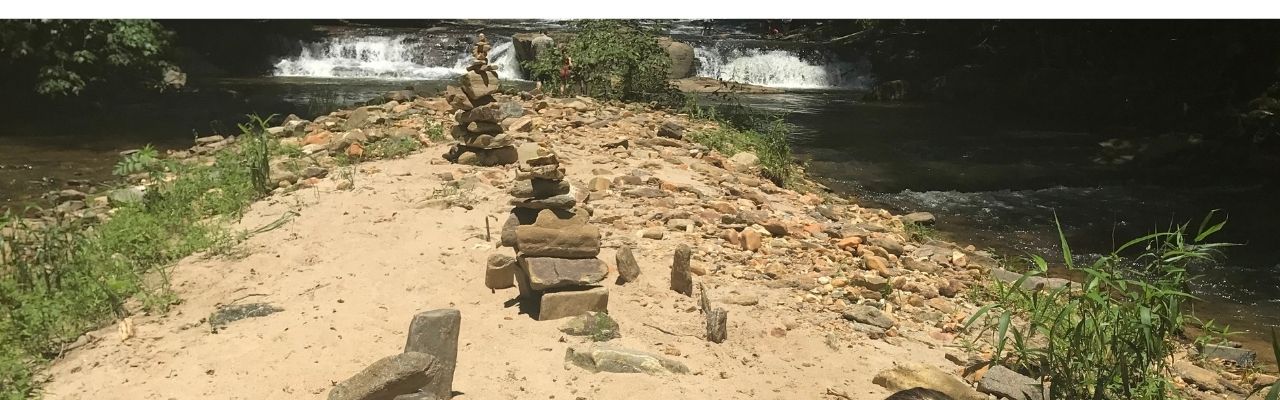
After hiking past Byrd’s Campground (feel free to stop by the camp store for ice cream) we crossed over Pheasant Ridge Rd. Then we hiked along the Powerhouse Trail which winds downward through the woods to a beautiful section of Big Elkin Creek. We played in the water, took in the waterfalls sights, and the girls played on the rocky/sandy island for almost an hour. We brought water shoes to change into from hiking shoes, which helped cross onto the island. Previous hikers built small cairns, man-made rock formations, on the small island.
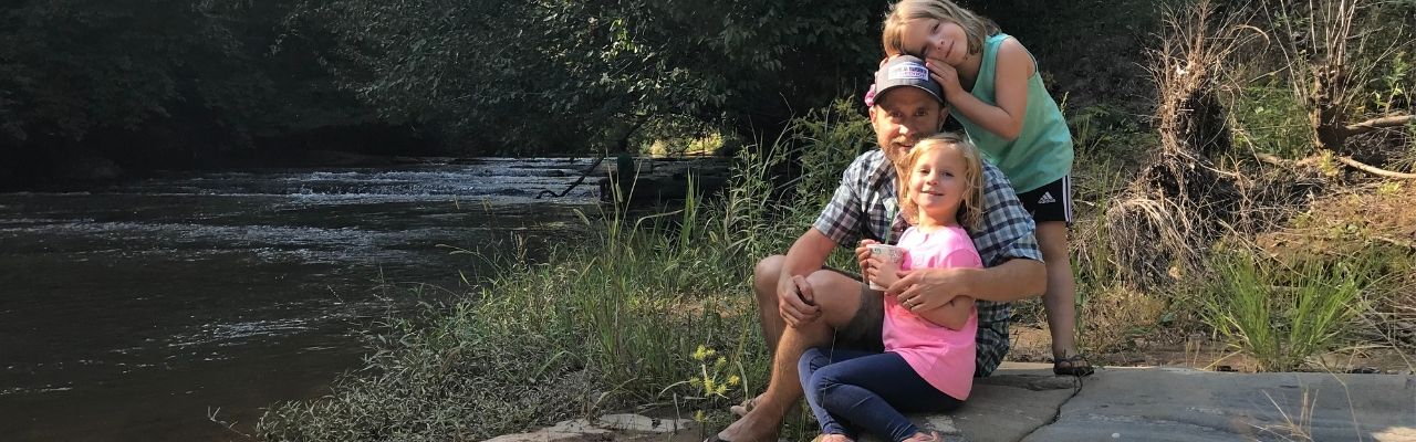
The Rivers
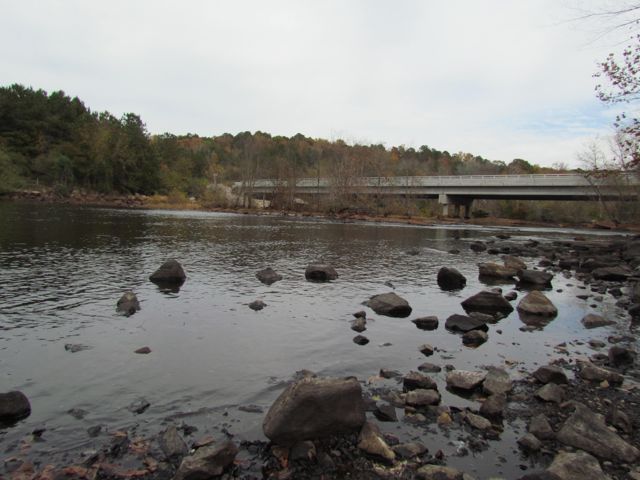
As noted earlier, the nearby rivers are a huge attraction for visitors. East Prong Roaring River is known for its trout fishing. Big Elkin Creek and the Yadkin River converge near downtown Elkin, providing great recreational sources today. The New River snakes way north of Elkin, also offering fun adventure options.
We haven’t done much exploring on the rivers yet, except for tubing down the New River. We rented tubes at the New River Campground in Independence, Va. They drove us up to the takeout spot and we spent about an hour floating. Summer thunderstorms popped up while we floated causing some scary moments. However, we stayed the course and limited our stops so we could float as quickly as possible. My husband and kids have returned for Y-Guides trips and each had awesome, thunderstorm-free trips!
Years ago we hiked Ivy Bluff Trail along the eastern section of the Yadkin River at Pilot Mountain State Park. This summer we hope to bring our paddleboard and kayak to the Yadkin River for some local paddle trips. The Elkin Valley Trail Association is a great resource for finding a network of connected hiking, biking and paddle trails in the area.
Celebrations
Fourth of July
If you’re looking for down-home family fun the Fourth of July celebration at Mountain Park is amazing. When we visited during 2019 they blew us away with their fireworks display. Other fun annual festivals include:
- NC Trail Days – first weekend in June
- Yadkin Valley Wine Festival – third weekend in May
- Merlefest – usually in April, but moved to September because of Covid
Additional Resources
Thumbs up:
- variety of recreational activities, small town feel, network of connected trails/wineries, breathtaking views at Stone Mountain State Park, great restaurants
Thumbs down:
- construction on I-77


Citations
- “History of Elkin, North Carolina“, Town of Elkin North Carolina, http://www.elkinnc.org/residents/living_in_elkin/history.php.
- “Elkin: A Town Woven Together by Chatham“, Explore Elkin, https://youtu.be/fbFv25L8LFI.
- “Chatham Manufacturing Was Engine That Drove Town of Elkin for over a Century“, Wilkes Journal-Patriot, 28 July 2017, www.journalpatriot.com/news/chatham-manufacturing-was-engine-that-drove-town-of-elkin-for-over-a-century/article_fe7518ce-73d9-11e7-8418-33de212843ab.html.


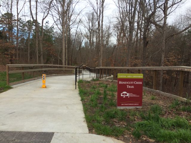 After exploring the northernmost section of
 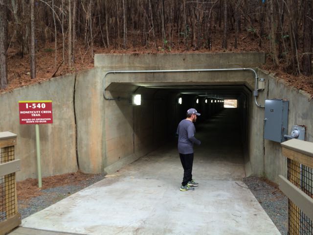 After running along the walkways we crossed under the I-540 pedestrian tunnel near the 2.75 mile marker. I was pretty out of breath pushing the double stroller up the small hills we’d run so far, but I was definitely not prepared for the long, steep hills on the other side of the pedestrian tunnel. Holy hills, Batman! Thankfully, Honeycutt Park (our destination) was only 1/2 mile away.


 We took advantage of the gorgeous weather over Christmas break and spent a lot of time exploring new places outside. The day after Christmas we drove north to Falls Lake for a 2.5 mile morning hike. If you haven’t checked out the
 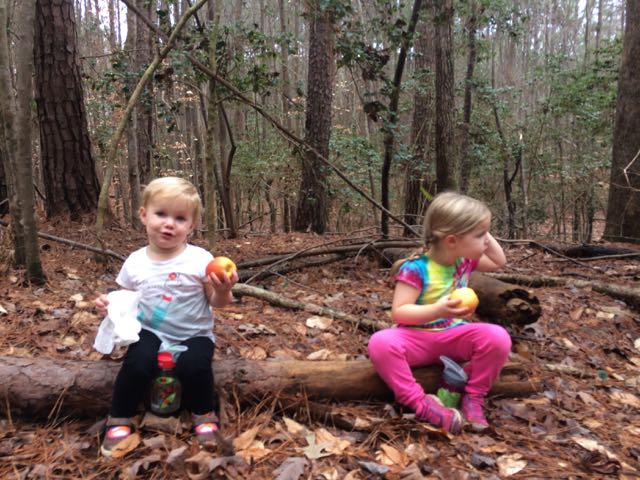 We hiked Day-Hike D that starts near


 This fall we wanted to further explore Falls Lake so we set off with intentions to start closer to the dam and finish
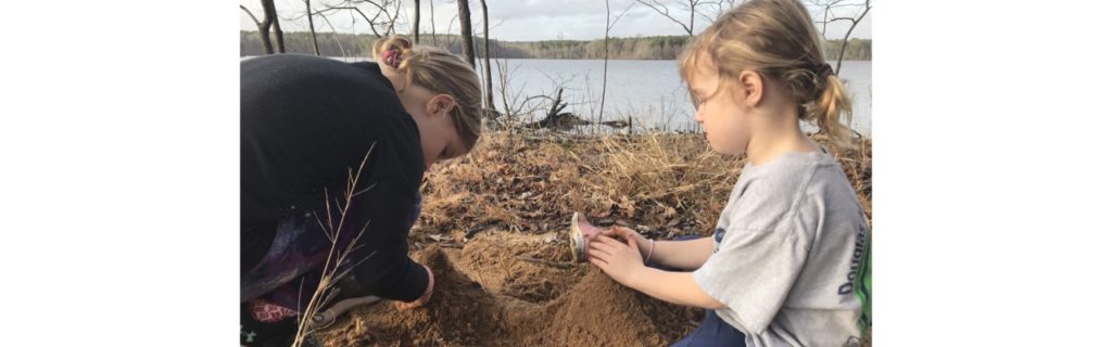
  The playground is designed for ages 5-12 and includes a few slides, climbing structures, tic-tac-toe, and several nearby picnic tables and benches. It’s a small playground, but the perfect size for a park with so many more activities. After taking in the views from the top of the dam, we walked down the unpaved trail adjacent to the playground where we got up close and personal with the beginning of the Neuse River. The girls enjoyed throwing rocks in the water while we saw fishermen and birds. There’s also a small parking lot, canoe launch, restrooms, information map, picnic tables, and access to the start of the Neuse River Trail greenway at the bottom of the dam.


 Every New Year’s Day, NC hosts First Day Hikes all over their state parks to promote a healthy start to the year. Even though the organized
 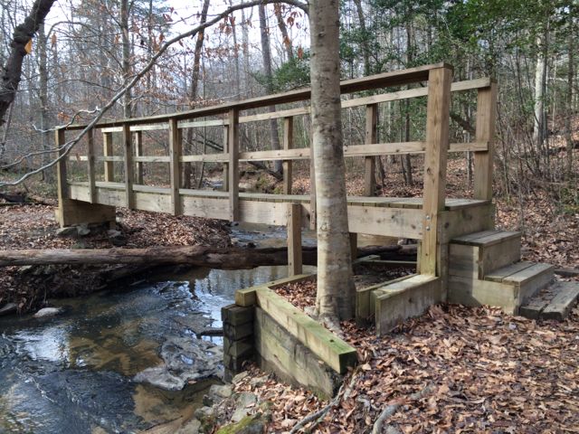 To find the gravel pull-off parking area (


 After devouring some delicious pizza from my favorite local food truck,


