
 In mid-January we headed to Raven Rock State Park for a morning hike and picnic. Raven Rock State Park is located about an hour south of Raleigh along the Cape Fear River in Harnett County. The underlying rocks in the area formed nearly 400 million years ago through heat and pressure. High winds and rushing water gradually shaped the huge crystalline rock where ravens perched. River captains relied on the outcrops until hurricanes permanently damaged the locks and dams in 1859. Railroad transportation soon replaced river travel, and the state established the park in 1969. The old Northington lock and dam are visible from the park.
We parked in the southern section of the park near the Visitor Center at 3009 Raven Rock Rd in Lillington. Newly built in 2010, the Visitor Center is a great first stop before heading to the trails. Inside the center we explored the exhibits with the topography map, animal scat samples, and history of the the dams. The ranger was friendly and helpful when guiding us to the trailhead. After making a last-minute stop in the clean restrooms, we walked along the left side of the road to access the Raven Rock Loop Trail.
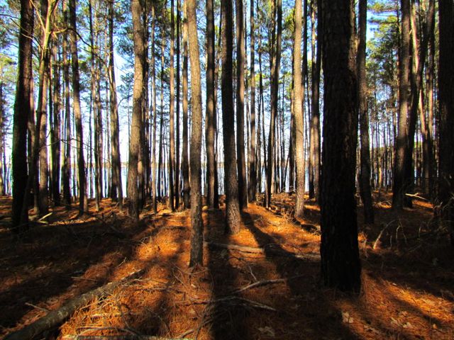
The Raven Rock Loop Trail is about 2.6 total miles. We walked clockwise around the loop, so the beginning of the trail was wide and gently sloped. The back half of the trail was slightly steeper, making the girls push harder at the end of our trip. About a mile into the hike, we arrived at the overlook above the Cape Fear River. The overlook provides beautiful views of the river and surrounding forests.
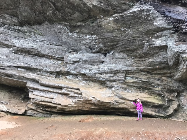
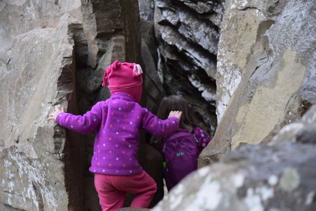 Then, we walked a little further until we arrived at the steep zig-zag stairs leading to the Raven Rock outcrop. We carefully walked down the windy stairs, stepping to the side to allow others to pass us. At the bottom we reached flatter ground with easy access to the river and the enormous Raven Rock outcrops. The girls loved climbing around the huge rocks and over the tree with the tangled web of tree roots. Portions of the rocks were large enough to crawl under and around, making for fun hiding spots. We also enjoyed listening to the trickling springs dripping from the moss-covered rocks overhead.
 After climbing around the main Raven Rock attraction, we ascended up the windy stairs and finished the steeper part of the loop trail. We crossed the stream a few times and enjoyed looking for wild animals through the bare forests. Lastly, when we returned to the trailhead we passed picnic tables, a large pavilion and the entrance for the American Beech Trail featuring the Kids in Parks Track Trail. Though we didn’t have time to hike it, this easy 0.5 mile hike features fun adventures such as Nature Hide ‘n Seek to excite kids about hiking. We also passed signs with information about the canoe-in camping.
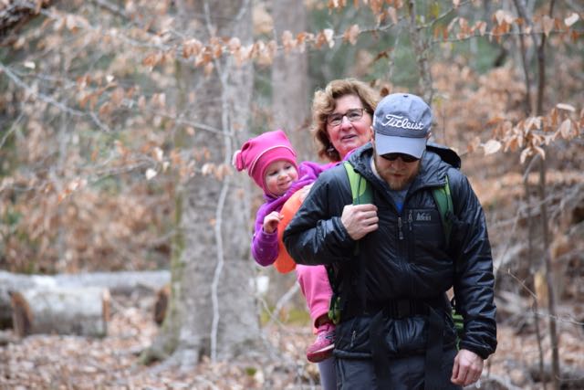
Though hiking can be tricky with small kids, the more you hike together the less whiny easier and more fun it can be. For hikes longer than 1 mile, we still bring our hiking backpack for our 3 1/2 year old. We always pack lots of snacks and/or picnic lunch and started letting the girls use our older cameras to capture sights along the way. The girls started melting down towards the end of this trail because we unknowingly saved the steeper portion for the end. Next time, we’ll hike this loop trail in reverse order and visit in warmer months to take advantage of playing in the streams!
Thumbs up: friendly park staff, informative visitor center, steady foot traffic along trail, beautiful views over river, interesting rock outcrops
Thumbs down: nothing to report


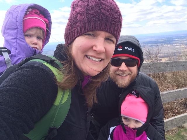
 On the way home from our mountain trip in West Jefferson we decided to take advantage of the close proximity to Mount Jefferson and pay a visit. Mount Jefferson State Natural Area is located just east of US 221 at
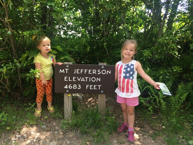
 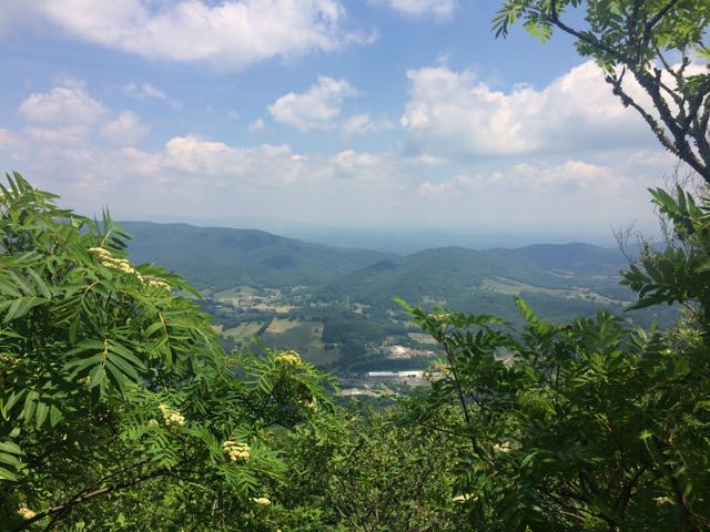 We walked through the picnic area and followed the short Summit Trail (0.3 miles) up the mountain. Although the website lists this trail as strenuous, we felt it was more on the moderate side. Due to our haste planning half of us wore flip flops, but could easily walk the gravel trail. The gravel path is wide and shady giving a cool mountain feel to the hike. Along the way we saw butterflies, rhododendrons, mountain laurel and red-starred flowers; though stop by the park office for official plant and animal checklists. We visited the bathrooms along the way, which were super convenient and an easy walk from the main path. We passed access to the Kids TRACK trail, which is part of the longer Rhododendron Trail (1.1 miles). Near the top we turned left to the Mount Jefferson summit, which has an elevation of 4683 feet. I climbed out a little further to catch the beautiful views of the Blue Ridge Mountains.


 Two months ago our family headed west to Dobson, NC to visit old neighbors and friends whose son was having a first birthday. Wanting to extend the trip so we could explore more of the Yadkin Valley area, we made it a three-day trip so we could visit Pilot Mountain State Park, the nearby towns, and vineyards. Having passed Pilot Mountain dozens of times via US-52 on our way to Blacksburg, VA we had always wanted to explore this area.
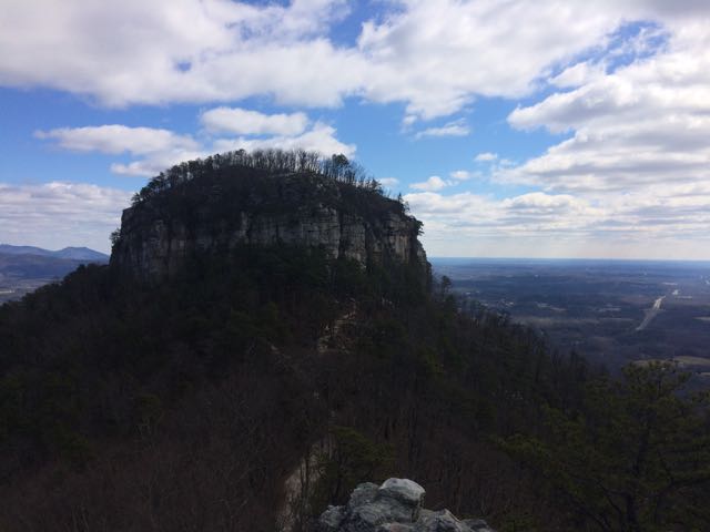 After a restful sleep on Thursday night we got up early and headed for Pilot Mountain State Park. We made a beginner’s mistake by going to the Bean Shoals Access of Pilot Mountain and after a 20 minute detour we found the main entrance to the park (
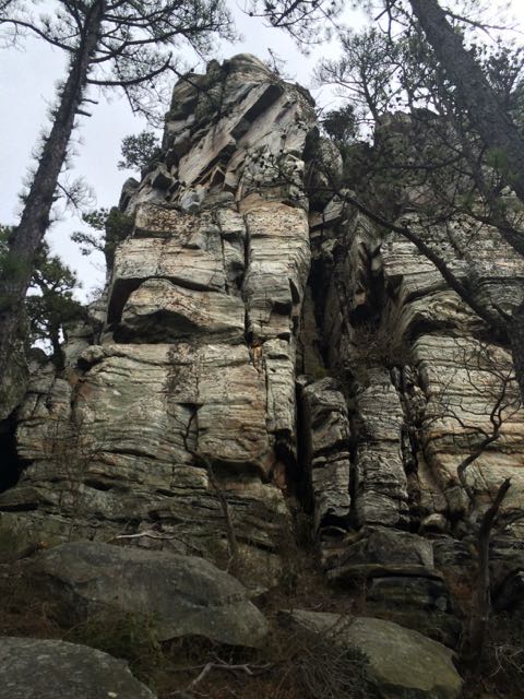 Jomeokee Trail is a short 0.8 mile looped hike around the base of big pinnacle sitting at 2400 ft elevation. To the Saura Indians, the earliest known inhabitants of the area, the mountain was known as Jomeokee, the “Great Guide” or “Pilot.” We headed around the trail counterclockwise, climbing up and down rock steps. There was little up and down terrain on the trail, but the cliff views were impressive to say the least. The trail can get rather narrow and offers some really up close views of the 200 ft Big Pinnacle. After making it about halfway around the base, our crew decided to call it a success and head back, given the cliff views were getting a little too hairy and too close for comfort (there are no railings).


 On New Year’s Day 2015 we visited the
 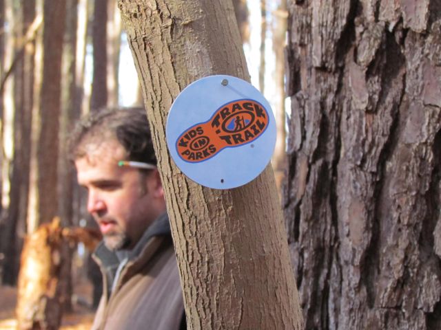 Once the families gathered at the trail head, the park rangers explained more about the short .75 mile hike and gave each child a scavenger hunt brochure of things to look for along the way. Ashley was a little too young for the scavenger hunt, but the older kids had a great time. They also explained the
 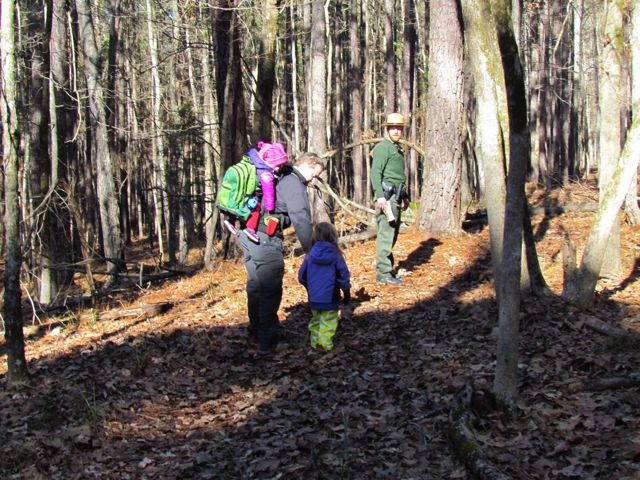 In the past our hiking experiences with our kids have mostly been self-guided with very basic objectives: 1) survive (


 With our red wagon and balance bike in hand, we headed out on a clear, sunny winter day to explore
 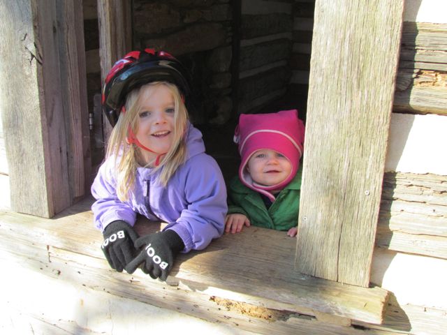 Along our walk/ride we passed several beautiful settings including the refurbished farm buildings. This park was originally a working farm as recently as the 1940s, owned by the Walker family who grew produce to sell to local merchants. It was sold to E. Carroll Joyner who raised cattle until the 1990s and then bought by the Town of Wake Forest in 2003 and opened as a public park in 2009. The original farm buildings include a tobacco barn, log cabin, chicken coop and mule barn. The girls had a fantastic time exploring the different buildings, especially the chicken coop. Several of these buildings and the nearby settings also offer great photo opportunities.


