
 When we were in Nags Head last month we spent the last full day exploring Pea Island National Wildlife Refuge, which is located on a barrier island of the Outer Banks in NC. The Pea Island National Wildlife Refuge is part of a larger national wildlife refuge system with more than 500 units that was founded by President Teddy Roosevelt in 1903 to conserve the nation’s natural living treasures. The Pea Island Refuge was established in 1938 to provide a resting and winter habitat for migratory waterfowl. It features a visitor center, the North Pond Wildlife trail (which is part of the larger Charles Kuralt Trail), and 13 miles of beaches. We did a little bit of everything just before the big storms rolled in, making the trip a perfect last day adventure!
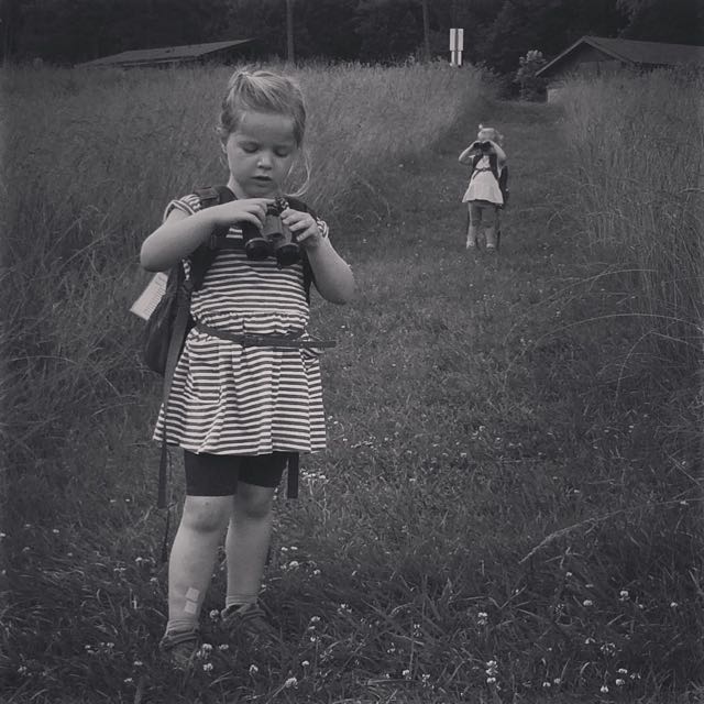
Before exploring the hiking/walking trail in the refuge, we stopped at the Pea Island Visitor Center. It is located a few miles south of Oregon Inlet along NC 12 (not to be confused with the National Wildlife Refuge Center main complex located on Roanoke Island). Volunteers run the visitor center and it’s free to explore. It features a few exhibits detailing the refuge’s history and animals in the area, a gift shop, scavenger hunts for kids, and telescopes for viewing into the marshes. Pea Island received its name because the migratory snow geese that frequented this area ate plants with peas in them.
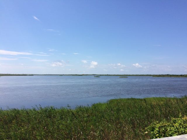
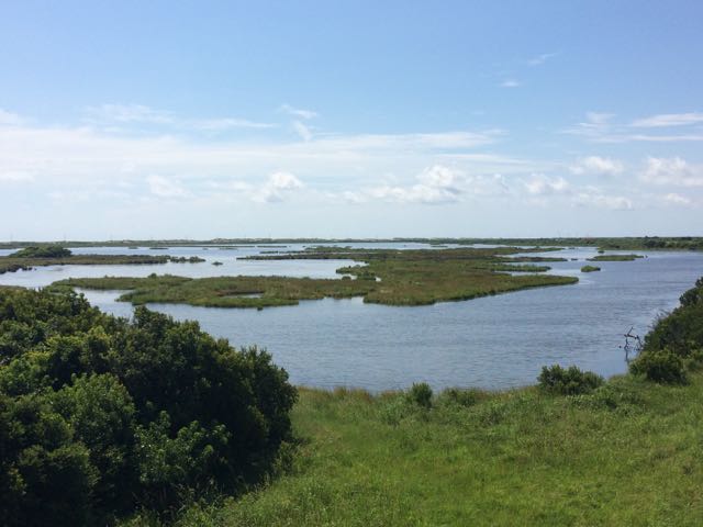
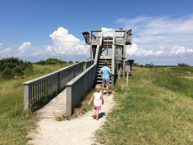 After exploring the visitor center we headed to the North Pond Wildlife trail, which is a 1 mile total walk to the observation deck and back to the visitor center. We first walked along the boardwalk and scoped out the turtles in the “turtle pond.” Continuing on, we walked along a partially paved/boardwalk path between North Pond and New Field Pond where we glanced through fixed binoculars towards North Pond. The trail then became narrow and sandy, but continued to offer beautiful unobstructed views of the ponds. At the end of the trail, we walked up the double decker observation deck, where we could see for miles and identified egrets and turkey vultures. Butterflies were plentiful this day, too. The observation deck features some informational plaques about animals in the refuge and fixed binoculars for viewing.
 The North Pond Wildlife Trail is part of a larger grouping of trails that make up the Charles Kuralt Trail. It was established to encourage people to enjoy the wild lands and recognize this great NC native broadcast journalist who loved exploring remote places. The Charles Kuralt Trail consists of 13 refuges or hatcheries along eastern NC and southeastern VA, offering interesting places to explore.
It was a really hot day, so we quickly walked the 1/2 mile back to the visitor center parking lot (although more adventurous hikers can complete the 4 mile loop around North Pond). After a short bathroom break, we grabbed our picnic lunch and beach bag and walked across highway NC-12 for more beach time. The Atlantic Ocean was beautiful this time of year and the water was relatively calm despite the large thunderstorm that popped up an hour later. Don’t forget to catch a glimpse of the remains of the Oriental, a Federal transport during the Civil War, which shipwrecked in 1862.
Additional Resources:
- Book: Fire on the Beach – tells the story of an all-black life saving crew who worked on Pea Island ensuring the safety of people and cargo
- Pea Island National Wildlife Refuge & Map
- Documented Wildlife at Pea Island
- Charles Kuralt Trail
Thumbs up: beautiful pond views, light foot traffic,
Thumbs down: Bathrooms near trail head


 While we were in the NC mountains, Bill and I scooted out for a day date hike and beers in Blowing Rock. We hiked the
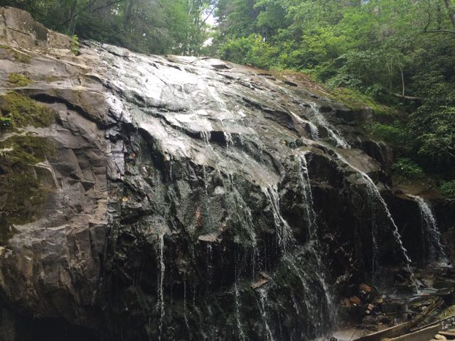
 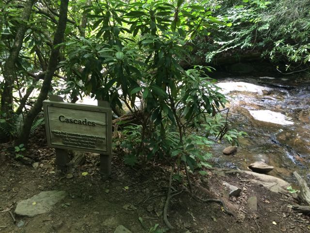 We arrived at the first waterfall, the Cascades, a little past halfway down the trail. The creek water gently flows over these moderately sloped rocks, allowing hikers to cautiously climb up the rocks to higher ground. We stopped to take in the sights and sounds before moving farther down the trail. On our next stop we hiked to the base of the trail at Glen Marie Falls. We climbed up large boulders sandwiched between small streams to get higher views of the mountains in the distance. Again, we stopped for several minutes to take in the quiet sights and sounds.


 We were very fortunate to spend a few weekends in the NC mountains this summer. On our second mountain trip we met up with my in-laws and stayed in a beautiful mountain cabin near the Appalachian Ski Mountain between Boone and Blowing Rock. On a tip from friends, we headed out to the
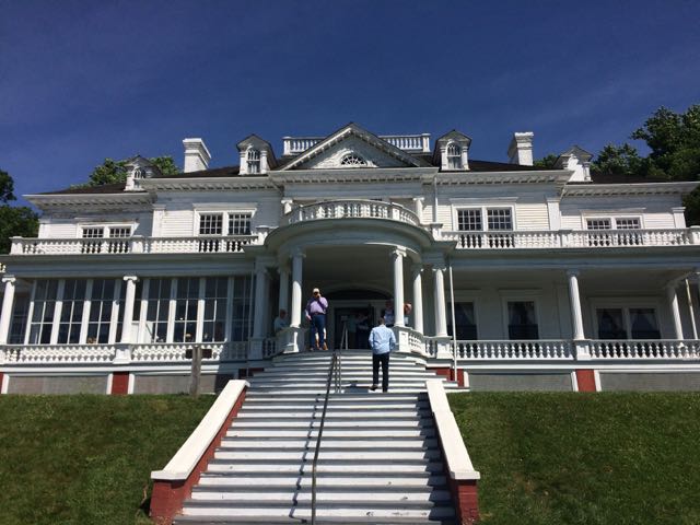
  After spending over an hour at the park, we turned left out of Moses Cone Memorial Park and headed 10 miles south to the Linn Cove Viaduct (MP 304). At an elevation of 4,100 ft, the Linn Cove Viaduct is a concrete bridge engineering marvel snaking around Grandfather Mountain; it is over 1,200 ft long and consists of 153 concrete sections weighing 50 tons each. Construction of the Linn Cove Viaduct was completed in 1983, cementing the final link of the Blue Ridge Parkway.


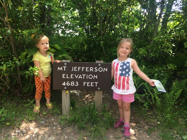 On the way home from our mountain trip in West Jefferson we decided to take advantage of the close proximity to Mount Jefferson and pay a visit. Mount Jefferson State Natural Area is located just east of US 221 at
 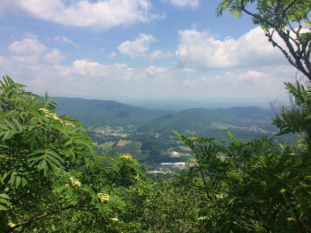 We walked through the picnic area and followed the short Summit Trail (0.3 miles) up the mountain. Although the website lists this trail as strenuous, we felt it was more on the moderate side. Due to our haste planning half of us wore flip flops, but could easily walk the gravel trail. The gravel path is wide and shady giving a cool mountain feel to the hike. Along the way we saw butterflies, rhododendrons, mountain laurel and red-starred flowers; though stop by the park office for official plant and animal checklists. We visited the bathrooms along the way, which were super convenient and an easy walk from the main path. We passed access to the Kids TRACK trail, which is part of the longer Rhododendron Trail (1.1 miles). Near the top we turned left to the Mount Jefferson summit, which has an elevation of 4683 feet. I climbed out a little further to catch the beautiful views of the Blue Ridge Mountains.


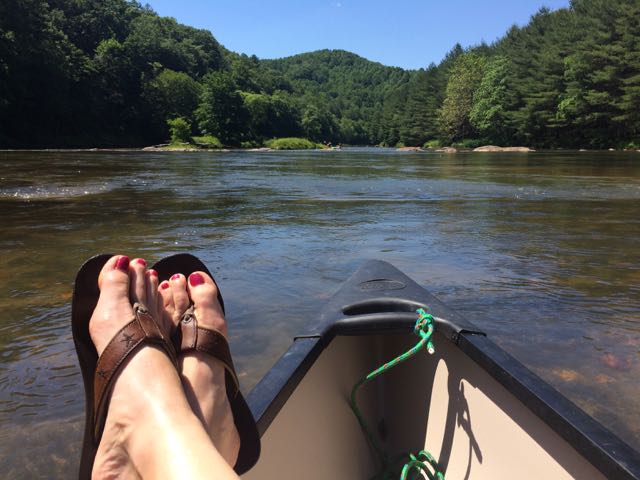 Last month good friends invited our family to their mountain cabin along the South Fork of the New River near West Jefferson, NC. Though this was my first time on this river in NC, being back on the New River reminded me of past trips whitewater rafting through
 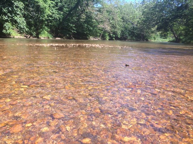 After an exhilarating drive down one-lane gravel roads in an old Chevy truck with a canoe in tow we arrived at a small put-in near the intersection of


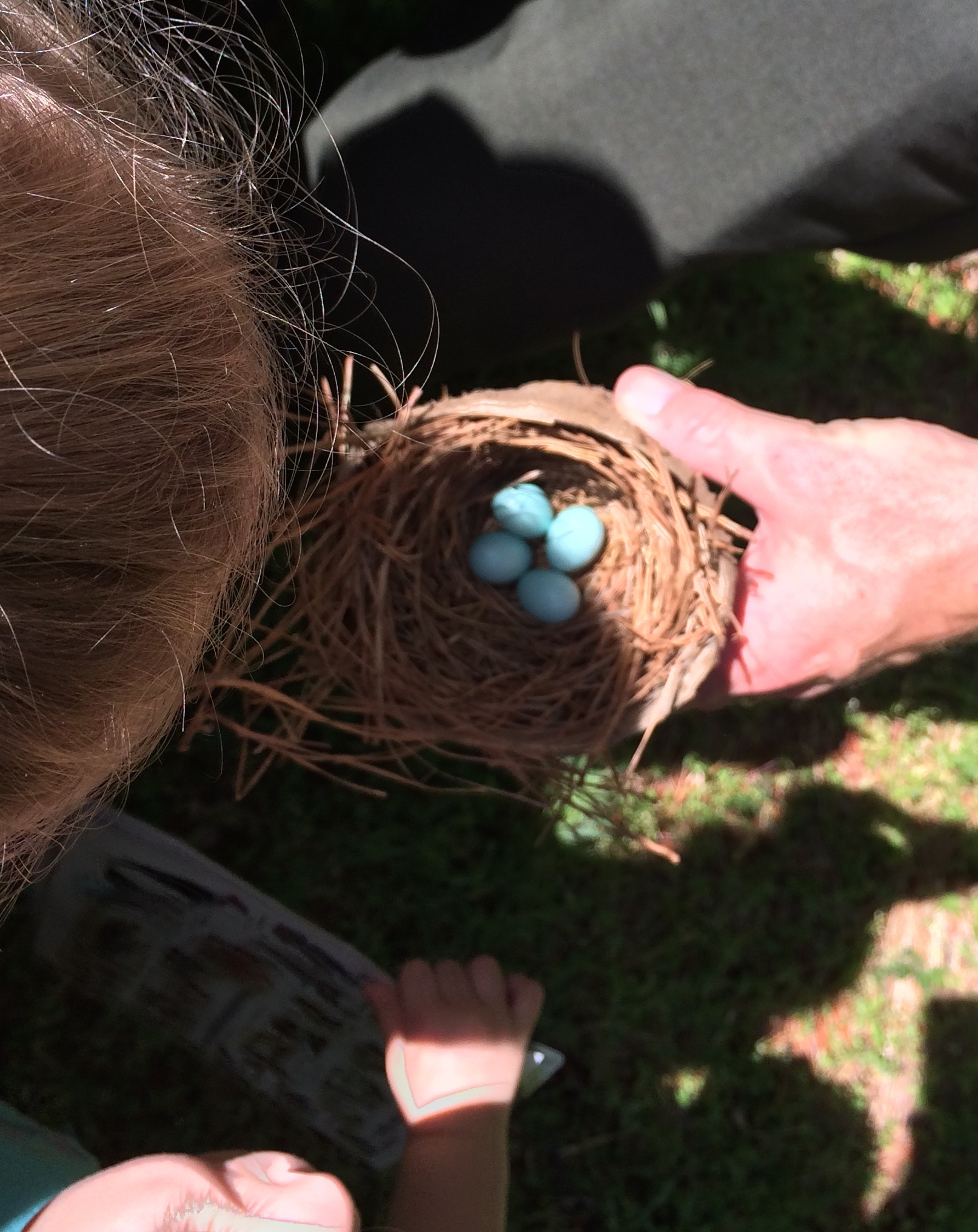
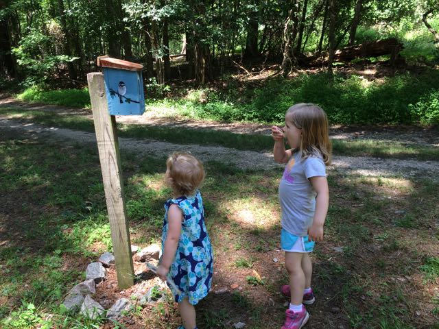 Once the girls finished in the natural play area, we walked across the parking lot and open field area to the bird and butterfly garden. The butterfly garden has a short trail surrounded by natural butterfly habitats of lilac, Queen Anne’s Lace, daylilies, eastern blue star and more. The butterfly garden leads into the shaded bird garden that features a mulched trail with several feeders, bird houses, and informational guides. We heard and saw a lot of birds flying in and around the gardens, but my bird identification skills are pretty pathetic – maybe some adult birding classes are in my future!


 On a cloudy summer day we headed to Annie Louise Wilkerson Nature Preserve Park to explore the nature playground and do some light hiking. It’d been awhile since we’d
 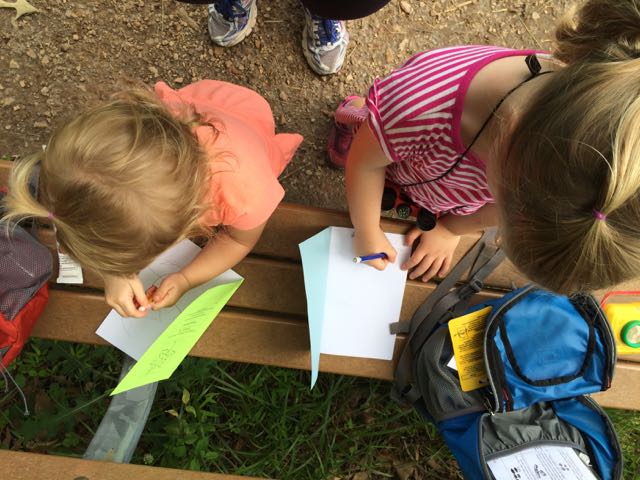 After our short hike we walked through Dr. Wilkerson’s former home, which has been renovated into an Education Center for the purpose of being a nature park research center. The front room is a mini museum of Dr. Wilkerson, highlighting her career and time she spent on the farm. We didn’t visit the other parts of the center, but the


 On day 2 of our
  This trail is about 1.3 miles in total length and is marked as being moderate. The only moderate part of the hike was heading up the bluffs on the way back. The parts along the river were flat and quiet, the only sounds coming from the river and wee ones. In the future when the kids are much bigger I’d love to explore this area further by canoe and camping!


 Two months ago our family headed west to Dobson, NC to visit old neighbors and friends whose son was having a first birthday. Wanting to extend the trip so we could explore more of the Yadkin Valley area, we made it a three-day trip so we could visit Pilot Mountain State Park, the nearby towns, and vineyards. Having passed Pilot Mountain dozens of times via US-52 on our way to Blacksburg, VA we had always wanted to explore this area.
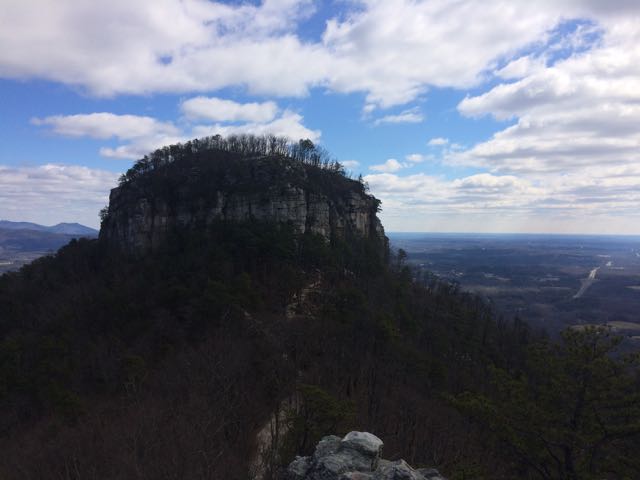 After a restful sleep on Thursday night we got up early and headed for Pilot Mountain State Park. We made a beginner’s mistake by going to the Bean Shoals Access of Pilot Mountain and after a 20 minute detour we found the main entrance to the park (
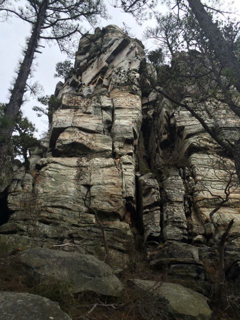 Jomeokee Trail is a short 0.8 mile looped hike around the base of big pinnacle sitting at 2400 ft elevation. To the Saura Indians, the earliest known inhabitants of the area, the mountain was known as Jomeokee, the “Great Guide” or “Pilot.” We headed around the trail counterclockwise, climbing up and down rock steps. There was little up and down terrain on the trail, but the cliff views were impressive to say the least. The trail can get rather narrow and offers some really up close views of the 200 ft Big Pinnacle. After making it about halfway around the base, our crew decided to call it a success and head back, given the cliff views were getting a little too hairy and too close for comfort (there are no railings).


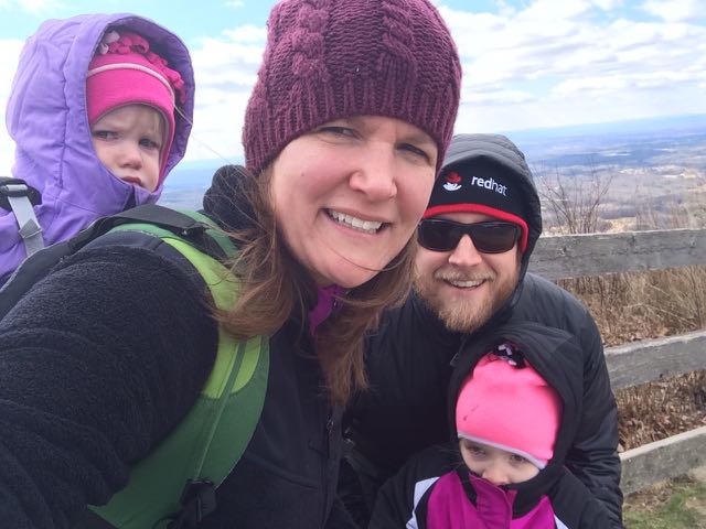
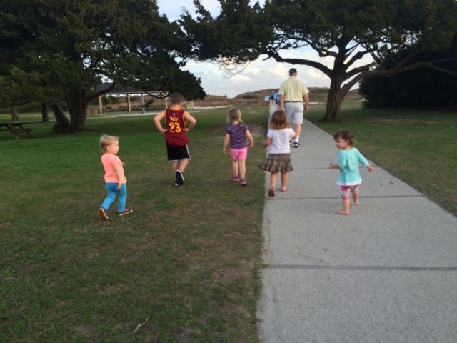 Over New Years we spent time with dear friends at their parent’s new home in Murrells Inlet, SC. I’ve known Jennie since 6th grade and Bill and Jennie’s husband, Gary, became fast friends over a decade ago when we first met Gary. With growing families and distance (they’ve been in Columbus, OH) our time spent together has been few and far between. Lucky for us they are moving to the Greater Raleigh area this Spring so our families will get more time together, which is great news for us and our kids, as they’ve all become fast friends too!
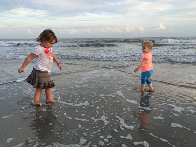 The weather was unusually warm around New Years so shortly after arriving we took advantage of the remaining sun and made the short drive to Huntington Beach State Park, located at
 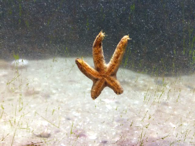 The next day we returned to the park to explore the Education Center, which is only open during daytime hours and offers daily feeding times where you can watch and learn how they feed several of the animals. With about two dozen animals to look at and learn about, we spent well over an hour in the center. They have a touch-tank with a horseshoe crab and stingray, a star fish, baby alligator, terrapins, snakes, turtles, and some hands-on exhibits about the nearby environment. The tanks are at perfect heights for little ones to get in on the action. After we exhausted the Education Center, the kids enjoyed a snack on the outdoor benches and we ran along the boardwalk overlooking the saltwater marshes. We learned about the numerous inhabitants – spider crabs, stone crabs, snapping shrimp, oysters, alligators, and lots of birds. Even though we didn’t see any of the 50-100 alligators living in the park we saw several oysters and lots of birds up close!


