
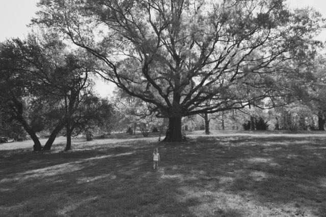
 On the eve of our Spring Break Camping Trip, it’s only necessary that I get back to writing about last summer! Last summer we met up with my in-laws in Black Mountain, NC for a beautiful weekend of hiking, exploring Black Mountain and beyond, and celebrating Claire’s 4th birthday.
Sierra Nevada Brewery (Mills River, NC)
Though we stayed in a gorgeous cabin in Black Mountain, we rarely spent much time in it. We split our time between exploring Asheville and downtown Black Mountain. With Raleigh being only 3.5 hours from Black Mountain, we arrived early on a Thursday (well before check-in) and immediately headed to the Sierra Nevada Brewery in Mills River, NC. The place was unbelievable! It’s as large as a Great Wolf Lodge, and dare I say more enjoyable for all ages! We enjoyed a delicious lunch and beers before heading to the outside area where the girls played in the kiddo-friendly sandbox area while we enjoyed a second round. Sierra Nevada’s outside area is beautifully landscaped, with lots of stone hardscape for eating, gardens, an amphitheater, and large open areas for corn hole. It also features an outside bar area for ordering light snacks and drinks with full-service sit-down areas.
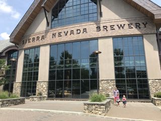 After exhausting the outside area, we dragged the girls (who were pretty willing) through the hallway that showcases their production areas. We glanced at the huge multi-story storage tanks, watched the bottle filling/cleaning process, and saw the packaging area. The girls mildly enjoyed watching the mechanics of how everything worked. Having toured only craft brewery operations, we were blown away by the grandness of everything at Sierra Nevada. I can’t wait to go back!
Pack Square Park (Asheville, NC)
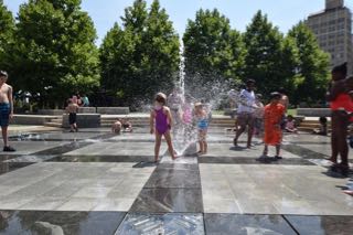 Since we had a little time to kill before checking into our cabin we headed to downtown Asheville to let the girls run off some energy in the water fountains at Pack Square Park. The park features multiple water fountains for splashing in, a large open green space area, nearby Veterans’ Memorial, amphitheater and a few restaurants. It was the perfect quick trip on a hot summer day – we parked right along College St and quickly walked across the street to the park. I’m only hopeful the City of Raleigh will recreate a similar water feature in the new Dorothea Dix park.
Biltmore & Western NC Nature Center
My mother-in-law and I quickly snuck off to Asheville for a visit to Biltmore and its winery. It’d been over 10 years since we’d last gone, so I quickly forgot the estate’s enormity. The first time I visited I left in awe of the house. This time I left with a much greater appreciation for the forests and grounds that Frederick Olmsted created. I had only ever been to Biltmore in the late Fall, so I really enjoyed walking the gardens and seeing how the landscaped differed in Summer. While we visited Biltmore, the rest of the crew explored the nearby Western NC Nature Center. They raved about the animals they saw and the interactive exhibits for children.
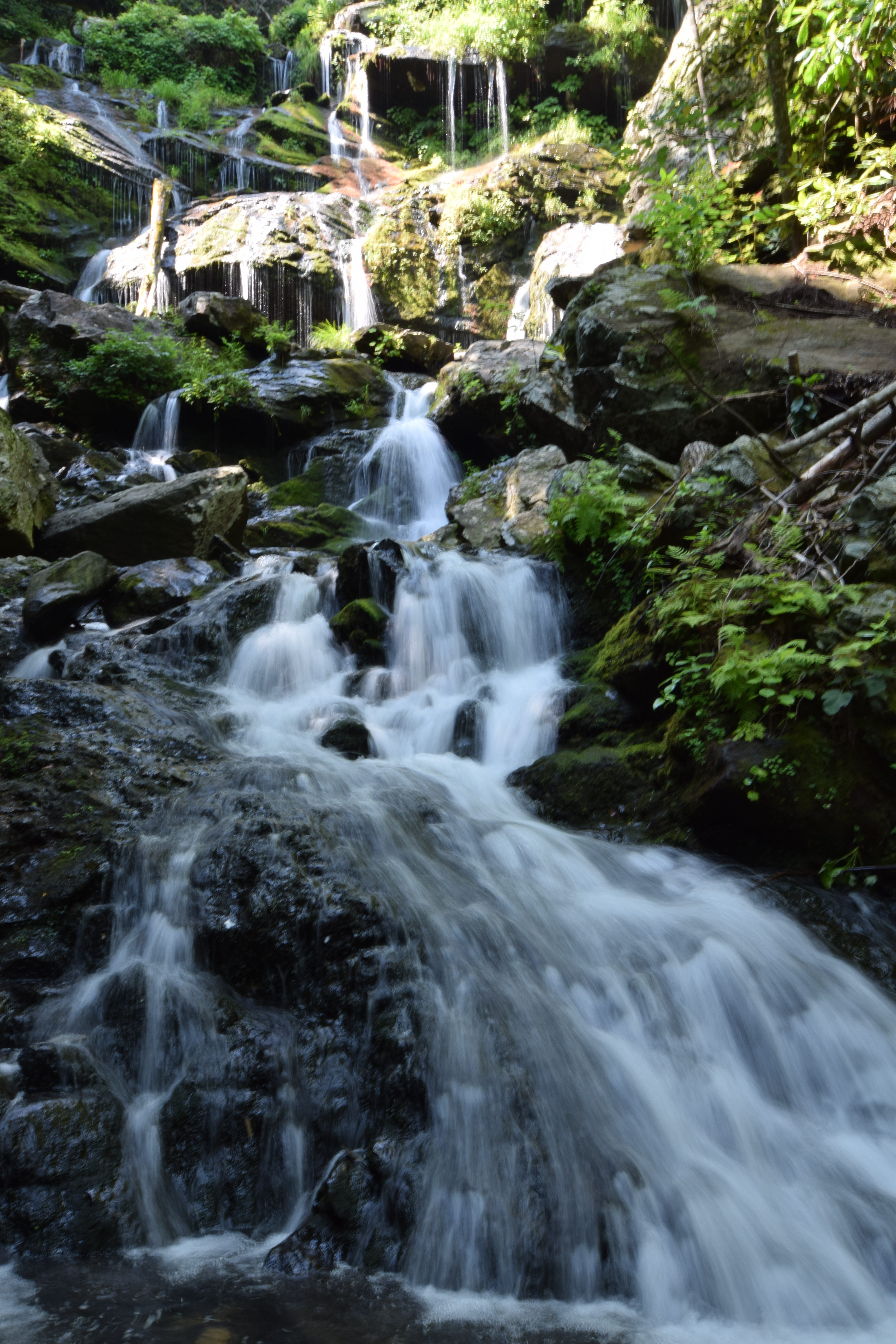
Catawba Falls (Old Fort, NC)
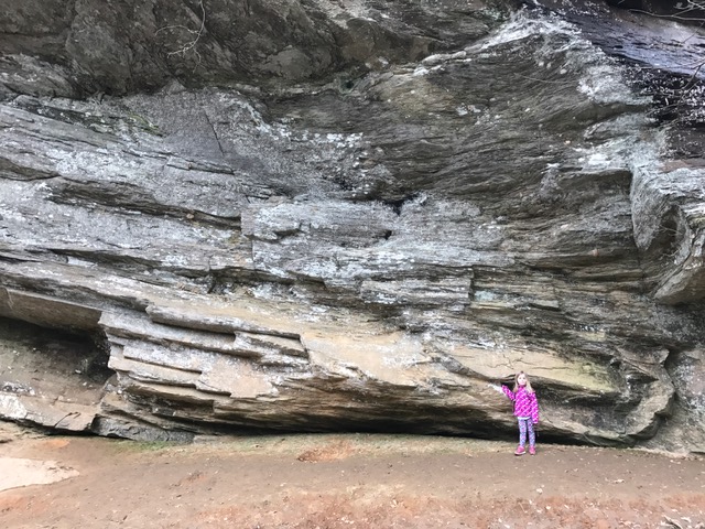
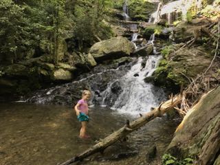 The next day we headed to Catawba Falls, which is in Old Fort, NC and part of the Pisgah National Forest. We parked at the trailhead a few miles south of Route 40 on Catawba River Rd. The trail is about 2.5 miles out and back and climbs about 500ft in elevation. The first 80% of the trail was moderately flat and easy with the last 20% being much steeper and required climbing over slippery rocks to get to the bottom of the waterfall.
We crossed a few streams along the way, which gave the grandparents and kiddos some time to rest and splash. Though the trail is wide, it does have some steep drop-offs so we repeatedly cautioned and held the little ones’ hands. Hiking on Saturday morning proved to be a super popular time, so it’ll take you a little longer to get those special bottom of the waterfall pictures.
After our hike we drove a few miles down the road to the Old Fort Picnic Area of Pisgah National Forest. Though this picnic area has seen better days, it features several picnic tables, old shade trees, and lots of green grass. The bathrooms were less than desirable, but we quickly finished a yummy picnic lunch just as the skies opened.
Downtown Black Mountain
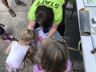 After recovering from our big hike and nearly rain-soaked picnic, we rallied to explore downtown Black Mountain. Black Mountain located in Buncombe County and part of the Swannanoa Valley area is about 15 miles east of Asheville right off I-40. Black Mountain incorporated in 1893, named after the Black Mountain range that borders the town to the north. For a busy Saturday afternoon we easily found a parking spot close to our destination of Swannanoa Valley Museum & Visitor Center. The museum houses two floors of interactive exhibits detailing the history of Black Mountain and surrounding Swannanoa Valley area. The girls enjoyed pounding the keys on an old typewriter and getting hands-on experience washing clothes in the earlier days with a wash basin, washboard, and fels-napth.
Shortly after visiting the museum, we stopped at the Dripolator coffee shop for some caffeine and ice cream. Then we walked all around downtown, stopping in the homemade musical instrument shop, clothing shops and general store.
For dinner we searched Yelp for the best pizza and headed to Fresh Wood Fired Pizza & Pasta. The place looks pretty sketch from the outside, but their pizza was AHMAZING! The crust tasted delicious, the ingredients were fresh and the beer was plentiful!
We thoroughly enjoyed revisiting Asheville and exploring the new (to us) small mountain town of Black Mountain. Whether you want to focus on the food and drink, local history, outdoor beauty or a little bit of all, it features fun for all ages. I can’t wait to explore this area again, maybe in the Minnie Winnie next time!


 It’s week three of an NC cold wave and I’m longing for our hot summer hike in Kilmarnock, Va. When traveling last summer we started looking for hiking suggestions with the
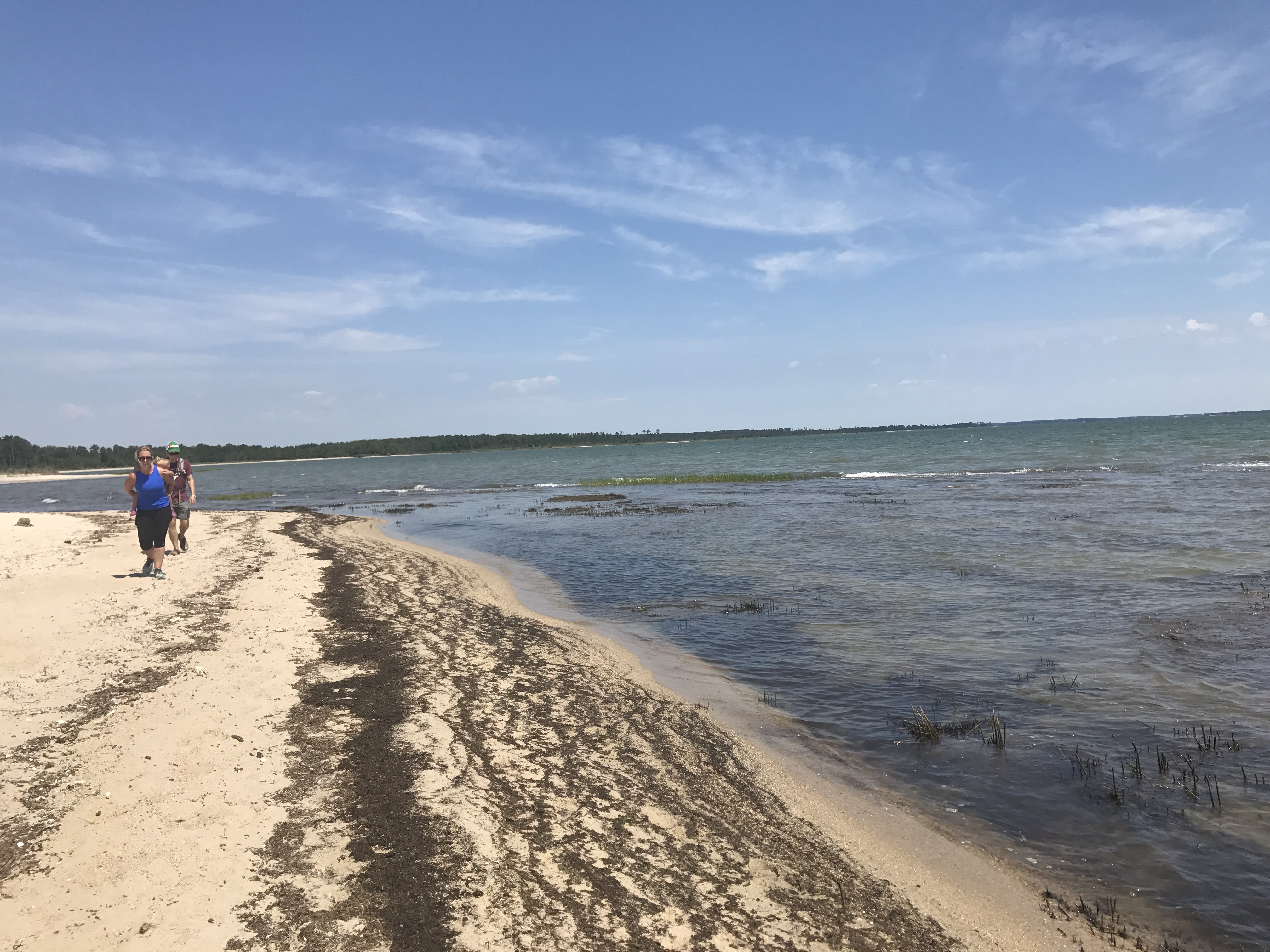
 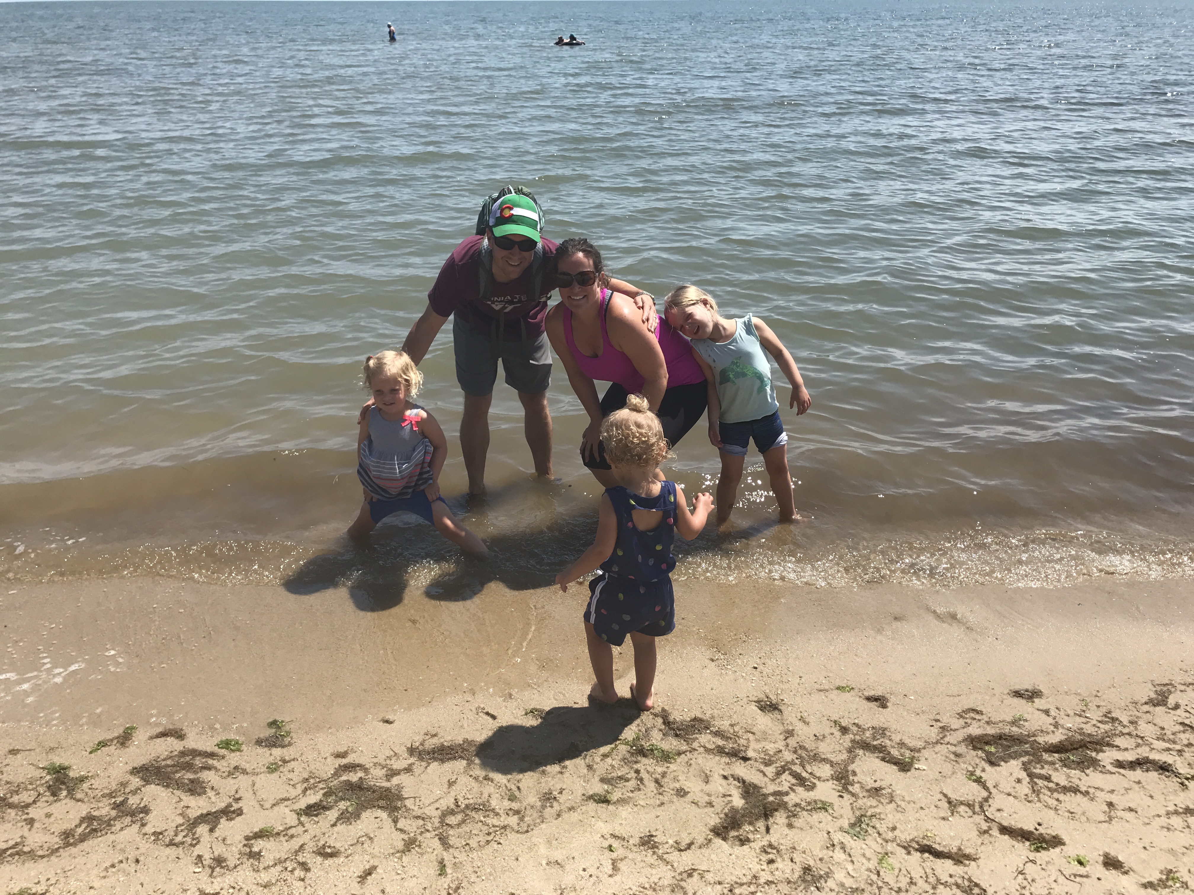 After parking at the trailhead we walked along the wooden walkway through the forest. We soon saw a sign post, and turned left to follow the North Loop. Shortly after starting along the North Loop we arrived on the Chesapeake Bay’s beautiful sandy shoreline. The sudden change from forest to deserted beach was breathtaking. The girls immediately waded into the water, while the adults took in the beautiful views. Being a flat undeveloped area, every direction we looked gave different views of a sandy shoreline, endless bay water, or grassy wetlands. It almost felt like we were on a deserted island.
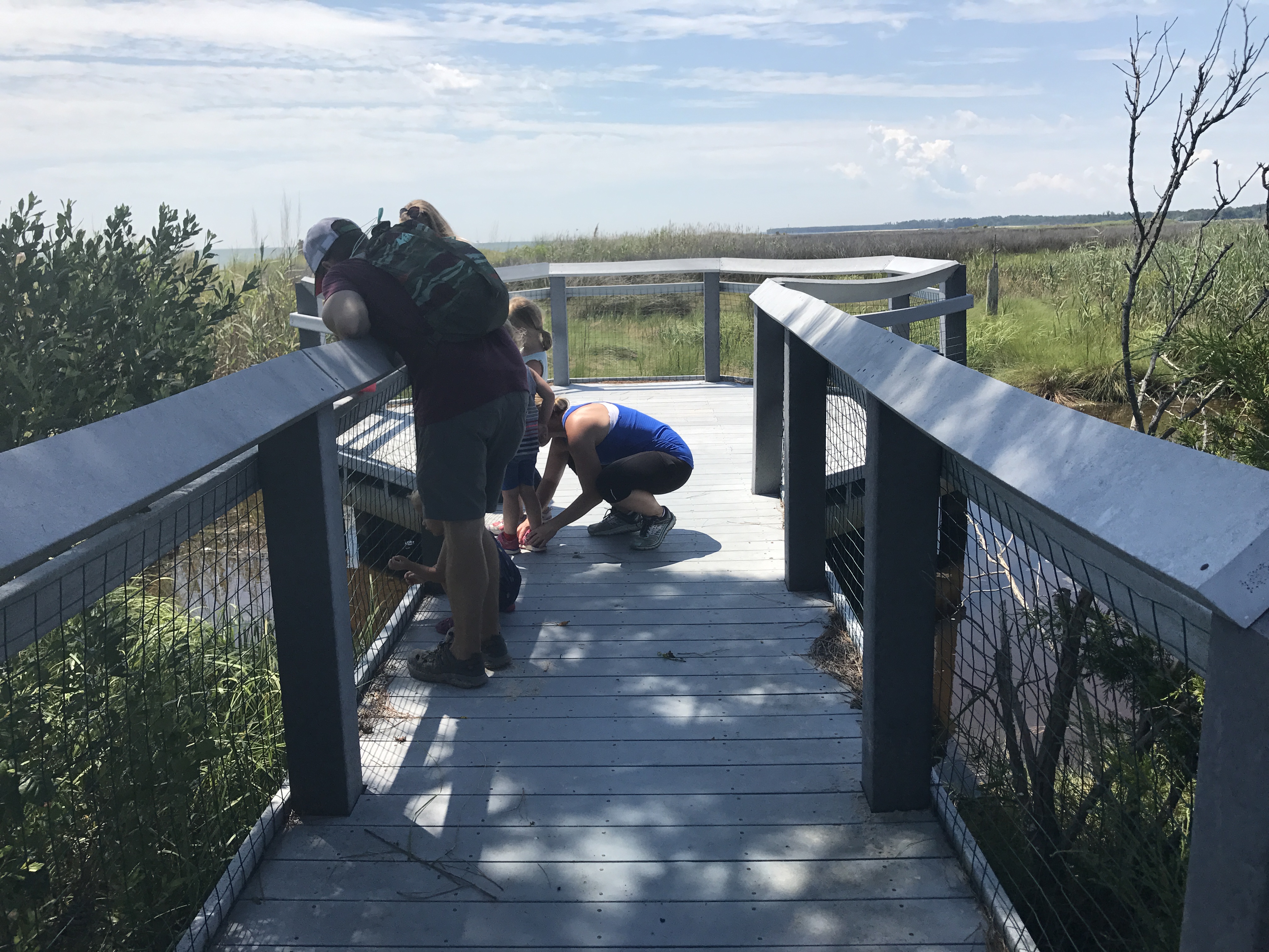 We caught our breath at an observation deck where the swimming crabs distracted the little’s tears. This trail features a few observation decks that overlook the flat and vast wetland areas. After watching the crabs swim through the water we continued walking on the dirt trail back to the parking lot. Unfortunately, we ran into some dense bug families through the forested walk back. Since the girls regained their breath while watching the crabs, they miraculously sprinted through the dense bug fog, and made it back to the car in record time.
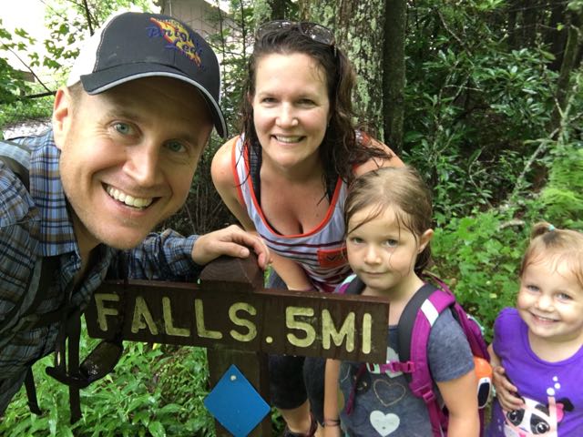 For our next Winnie adventure we headed to the beautiful Blue Ridge Mountains near Marion, NC. We stayed at the
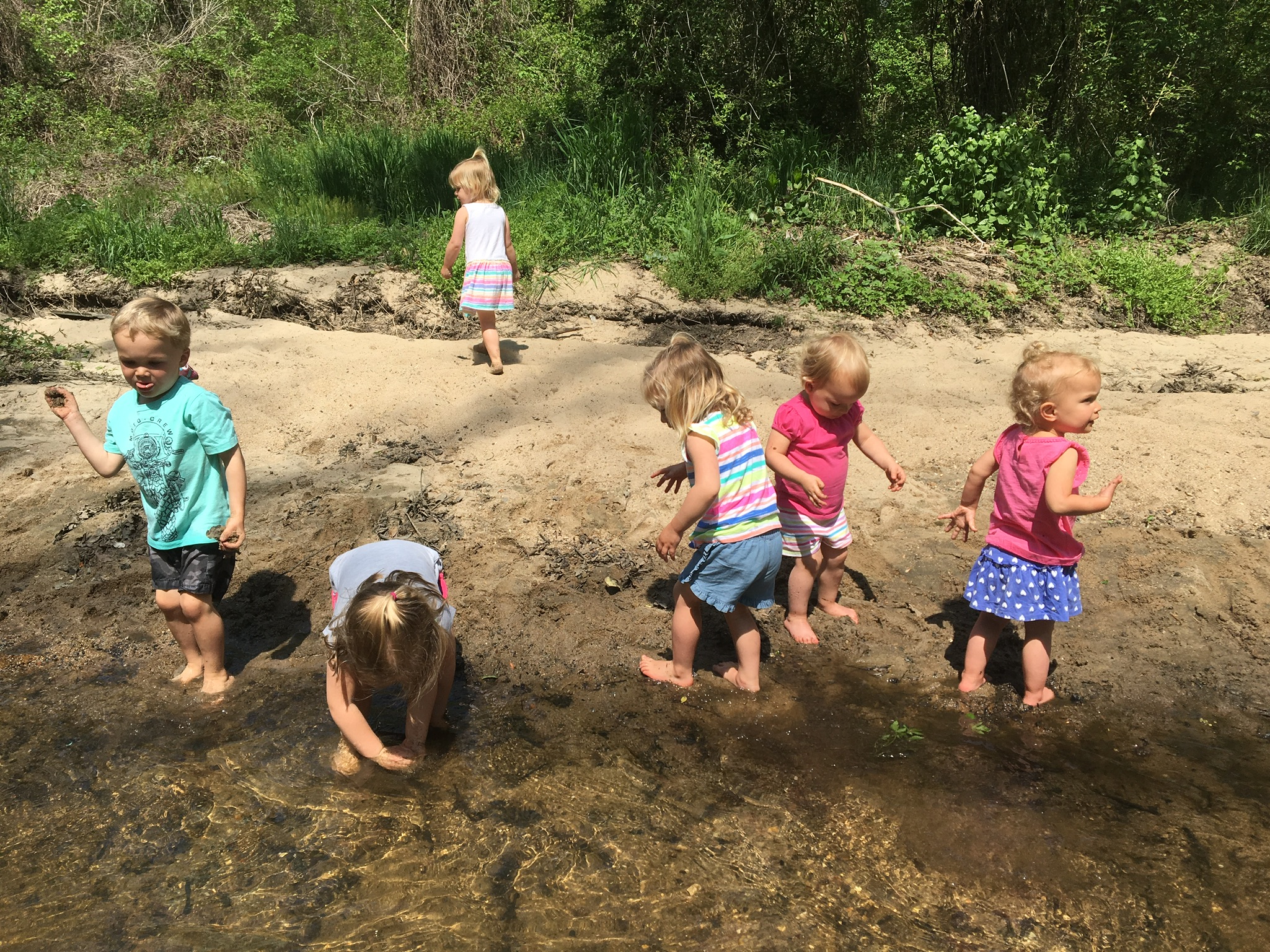
 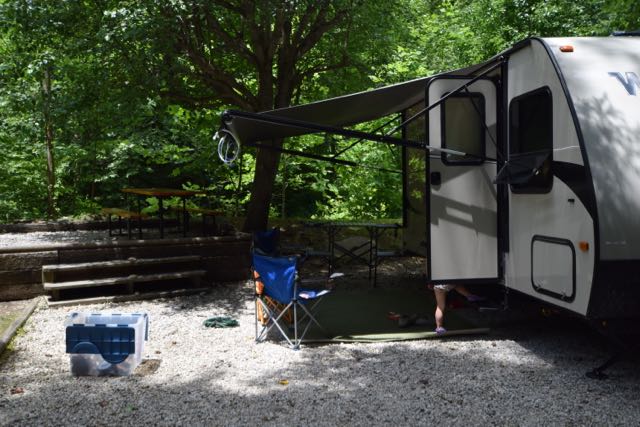 The Mountain Stream RV Resort was the perfect spot for camping. They have 40 camp sites situated around a loop gravel road with a grassy median. A cool, clear mountain stream runs behind more than half of the campsites. We stayed in one of their prime spots near the back of the campsite with easy kid-friendly access to the stream. We loved splashing in the water, walking upstream, and sitting at the campsite listening to the babbling stream.
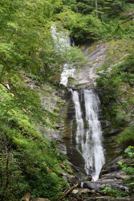 We spent all day Saturday hiking waterfalls in the Pisgah National Forest and exploring interesting places off the Blue Ridge Parkway. First, we explored the Tom’s Creek Falls, located about 20 minutes northeast of our campsite. Tom’s Creek Falls trailhead is about 1.3 miles from the
 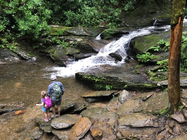 After leaving Tom’s Creek Falls, we drove about 45 minutes northwest to the Roaring Fork Falls trailhead. Roaring Fork Falls trailhead is located near the


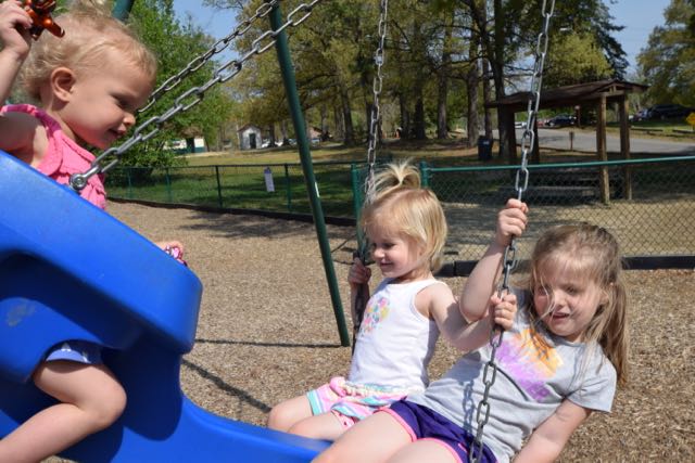


 In January we headed with friends to Umstead Park to explore the super kid-friendly Oak Rock Trail, which is only 1/2 mile long. This is a great hike for young families or large groups with young kids. The trail has easy access to clean restrooms and picnic tables, and shallow stream access for water fun in the warmer months. It’s also part of the
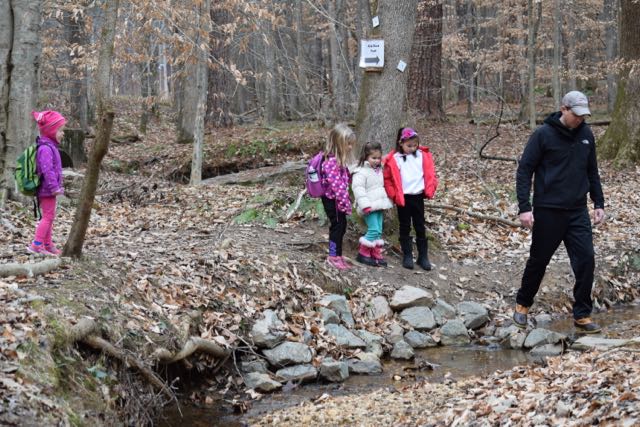


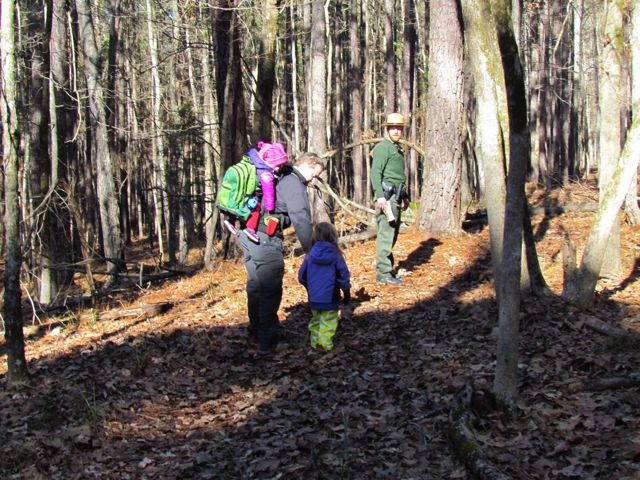
 In mid-January we headed to
 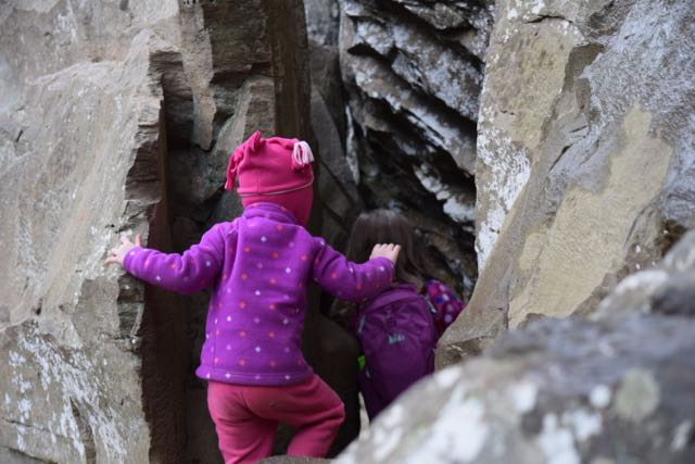 Then, we walked a little further until we arrived at the steep zig-zag stairs leading to the Raven Rock outcrop. We carefully walked down the windy stairs, stepping to the side to allow others to pass us. At the bottom we reached flatter ground with easy access to the river and the enormous Raven Rock outcrops. The girls loved climbing around the huge rocks and over the tree with the tangled web of tree roots. Portions of the rocks were large enough to crawl under and around, making for fun hiding spots. We also enjoyed listening to the trickling springs dripping from the moss-covered rocks overhead.
 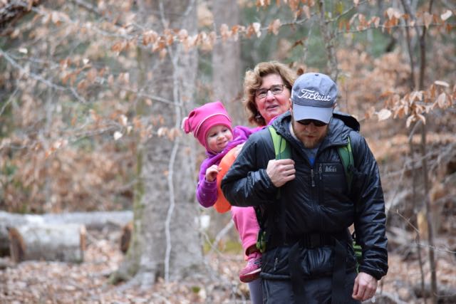 After climbing around the main Raven Rock attraction, we ascended up the windy stairs and finished the steeper part of the loop trail. We crossed the stream a few times and enjoyed looking for wild animals through the bare forests. Lastly, when we returned to the trailhead we passed picnic tables, a large pavilion and the entrance for the American Beech Trail featuring the Kids in Parks Track Trail. Though we didn’t have time to hike it, this easy 0.5 mile hike features fun adventures such as Nature Hide ‘n Seek to excite kids about hiking. We also passed signs with information about the canoe-in camping.


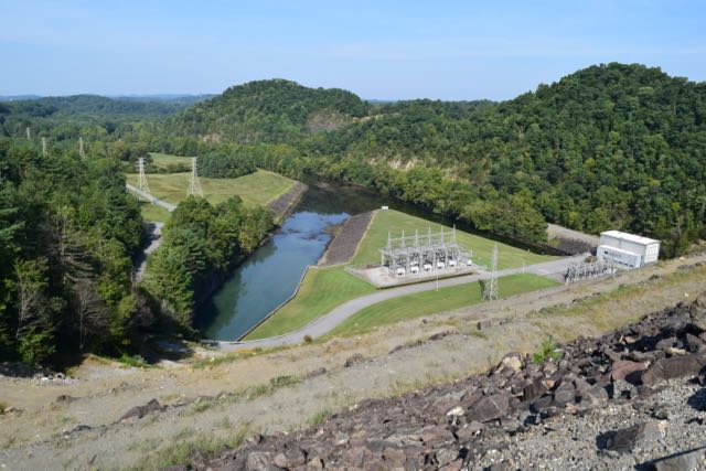 Dam, Plant & Reservoir
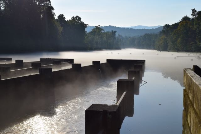 Osceola Island


 Lace up your hiking boots and head outside on New Year’s Day for an organized hike in a local park. Every state park in NC (city parks are catching on, too) organizes
 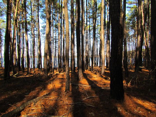 Falls Lake State Recreation Area – scavenger hunt with hike along Rolling View Track Trail (0.75 miles); start times at 10am, 11am, 12pm, 1pm; pre-registration is required; prepare for natural surface walking;
 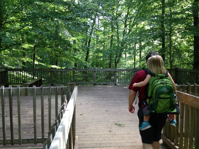 Umstead State Park – 1.3 mile hike along Pott’s Branch Trail; start location: small parking lot by Pott’s Branch trailhead (Hwy 70/Glenwood Ave); 9am start time;
 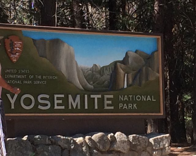 Who’s up for a last minute visit to Yosemite with young kids during the super busy summer months? We are! Capitalizing on our successful Norther Ca trip, we rolled the dice on our final full day and drove our family two hours west to explore Yosemite for the day. With plans to rendezvous at my uncle’s rural 1910s family cabin situated on original Yosemite roads, we left early in the morning with a full tank of gas, fully charged iPads, open minds, and lots of food.
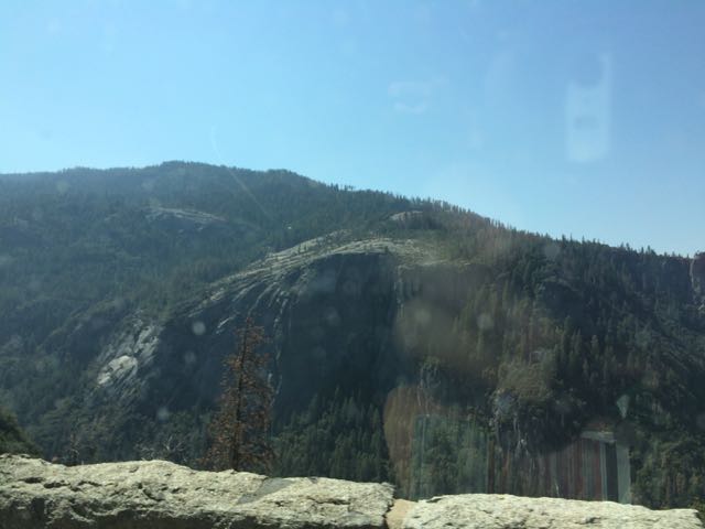 Since the Yosemite trip was last minute, intermittent cell service limited my mobile-friendly research as we drove through harrowing switchbacks and rural towns. Following my aunt and uncle’s advice, we headed to the popular Valley area of Yosemite in hopes that we could catch glances of El Capitan, Half Dome and some of the waterfalls. Driving from Sonora, Ca we drove along 120 East through Groveland and the Big Oak Flat Entrance. The drive through Yosemite starts out hilly with dense conifers and then becomes hillier with sparse shrubs, dead underbrush, sand, rocks and old dying pine trees. Then, suddenly before crossing into the big tunnel, the massive granite rocks explode before your eyes. You catch really quick (yet far away) views of El Capitan and Half Dome before going through the tunnel. After the tunnel you wind through switchbacks catching different views of the granite formations. Yosemite is enormous – it takes at least 40 minutes to drive from the main entrance to the bottom of the park.
 Knowing the park would be busy, we aimed for short hikes easy in difficulty and with easy access. Using the simple
  Lower Yosemite Falls Trail is a one mile paved trail with little elevation change making it an easy walk for everyone. The path is mostly shaded with giant sequoias and huge slabs of granite rock making for nice photo backdrops. About half mile into our walk we arrived at the observation bridge of the falls. Lower Yosemite is the bottom waterfall section of the three-part Yosemite Falls. Unfortunately, with it being late summer the waterfall sprayed a mere trickle, but we tried to imagine the
 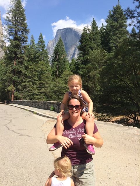 Wanting to get closer to Half Dome I quickly researched places within the valley to catch a glimpse. I learned the meadows behind the Majestic Yosemite Hotel (formerly known as the Ahwahnee Hotel) provide good views of the massive mountains, so we rode the shuttle bus to stop #3 outside the hotel. The hotel was built nearly a century ago with the design influences of Art Deco, Native American, Middle Eastern, and Arts & Crafts Movement. We walked to the back of the hotel, through a small path and turned left on the pedestrian path. Before crossing over the pedestrian bridge we arrived at the best spot we could find with a good glimpse of Half Dome (elevation 8800ft) in the background. Even from so far away it’s amazing to imagine people (including my crazy aunt) hike the 16-mile round trip.


