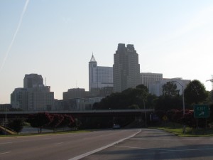
A few weeks ago, I woke up before sunrise and headed downtown with just a coffee and my camera in hand. I have a lot of photos of parks and greenways throughout the city, but not many personal photos of downtown Raleigh. It was a muggy Sunday morning, so downtown Raleigh had a faint Bourbon Street-like smell with evidence of a super fun Saturday night. I’ve always had a lot of respect for real photographers, but after this personal quest to capture photos to print for our house I have so much more appreciation for the pros who can really nail down the fine details of light, exposure, camera angle, etc. It was fun, but exhausting hopping around downtown from Boylan Bridge, near the Shimmer Wall, on McDowell St looking North into downtown Raleigh, and on Fayetteville St.
After about an hour of exploring and taking photos of downtown Raleigh, I headed back to North Raleigh to capture photos from one of the highest places of elevation in Raleigh – Top of the Hill trail in North Wake Landfill District Park. I’ve visited this park before, mostly for the kids to play on the playground, so it was nice to explore a park solo. After entering the park, which is under construction, I parked in the small parking lot and made a short .1 mile walk up the gravel trail. The 360-degree views from the top are amazing! Despite a muggy morning, I could still see several downtown Raleigh buildings (thanks to the bright red Redhat sign), neighborhoods and water towers in the distance, and trees for miles! It was so comforting to see how green Wake County still is!
Other than great views from the top, there are several picnic tables, benches, and a bike rack. Even though my downtown Raleigh pictures didn’t turn out as well as I would’ve liked, the whole experience certainly fueled my desire to practice and learn more about photography.
More Resources:
previous post about North Wake Landfill District Park
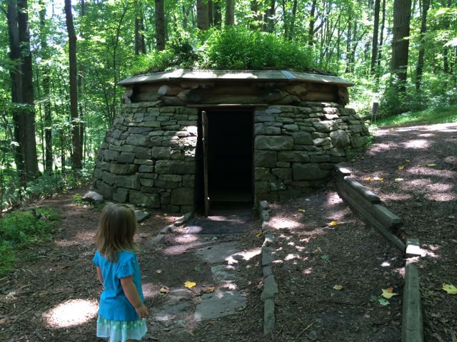
A few weeks ago, Bill planned a fun Sunday outing to explore the outdoor Cloud Chamber for the Trees & Sky exhibit (aka Hobbit House) at the NC Museum of Art’s Museum Park. Between trips with out of town guests and regular Stroller Strides workouts, we’ve been to this museum a TON, but never to see the Cloud Chamber exhibit or hike the corresponding unpaved trails.
We parked in the large parking lot off Blue Ridge Rd and headed down the paved trail towards the infamous Gyre exhibit (the three huge concrete ellipses). After passing the Gyre and Chairs in the Trees exhibits, we made a right onto the Blue Loop and then a left onto the unpaved trail that starts by the Crossroads/Trickster I exhibit. The unpaved trail starts out as gravel, but then we made a slight right towards the Cloud Chamber and the path became grassy and then a very narrow dirt trail in the wooded section. We made the mistake of bringing a BOB Revolution SE Stroller and should’ve brought a carrier for Claire and let Ashley walk. Having two adults made it easier to maneuver the stroller over the bridges, but I wouldn’t recommend it.
So, after a short walk through the wooded section we found the Cloud Chamber house, which looks like a replica of Bilbo Baggins’ house. It’s a short, circular house built into the side of the hill with large stones, some criss-crossed logs, and a green plant-based roof. It has a concrete floor and a heavy wooden door and the house’s neat feature is that it acts as a camera obscura. After entering the house, close the door and wait for your eyes to adjust to the darkness and you’ll see faint views of the sky as light is projected through an opening in the roof onto the floor of the house. Bill took Ashley into the house by themselves but didn’t stay long and then I went in by myself and witnessed puffs of sky inverted on the floor…it was neat to be able to look “down” onto the sky! And, I don’t think we’ll ever forget our trip to the Hobbit House with Ashley asking where are the “wobbits” every minute; poor girl was expecting to see some real life hobbits.
We then continued our walk along the loop trail where we also saw the Untitled exhibit by Ledelle Moe, which looked like a small concrete person concrete curled into a ball. After completing the loop trail we headed back to the gravel path and turned right. We headed downhill and came across the Whisper Bench exhibit, which was a fun interactive piece of art for Ashley. It’s two steel benches on opposite sides of the trail that are connected by an underground sound pipe. Ashley and Bill enjoyed talking back and forth to each other and I loved hearing the toddler giggles! After the Whisper Bench we continued on the very sunny gravel path that led us uphill and back to the paved trail near Lowe’s Pavilion. Finally, we stopped for a quick picnic lunch inside the pavilion before heading home for naps.
It was such a fun morning filled with fresh air, science and art and I didn’t have to plan any of it… #besthusbandever!
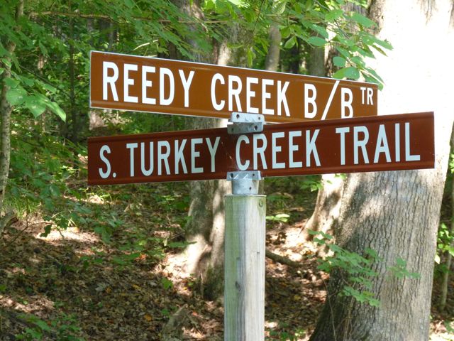
Craving some exercise and needing to leave the house for a Sunday morning showing (yes, cute house for sale), we headed to Umstead Park a few weekends ago to check out S & N Turkey Creek Trails. We figured we’d park at our regular spot in the median off Reedy Creek Road, but came to find nothing but “No Parking” signs! Ugh, you could sense the frustration I had when I saw them. There are a few nearby neighborhoods, but those too have several “No Parking” signs along the streets and my husband’s disapprovement of parking in random neighborhoods meant we had to search elsewhere.
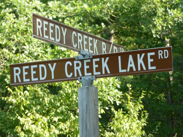
Knowing S & N Turkey Creek Trails parallel much of Ebenezer Church Rd, we drove over that way looking for the parking spots I stashed in my memory bank. Heading north on Ebenezer Church Rd, just past Clyden Cove on your right, you’ll come to gravel/dirt parking on the left-hand side of the street. There are several “No Parking” signs near the gate so just be sure to park towards the left.
After quickly bundling up the baby, we set off down the gravel hill and continued north on S Turkey Creek Trail. If you head left at the bottom of the hill, you’ll go south back towards Reedy Creek Rd. Very soon in our trip we came upon Crabtree Creek followed by Cedar Ridge Trail, one of the many hiking trails in the park.
Continuing on, N Turkey Creek Trail begins. A bike race was happening this particular Sunday morning, so it was pretty exciting to see all the bikers with race bibs zoom by us. There are some narrow sections on this trail, but for the most part they are wide, gravel paths. Lucky for me, Bill pushed the stroller on the way out and dealt with most of the hills. Knowing Ashley would be hungry soon, about 30 minutes out we turned around and headed back for the car.
I love exploring the Umstead Park trails because of its peacefulness amidst a bustling city. Regardless of the trail you explore in Umstead, it’s bound to be an exciting one full of walkers, runners, bikers, or horses!
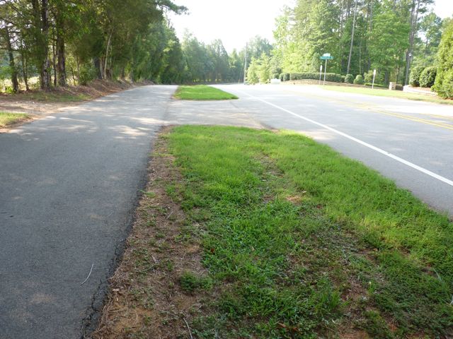
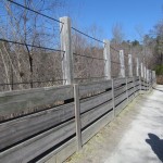
Two weekends ago we made a short drive to the Umstead Park entrance near the intersection of Reedy Creek Rd and Trenton Rd to try our new BOB stroller. We parked in the grassy median between the paved greenway trail and Reedy Creek Rd since there isn’t an actual parking lot. Be careful to abide by the parking signs.
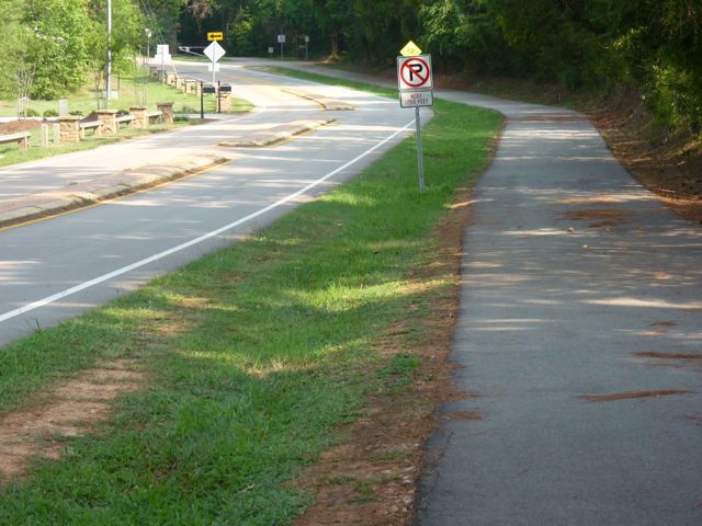
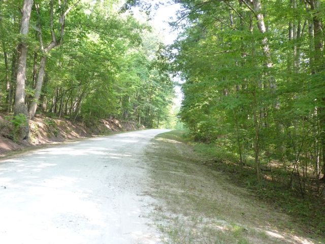
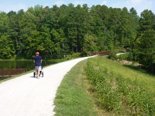
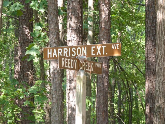
Once in the park, we decided to head straight and follow the Reedy Creek Trail, which we’ve biked several times in the past. It’s a wide, gravel, mostly shady trail that is great for walking, running, biking, and horse back riding. It’s a very long trail that eventually goes past the Airport Overlook, crosses I-40 west of Harrison Ave, and connects with the Black Creek Greenway. Even though we didn’t see any horses that day, we’ve definitely seen them on cooler days. The new stroller glided over the gravel trail, but we did have to be more careful when going over washout areas.
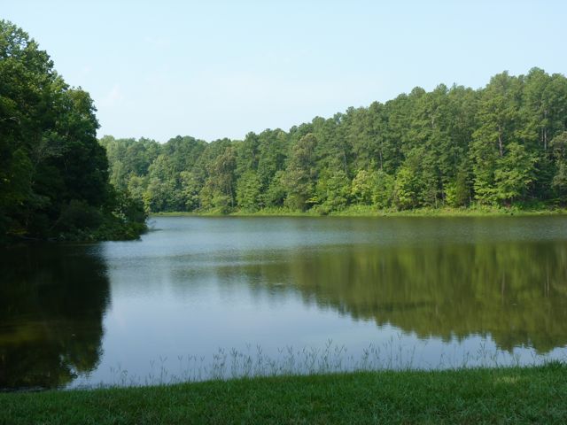
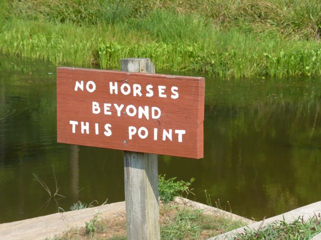
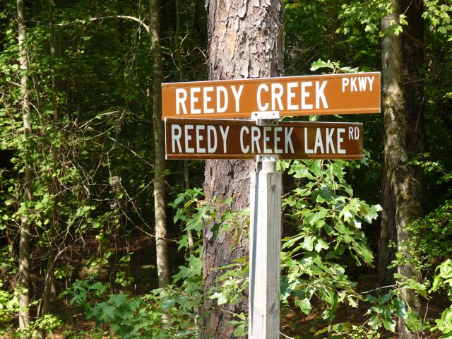
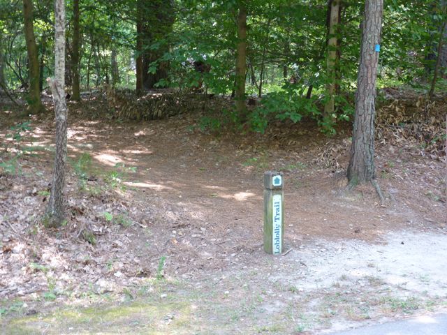
Along Reedy Creek Trail, you’ll pass access to other popular trails such as the Loblolly Trail (heavily wooded trail for hiking) and Reedy Creek Lake Trail (access to the Harrison Ave entrance of Umstead Park). Knowing the Reedy Creek Lake Trail is a relatively short walk and passes by Reedy Creek Lake we made a sharp left turn onto Reedy Creek Lake Trail. You’ll immediately pass by Reedy Creek Lake, which is great for photo ops but swimming is prohibited. Horses are not allowed any further on this trail either. Here is a 360 degree video taken along the trail by the lake.
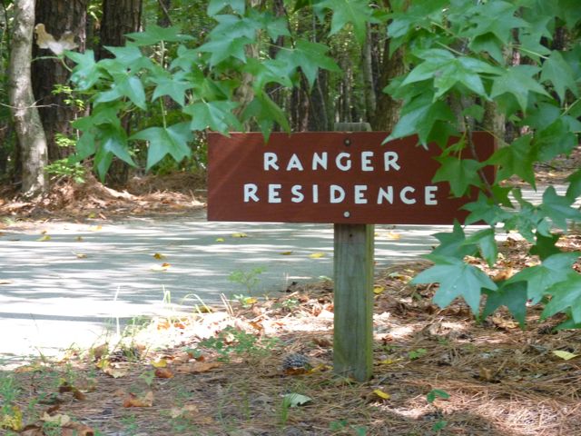
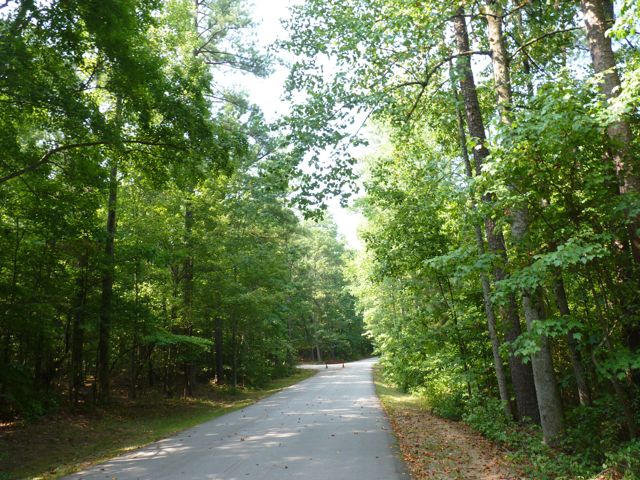
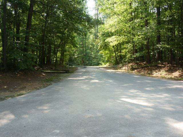
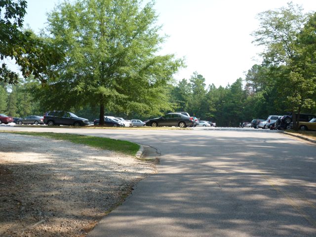
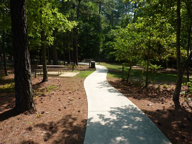
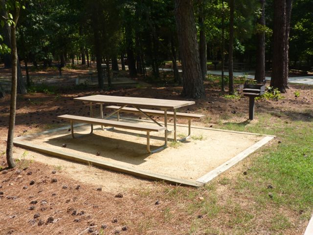
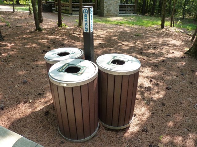
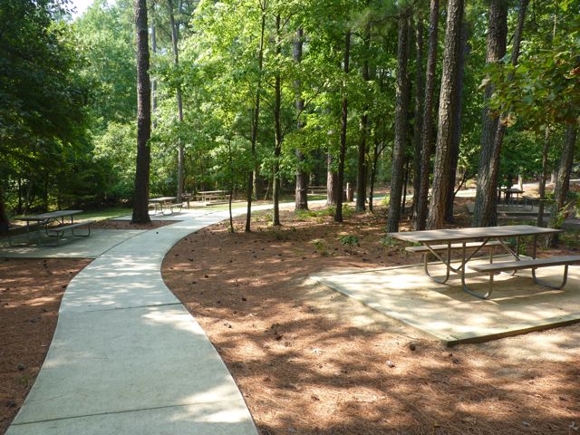
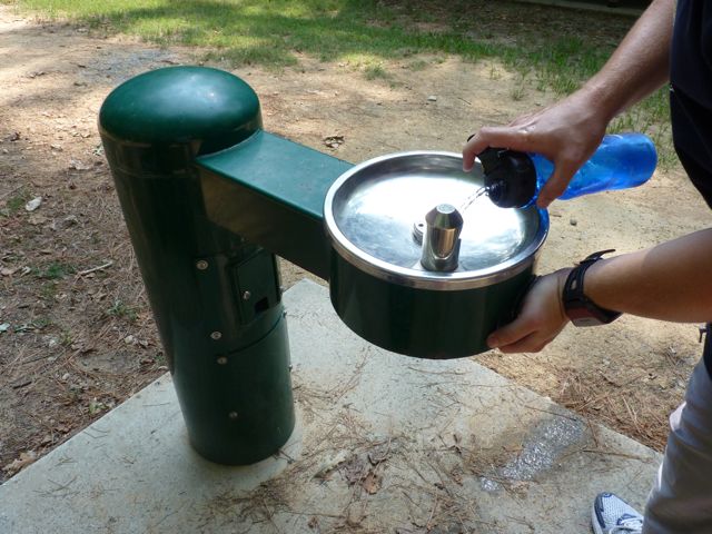
Continuing on the trail is a long, steep hill that eventually flattens out. It’s quite shady and also a gravel path, perfect for using the new stroller. Eventually you’ll come to the trail head at the paved Reedy Creek Pkwy, which leads to the Harrison Ave entrance of Umstead Park. Follow Reedy Creek Pkwy where you’ll pass the Park Ranger’s residence and eventually come to the large Harrison Ave parking lot. We needed to refill our water bottles, so once in the parking lot we stopped at the first shelter on the left, Shelter #2. We followed the paved sidewalk where we passed several picnic tables, charcoal grills, recycling areas, a water fountain, and a large pavilion for Shelter #2.
After a water refill, we quickly began our hike back to beat the encroaching heat! This has to be one of my favorite trails in Raleigh. It’s a great combination of shade, scenery, and steepness. Even though we walked most of the hike, the steep hills made for an exhausting workout. To extend your ride/walk further start by parking at the NC Museum of Art and following Reedy Creek Rd across Blue Ridge Rd and Edwards Mill Rd before arriving at Umstead Park.
Distances:
1.1 miles from Reedy Creek Rd entrance to Reedy Creek Lake
1.7 miles from Reedy Creek Rd entrance to Reedy Creek Pkwy
2.4 miles from Reedy Creek Rd entrance to Harrison Ave entrance
Thumbs up: wide, shady trails, helpful maps, scenic views, good combination of steep hills and flat roads, access to other trails, signs and maps
Thumbs down: little parking near Reedy Creek Rd entrance
Parking in the grassy median
In our new stroller
Some grassy medians show no parking signs
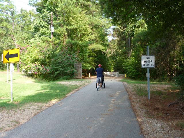
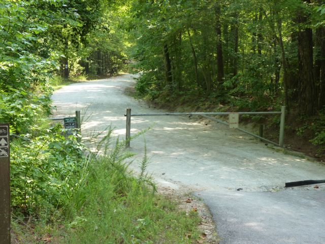
Heading into the park
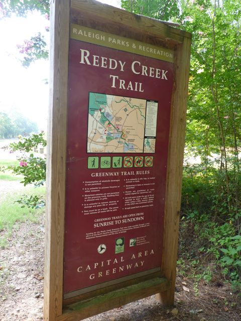
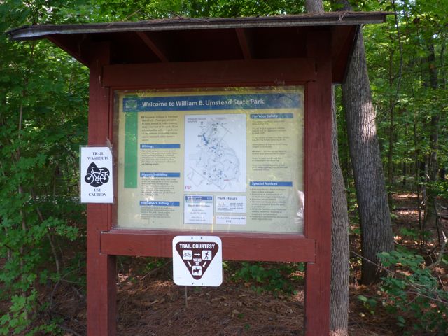
Entrance sign
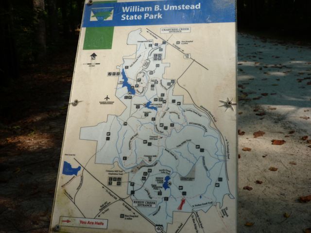
Park map
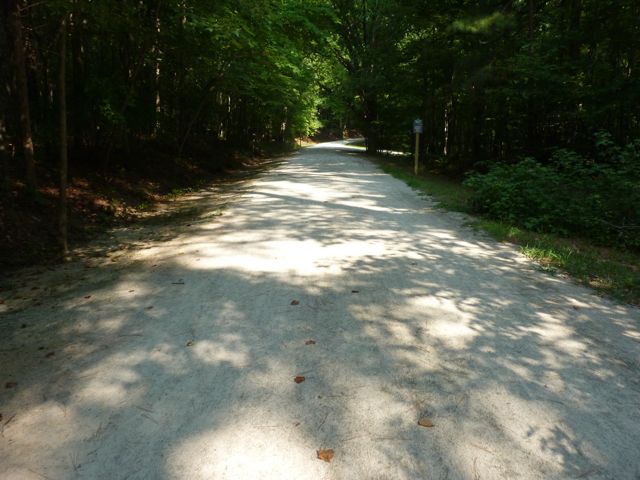
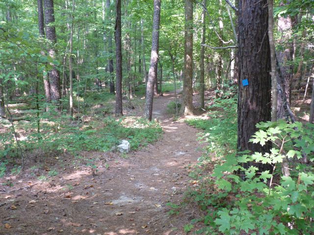
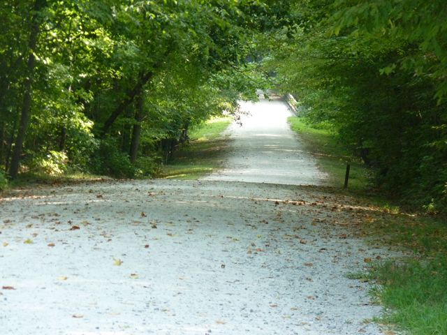
Shady, gravel trail
Signs near the entrance
Another view of the trail
Smaller maps near other trail’s access
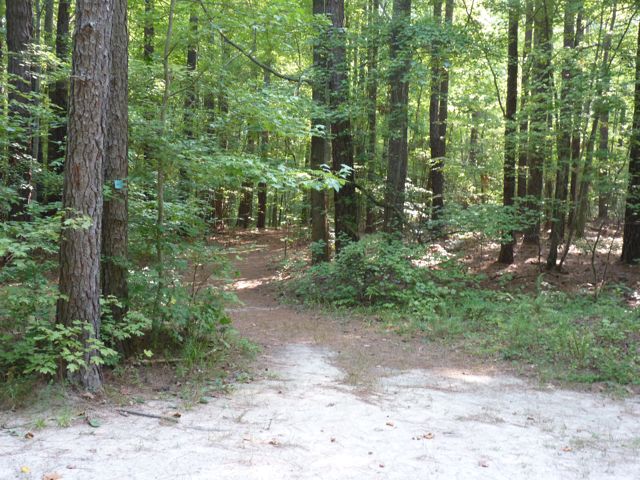
Loblolly Trail access
Another access way
Washout on the trail
Intersection of Reedy Creek Lake Trail and Reedy Creek Trail
Looking back towards the trail
Reedy Creek Lake
Full sunny view of the path near the lake
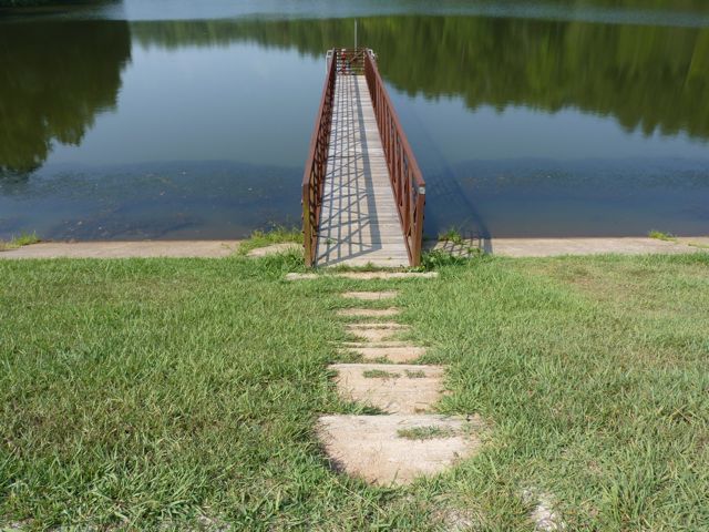
Stairway toward the lake
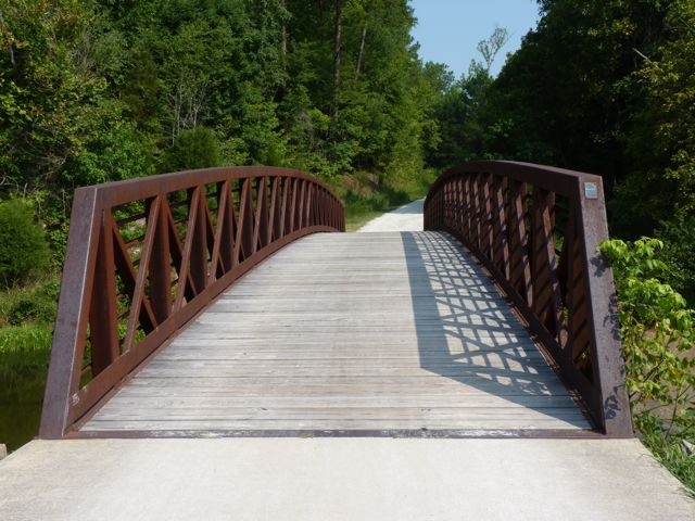
Bridge over the dam
Horses prohibited beyond the bridge
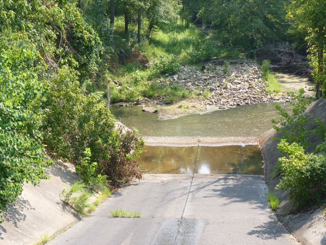
Water level looks to be a little low
Trail head near Reedy Creek Pkwy
More helpful signs
Park ranger’s residence
Paved streets towards Harrison Ave
Another access point for Loblolly Trail near Harrison Ave entrance

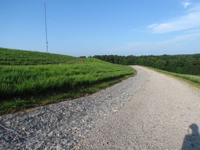 After about an hour of exploring and taking photos of downtown Raleigh, I headed back to North Raleigh to capture photos from one of the highest places of elevation in Raleigh – Top of the Hill trail in North Wake Landfill District Park. I’ve visited this park before, mostly for the kids to play on the playground, so it was nice to explore a park solo. After entering the park, which is under construction, I parked in the small parking lot and made a short .1 mile walk up the gravel trail. The 360-degree views from the top are amazing! Despite a muggy morning, I could still see several downtown Raleigh buildings (thanks to the bright red Redhat sign), neighborhoods and water towers in the distance, and trees for miles! It was so comforting to see how green Wake County still is!
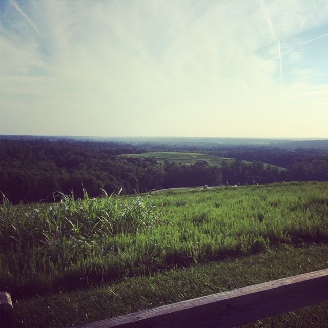 Other than great views from the top, there are several picnic tables, benches, and a bike rack. Even though my downtown Raleigh pictures didn’t turn out as well as I would’ve liked, the whole experience certainly fueled my desire to practice and learn more about photography.


 A few weeks ago, Bill planned a fun Sunday outing to explore the outdoor Cloud Chamber for the Trees & Sky exhibit (aka Hobbit House) at the
 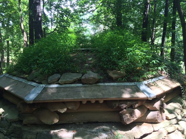 So, after a short walk through the wooded section we found the Cloud Chamber house, which looks like a replica of Bilbo Baggins’ house. It’s a short, circular house built into the side of the hill with large stones, some criss-crossed logs, and a green plant-based roof. It has a concrete floor and a heavy wooden door and the house’s neat feature is that it acts as a camera obscura. After entering the house, close the door and wait for your eyes to adjust to the darkness and you’ll see faint views of the sky as light is projected through an opening in the roof onto the floor of the house. Bill took Ashley into the house by themselves but didn’t stay long and then I went in by myself and witnessed puffs of sky inverted on the floor…it was neat to be able to look “down” onto the sky! And, I don’t think we’ll ever forget our trip to the Hobbit House with Ashley asking where are the “wobbits” every minute; poor girl was expecting to see some real life hobbits.
 We then continued our walk along the loop trail where we also saw the Untitled exhibit by Ledelle Moe, which looked like a small concrete person concrete curled into a ball. After completing the loop trail we headed back to the gravel path and turned right. We headed downhill and came across the Whisper Bench exhibit, which was a fun interactive piece of art for Ashley. It’s two steel benches on opposite sides of the trail that are connected by an underground sound pipe. Ashley and Bill enjoyed talking back and forth to each other and I loved hearing the toddler giggles! After the Whisper Bench we continued on the very sunny gravel path that led us uphill and back to the paved trail near Lowe’s Pavilion. Finally, we stopped for a quick picnic lunch inside the pavilion before heading home for naps.


 Craving some exercise and needing to leave the house for a Sunday morning showing (yes,