
I carry my childhood close to my heart. I didn’t really realize what effect it had on me until later in life, when I started having kids and after my mom’s passing. Several times I find myself wondering what I was like at ages that correspond to my kids’ ages. I love re-visiting special places from when I was young so I can pass those fun memories onto my kids and, also, selfishly so I can feel the spirit of my childhood.
As I’ve written about in the past, my mom was big on taking us to local parks and libraries. My dad, who worked all day at IBM, always spent late evenings and long Saturdays with us on the soccer field or in the backyard. My parents were also really big on introducing us to different experiences, mostly outdoorsy ones like skiing, water sports, and animal husbandry (turkeys, ducks, dogs… you name it and we had it). Though my aunt lived 90 minutes away in Charlottesville, she also played a big part in my childhood. My parents often met her halfway at a car dealership on Route 29 and she’d whisk us away for some type of crazy adventure that usually involved hiking, camping and swimming!
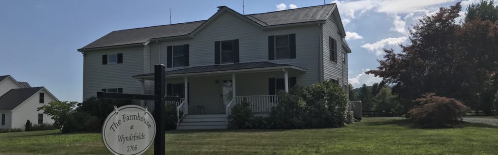
One of the favorite places my aunt used to take us was to Mint Springs Valley Park in Crozet, Va. So, when we planned out our 2018 summer trips (not a typo, that’s how far behind in writing I am), I suggested camping in Central Virginia so I could get back to Mint Springs.
Mint Springs Valley Park
Mint Springs Valley Park is nestled in the mountains of Albemarle County sitting at 1,000ft in elevation. As soon as we drove up, the tree-lined entrance took me back to being 10 years old again. The park seemed just as I remembered, though so much time had passed. We drove past the stocked fishing pond and to the main parking lot outside the swimming lake.
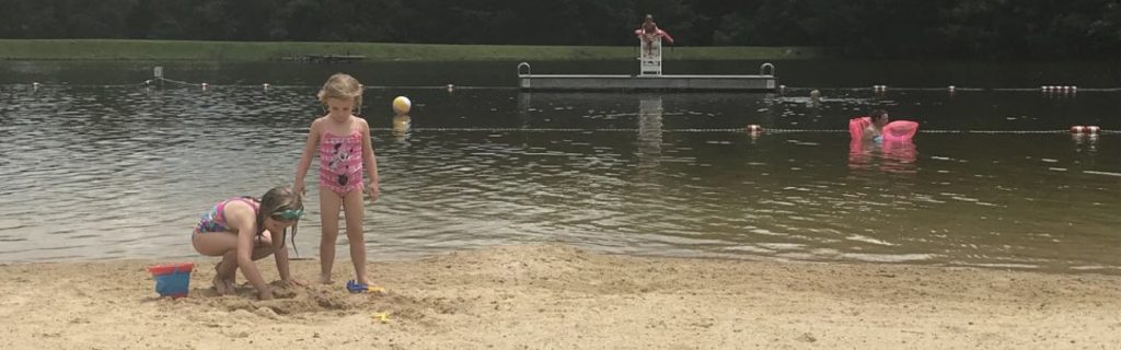
The swimming lake sits between the mountains and features a large sandy beach with designated swimming area. It’s a great place to bring noodles, floats and small inner tubes. The swimming area has at least two lifeguards on duty – one on the sandy beach and one on the wooden dock. The wooden dock sits about 25 yards from shore, and makes for a great spot to sun and jump into the deep water. As a tribute to my childhood, I swam the 25 yards to the dock and sat with my feet dangling over the water and waving to my family back on shore. I thought about old trips with my aunt and siblings where we jumped over and over from the dock into the colder, deeper water. And then, without hesitation, I plunged into the water and swam back to shore.
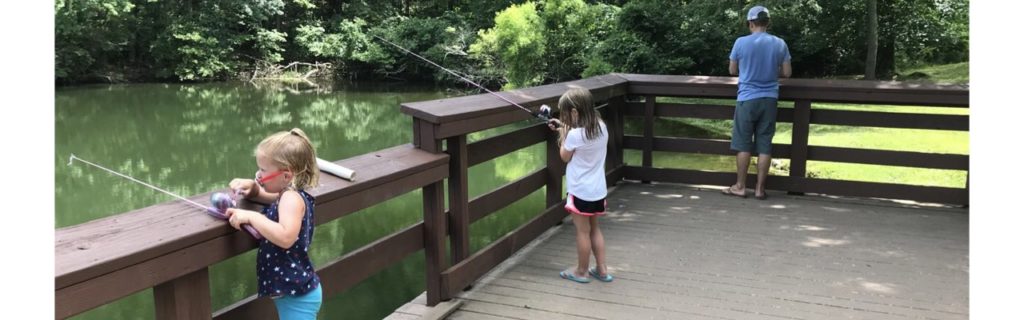
After swimming and picnicking on shore, we drove to the fishing pond, where we tried to catch some fish. Without any live bait we didn’t have much luck fishing. But, we did enjoy the peacefulness of the pond, casting from the dock, and using our nets to catch and release minnows.
Camping
We stayed for three nights over Fourth of July weekend at North 340 Campground. Overall, it’s a great campground with all the amenities – swimming pool, full hook-ups, camp store, and playground. The campground even hosted a Patsy Cline tribute singer one night, who was really fabulous! The girls loved biking around the campground and per usual, met friends to swing with at the playground and shared sparklers with neighbors. However, we felt the campsites were very closely packed next to each other. We could definitely hear the comings and goings of our neighbors who had a large group of people and dogs.
Exploring Waynesboro
When we weren’t swimming at the campground or at Mint Springs we explored all over the Waynesboro area. From caves to breweries, farms, and downtown parks, we did it all!
Grand Caverns
The morning after exploring Mint Springs, we headed to Grand Caverns in Grottoes, Va to explore the caves. Bernard Weyer (not the landowner) discovered the caves in 1804 when he was looking for his lost raccoon trap. Grand Caverns opened in 1806 to the public, and has hosted many tourists since then, including several Confederate and Union soldiers during the Civil War. Grand Caverns is an enormous space with many rooms to explore. Rivers once flowed through the rooms, and the cave is mostly formed into the hill so there’s not much cave space underground.
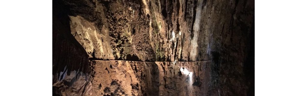
Grand Caverns conducts walking group tours that last about an hour. Our tour guide was super knowledgeable about the caverns and kept our group moving. He told us interesting facts about special events and church services held inside the caves in the 1800s, and pointed out unique stalagmites that seemed to take the shape of old presidential faces. Despite the lengthy tour, there was so much to admire that it held our kids’ attention.
After finishing the tour we enjoyed a picnic lunch at the large covered pavilion. The park also features hiking trails, fitness trail, swimming pool, playground and mini-golf. After lunch, we headed out to the Blue Ridge Parkway for a quick hike before storms came through.
The Slacks Overlook
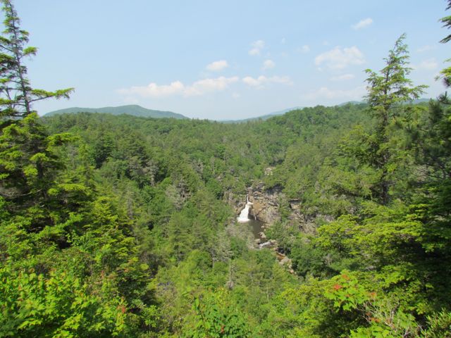
Despite the name of this stop on the Blue Ridge Parkway, the Slacks Overlook (near milepost 20) does not have an overlook. We hoped to find the nearby White Rock Falls so we headed off on an unmarked trail behind the picnic tables hoping it was the White Rock Falls trail. The pull-off area did not have a map and our cell reception was not working, but we pushed on.
After hiking awhile we found a sign showing we were on the Slacks Trail. At the directional sign we continued towards the White Rock Gap Trail. After hiking a bit longer we never found the falls. We noticed stormy weather coming and with little things of interest on the hike, we decided to turn around. The girls also became super frustrated on this hike, which started the idea of bravery stones. They found stones on our hike to hold that helped them refocus and get back to the car with less crying. Since this hike, we’ve found many bravery stones on future trails.
Though our hike was a bust, we made it back to the car right before the heavens opened up on us. After further research I found a similar website highlighting more information about how to find the White Rock Falls waterfall. And, I feel better knowing he, too, had difficulty finding the falls at first.
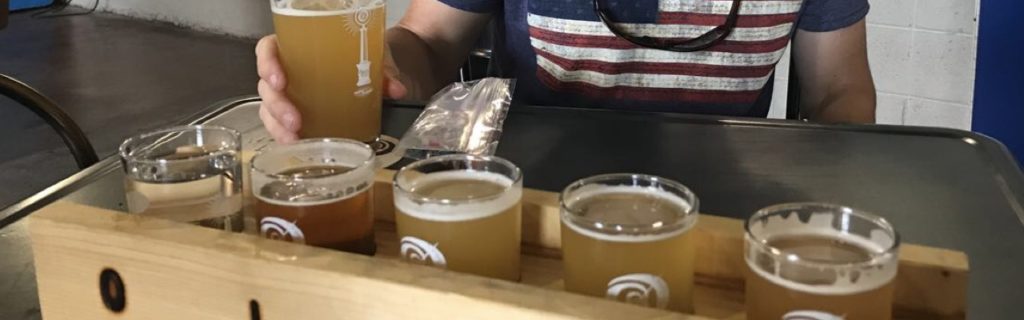
Breweries
During our trip we explored Basic City Beer Co and Stable Craft Brewing. Even though both places are breweries, that’s where the similarities stop. Basic City Beer Co is located near the intersection of 340/250 at 1010 E. Main St in a renovated warehouse in the older downtown part of the city. The brewery’s name is a tribute to the history of the Waynesboro area, and features a cool steel structure outside. Basic City Beer Co is the first brewery I’ve been to that features an area in the back for food trucks to pull-up to and operate a mini storefront, complete with a counter – genius!! We enjoyed delicious food, played kid-friendly games, sampled beers, and can’t wait to return some day!
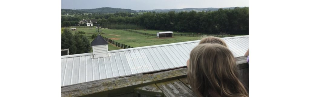
We visited Stable Craft Brewing after our big hike fail from above. Stable Craft Brewing is located in the western part of the city among the beautiful rolling countryside. We first visited this brewery in 2015 when it hadn’t quite opened yet, and was the setting for a friend’s wedding. I remember falling in love with this space then, and couldn’t believe the beauty of it the second time around.
Stable Craft Brewing is a working horse farm, special events venue, restaurant, and brewery all wrapped into one. We enjoyed some yummy dinner and beers inside, and then took the liberty to explore the farm before having a final beer overlooking the countryside. The girls loved climbing the spiral staircase out front to look over the barn, seeing inside the horse stalls, and waving to the horses from afar. If you are craving country hills and yummy beers, this is the place. Dare I say it rivals Rising Silo Brewery in Blacksburg??
Ridgeview Park
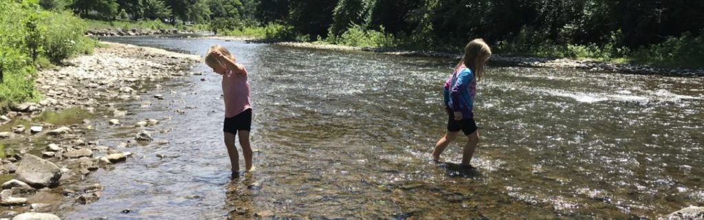
On a different day we explored Ridgeview Park located adjacent to the South River at 700 S. Magnolia Ave. With its huge open space, rolling hills, established trees and easy river access we all immediately fell in love with this park! Situated on 85 acres along the South River, this park also features a large outdoor swimming pool, ball fields, amphitheater, Serenity Garden, shelters, tennis courts, and soccer fields.
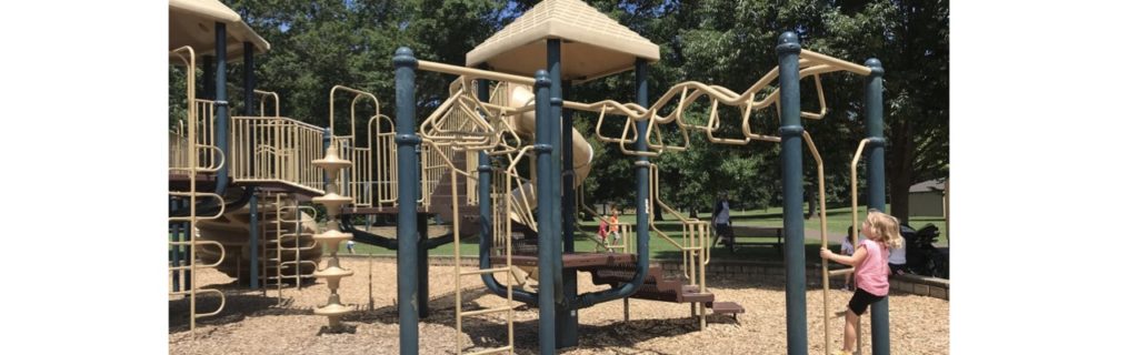
The girls played on the playground for awhile and then cooled off in the river. The South River is very shallow for a good stretch, making it pretty kid-friendly. We walked up and down the banks of the river and even rented kayaks from the nearby swimming pool for some extra activity. This park also features a pedestrian bridge that connects to a large neighborhood on the other side. Bill and I seriously checked Zillow for surrounding houses for sale – the proximity to the park and river would be amazing for any family!
Dining Out
We made most of our food at the campground, but did make it out for food a few times. After our big hike we made our way to Kline’s Dairy Bar for delicious ice cream. They’ve been around for 75 years, so it felt great to support such a historic spot.
For lunch one day we enjoyed coffees and light food at Farmhaus Coffee Co at 908 W. Main St. The weather was perfect for sitting outside on the patio, though they also have beautiful sitting areas inside, too. I loved the farmhouse decor, bookcases of books everywhere, and oh yeah – the food and coffee were delicious too!
Waynesboro, you exceeded all our expectations! We packed in so many adventures, but with the rural settings our trip still felt very peaceful and relaxing. We can’t wait to come back one day!
Thumbs up: Ridgeview Park, South River kayaking and access, breweries, peaceful rural settings, campground amenities, proximity to dining/hiking/adventure
Thumbs down: squished feeling at North 340 Campground, hiking trail signage at Slacks Overlook


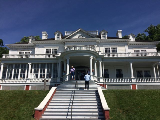 We were very fortunate to spend a few weekends in the NC mountains this summer. On our second mountain trip we met up with my in-laws and stayed in a beautiful mountain cabin near the Appalachian Ski Mountain between Boone and Blowing Rock. On a tip from friends, we headed out to the
  After spending over an hour at the park, we turned left out of Moses Cone Memorial Park and headed 10 miles south to the Linn Cove Viaduct (MP 304). At an elevation of 4,100 ft, the Linn Cove Viaduct is a concrete bridge engineering marvel snaking around Grandfather Mountain; it is over 1,200 ft long and consists of 153 concrete sections weighing 50 tons each. Construction of the Linn Cove Viaduct was completed in 1983, cementing the final link of the Blue Ridge Parkway.


 For Memorial Day weekend we headed out to the Grandfather Mountain area on the annual


