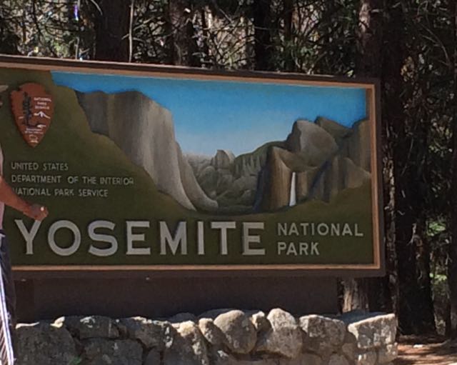
 Who’s up for a last minute visit to Yosemite with young kids during the super busy summer months? We are! Capitalizing on our successful Norther Ca trip, we rolled the dice on our final full day and drove our family two hours west to explore Yosemite for the day. With plans to rendezvous at my uncle’s rural 1910s family cabin situated on original Yosemite roads, we left early in the morning with a full tank of gas, fully charged iPads, open minds, and lots of food.
Yosemite National Park spans nearly 1200 sq miles in Eastern Ca, making it about the size of the state of Rhode Island. It reaches across the Sierra Nevada mountain range and is mostly known for its mammoth granite cliffs, waterfalls, giant sequoias, and diverse plants and animals. The geology of Yosemite National Park is a result of a combination of volcanic activity, uplift, erosion, exfoliation (responsible for the dome-shaped granite areas), and glaciation that happened over 25 million years ago. Starting in the 1850s, explorers, artists, and writers advocated for preserving Yosemite Valley and slowly expanded the protected area to include nearby forests and mountains. Yosemite switched from a state park to a National Park shortly after the National Park Service was started in 1916. We visited 100 years later!
Getting There
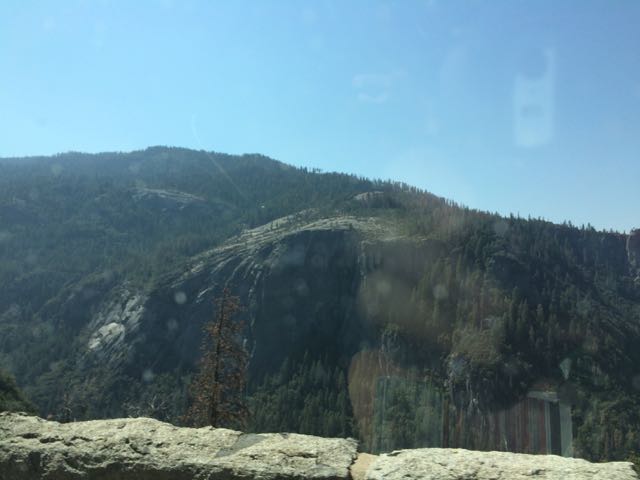 Since the Yosemite trip was last minute, intermittent cell service limited my mobile-friendly research as we drove through harrowing switchbacks and rural towns. Following my aunt and uncle’s advice, we headed to the popular Valley area of Yosemite in hopes that we could catch glances of El Capitan, Half Dome and some of the waterfalls. Driving from Sonora, Ca we drove along 120 East through Groveland and the Big Oak Flat Entrance. The drive through Yosemite starts out hilly with dense conifers and then becomes hillier with sparse shrubs, dead underbrush, sand, rocks and old dying pine trees. Then, suddenly before crossing into the big tunnel, the massive granite rocks explode before your eyes. You catch really quick (yet far away) views of El Capitan and Half Dome before going through the tunnel. After the tunnel you wind through switchbacks catching different views of the granite formations. Yosemite is enormous – it takes at least 40 minutes to drive from the main entrance to the bottom of the park.
Bridalveil Fall Trail
 Knowing the park would be busy, we aimed for short hikes easy in difficulty and with easy access. Using the simple Yosemite Valley day hike chart, we hiked the 0.5 mile (round trip) Bridalveil Fall Trail on our way into the park. We parked at the trailhead and follow the paved path to the 620 ft waterfalls. Since we visited in late summer, the waterfalls trickled, but I imagine in spring time after snow melts the falls are quite a spray. Other visitors climbed along the large boulders to the bottom of the light waterfall. Even though the waterfall spray was barely visible, it was amazing to look up at the massiveness of the rocks and feel so tiny.
After Bridalveil Fall Trail, we parked in the main parking areas near the Visitor Center/Museum so we could scope out the center and easily hop on the free shuttle buses. In my little research, I learned the shuttle buses were key to getting around busy Yosemite Valley. The trailheads and points of interest are spread out so we either walked along the wide bicycle paths or rode the bus. Wishing for more time in the museum and to see the short Spirit of Yosemite film, we pushed on and walked about a half mile along the bicycle path to access the Lower Yosemite Falls Trail.
Lower Yosemite Falls Trail
 Lower Yosemite Falls Trail is a one mile paved trail with little elevation change making it an easy walk for everyone. The path is mostly shaded with giant sequoias and huge slabs of granite rock making for nice photo backdrops. About half mile into our walk we arrived at the observation bridge of the falls. Lower Yosemite is the bottom waterfall section of the three-part Yosemite Falls. Unfortunately, with it being late summer the waterfall sprayed a mere trickle, but we tried to imagine the command it carries in spring after the snow melts. Before leaving the falls we admired, in jaw-dropping fashion, as pea-sized rock climbers scaled the mountain.
Views of Half Dome
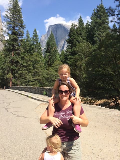 Wanting to get closer to Half Dome I quickly researched places within the valley to catch a glimpse. I learned the meadows behind the Majestic Yosemite Hotel (formerly known as the Ahwahnee Hotel) provide good views of the massive mountains, so we rode the shuttle bus to stop #3 outside the hotel. The hotel was built nearly a century ago with the design influences of Art Deco, Native American, Middle Eastern, and Arts & Crafts Movement. We walked to the back of the hotel, through a small path and turned left on the pedestrian path. Before crossing over the pedestrian bridge we arrived at the best spot we could find with a good glimpse of Half Dome (elevation 8800ft) in the background. Even from so far away it’s amazing to imagine people (including my crazy aunt) hike the 16-mile round trip.
After capturing a few pictures with Half Dome in the background, the girls and I splashed around in the crisp, cool Merced River that flows behind the hotel. We were hot and tired from the long day and we felt refreshed after a quick dip.
Driving out of Yosemite Valley, we followed my aunt’s handwritten directions for meeting them at my uncle’s rural cabin. After a harrowing 7 mile drive up original access roads into Yosemite, we arrived at the cabin. I immediately relaxed after enjoying a beer on the hammock and we took in the beautiful sites of the meadow from the back deck. My aunt and uncle planned a delicious steak dinner with all the trimmings – it made for a very memorable early birthday celebration! After a restful night’s sleep, we left for San Francisco the next morning feeling very accomplished as a young family of four and thankful to experience Yosemite! We can’t wait to return to Yosemite and spend an entire week camping and exploring the different trails – maybe one day we’ll even hike to the summit of Half Dome!
Looking Ahead & Tips For Young Families
Having spent only about 5-6 hours in Yosemite, we definitely maximized our visit with seeing a few waterfalls and catching a glimpse of Half Dome and El Capitan (on the way out). The girls pushed through the early afternoon hour when they’re usually quietly relaxing, but felt refreshed with our backpack snacks and a quick ice cream treat.
- Plan ahead and stay for a few days – camping spots in the park fill up months in advance, so plan your trip early or stay outside the park
- Less is more – bring a small backpack to carry around the park with essentials and snacks; visit the convenience stores and restaurants to refill with snacks and treats
- Bring a good camera – I’m kicking myself for not having my big camera with me
- Park & ride – park your car in one of the main lots and ride the bus as much as you can
- Do some swimming – there’s lots of options for cooling off in the creeks and Merced River
- Visit in late spring when the waterfalls are at full peak
- Wear your patience pants – if visiting in summer be aware of the large crowds and take breaks accordingly
Additional Resources:
Thumbs up: breathtaking views, massive rock formations, free shuttle bus rides, bike/pedestrian path connecting many points of interest, paved trails provide accommodations for everyone
Thumbs down: little time for planning on my part, drier waterfalls in summer mean less dramatic views, busy summer crowds

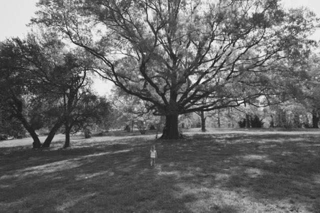
 Have you visited Dorothea Dix Park lately? Located just south of Downtown Raleigh, its rolling hills and grassy open fields are the perfect spot for a picnic, skyline photos (mine are courtesy of the super talented MasonDee Photography), or attending a City of Raleigh event or program.
 Wed., Aug. 16 at 1pm: Explore Dorothea Dix Park: Water Wonders – meet in the big field and explore activities and games featuring water! Ages 2+; free; pre-registration is required
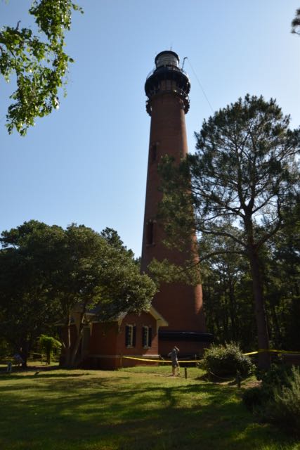 After school let out for the summer we headed with friends to Duck, NC for the weekend. The Town of Duck is located on the northern section of the Outer Banks mainland, not far (physically) from the Virginia border. We wanted to take advantage of staying in the northern Outer Banks, so we explored the Currituck Beach Lighthouse one morning.
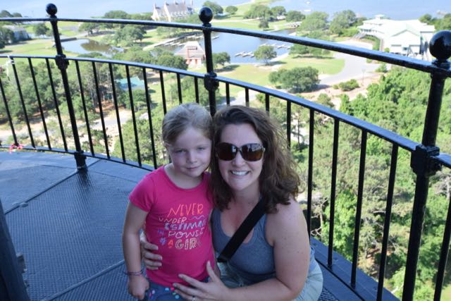 Climbing the Lighthouse


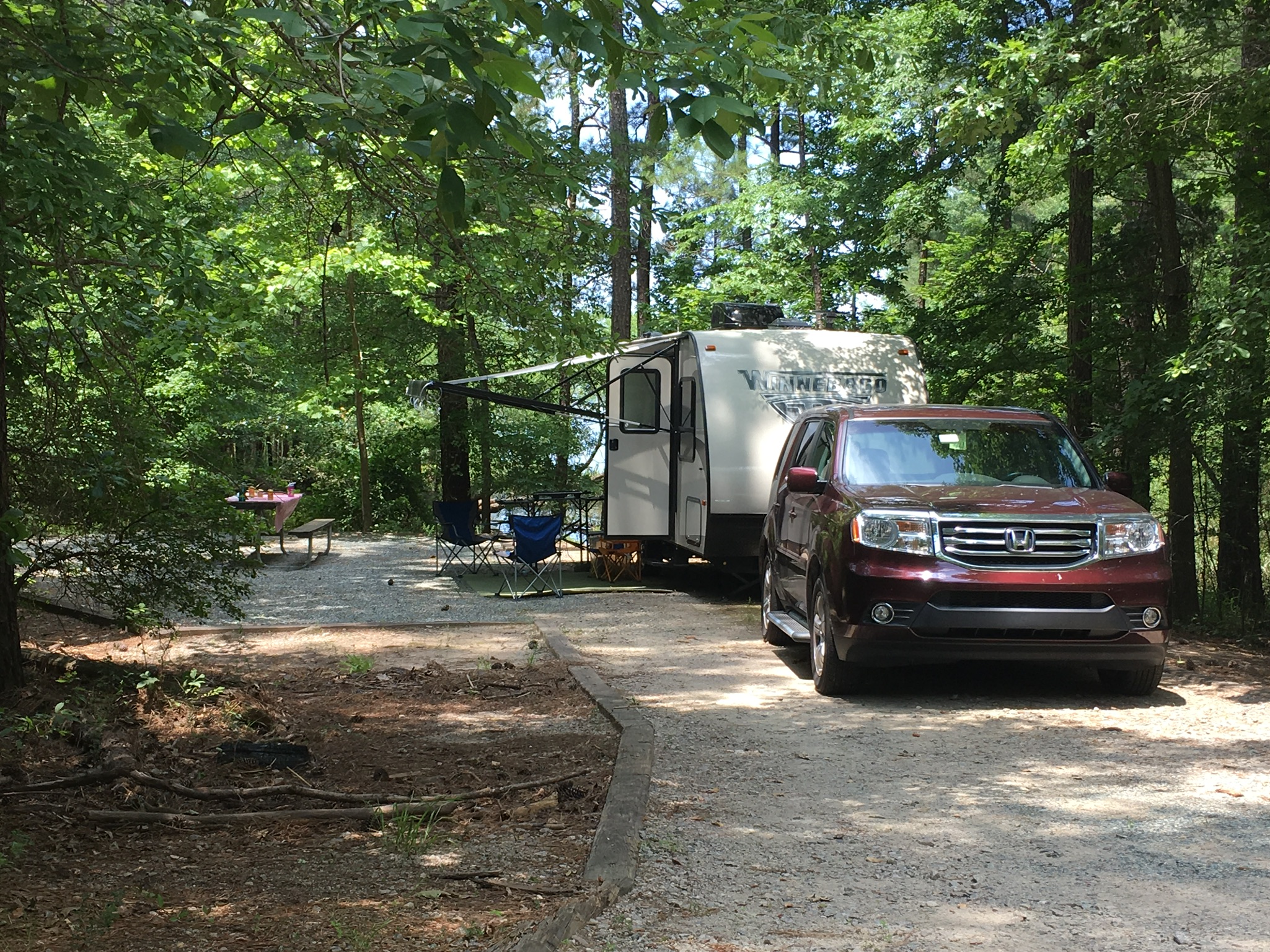
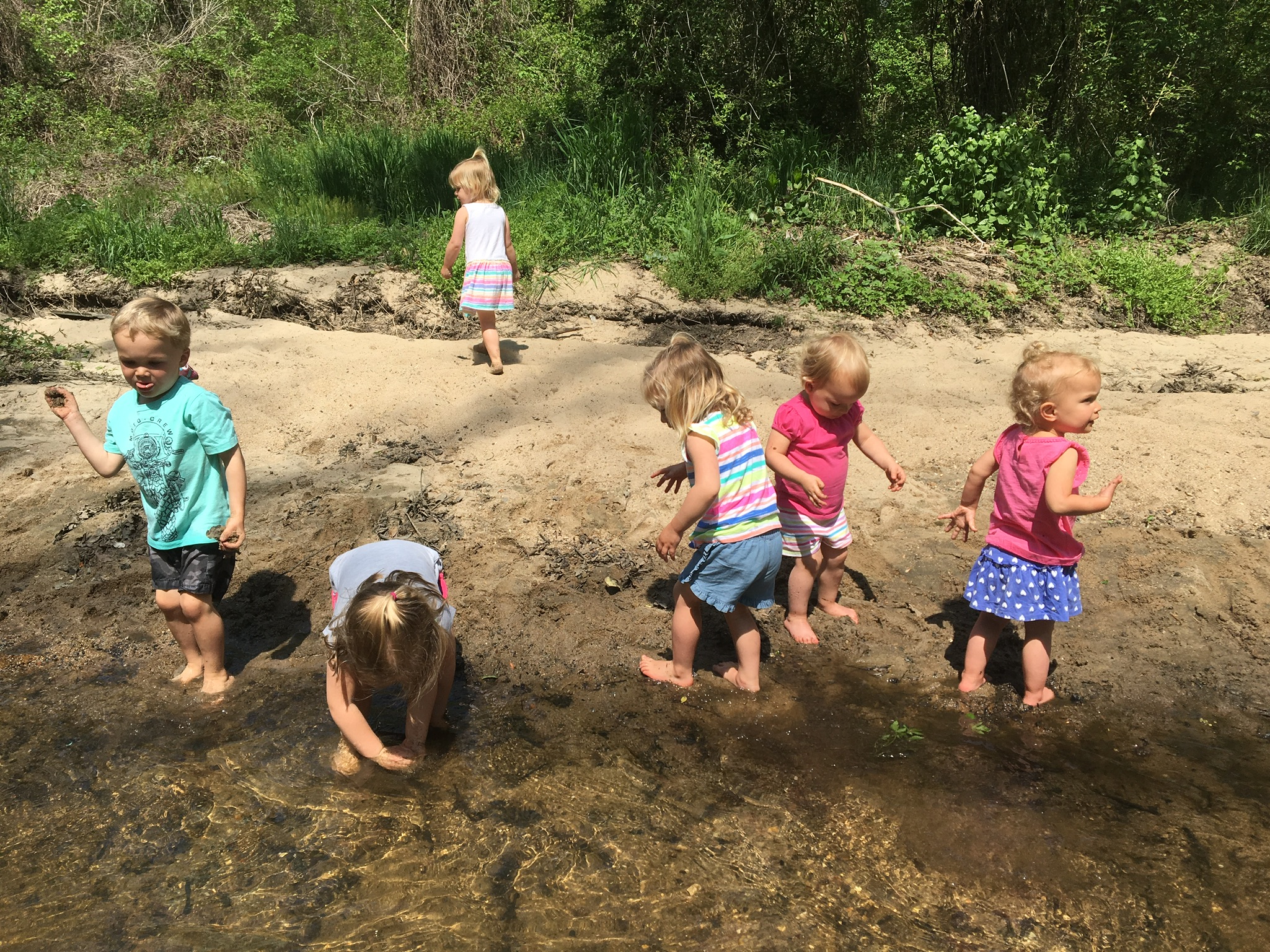
 Our partially shaded campsite featured a flat gravel pad, picnic table and grill. There’s a short walk to the water, which we were hoping to use for fishing access, but unfortunately there was more poison ivy than we wanted to dodge. We found another access to the water, but the low-lying trees made casting difficult for the girls. Surprisingly, we didn’t have any neighbors during our entire stay. Though the girls were sad because they couldn’t play with new friends, it also meant they could run around like maniacs without worrying about traffic.
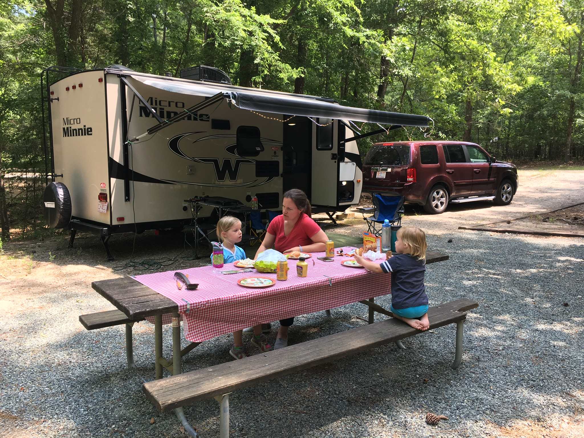
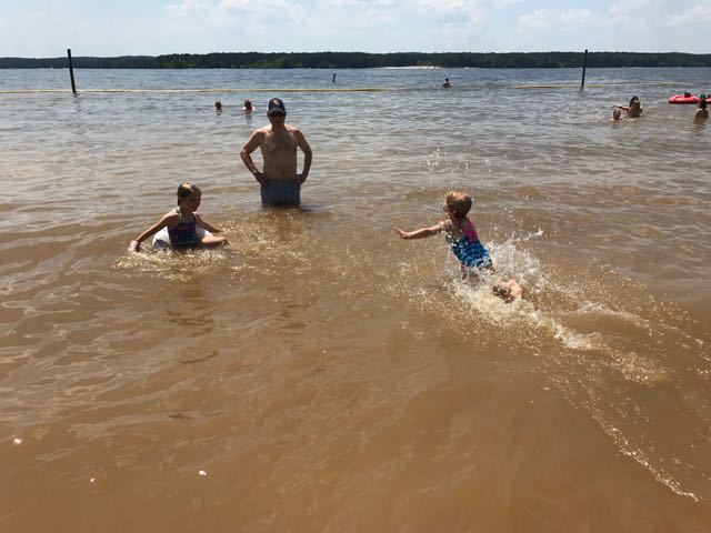 After lunch we headed to the recreation area to cool off in the beach. The recreation area at Loop E features a large sandy shoreline with designated swimming area. The water was refreshing and the boats racing by made fun waves for the girls. The girls loved catching the waves with their inner tubes and building sand castles on the shore. They enjoyed racing into the water and diving into the calm water. Even though the water was a little murky, they didn’t seem to mind.
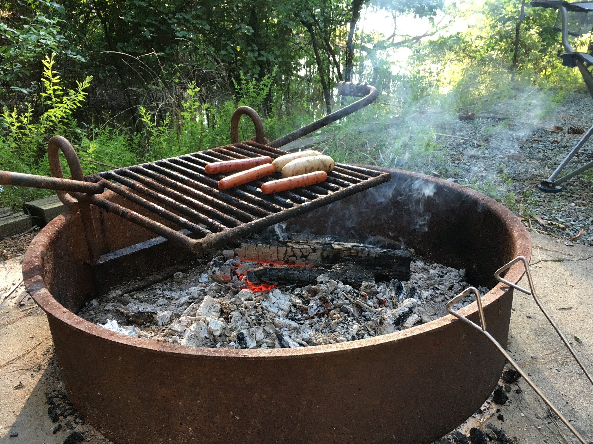 After playing at the beach we headed back to our campsite for showers and dinner prep. The girls helped shuck corn for grilling on the fire pit while I made mac n cheese on the trailer range. We grilled chicken sausages, corn on the cob, hot dogs and cinnamon sugar filled apples for dessert.


 Over Memorial Day weekend, my in-laws visited from Maryland. Wanting to find something new to explore that is appropriate for both older and younger people, I researched the upcoming
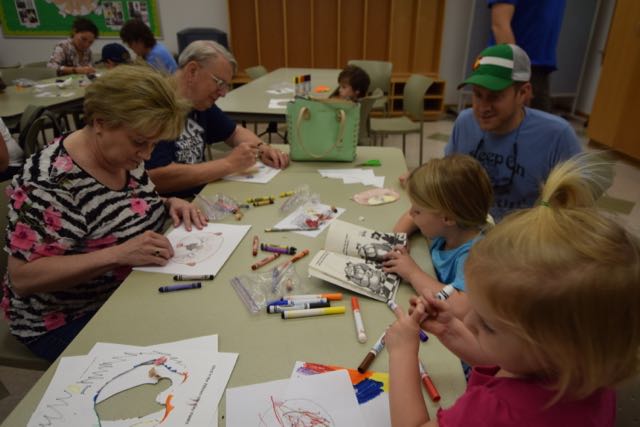
 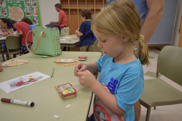 The instructor started the class with a coloring activity as the participants arrived. We colored paper animal masks of characters Badger, Toad and Otter from the book. Then, we constructed our masks with either popsicle sticks or string. After the coloring activity, the instructor presented material about the mill’s history and different types of energy. She catered the presentation to all age groups and made it especially interactive for the young ones. Next, the instructor walked us through creating a boat from an Altoid box and powered by stored-up rubber band energy. She related the craft to the energy lesson and also read from The Wind in the Willows story.
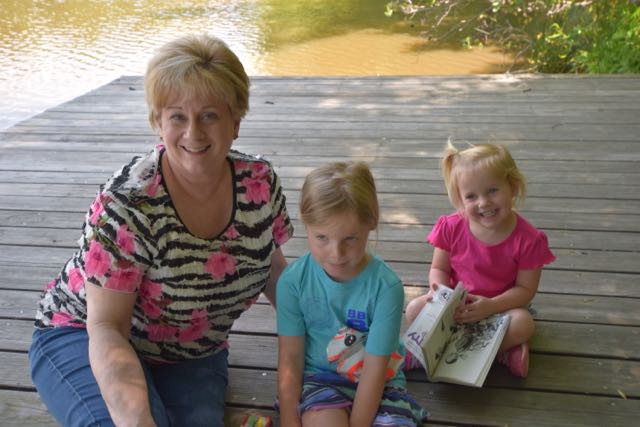 After everyone finished making their boats, we headed outside to the docks to launch our boats. Sure enough, our wound-up rubber bands caused the plastic paddles to propel the boats a few feet into the water. The instructor came prepared with a net to scoop up the boats so the kids could try again. The entire program was a perfect combination of creating, science, and hands-on experimenting for this age group.


 In May, we travelled to Nags Head for our annual trip with friends (and family this year, too) to run the Nags Head Preserve Yuengling 5k race. This year the race weekend coincided with the grand opening of Dowdy Park, located at the intersection of
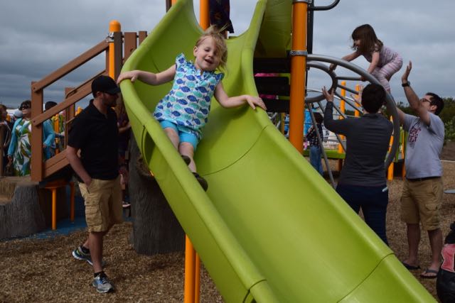
 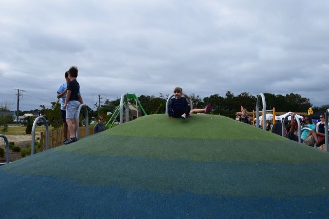 Dowdy Park features several play areas where kids can jump, run, swing, climb and slide until their hearts are content! The older kid playground has wide wheelchair-accessible ramps to musical and periscope play items. The ramp connects to stairs for climbing higher along a net bridge or to the ground via a rock wall. The other side of the net bridge features challenging ladders, a climbing tree stump and a fast, twisty slide. A colorful climbing hill with curved bars, musical instruments, balance beams, surfboards, bench swing, and merry-go-round are also located nearby. With the large festival and park attendance, it was overwhelming to keep track of multiple kids bouncing between so many activities.
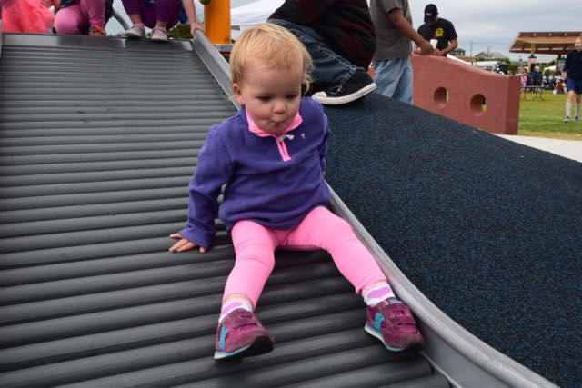 The smaller kid playground features short steps up to ramps connected to a double slide. All the kids thoroughly enjoyed the nearby rolling slide. They loved making rattling noises as they slid down the bumpy slide. Across from the small kid playground is a wheelchair-accessible ride. It allows folks in wheelchairs to reverse their chair onto a ramp and swing. And, a playground near the beach wouldn’t be complete without a little sand – just follow the sea turtle flipper prints! Short pier pilings line the sandbox area, which has a large climbing sea turtle in the middle.
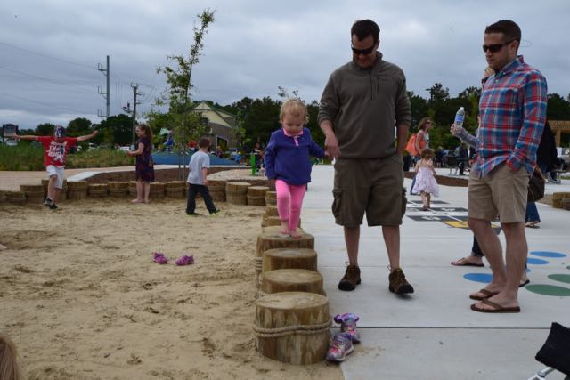 Also near this area are hopscotch and twister games, checkers tables, another climbing hill, picnic tables and benches. On this particular day vendors lined the perimeter of the open green space area. Park-goers filled the open green space area watching the performances under the covered pavilion. Throughout the park you’ll find pieces of art, such as the nautilus stamps shells, temporary art pole exhibit, and wooden paintings. Even though Dare County is mostly known for its beaches, I’ve always been impressed with the


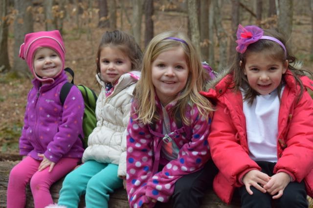 In January we headed with friends to Umstead Park to explore the super kid-friendly Oak Rock Trail, which is only 1/2 mile long. This is a great hike for young families or large groups with young kids. The trail has easy access to clean restrooms and picnic tables, and shallow stream access for water fun in the warmer months. It’s also part of the
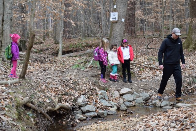


 Last fall we headed to Richmond for a little man’s 1st birthday party. Before the big party we headed with friends and all our littles to
  Farmers Market, Trail Walking & Pond
 The playground features two play structures divided by age group and swings for all ages. The younger child playground contains slides, a spiral ladder, and nearby teeter totters. The older child playground contains steeper slides, arched ladders, double “racing” slides, monkey bars and zipline. The kids loved racing each other down the slides and swinging across the monkey bars. The playground’s hardwood mulch surface lessened the monkey bar falls. The original 1840s Stone House, picnic tables and tennis courts are also just a short walk away.


